Tuesday, April 30, 2013

SLIDERS CARGO RIDING PANTS

Initial Product Review

Last week, my new pair of Sliders arrived via parcel post.  I ordered them with cargo pockets: a feature that would give me access to my little camera without having to hang it on my belt or fumble with a tank bag zipper.  I was impressed with the soft texture of the khaki fabric.  These felt like pants, rather than riding pants.  Also impressive was the workmanship involved in stitching layers of cotton and Kevlar and mesh together.

One thing missing was the armor I’d grown used to.  The catalog suggests that for about ten dollars more, one can purchase CE approved inserts that fit nicely into some interior pockets at the knee.  I missed how to order these when I purchased on-line – a circumstance I’ve since rectified.

Upon their arrival, I put ‘em on and traipsed around the house. Right out of the box, the Sliders felt soft and broken in.  I did some squats (ultimately having to use a dining room chair to get my creaky knees fully straightened back out – yikes!) and found plenty of room for leg movement. 

The following day, I mounted the Guzzi and headed out for a little get acquainted tour.  Temps would range between 58 and 90.  I’d read that these trousers might feel a tad warm but my impression was that, rather than being too warm, they were successful in insulating my ankles from heat I sometimes feel blowing over the Breva’s heads.  

I purchased this pair with an inseam two inches longer than my street clothes.  The Sliders seemed to crest the tops of my riding shoes, but stayed below the tops of my more substantial boots.  The cargo pockets stowed the camera quite nicely although buttoning and unbuttoning the pockets invited fumble.  I found the camera quite secure with the pockets unbuttoned.

Getting on and off the bike multiple times for breaks and walks, I felt as if the belt I was wearing looped around my midsection where I wanted it to, not lower as was my niggle with the expensive, bike-labeled brand I’ve worn and liked for some time.  (I also own some rather cheesy denim riding jeans that I purchased just because they were denim.  They really have some fit issues.) Engaging in a little rock scramble to get a particular picture, I noted ample room in the Sliders and no binding.  “Relaxed fit,” I think they call this.

After six hours in the saddle I came home and sat down to check e-mail and do a little office work.  Two hours later, I realized I was still wearing the motorcycle pants.  I guess that says something about their comfort.

© 2013
Church of the Open Road Press

Saturday, April 27, 2013

ALTERNATIVE TO INTERSTATE 80 – WESTSIDE OF THE SIERRA


California’s State Route 20 to Nevada City

Sometimes traveling east or west between San Francisco/Sacramento and Reno/Truckee, we just have to get there now.  So we mount up and rocket over the Sierra on Interstate 80.  A freeway, I-80 is designed for people in a hurry – and big trucks.

A pleasant alternative, and a “must do” for folks who may pass this way but once involves California’s state route 20.  This little gem departs I-80 about 20 minutes west of Truckee and by hooking in with CA 49 at Nevada City, thence to Auburn, adds only about an ninety minutes to the trip.  That is, if you don’t stop and if you’re not enticed to explore.

A late April day in the Sacramento area felt more like summer than spring.  A trip to elevation seemed in order.  I 
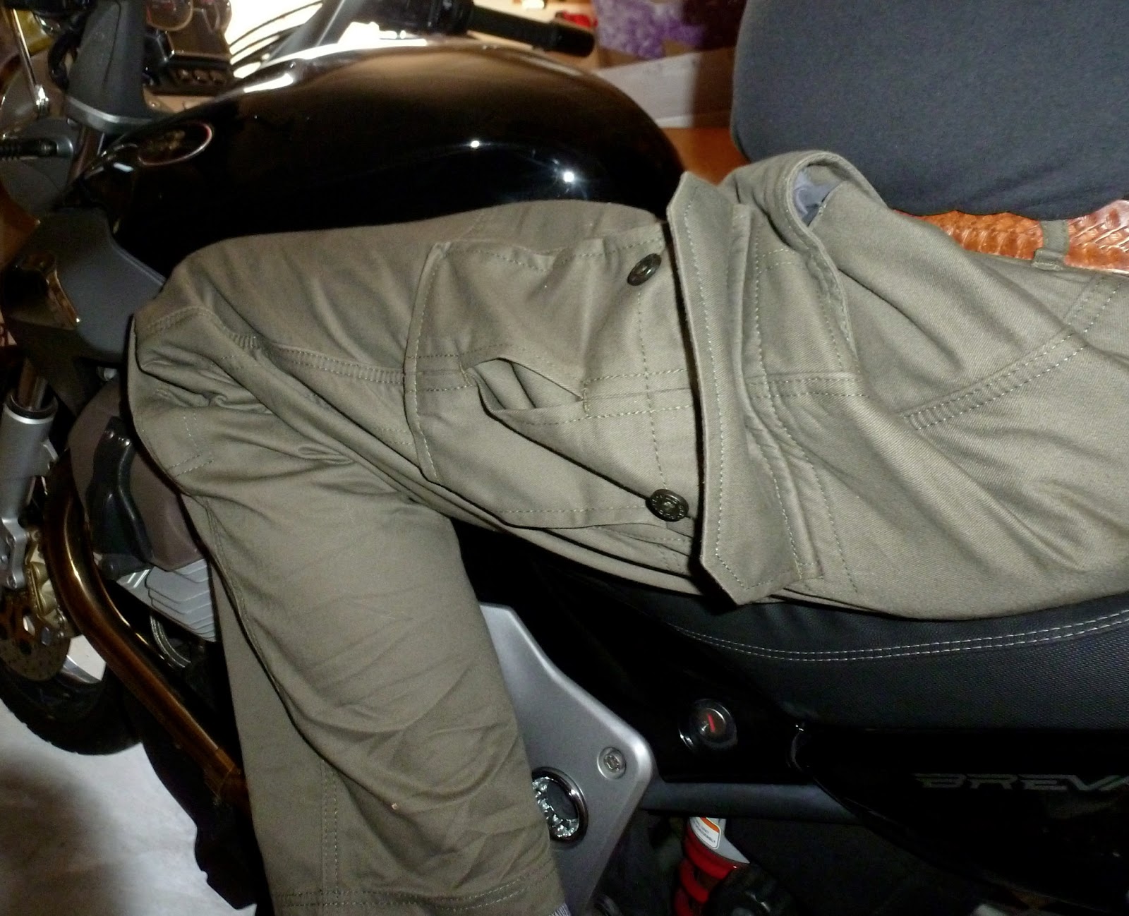
mounted Aria, the Moto Guzzi Breva – what a fun bike that is! – and headed east to enjoy this favored route.  After stopping at Brunswick, between Grass Valley and Nevada City for breakfast I zipped all the twenty-seven sweeping miles Highway 20 offered before it conflues with I-80.  There, I U-turned, retracing the route, pausing for pictures and sojourns along the way.


West of the interchange, CA 20 slips downward into the drainage of the Bear and Yuba Rivers. 

Bowman Lake Road offers a nice dalliance into the basaltic northern high Sierra.  A nicely engineered Sierra Discovery Trail begs one to stop and investigate the upper reaches of the Bear. 


Although here, it is more of a brook than a river.


Further up this side trip, we cross the more robust South Yuba.  I turn back at this point knowing what the road will become aware that the dual-sport is resting in the garage.


The area is bisected with flumes dating back to the gold rush.  Miners spared no effort in diverting the natural flow of the area’s rivers into these gradual ditches in order to serve their industry.   


The flumes – modernized and upgraded, still carry water for domestic use down the hill.  They also provide easy paths for a nice stroll.  This is one reason why the CA 20-49 scenic route’ll take more than those 90 minutes.


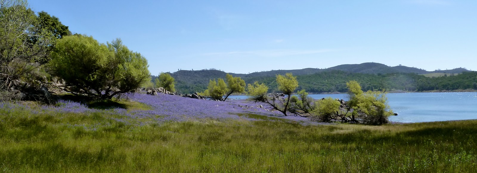
Back on CA 20, the road descends and then crosses a high country valley that seems lush and green any time of the year that it is not blanketed in snow.


A few miles on, a sign advises of a Scenic Overlook.  (Nice restrooms.)  A paved trail loops less than a half-mile to a view to the north.


A substantial viewing platform reaches over the canyon edge.


Affixed to the railing is a panoramic photograph labeling promontories as near as a stone’s throw and as distant as the Coast Range. 


Roads to places like Relief Hill, Graniteville and Bloomfield are clearly visible through the forest.  In less than a moment, about six adventures are added to the bucket list.


Four or five miles further, we find the little-more-than-a-turnout vista point.  The view is similar to what we’ve just seen, so I end up taking a portrait of the bike…


…but a turn-off to the old town of Washington is marked.  The lusciously paved and well-maintained road sweeps and twists down the canyon to this historic site. 


Cell-phone service?  I doubt it.  Good.


Not far beyond town, the roads improve from pavement to gravel and I think about “the Horse” stabled at home.


One stop I’d not made before was to visit a “Point of Historic Interest.”  A small rectangle of white picket fence encloses the marker of a little boy who was carried across the trail west but only made it this far.


Passers-by leave mementos on the fence.  I suspect someone comes through every now and again and cleans ‘em up.  (Be careful exiting due to accumulations of winter road sand.)

 
A few miles further on and we find ourselves in the “standard metropolitan statistical area” of Grass Valley and Nevada City.  There’s a bit more traffic these last few miles and folks are a bit less leisurely in their approach to the road.


Nevada City and Grass Valley ooze history.  Both have inviting main streets with a nice selection of restaurants, galleries, antique stores and mercantiles.  Both are quite walkable.  Both will contribute to that ninety-minute detour becoming a full day.


Old heliport windsock frame
Today’s Route:  Exit I-80 at CA 20.  27 miles to Nevada City.  To rejoin I-80, head south on CA 49 to Auburn (a pleasant but busy stretch.)  Diversion 1: Right on Bowman Road – the paved portion extends several miles through nicely forested lands, past historic power generating dams and flumes, and by several pleasant reservoirs.  The road turns to gravel and head toward historic Graniteville (west) or over Henness Pass (east.)  Diversion 2: Right on Washington Road; five miles into town.  Great views on the sweeping descent.  Two miles beyond town, the road turns to gravel with the right fork heading up to Graniteville and the left fork (poorly signed) heading through Relief Hill to North Bloomfield and the delightful state historic park.

Note:  CA 20 heads west from Nevada City / Grass Valley through the rolling Sierra Foothills, into Marysville, across the Feather, into Yuba City, below the Sutter Buttes, into Colusa, across the Coast Range, past Clear Lake, joining US 101 to Willets, then on through the redwoods to the coast at Fort Bragg.  One could take weeks exploring all of it.  And probably should.

© 2013
Church of the Open Road Press

Wednesday, April 24, 2013

HANDWRITTEN LETTERS

About ten or twelve years ago, on Veteran’s Day, the Sacramento Bee published a letter from a gent who’d recalled the return of soldiers after the armistice.  His letter indicated that he had been too young to enlist.  A poignant line at the end said: “The boys who left the farm and went to war came back changed.  They came back men.” 

The letter ran at the top of the column that day.  It impressed me enough to contact whoever was the letters editor and ask him to pass along to the writer my thanks for sharing his perspective and insights.

The editor responded that the letter had come handwritten in a hand-addressed envelope and that it clearly was from an elderly writer who probably did not have access to a typewriter or word possessor.  He said that he could not give me the man’s address (rightfully so) but he would try to pass my comments back to the correspondent.

About a week later, I received an envelope, addressed clearly by an arthritic hand.  Inside were two sheets of lined paper – composed in the same hand – completely filled with recollections of World War I and its impacts on the little Midwestern farm community in which the then young boy had been raised.  He wrote with excitement about the increased responsibility with which he'd been saddled, having to rise early and harness the team for work in the field each day; a task formerly accomplished by older youth.  He contrasted that with the community’s reaction to the few who “only made it as far as Flanders.”

I know I’ve saved that letter somewhere.  Historians might call it a “primary source.”  For me, it is a connection I have to a distant past that I now feel I have somehow experienced.  I must find it and share it with the grandkids.

© 2013
Church of the Open Road Press

Wednesday, April 17, 2013

THE CORRUPTED CONSCIENCES OF CONGRESS


And what to do about ‘em 

I expect my representative to vote his or her conscience.  And sometimes, I won’t agree with the vote cast.  I accept that. 

Not acceptable is when my elected representative’s conscience is for sale to the highest bidder. 

The test?  If in explaining his or her position, I am offered a rational argument, grounded in constitutional principle, historic perspective (if we ignore history we are doomed to repeat it), scientific precept, or the plain and simple common good, I’ll believe we simply differ.

If however, the explanation is non-existent or is laced with platitudes, faulty data, sound bites from moneyed sources, false patriotism, or is based upon fear mongering and half-truths, then it’s pretty clear someone sold their conscience as a commodity.  That, or they're just plain stupid.

Inarticulate, corrupted or ignorant, that individual has lost my confidence and trust and I will look elsewhere when casting my vote.

The country deserves better than what we are witnessing.

© 2013
Church of the Open Road Press

Tuesday, April 16, 2013

THE LUPINE FIELDS OF FOLSOM LAKE


Click on any picture and they'll all expand.

A Sunday in mid-Spring and the dogs deserved a walk.  We headed to a nearby reservoir that had, only a week or so before, exhibited a deep and nasty bathtub ring.


Warm temps in the high country, however, had worked their magic on the snowfields and this day, the lake was brimming.

 
Parking at Beek’s (Joseph Beek being instrumental in development of the Folsom Lake Recreation Area) Bight ("bight" meaning a curve in the river or shoreline) we headed east.  [Thanks for the historic and linguistic research, Dr. Sazima.]


Impressive though the azure sky’s reflection in the pool might have been, more stunning was the acre-upon-acre veldt of blooming Douglas Lupine – Lupinus latifolius.  [Thanks former 4th grade student Scotty Campbell for the Audubon wildflower book you gave me at the end of the 1982 school year.  I still use it and think of you, pal.] 


Only a short way from the parking area, the trail finds itself splitting a field of the knee-high array.


Amidst them, almost every direction was awash in purple – although the Audubon folks call ‘em “blue.”


So dense is their coverage that it is impossible to photograph a single stalk.


The dogs enjoy this with Edward, the lab mix romping through them like a dolphin breaching the ocean’s surface over and over.  I can’t get a picture of him doing this, but we did settle him down for a group shot.


Jax the Dog, an aging Aussie and more conservative hiker, poses.


But that whole “sea” analogy begins to take hold.  Here, a wave of Lupine seems to break upon the shore and race up the embankment.


Around the bend, they encircle a granite knob turning it into a tiny island.


Next comes a Lupine lagoon.


Then there’s the remains of a miner’s flume, once used to transport water from an untamed American River to a camp or site where its power was harnessed to separate gold from sand or sourdoughs from caked filth.  Now the dissolving hull of that conveyance looks like a ship’s prow carrying eager immigrant, perhaps seas-weary Lupine to the waiting masses on the shore. 


Further on, a scene contrasts permanence with delicacy.


I wade into the middle of a stand of these things to picture them from the top and imagine, for a moment, that I am looking down upon a thick forest of purple conifers…


…while a pair of Canadian geese eye my actions and perhaps wish I’d just stick to the trail.

Returning after about two-and-a-half miles of trail, I look over my shoulder and snap a parting shot knowing that in about a week and a half, this will all be gone.


o0o

Today’s Route:  I-80 to Roseville, CA; exit Douglas Blvd.  East – but it feels south – on Douglas to Granite Bay entrance of Folsom Lake State Park.  Fee.  Continue east – now feeling east – through some nice oak woodlands to Beek’s Bight.  Give bicyclists the right-of-way.

© 2013
Church of the Open Road Press

Saturday, April 13, 2013

RETURN TO TABLE MOUNTAIN

While much of the country is just shaking off the mantle of snow and ice that is a rugged winter, out here on the left coast, we are about half way through spring.  An annual trek I take is to visit the display of wildflowers carpeting Table Mountain outside of Oroville in Butte County, California.  I’ve done it on every motorcycle I’ve ever owned beginning with that Honda Trail 90 back in 1970.  And I’m never disappointed.

This day, the road through Cherokee which “backdoors” the flat top of the mountain was dry and clear and travelled by a least a couple of motorcycle clubs as well as a group of vintage British sports car enthusiasts.  While it is said that the journey is as grand as the destination, it’s tough to suggest that the destination itself wasn’t pretty damned grand.

A relatively dry spring has rendered the creeklets across the top of the basalt mesa pretty impotent.  Yet they provide enough sustenance for a nice display of whatever these little white gems are that grow along the banks of the rivulet. 

Exploring the area, I find myself walking on a carpet of clover – clover abloom with dainty pink blossoms.  Each one I want to savor and not step upon.  Each one making me glad I stopped at this popular place to stretch my legs a bit.

Cattle country, this has become, since the gold played out 150 years ago.  Intrepid ranchers attempted to carve up the land by wire-fencing sections planting wooden posts into a basaltic hardpan that must have required dynamite in order to pierce.  Eventually the hand-hewn posts rot and the once-taut wire lies across the top of the mesa.

Underfoot, acres of lupine stretch in all directions.  Where the environment is just so, a cluster of owl clover may rear it’s beautiful head.

Poppies tend to seek the sunnier, drier locations…

…while a Monkey Flower has found a home in the middle of a seasonal stream course.

Atop the dry, chunky basalt, an alligator lizard hopes to be overlooked.

On this April Saturday, flocks of people enjoy this renowned locale.  The further one ventures from the parking area on Old Cherokee Road, the less dense the number of visitors.  Here a hiker and her companion explore a verdant hillside looking so much like someone you might spy in the amongst the heather in some Irish musical.

Through some sort of cooperative venture, the public is allowed to explore this rangeland.  Port-a-Johns are set up at a parking area from which trails branch out in all directions.  But no matter where one hikes, they are always beneath the watchful eye of a bovine sentinel or two.

Table Mountain affords a delightful display of wildflowers as well as a commanding view of the northern portion of the Sacramento Valley.  The best times to visit are from mid-February to mid-April depending on the season’s rainfall.  Folks traveling State Route 70 northeast out of Oroville would do well to plan on an hour’s saddle respite up this way.

o0o

Nearby Oregon City Covered Bridge
Today’s Route:  State Route 70 to Oroville; exit Grand Avenue.  East on Grand Avenue; left on Table Mtn. Blvd.  Right on Cherokee Road (a couple of blocks.)  Cherokee Road twists up through basaltic draws.  Six or eight miles on, a parking area is evident.  Return:  Continue on Cherokee Road to the old Cherokee town site – consider taking a stroll through the historic cemetery.  Continue north-northwest to State Route 70.  Left takes you back to Oroville.  Right leads up the incomparable Feather River Canyon to Quincy through the northern-most reaches of the Sierra.

© 2013
Church of the Open Road Press