Friday, May 31, 2013

PARALLELING HISTORY: WINNEMUCCA TO GERLACH


On the Cedarville, Burns Winnemucca Tour
Final Installment of the Series

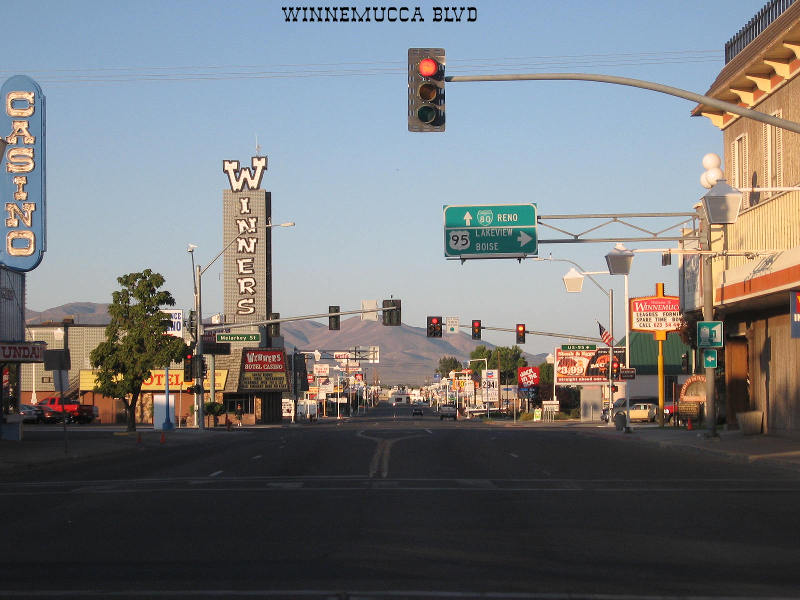
We left Winnemucca intent on avoiding I-80 as much as possible.  The Nevada copy of DeLorme’s Atlas and Gazetteer tempted us with thin, red lines linking place names forgotten by the freeway: locales on the edge of being lost to history. 

(c) WPRR
We chose something called the Jungo Road, a route that parallels the tracks of the old Western Pacific fifth subdivision and lead us through namesake Jungo, Sulphur, Trego Springs and around the edge of the Black Rock Desert (think Burning Man) to Gerlach.

Departing at 7:15, we assumed the Jungo route off US 95 north of I-80.  Straight, flat and paved across an endless plain of alkali and sage, the road converted to a slurry of oiled gravel recently watered to minimize dust.  Ten minutes out of town, four Coach USA buses approached, returning from the Haycroft gold mine with a weary night shift.  Two or three more were to follow during the course of the 48 miles from town to work.  The spray from the on-coming traffic and the cake-frosting-like texture of the road’s surface made me glad I was a passenger in the Toyota SUV and not astride the GSA.

The Western Pacific was the last east-west route to cross into California.  Following the trail of early 1800s mountain man from Virginia named Jim Beckworth, the WP makes the lowest elevation passage through the Sierra.  Folks suggest this was the easiest route and the one that should have been completed first.  But politics, undoubtedly, were at play.  Something about a Dutch Flat swindle?  Leland?  Charley?

The WP route seems smooth – easy to construct, as long as I’m not swingin’ the sledge – with only a turn here and there to go around the mountain.  Now subsumed by the Union Pacific, Jungo, listed as a siding, proves to be little more than a curve in the tracks. 


A half hour further on, we note to the north a stand of derelict buildings built low to or into the ground.  They deserve our attention.  Inspection shows they were constructed out of used rail ties.

From a rise above this enclave, we look south and see the activity of the Haycroft’s huge gold mining operation.

Talus debris stretches for four-and-a-half miles, the various colors of which speak to the rich variety of minerals beneath the Nevada desert surface.

Toward the end of the extraction zone, we pause for a picture of Pulpit Rock.  Driver John considers a hike up there and an impromptu sermon, but the closer we get to the landmark, the higher it rises.  And the area seemed barren of folks in need of our words of salvation – or anybody else – this day.


The drive the 98 mile length of Jungo Road proves to be a series of ancient mountains tilted by tectonic activity divided by flat stretches of one-time lakes filled to their brims with alluvium from the withering hills. 

1860s era pioneers passed this way.  A steel marker notes the crossing of the old Nobles Immigrant Trail.

It appears the route followed a now-dry rill.  It was likely easier to parallel the tiny channel than trundle back and forth across it with ox-driven rolling stock.


A rise presents one of those Church of the Open Road vistas where one can see over the small ridge we’re about to cross and on to the next set of mountains ten or fifteen miles distance – a scene that asks “What might be next?”

Backing down the hill to angle for the best shot, The GPS indicates we’ve stopped at a crossroad.  It takes some looking through the sage to realize the electrons are not speaking in error.

Another steel marker confirms that we are near a place of some significance.

Amid this dry landscape, a submerged fumarole vents into water that seemly comes from nowhere reminding us that the change process is not finished with this landscape.  Here the water bubbles and smells of failed attempts to poach eggs.

Trego Springs:  Not far away, the pool is bathwater temperate. 

Some latter-day pioneer installed a pool ladder for those in need of a soul-cleansing soak.  Other left Coors Light empties.  The WP passes a few yards away.  We consider soaking our feet, cracking a beer and waiting for a freight to pass by.  But in the two-plus hours we’d monitored the tracks, we’d noted no traffic.


Coursing along the southerly edge of the Black Rock Desert, we find pavement - Nevada Route 447. 

North a couple of miles leads to Gerlach, a point that will remain on the bucket list for the time being.  South leads to I-80 with a quick jaunt past Pyramid Lake, over the Sierra and home.   

We were pleased to have taken this road-not-taken and enjoyed tidbits of history that soon – like auld acquaintance – may be forgot.  Let’s not let that happen.


Geography, we geographers believe, is the canvas on which layer upon layer of history is rendered.  Whether as far back as the fossil record or as recent as the latest electronic flash, the spatial relations outlined in a competent map provide context for nearly every event in pre-human and human history.   

Geography is what we drive through both on the way to work and on a really interesting vacation.  Pausing along the way, we discover the stories that inform and fascinate us – challenging us sometimes to wonder “What if…”


Resources: 

Holmes, Norman W., My Western Pacific Railroad, Steel Rails West Publishing.

McManus, M.C., (Director of Train Operations, The Western Pacific, Sacramento Northern and Tidewater Southern Railroad Companies), Timetable No. 4, April 25, 1976.

© 2013
Church of the Open Road Press

Thursday, May 30, 2013

DINING WITH NEW FRIENDS – THE HISTORIC MARTIN HOTEL

On the Cedarville, Burns, Winnemucca Tour
Sixth in a series…

Nevada exists, or so the wisecrack goes, to provide Interstate 80 something to cross at night.  And Winnemucca is the halfway point.  The late CSU, Chico Geography Professor David Lantis labeled such towns GEMs for Gas, Eats and Motel.  Freeways across the west are dotted with these.  Indeed, the moniker is what this gritty little city has devolved to.  Sadly, its rich herding, mining and railroading heritage is viewed only by those not numbed by a perception of monotony along the I-80 corridor. 


A good day in the saddle or seat ends between 3:00 and 4:00 PM.  Lodging is secured – this time at the Best Western.  A power nap followed by a quick shower reenergizes me to take a hike around wherever I am in order to work out the kinks and discover what’s what. 

Postcard photo
Winnemucca’s main drag (Winnemucca Boulevard, US 95) is as Dr. Lantis described with the addition of a couple of casinos and a Yamaha dealership.  I walked past a string of both nationally and locally owned motels and nationally and locally owned eateries.  I came to Bridge Street.  Up this way seemed to rest the more vintage buildings in town.  Most are home to antiques stores, county offices or vacant.  To lengthen my stroll, I hiked along West Railroad Street parallel to the UP tracks figuring I’d take a look at the Amtrak station.  We’d been through the previous summer on the Zephyr, but hitting town while snoozing around midnight, missed it.  A spare but new brick waiting area, the facility looks more like a whistle stop than a full-fledged station.

Across from the depot, a wood frame building, certainly over 100 year old, stands.  All parking in the immediate area was available.  Had it not been for the various flags hung from the balcony, I’d have thought it was just another empty building.

Returning to the Best Western I informed travelling partner, John, that I might be on to something.


The Martin Hotel has earned a listing on the national register of historic places.  No longer offering rooms, it does offer drinks to parched travelers and dining to both locals and those simply passing through: Basque family-style.  “Basque Family Style”: that’s a redundancy right there.

A hour and a half after my discovery of this place we were seated with twelve soon-to-be good friends dining over course after course of freshly prepared soups, salads, baked beans and entrees served by a delightful wait staff.

A carafe of red wine is placed in front of us – rightfully – owing to the fact that wine is a staple.  While dining on a luscious cream of mushroom soup, cloved roasted carrots, mashed potatoes, and (my choice) tiger prawns over linguine (the lamb shank certainly looked good!) the conversation began. 

To my right dined an eighty-plus-year-old matriarch who, with family, was half way between home and a grandchild’s university graduation.  Winnemucca would be their GEM this evening.  Through banter she discovered my yen for motorcycle touring.  The conversation came to life as she talked about Italy – including Stelvio Pass – Germany, France and England: all viewed from the seat of a BMW motorcycle with her late husband. 

“Which model was it?” I asked.  “The black one,” she replied.  “We shipped it back and drove the thing all over the country before we got home…”

How her eyes danced at the thought of her husband and their journeys through the continent, the US and through life.


The historic Martin Hotel: I was glad I’d wandered off the main drag and found this gem among the GEMs.

o0o

Resource: Embedded in the history of Northern Nevada exists a subtle impact of the Basque people who grazed sheep and cattle in what appears to be a pretty unforgiving landscape.  The Martin Hotel is touted as one of Nevada’s best Basque Restaurants.  I can’t disagree.  Their website: http://themartinhotel.com/

© 2013
Church of the Open Road Press

Wednesday, May 29, 2013

POMP’S CIRCUMSTANCE: LOCATING JEAN BAPTISTE CHARBONNEAU


On the Cedarville, Burns, Winnemucca Tour
Fifth in a series…

The high sweeping desert of Oregon is as good a place as any to enjoy eternity.  Sacajawea’s son, Jean Baptiste “Pomp” Charbonneau would know.  A bit west of Jordan Valley, Oregon is where his epic tale ended – a tale that might not have been so epic had it not been for the confluence of history and compassion.

As an infant, he was carried halfway across the continent as his mother guided Meriwether Lewis and William Clark on the Journey of Discovery.  Along the Clark Fork of the Yellowstone, flowing out of the Absaroka Mountains, according to the Journals of the Corps of Discovery, “[William Clark] carved [Jean Baptiste’s] name on a rock formation which he named Pompey’s Pillar for Sacajawea’s child, who traveled in his dugout and had become ‘my boy Pomp.’”*

Clark’s de facto adoption of the young lad ensured an education in a comparatively urbane St. Louis, and subsequent travel to Europe where he rubbed elbows with the aristocrats of the day.

Returning to the States, a twenty-something Charbonneau guided parties across a rugged interior.  He assumed the gritty lifestyle of his French trapper father for a time.  Having acquired several European languages as well as those native to his mother, he served as an interpreter for touring dignitaries great and small travelling throughout an untamed west.

In ’49, like others, he was bitten by California’s gold bug.  There, he dabbled in politics and achieved a respected position in his communities, including service as alcalde of San Luis Rey, California.

As California played out, Charbonneau headed northeast – perhaps along the route of yesteryear’s Idaho Oregon Nevada Highway – to cash in on the gold strikes coming from the Idaho and Montana mines.

In 1866, crossing Jordan Creek – or somewhere out here near Danner Oregon – his mount misstepped, throwing him into the stream’s icy waters.  A chill must have taken hold because pneumonia set in and here, at a place called Inskip’s (or Inskeep’s) Ranch, he rests.


Our inside-the-4-Runner banter subsided greatly as we disembarked the vehicle and stood at the foot of his grave.  Monuments and placards from the State of Oregon, the Oregon Historical Society, the Lemhi-Shoshone Family Descendants and the BLM mark the spot.  Each adds a bit of detail to Pomp’s legacy.  (Click on any picture to expand.)  The breeze pulls at an American flag flying gloriously in an azure sky.  Aside from the Inskip-Inskeep farm across the road, the horizon is nothing more than rolling volcanic tablelands dotted with sage.  Why not here?

Pausing for a moment at the resting places of those larger-than-life participants in history’s cavalcade offers time to reflect on their accomplishments and our own.  Captain Clark’s care for the son of a French trapper and an Indian maiden doubtlessly contributed to the richness of Pomp’s later life.  And the boy, as a man, passed those gifts forward. 

A couple of moments of silence accompanied us back into the rig.  What contributions had we made?

o0o

* Bernard DeVoto (ed.): The Journals of Lewis and Clark, Houghton Mifflin.  1953.

© 2013
Church of the Open Road Press

Tuesday, May 28, 2013

ON THE OLD ION HIGHWAY


On the Cedarville, Burns, Winnemucca Tour
Fourth in a series…

The old Idaho Oregon Nevada route, known as the ION Highway directed frustrated California 49ers to the greener (or more golden) pastures (goldfields) of Idaho and Montana which opened up in the mid-60s.  I suspect California’s Yuba-Sierra County Henness Pass Route was an extension of the ION.

A night-before’s glance at the map informed us that the ION would be an interesting diversion from US 95 passing through Rome to Arock to Danner – in search of the final resting place of Jean Baptiste “Pomp” Charbonneau, son of Sacajawea.  

But, as with many Church of the Open Road adventures, we shoulda known something was up when John's 2012 4-Runner's skid plates began cutting the tops off sage and bouncing over boulders amid the "highway's" ruts.


US 95 heads east-northeast from Burns Junction toward Jordan Valley.  It would be easy to fly by the unpaved Rome Road that connects to the historic and remote ION route across the plateau. 

Paralleling the Owyhee River, the Rome Road turns and becomes the route we’re looking for, according the GPS in John’s 2012 4-Runner.  It crosses the Owyhee on a vintage 1906 steel structure.

A filigreed placard immortalizing those visionaries who planned and built the bridge rusts atop the span.

Up stream, a small dam diverts water into an irrigation flume, which courses along the base of the sandstone bluffs.

Nearby, the bulldozer perhaps once used to maintain this “highway” rests in a state of perpetual unemployment.

The GPS unit is spot on.  It directs us through a weary looking farmstead and up a chiseled grade and across some high, gently rolling terrain. 

The road looks as if it hasn’t seen a grading blade since the old boy down the hill retired, but the Toyota’s high ground clearance and rugged body-on-frame engineering makes light work of the tough climb.

Miles on, a primitive gate bars further access toward Arock.  Sans any type of lock, we utilize the cleverly provided wooden lever to unbind the stay from the wire loop and pass through.

 Returning the gate to its closed position takes more torque than I can muster, but close and secure it we finally do.

We know we are nearing an outpost as we encounter more and more derelict equipment slowly melting into the sage.


Arock – the halfway point to Danner – sports a Community Center, a church, a Post Office, and a crisp looking little grammar school.  A substantial route leads south back to US 95.  But we scoff at this.

A home built from quarried lava cap stands across from the Community Center.

The GPS leads us eastward out of town.  At a point not much further on, the unit tells us the ION Highway courses northerly.

But, being smarter than any electronic gizmo, we stick with the rutted route that appears more heavily frequented.

As things would turn out, we are proven not to be smarter than the GPS nor are we particularly Frostian in our choices about which road not to take.

A gorge carved by a tiny stream that was dammed in 1903 blocks our route.

We would not make Danner this way.

We return to Arock, find the road south to US 95 and hope that none of the locals – peeking through their curtains – catch us backtracking.  After all, we’re geographers. 

© 2013
Church of the Open Road Press

Monday, May 27, 2013

LUNCHING WITH VANNA WHITE: FIELD’S STATION, OREGON


On the Cedarville, Burns, Winnemucca Tour
Third in a series…

Denio, this day, was closed – locked up tighter than a barrelhead – and had been for some time.  The gas pumps at the four-corner store were derelict; paint on the buildings nearly gone; the “closed” sign slipped crookedly behind a plate glass window seemed a bit redundant.   

Having travelled a distance further on Oregon Route 140 from Adel than planned, we’d hoped for lunch, but there was no lunch to be had, not even a Snickers bar. 

The map gave us options and Field’s Station, Oregon seemed the nearest.  An hour further on, we arrived at this place name.  The berg hosts barely an intersection.  It is home to two gas pumps, a dusty little general store, a four-room motel, and a well-worn cafe with nine indoor seats.  Five (count ‘em, 5) Coach USA tour buses idled in the parking area out front.   A little quick mathematical formulation told us that the 100 plus tourists transported there on would likely tax this outpost to the breaking point.

Nearing 2:00 PM, John and I were on the edge of famished and not pleased with the prospect of having to wait hours while the crowd cleared.  Never mind that those who crossed this trackless high desert 150 years back hadn’t the luxury of the prepared beef jerky or bottled Arrowhead Springs water we’d polished off to tide them over. 

Snaking the big Toyota through the idling coaches, we found parking in front of the store.  Curiously, no long line stretched out the door of the tiny establishment. The nine-spot café was not teaming with patrons.  Perhaps this was some sort of promotional outing for the bus line.  Maybe Coach USA spokesperson Vanna (Wheel-of-Fortune) White was filming a commercial.  Perhaps I could order a cheeseburger and buy a vowel to go along with it.  My mind raced.  Hunger does that to folks.

A dozen or so orange-vested individuals were catching a smoke or chowing down at an array of picnic tables out front of the store. 

“What’s up?” we asked no one in particular.  “Training,” came the response.  “We’re running up here from Winnemucca to learn to drive these units.”  “Why to-hell-and-gone out here?”  “Coach is contracted to transport workers living in Winnemucca out to the mines where they are employed; fifty, sixty miles away.  Keeps ‘em off the road and makes sure they show up on time.”

We slipped through the door, past a couple more orange vests and, finding the lunch counter, sat down.  The proprietress’ brother, resident of far off Salem, was slinging burger patties and frying up bacon three or four pounds at a time.  “Sister’s hubby’s off to Boise to pick up meat today from… (and he mentioned the supplier.  We nodded as if we knew who that was.) “We gotta be ready for Memorial Day weekend comin’ up.  That’s why I’m cookin’ up this bacon.  I c’n reheat it up for the weekend crowd.  Breakfast or burgers.”  He slid a metal spatula under the sizzling pork.  “Nobody delivers anything out this way but the gas guy.  Sis makes supply runs to Burns or Bend a couple of times a week for milk, bread, shelf stuff.”

We made mental notes. Bend, Oregon: hours away.  Boise, further.

“So do these training buses stop by here regular?” we asked. 

“This is the first time.  We had no idea when they rolled in.  We thought they was full of chukker hunters or bird watchers.  No idea what so ever.  Sis about…” He laughed heartily.  “Well, let’s say she was concerned when they all pulled up.”  He’d been talking over his shoulder, focusing on the grill all this time, but turned and with a pad of paper asked, “What’ll you have?”


Living on the high lonesome is not for the weak in character or feint of heart.  The romanticist in me harbors fantasies about a simple cabin, vast horizons, clean air, endless sunsets and Maureen O’Hara.  But reality centers on hard work – harder than in our suburbanized sprawl – tough choices, and no days off.  Those who survive do so with grit and ethic and humor.  Their reward?  Those horizons and sunsets, I guess.  And some deep, well-earned rest at the end of the day. 

The burger was outstanding, but, apparently, I had been mistaken about Vanna filming anything here this day.

© 2013
Church of the Open Road Press