Showing posts with label State Route 96. Show all posts

Sunday, October 7, 2018

TOURING THE DEPTHS AND MYSTERIES OF THE KLAMATH

fabulous Klamath Country adventure


October finds Seattle-based riding buddy connecting with California-based me for an annual ride.  Favorite haunts include Eureka’s Eureka Inn 
and McCloud’s McCloud Hotel.  This year, we’d partake of both – and the roads in between.


A first night in Eureka https://www.eurekainn.com found us enjoying the city’s public art… 


…pleasant wharf… 


and multiple dining options.

California’s State Route 299 is the northernmost major thoroughfare between the coast and the Sacramento Valley.  Well-maintained, this delicious route winds from sea-level marshes and meadows just north of Eureka, tunneling through redwood groves and over the southernmost ridges of the Trinity Mountains, past mining towns oft-overlooked when studying California’s Gold Rush, into oak woodlands finally arriving at Redding. Fairly heavily traveled, it is still a good introduction to the rugged and remote Klamath area of northwestern California.


Better still, however, is California’s State Route 96 that splits north from 299 at Willow Creek first following the Trinity River, then the Klamath which it traces some 140 miles east to Yreka and beyond. Winding through bergs offering no gas (fill up in Willow Creek) and little eats (fill up in Willow Creek), the ride becomes an exploration of the rugged environs that somehow supported five of the least-known tribes in all of the state – until demon gold was discovered in the sands and silt of the riverbed.

Vast numbers of the native population died within the first five years of contact with Europeans.  It took a bit longer, but many of the gold-era settlements have fallen into the little-known category as well.  We stopped for a calzone in Happy Camp, after about two hours, at the first eatery we would find along the route.

Highway 96 heads east following the Klamath past post offices of place names whose claims to fame have long since gone bust. But the road is built for touring and we find we’ve left the lush coastal landscape behind to be replaced by grasses and stunted chaparral dotting rocky canyon walls.


A detour over to Siskiyou County’s Living Memorial Sculpture Garden


https://www.fs.usda.gov/recarea/klamath/recarea/?recid=81810 - a moving tribute to all of the county’s military veterans – is required if in this neck of the woods.  


Only eleven miles north of Weed on US 97 and under the watchful gaze of Mount Shasta, queen of the north country, this stark and beautiful park invites pause and reflection.


An overnight at the historic McCloud Hotel https://mccloudhotel.com is restful and comfortable.  Breakfast is filling. And a morning stroll around town before mounting the bikes is always in order.


Riding pal departs north as responsibilities called him home – responsibilities a retired guy, such as myself, can only vaguely recall. Thus, I embark on a solo adventure which starts at the Stewarts Springs exit from I-5 north of Weed.  

Shifting from county-maintained to Forest Road 17, the pavement narrows.


Rising from the hayfields of the Shasta Valley an over-the-shoulder glance offers a view of the queen cloaked in an early autumn mist, her crystalline peak sparkling just above the cloud.


At FR17’s summit, I cross the Pacific Crest Trail for the first of three times this day.


The view to the west recalls the uncertainty with which I tried to explain the Trinity Alps and the Marble Mountains to my fourth graders 35 years ago.  The Coast Range was easy: ridge upon ridge folded and bent by the eons-long collision of the North American and Pacific tectonic plates.  The Sierra, too: a massive granitic fault block tilted from a fissure on the Nevada side of the range.  The Central Valley’s fertile loam and the Mojave Desert’s dryness equally easy.

Expand this image by clicking on it.

But, the mountains of Northwestern California – a combination of faults and volcanism and ice and erosion – were harder to define to little kids.  “You just have to see ‘em,” I’d said.

The road I was on would snake ten or more miles down to trace a remote stretch of the Trinity River.  Rock strewn and narrow, I hadn’t seen nuttin’ yet.

My forest route ended at State Route 3. Turning right (north) twelve well-paved but twisty-downshift-to-first miles would lead me to Callahan.  There, there is a small store and bar and there, the skies opened up. 

Rather than dismount – although I should have – I relied upon my KLIM riding gear to keep me cocooned in Gore-Tex and dry.  https://www.klim.com/Latitude-Jacket-5146-002 This would be the first test of the rather pricy outfit’s weather-proof-ness.  It did not fail.  Money well spent because as it would turn out, most of the rest of the day would be ridden in showers.


The Callahan-Cecilville Road is yet another of those routes that gets lost in the folds and rises of the Trinities.  Nicely banked and paved at the beginning, it’s all just a ruse. Soon I find myself coursing under the fall colors of black oaks, following this stream and that, climbing over ridges and rises I cannot name while hoping in the ability of my Bridgestone tires to navigate chuck-holed and drenched pavement.

Around a bend I splice a pretty good pile of horse poop and then find the offending equine standing on the shoulder of the road. With several pals.  I’d arrived at Cecilville where pastureland, front lawns and thoroughfares are not cordoned from one another by fences and where the only business I was interested in open four days out of the week and this wouldn’t be one of those days.  I purchased a bubble water and a Slim Jim from the self-service frig in front of the shuttered bar.  Why no pictures?

From Cecilville to Forks of Salmon, the road clings to the side of the canyon wall.  Why no pictures here?  Because there is no wide spot to stop on this one-lane-width of busted pavement where I wouldn’t be at grave risk of obliteration by someone rounding a blind curve. That, or pushed off the 125-foot cliff where today’s rains would rise the river and carry my carcass away downstream to the nearest log jam.  Though slow, the ride is stunning and – all the while – reminding me why they call this big Yamaha an “Adventure Tourer.”


At Forks, I run into the improbable: A teacher and a bunch of 10-to-12-year-old students from Bend, Oregon riding bicycles and discovering first-hand those elements of the Trinities that I could not find the words to describe to my students so long ago.  


I suspect they’ll do just fine on their standardized test coming up this spring.


Forks of Salmon – where horses, too, roam the streets and front lawns – is a pretty long way from anywhere and that long way continues to involve a narrow, rock-strewn, paved single-lane somehow hung on the canyon wall.


I grip tightly, drive slowly, contemplate any missed curve with dread and finally, after about 2 hours of thirty mile-per-hour bliss and distress, wind up at State Route 96 where I retrace my steps back to Hoopa, 299…

…101 and the comforts of the Eureka Inn.


That evening, over a dram of Whistle Pig, I think about the hearty souls that populate Cecilville and Forks and the deep canyons of the Salmon River, how rugged and independent these folk must be and how similar they are to the sourdoughs and gold seekers of 150 years back.  Or, for that matter, the Hupa, the Chilula, the Karok, or the Wintu – all inhabitants of the Klamath region for so many centuries before.

Dropping off into feathered slumber, I have to admit to myself that while I like a good adventure ride, I’m really not all that tough.

© 2018
Church of the Open Road Press

Saturday, June 18, 2016

THE INCLEMENT EUREKA, YREKA, BURNEY ADVENTURE


“Unseasonable weather is typical this time of year.”
- Dad

This would be the first “tour” on the Thunderbird LT.  LT reportedly stands for “light touring.”  We’d find out.  Our goal was to drive north to Eureka, east to Yreka, where brother Randy would split north on his Guzzi Stelvio, and I would head further east to Burney and Lassen Volcanic National Park.  Summer being but a week away, the weather should be perfect.  But, as things turned out, unseasonable weather is typical this time of year.

Upon my return home, I realized I did not stop frequently enough for pictures, as is so frequently the case.  But oh, well…


Every good ride starts with a good breakfast and we are never disappointed with the fare at the Bluebird Café in Hopland, California.


We pose the bikes at a lovely rest stop north of Willits on US 101.  A nice place to pause even if you don’t have to “rest.”


Having stayed at the historic Benbow Inn http://www.benbowinn.com/, just south of Garberville, I insisted we stop there for coffee just to show the place off to my riding partner from Washington State.  The historic bridge and the inn are sublime.


North of Garberville on the old 101 at Redway, a route heads west toward the Kings Range National Conservation Area (great, remote Lost Coast hiking) and Shelter Cove.  Bearing right on Ettersburg Road toward Honeydew the pavement tunnels through oak woodlands and across dry pastures.  I’d taken this route on the more capable BMW GSA a year ago and, about forty-five minutes into this leg of the trip, I realized why I swore I’d never take it again.  Just two-and-a-half miles from Honeydew the road begins a very steep descent, corkscrewing down perhaps 600 feet in elevation in what seems like about a four hundred yard section the way the crow flies.  The problem is that, with no turn around and with a stupid desire not to revisit the previous forty-five minutes of travel, this is where the pavement ends.  Hidden beneath a four inch layer of dust and grime is a jumble of brick-sized rocks each intent on throwing the unsuspecting motorcyclist off his or her mount.  And I was on my pristine, new, 800-plus pound Triumph Thunderbird with, as yet, no scratches.  Second note to self: Don’t do this again!

Mattole Road is paved, sort of.  We follow it west of Honeydew and past Petrolia, the little wayside where oil was first discovered in the state.  We find reward for our gritty recent travel after several chunkily paved miles: a six-mile run just north of the Lost Coast.


Brother Randy opines that the Mattole Road could provide someone engaged as a pothole filler employment for life.   


From this remote section of coast, we climb over Bear River Ridge and drop in to Ferndale for a slice of pie and a little time out of the saddle.

Day 1 ends at the historic Eureka Inn http://www.eurekainn.com/Pages/default.aspx a short stroll to that city’s picturesque fishing port and some pretty good dining at the CafĂ© Waterfront http://www.cafewaterfronteureka.com/.  


The route from Eureka to Yreka would be less challenging to either bike’s suspension.  US 101 north along Humboldt Bay is a delight in the early morning mist.  East on CA 299, we pause at a vista point to glimpse the coastal-most hills, but the big blue Triumph somehow gets in the way of the photo.


CA 96 junctions 299 at Willow Creek where we’d stopped advisably to top off and inadvisably for coffee.  96 passes through Hoopa, crosses Mill Creek Ridge and then drops into the Klamath River Canyon.  With sweeping curves through rocky canyons and into and out of remote burgs, state route 96 may be one of the great motorcycling roads in all of northern California – which is saying something.


An oft-forgotten historic fact is that California’s gold rush reached this far north and west.  Mining claims are still active.


A fine suspension bridge crosses the river at Orleans, worthy of a photograph, but, once again…


To further animate our ride, an early wildfire was active west of Happy Camp; helicopters swoop into the depths of the canyon to capturing Klamath River water to be dumped on the blaze.  Seeing the various stages of fire-scarred hillsides on this drive, one wonders: Is there ever a time when some portion of the Klamath National Forest isn’t on fire?


All in all, it is 156 miles from Willow Creek to Yreka.  The highway traces the Klamath in a most engaging fashion, but toward the end of the run, the limited fuel capacity of the ’09 Stelvio becomes a concern.  Topping off in Willow Creek was the right call, indeed.


After a late lunch in Yreka, brother Randy headed north while I sojourned east into the Cascades.  A leadened sky portended showers, but it wasn’t until twenty minutes down I-5 that I stopped to wriggle into my rain gear, placing my camera a layer or two out of easy reach.

California’s route 89 is also a keeper.  Coursing from Mount Shasta City south to Topaz Lake on US 395, it crosses the Cascades and the Sierra past lovely lakes (including Tahoe) warranting several days simply to appreciate its diverse beauty.  I’d get only as far as Burney, enjoying high pine forests illuminated by dappled sunlight as the series of thunderstorms bumped overhead.


Arriving at my lodging early evening, I shuddered to think of my newly beloved Thunderbird getting soaked as the night’s rain set in, but there are some things you can help and some things you can’t.


My plan for day three involved touring Lassen Park on CA 89.  Reports indicated that its winter closure ended two days ago, but by morning, the snow level had dropped to 5,000 feet.  With the park road’s summit at over 8,000, I chose a westerly escape route down a curvaceous, but wet, CA 299 to Redding and then home.

Disappointed?  Nope.  As a six or seven-year-old on my first backpack trip – mid-June in Lassen Park – sleeping bag in a plastic tube tent as rain and hail pounded Dad and me to sleep, I’d learned early on that, in these parts, unseasonable weather is typical this time of year.  Dad said so.

o0o

Tour Route – Day 1:  US 101 north; at Garberville/Redway, west on Briceland Road bearing right onto Ettersburg Road (I’m tellin’ ya: don’t ever do this!), at Honeydew west on Mattole Road to Ferndale; north on 101 to Eureka.  Day 2: US 101 north to Arcata; east on 299 to Willow Creek (get fuel!); north on 96 toward Happy Camp and Yreka.  South on I-5 to Mt. Shasta City, east on CA 89, west on 299 to Burney.  Day 3: Live right and it won’t have snowed in Lassen Park, otherwise, continue west on 299 to the North Valley around Redding.

© 2016
Church of the Open Road Press

Sunday, February 28, 2016

ISHI PISHI WINE


…while up in Redwood country…

About 35 years ago when I left Chico to pursue my career in education elsewhere, my dad began writing a (really bad, sorry Dad) novel centered on a character not unlike his younger son.  The boy had left town to become a sheriff’s deputy in a far-flung northern California county.  At one point, the boy-deputy was investigating some crime or other occurring at a place called Ishi Pishi Falls, a name I was sure Dad had concocted on his own.

The other day, at a grocery store in Garberville, California, a bottle of red boasted fruit from a ranch of exactly that name.  How could Dad’s younger son resist?

o0o

Tasting Note:  Briceland Vineyards sourced fruit for this substantial Bordeaux Blend from a dry farmed hillside above the hamlet of Orleans off CA 96 along the Klamath River – a locale which could legitimately claim to be in a “far flung northern California county.”  We enjoyed this wine with some rustic French bread and a selection of Humboldt County cheeses, but we believe it will pair nicely with grilled lamb, roast duck or a hearty winter's stew.  Better find a second bottle…

© 2016
Church of the Open Road Press

Thursday, September 22, 2011

THE NORTH COAST – VOLCANIC LEGACY LOOP

No place on earth is home to such scenic wonder
and is visited by roads engineered with such grace.

More evidence that God must,
in her leisure time,
ride a motorcycle.


The Vaca Hills west of Winters, CA

STATE ROUTE 128 climbs across California’s Coast Range beginning in the Sacramento Valley at Winters and ending on the rugged California Coast below Fort Bragg.

Monticello Dam
Along its route one passes through the arid rain shadow of the Vaca Hills, past what used to be the Monticello Valley (now inundated by Lake Berryessa)...


Dry Creek area vineyard
 ...among vineyards of the Napa, Alexander and Anderson Valleys...


Where angels may be heard on occasion

...finally tunneling through redwoods before achieving the coast.


STEWARTS POINT SKAGGS SPRINGS ROAD offers an alternative route to the Pacific. Heading west from US 101 at Healdsburg, this secondary road explores the Dry Creek wine-growing region…


Escaping the Tule fog
…before rising to capture of view of Lake Sonoma.


Historic Haupt Creek Bridge
From there, it skips from ridge top to ridge top, plunging into and out of tiny stream courses that have worked for eons to sculpt the Coast Range. Within the last two hundred yards, the road emerges from the redwoods to afford the rider a heart-stopping glimpse of the ocean.


Near Caspar (Google Img.)
STATE ROUTE 1 is legendary. So much so that people fly in from all over the world just to ride or drive its winding course, absorb lungfuls of fresh maritime air…


Coastal California
…view the sea chewing away the ancient cliffs and stop for rest or refreshment in any of a number of quaint, rustic shoreline villages.


Farming the north coast
The route seethes with history from the ancient Pomo, the failed attempts of Russian settlement, the glory days of redwood lumbering and the boom and bust cycles of the salmon industry.


Light plays in the redwoods (Google Img.)
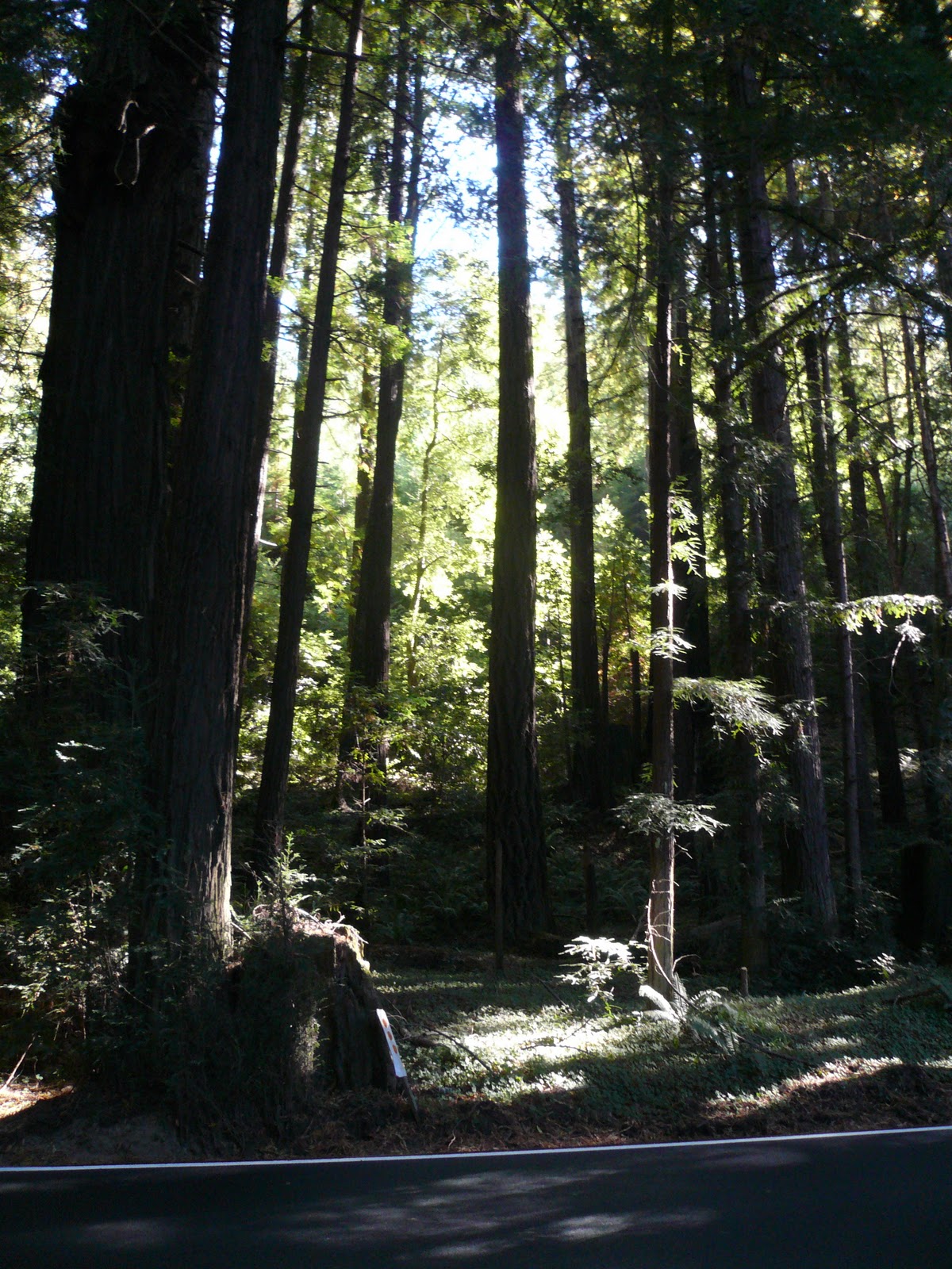
US 101, north of Leggett picks up the state route’s theme, coursing through parks of towering redwoods where echoes of siren songs can still be heard if one simply gets off and listens. The play of mid-day light through the ancients creates kaleidoscopic colors that change with each turn of the highway.


Coastal cooling
Further north, through the area’s capital, Eureka, the seashore’s moderate climate underpins the unique and delicate ecology where the Coastal Redwoods thrive...

Old PalCo mill at Scotia

...and air conditions the old mills where these giants had been harvested and transformed into fencing, decking and trim.


US 199 departs a fog-blanketed coast at Smith River and quickly climbs north of the Trinities…


Crossing into Oregon (Google Img.)
…passes through the Randy Collier tunnel under Hazel View Summit and enters Oregon. Tiny towns dot the route – somewhere the lunch spots don’t open until nearly noon and premium gas for the bike is unavailable. Out of the groves of sequoia, forests transition to yellow pine and the rocky pastures provide forage for deer and cattle.


Indian Creek Road
A SECONDARY ROAD leads south out of O’Brien, twisting and switch backing over the Siskiyous. The Rogue-River Siskiyou National Forest management has chip sealed the road ensuring its longevity for a season or two longer, but tempering the degree to which one enters the inviting turns. At the summit, views stretch southward over range after range of rugged territory.


Happy Camp (Google Img.)
Winding down into Happy Camp it is easy to see why these remote reaches of forestland burn so readily and often. Steep. Rugged. Difficult to access. And full of forest tinder.


Rt 96 in the Klamath Canyon
STATE ROUTE 96 traces the Klamath River in through the depths of its canyon. The late summer water is emerald green and the hillsides deep, dry golden. The cool temperatures of the coast and the high country are long gone as the thermometer reads mid-nineties.


Crossing the Shasta River
At I-5, an alternate highway, State Route 263 (perhaps the old 99) slips through a canyon, and just before Yreka crests to afford a breath taking view of Shasta.


Mount Shasta from McCloud
STATE ROUTE 89 begins in Mount Shasta City and may prove to be the best motorcycling road in the entire state. After departing McCloud, the struggling once-lumber town...


Burney Falls
…the highway rifles straight through tall forests of buckskin pine, the floors of which are neatly manicured to reduce fire damage potential. 30 miles on it swings south past Burney Falls, through the placid pasturelands of the Hat Creek Valley…


Mount Lassen over Hat Creek Meadow
…thence through Lassen Park and then off to explore the high country of the Sierra.


High meadows near Mineral, CA (Google Img)
STATE ROUTE 36 is joined east of Mineral. Traveling west we descend through the cinder-soils and fir forests into the land of Ishi, the last North American stone-age man.


Ancient Cinder Cone near Red Bluff (Google Img.)
The road is chiseled across ancient mud floes and through small lush valleys supporting small acreages of irrigated pasture. A fifteen-mile stretch of hardpan leads down to the northern Sacramento Valley where I-5 is accessed for a quick blast north to Redding.


Platina.  All of it.
36 IS AGAIN PICKED UP at Platina, former lumbering transshipment point and one-time platinum mining berg – hence the name, at least according to the young woman working the watering hole there.

The highway immediately climbs over several ranges finally descending into the course of the Mad and Van Duzen Rivers. No real food or gas until Fortuna out by the coast, but the turns are luscious and one never knows when the next curve over a ridge will afford a view that you’d stop for if you weren’t having such fun in the saddle.


Looking east on 128
 Approaching the coast, again we tour cathedrals of redwoods. Road noise slips away to be replaced by that soft choral siren song of the ancients.


Noyo Harbor
 THE LOOP IS COMPLETED by heading south on 101 to Leggett and following 1 back to Fort Bragg. This time we take 128 east and enjoy a final few miles along the Navarro River and its attendant redwood groves.


West end of Berryessa
A “shortcut” through the Seventh Day Adventist community of Angwin adds an additional 80 minutes to an already too-long, too-hot final day. The west shore of Lake Berryessa appears where my mental compass said it shouldn’t have been.


Winters Main Street
But a twenty-minute stop in Winters allows enough energy regeneration for a charge across the valley to home.

© 2011
Church of the Open Road Press