Part 2 (of 3): Rails to Trails in our Backyard
The completion of the transcontinental railroad in 1869 linking east to west ushered in the golden age of railroads in the United States. Midwestern wheat easily shipped to east coast flour mills, Kansas feedlot cattle mooooved almost effortlessly to east coast markets, and folks could cross from east coast to west in days rather than months. The magic carpet made of steel sealed the early 19th century doctrine that American expansion across the continent was inevitable. And, until the 1950s, rail was most certainly king.
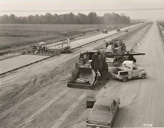
In 1956, The Federal-Aid Highway Act authorized the construction of a 41,000-mile network of interstate highways that would span the nation, and rail transportation’s dominance began to fade. Some opine that the last most profitable year for the freight rail industry was when trains transported the cement that was used to build the interstates. That may or may not be true, but as trucking allowed more flexibility, rail lines became less feasible, and many were ultimately abandoned.
The “Rails to Trails” movement sought to repurpose these rights-of-way. Given that out of necessity, rail lines rarely exceeded a grade of 2% ~ that is two feet of rise for every 100 feet in distance ~ rail grades could and do offer easy walkin’ and ridin’ for hikers and bicyclists. Many provide access to some of the most beautiful, rugged, and remote quarters of the west: The Bizz Johnson Trail on the old Pacific Fruit Express line skirts Fredonyer Pass in Lassen County; miles of the old Tonopah and Tidewater slip toward the edge of Death Valley at Rhyolite (my dad worked for the T&T); and the original route of the Central Pacific over Donner Pass invites hikers through tunnels chiseled and blasted back in the 1860s. (Even today, if you listen carefully, you can still hear the echoing ping of the picks striking the granite.)
The Great Redwood Trail is envisioned as repurposing the old Northwestern Pacific line from Cloverdale, through the Eel River canyon to Rohnerville and Eureka. The route will use existing bridges and tunnels ~ work around them where necessary ~ and split the third largest watershed in the entire state. Travelers will hike through the ancestral homelands of the Yuki people, cross ranchlands that date back to the mid 1800s, and ultimately follow the edge of a languid Eel River as it meanders along the coastal plain en route to the sea. Along the way, the adventuresome will observe flora and fauna in nearly pristine environs while stepping back some 200-plus years from the pressures of the 21st century into the pleasantries of… well… not the 21st century.
Access points may serve to revitalize dot-on-the-map communities including Outlet, Dos Rios, Bell Springs, Island Mountain, Alder Point, and Fort Seward. Each of these places holds a unique history associated not only with the railroad, but with the First Peoples who resided in the region for over 10,000 years as well as the ranchers and lumbermen that followed. Users may choose to day hike or bike out of each locale or engage in a point-to-point-to-point for all or part of the two-hundred-mile section north of Cloverdale. Camping and sanitation will be available as well as security for local landowners. (SMART is committed to construction of a bikeway along its tracks from Cloverdale south to the Bay.)
Though currently only in the planning stages, if all goes well, within the decade a vast and wonderful experience will be open to us and our children. Many communities are already on-board with the project.
Besides: What could possibly go wrong? Could the Great Redwood Trail possibly get… dare I say it?... derailed?
Next: The Great Redwood Trail: Dreams and Challenges
© 2022
Church of the Open Road Press


This would be the best possible use of the abandoned right-of-way. An additional benefit might be increased access to the Eel River for white-water boating. A reportedly great class-II/III river run where currently access is difficult (at best).
ReplyDeleteHaving bicycled many Rails to Trails around the country I've seen the positive economic effect as well as the health benefits for local communities. Looking forward to completion of the Vine Trail here in Napa Valley to link Vallejo and Calistoga
ReplyDelete