Showing posts with label Foresthill Divide. Show all posts

Wednesday, October 30, 2013

DOG GONE!


The Auburn State Recreation Area boasts a complicated web of trails scored into the rocky canyon that, at one time, would be inundated by the Auburn Dam.  The Stagecoach Trail leaves the ridge top near Russell Road splitting about two-tenths of a mile into an upper and lower Stagecoach.   

We typically take the upper for a distance, then, break down into the canyon on a series of marked deer paths and dry stream courses, twisting along the wall of the North Fork to the abutment of the Foresthill Bridge, then link up with Lower Stagecoach for a steady climb back to the top.

For the past two years, a restoration of the 730-foot high Foresthill Bridge finds hikers, when rounding a final bend down by the river, nearly deafened by a cacophony metallic sounds – hammering, sawing, pinging – the soundtrack of engineering moving from paper to product.   

Music to some, but to Jax-the-Dog, our 12-year-old Aussie mix, this is yet one more example of something that’s somehow out to get her.  (Her list includes thunder, the cat, cars passing on the street, and my utterances when this computer malfunctions.)

Off-leash, because I’d forgotten this detail this day, I turned to whistle her near as I rounded the bend, but she was nowhere to be found.  My mind flashed on the Cowardly Lion’s response when first encountering the Wonderful Wizard of Oz.  

Brother Tim and I immediately started one of those search and rescue operations often televised on the Weather Channel – although there was no category 5 hurricane in the canyon this day – wading through tickets of poison oak and ducking under unbending stickery oak branches and past abandoned homeless encampments.

After forty minutes, we had to call off the search.  We'd be losing daylight in about six hours.  A mile-and-a-half from the parking area, our best hope was that someone would find her, discover she was chipped, we’d get a call and all would be well.

Still, on our return, Tim took an uncharted high route and I retraced our steps, calling “Jax! Jaxie!” every ten to fifteen seconds or so.

Halfway back through the maze of trails and brush, my call returned three sharp reports.  Across the draw, on an open spot of the trail, the black and white Aussie had stopped, recognized something through her aging ears or glassy eyes and came racing my way.

I bent down to offer a welcome rub of her ears and she licked me with a too-familiar fetid tongue but, this time, I didn’t pull away.  Clipping her leash I told her how she’d damned near broke my heart and how it would be broke again when I had to tell her mom and how, most of all – another of her nemesii – Edward-the-Lab-Mix’s heart would be broke for having lost his favorite chase-n-chew toy.  In fact, I talked gently with her all the way back up the trail, pausing occasionally to run my fingers through her fur and scratch her neck. 

Once back in the pickup, her time-honed malodorous breath filled the cabin and I sorta wished I’da left her on the trail.

© 2013
Church of the Open Road Press

Saturday, September 28, 2013

AFTERMATH: AMERICAN RIVER WILD FIRE

A mid-September inch-and-a-half of rain to the high country was considered early this year, but not early enough.  Back in mid-July a wild land fire roared up from the depths of the Middle Fork of the American River.  For a time, the community of Foresthill was threatened.  But as the winds shifted, most of the fire’s activity worked its way east.

Earlier this month, before that storm, I decided to ride up Foresthill Divide and check out the changes in the environment up there.  At a junction in a still-green section of cedar and fir, a Forest Service Security Officer – all the way from Minnesota – stopped me.  “Fire’s still active.”  (It had been at least six weeks.) “They’re still doing water drops on hot spots with helicopters.” 

I’d seen a distant plume from a clearing back down the road and was a bit surprised by its robust nature this late in the game.  “Did it get as far as Robinson Flat?” I asked.  “Is the old guard station okay?”

“You know, I don’t know.  Ever’body who comes up this way seems to want to know about Robinson’s Flat.  I’ve never been there.  This is as far as I’m supposed to go.”

I counseled him to get up that way if he got the chance.

“Not the first time I’ve heard that,” he said with a casual grin.


Curiosity and time arc on separate trajectories.  Yesterday, mine crossed.  I straddled the Breva and headed up the Divide to tour the aftermath.

That first good soaking quelled the fire.  The security stop was gone but the area immediately around it was still a verdant green.  A map of road closures was posted there.  It indicated that Foresthill Road was open all the way to Robinson Flat and beyond, but every offshoot from Foresthill Road was closed.
A half-mile up the road, the fire’s effects were fully realized.

Blackened trees, devoid of leaves or needles stood naked against an innocent, blue sky. 

Manzanita ground cover was stripped of leaves in some areas; reduced to ash in others.
The pavement of Foresthill Road provided enough fuellessness to break the torrent from crossing and descending into the North Fork drainage.

Huge sugar pines had been expertly felled by the side of the road in an effort to push fuel back into the fire’s path.  I could imagine the heroic efforts of the firefighters wielding chainsaws in choking, hot conditions.
Foresthill Road, six weeks hence, was open, clear and free of debris, although the air was tinted with a stale ashtray aroma emanating from the moist and musty remnants of charred duff.
Three or four miles in, I came to a sign recounting the story of the last major fire in the area, one from 2008.  Conflagrations are not unknown in these parts.  Not even rare.


The drama of the American Fire was eclipsed by an explosion called “the Rim Fire” down on the Stanislaus, about 80 miles south.  In that episode, tens of thousands of acres were scorched and thousands of folks battled to save forested lands and properties.  Beyond the monetary costs and human-view losses, an unfortunate aftermath of both of these fires has been finger pointing and blamesmanship.

Some say if we’d allowed timber harvest to continue as it had in the 60s, there would not have been the fuels available for such a broad swath.  Others suggest that the government mishandled clearing of the understory.  Still others say the urban-forest interface locates people in places where protection of private property is too expensive and is accomplished at the expense of the rest of the forest.  Many, in each of these camps, are absolute in their assurance that it is the other guy’s fault, whether the other guy is the environmentalist, the government or the developer.


Some things seem fairly simple, however. 

The devastation of a forestland fire is awful to look at, but simply part of a regenerative process.  Prior to our meddling in the natural situation, fire rolled through forests cleaning underbrush, reducing fuels and enriching soils for seeds to sprout and the cycle to continue.  Then we came along with plans to improve on the circumstance.

We are all responsible for maintaining healthy forests.  We can do this through moderation in our efforts to harvest, develop and groom our wild lands.  Too much of any one puts things out of balance.  And we see the results.

Individual visitors to the forest must be careful with fire.  It has always been the case that our southwestern forests live in an arid climate.  Folks leaving campfires unattended, carelessly discarding smoking refuse, using fireworks, or especially deliberately setting fires deserve jail time salted with some time on a crew cutting line.

And this I learned from a whiskered Forest Service fire boss while hauling groceries to the huge Skinner’s Mill fire camp on the Mendocino outside of Corning, CA back in the 70s:  "We don’t put wild fires out," he said.  "They go out."

With that inch-and-a-half of rain recently, that’s what happened on the Foresthill Divide.

© 2013
Church of the Open Road Press

Tuesday, May 29, 2012

“TODAY’S PERFECT...”


Robinson Flat Road – Placer County, CA

...Or so said the man piloting a county dump truck laden with gravel up the hill.  Just above Robinson Flat, I’d pulled over to the side of the road giving him ample berth to pass. 

“You okay?” he’d asked.

“How could anyone not be okay up here?” I responded.  Then I added, “Unless you gotta work.”

“Yeah,” he said looking down from the cab of his International 2½ ton, checking out my abnormally clean GSA, “but I getta work up here.”

“Today is perfect,” I said as he waved and shoved the rig into gear.


Robinson Flat is a favored destination.  About 70 minutes from home we frequently find ourselves with a better bottle of Tokay, a couple of chicken sandwiches, folding chairs and a free, languid afternoon. Whatever book has been resting unfinished on the bedside table will be finished while the dogs freely gambol in the meadow.

Today’s mission was simple reconnaissance: take the bike up there to assess the condition of the road and the meadow and parse out how soon one of those lazy afternoons might safely be added to the summer schedule. 

Although a storm had blown through on Saturday prompting the local TV station to be agog about snowfall in the mountains, the intervening 80+ degree-days wiped out any accumulation.  The 29 miles of paved route from Foresthill were clear and dry, and the tiny bit of gravel I traveled was being filled and graded by a county crew that included the young man. 

The guardhouse near the meadow looked as if it has struggled through a winter that was not yet fully finished.  Refurbished about three years back, its brown painted sides looked in need of another coat and the green painted shingles on the roof made it appear that painting roof shingles green was not such a practical plan.  A mitten of snowfield wrapped about half the base of the cabin.

Likewise, the meadow had yet to see spring.  Water stood atop the saturated glade with no place to run off and nowhere to sink.  I was reminded that this spot, long before man, was a tiny subalpine lake – probably home to the ancestors of today’s black bear and whitetail deer.  Whatever wildflowers I might expect to see in a month or so were probably still encased waiting for a longer spell of warm weather to break out of their shells and splash their color on the landscape.

Hiking around the grounds, the litter of the prior season had been either picked up or scrubbed away by an icy, departing winter.  I did find a derelict poster warning of bear encounters tattered and tossed on the moist duff.  I wondered whether the vandals responsible for the defacement of this government notice were named Bubba and Jim-Bob or Yogi and Boo-Boo.  I hoped it was the latter.


Opting not to traipse through the county’s construction zone this day, I retraced my steps back toward Foresthill.  While riding on gravel and dirt is pleasurable on the big GSA, having time to simply ride and enjoy the nectar of the first breaths of spring is as well.  I could take the long way home next time.  I figured I’d be back up this way in about three weeks with a good book.


Today’s Route:  I-80 west to Auburn; exit Foresthill Road.  East on Foresthill Road 17 miles to the community; continue 29 miles further to Robinson Flat.  Alternate return:  South, over the ridge on graded gravel Robinson Flat Road, passing the road/trail to Duncan Peak LO (Hike this!); right on Mosquito Ridge Road (paved) back to Foresthill.


Related Posts:  Having been to Robinson Flat numerous times, here find a couple of Church of the Open Road posts about rides and hikes hubbed from that point.


Also, click on the “Foresthill Road” label and see if something else shows up.

© 2012
Church of the Open Road Press

Friday, December 16, 2011

ON THROWING THE BASTARDS OUT

Just the facts, Ma'am...
 - Joe Friday

A SMALL WATER DISTRICT serving a tiny community in the Sierra foothills finds that its income doesn’t cover its costs. A plebiscite is placed before voters regarding a rate increase. It fails. Unable to make ends meet, the district manager shrugs: “Maybe we’ll have to close up shop.” Howls of protest follow. “This is just another example of big government taking our money!” “The unions sold us out!” [The water district employs six (6) people.] “The board members forgot where they came from!” “You’re just punishing the voters for telling you no!”

Digging deeper, one finds that a former iteration of the Board, concerned about providing a secure source of water, purchased a dam and the rights to the water reserved behind it. Knowing that their future constituency needed the water but the current constituency did not favor higher rates, the Board made no accommodation for paying for the purchase. New members elected to the Board pledged to continue to hold the line against rate increases. Once seated, reality sets in. An outstanding debt exists to pay for capital acquisitions and improvements to serve ratepayers who desire a reliable, uninterrupted source of water. But the rates don’t cover the costs and the Board can’t give the dam back. Confronted with the big picture, the Trustees are stuck: there is but one course of action.

Never in a position to garner all the facts or see the entire big picture, some ratepayers demand a more responsive board. They demand Board change. Again. And again. And again.


(c) illinoischannel.blogspot.com
THE SAME SCENARIO PLAYS OUT in water districts, lighting districts, town councils and school boards across the country; and now, even Congress. Agenda-driven candidates are elected to positions at their own risk.  Once sworn to “…defend the Constitution of the United States from all enemies foreign and domestic…” these new representatives find themselves in an unavoidable conflict between what they said they intended to do and what actually needs to be done.  Myopic adherence to the narrow view that got the individual elected can sink the governmental organization.  Acting responsibly to meet the needs of the entire constituency can sink a political career.


IN A REPRESENTATIVE DEMOCRACY, here’s how it works: As the electorate, we pay the elected to grasp the big picture. We understand and accept that the big picture is not something we have the advantage or privilege of seeing. Truth be told, we don’t want to see it. The big picture is often just too damned complex – except in the example of the water district where it’s pretty damned simple.  Never-the-less, we expect our elected representative to get the big picture and then to make choices based upon the big picture.

(c) California State History Museum
Skewering, brow-beating, slandering, editorializing against or condemning a good person who has risen to a legislative position simply because her or she bases important decisions on an understanding of all the of facts, including those not available to us – that is, condemning someone for doing their elected duty – doesn’t add to the debate. Neither does it strengthen our democracy, contribute to getting work done in our school districts or our water districts nor make us look as if we paid attention in Civics class back in 12th grade.

© 2011
Church of the Open Road Press

Monday, November 28, 2011

MY DARLING [LAKE] CLEMENTINE

THE LEADING EDGE of December turned out to be a sixty-degree day. Whether or not this was a weather mirage – the Tule fog common to the area never showed up this morning – I would take advantage and ride smack into the middle of autumn. It was the GSA’s turn for a run so I saddled up and went looking for fall.


BEFORE RETURNING to motorcycling, I built a kayak from a kit. My Pygmy “Golden Eye” is light, stable, and maneuverable; plus, the mahogany plywood makes her a real looker.

(c) Pygmy Boats

John Lockwood; (c) Pygmy Boats
The story goes that John Lockwood, the developer of Pygmy Kayaks, was an outdoorsy sort who endured a tragic construction accident – one which left him with limited mobility from the waist down. Resourceful gentleman that he is, Mr. Lockwood used his computer savvy to create a lightweight vessel that proved to be quite seaworthy. He could return to the wilderness – sometimes for months at a stretch(!) – and along the way, so could many of the rest of us. The maiden voyage of my Pygmy Kayak was on Lake Clementine.


A LUSCIOUS SINGLE-LANE STRIP of pavement leads to Lake Clementine from Foresthill Road, east of Auburn, California. This day, the damp, shaded curves are blanketed in slick, fallen leaves, the likes of which I’d hope to photograph while still on their trees. A break in the forest cover affords a nice view of the North Fork Dam, a debris dam built in 1939 to mitigate the unnatural flow of mining detritus from 90 years prior. There being no outlet at the bottom of the dam, water simply fills the basin and cascades over the top. The good news for kayakers is that never do they find a “bathtub ring.” The area foliage always grows right down to the water’s edge.

Ample parking greets the boater or skier or fisherperson. I find an inopportune place and hike down to the boat ramp. While a couple is loading a pair of kayaks onto the roof of a Honda Pilot, I think about how little attention my Pygmy has received since I re-entered the realm of motorcycling.

A view from the dock offers a find view of the top of the North Fork Dam. The still water has that mirror-like quality that paddlers long for. The reflection of the south facing canyon wall is picture perfect.

Looking eastward, a small seasonal marina is located a few yards away. Just around the bend from that, I recall from a paddle trip some ten years back, is a maple with flaming red leaves. Somewhere I have a slide of the tree and its mirror image. Somewhere. Can’t get to it now without a boat.

Wandering about the parking areas, I do find some fall colors still clinging to a Freemont Cottonwood.

In a drier micro-environ, a red-berried Toyon invites pause.


WITH A BIT OF LATE AFTERNOON sunlight remaining, I wind back up the canyon wall and find a spot beyond the pool to peer into the depths of the North Fork Canyon.

Along the crest of the ridge, black oak leaves still hold, but with the next cold storm, surely will cover the pavement; ancient trees again waiting for a spring thaw and the promise of renewed life.

All in all, a satisfying ride for a day when normally one would only dream about the road. I head home thinking that I must rescue that beautiful mahogany craft from its sad and dusty mooring in my garage and, again, venture to the far reaches of Clementine.


RESOURCES:

Pygmy Boats – beautiful kayak kits that draw little water but many, many appreciative glances. If I can build one, believe me, anyone can! More details at www.pygmyboats.com

© 2011
Church of the Open Road Press

Saturday, September 3, 2011

ANOTHER NICE RIDE ‘N’ HIKE COMBINATION

Robinson’s Flat to Duncan Peak LO (Placer County, CA)


THE OTHER DAY I took a copy of Timothy Egan’s The Big Burn up to the fellow manning the lookout on Duncan’s Peak. Two reasons: 1) Egan’s book presents a compact history of the early days of the US Forest Service along with its earliest great challenge, and B) any day one gets to ride a Beemer or Guzzi (or a KLR) up Foresthill Road from Auburn to Robinson’s Flat is going to be a really good day.

I tossed some hiking shoes into the Jesse’s on the GSA, leaving the Breva home in case I was tempted to ride the gravelly mile and a half from Robinson’s Flat up to the lookout. I wasn’t. The walk would be a good one and watching the scenery unfold at my feet never ceases to steal my breath.


FORESTHILL ROAD departs I-80 just east of Auburn; just a short jaunt up the hill from Sacramento. It crosses the North Fork of the American and traces the high ridge into Foresthill. These 17 miles are gorgeously engineered and heavily patrolled.

Climbing above Foresthill, the road creases through mixed forest as it gains elevation. Eight or ten miles further on, a side road leads to Sugar Pine Reservoir, thence off to Iowa Hill and Colfax back on 80. Continuing east, one rides through the yellow pine belt past little dirt tracks that lead to gold rush era locales lost to history.

The last ten miles of pavement lack a centerline. Through stands of forest and clearings, the shoulder drops off inviting the rider to pay close attention in and through the wondrous twisting curves. [Click on Foresthill Hill Divide in the “tag” section to learn more about this magnificent route.]


File photo from my KLR days
AT ROBINSON’S FLAT, I rest the bike on its sides stand and change footwear. A nineteen-teens era guard station has been resurrected and sits as a monument to the early foresters who watched over the resource.

A stroll to the nearby high forest meadow and a few cranks on the hand pump there, rewards me with some of the world’s purest waters. Good to remember on a day when, hiking at 7500 feet, the temperature may touch ninety.


THE WALK TO DUNCAN PEAK can be accomplished via trail or via road. I choose the gravel and dirt extension of Robinson Flat Road for the climb, opting for Little Bald Mountain Trail for the return. Either way, the final two hundred yards to Duncan Peak is a delight, as the entire world seems to unfold at my feet.

Once there, a nice conversation with John, the ranger on duty, ensues. He points out area promontories and talks about the various hikes he’s taken on his off days.

“See that outcrop?” About a mile north, a small white dome rises above the forest. “That’s the site of the original lookout.”

I’d been up this way easily two dozen times and didn’t know there had been a former lookout anywhere in the area.

“Seems they built the thing, had a great view of everything except what lies beyond this ridge right here.” He pointed at the ground below the current tower.

“Wouldn’t they have figured that out before they built the thing?” I asked.

We shook our heads in concert and both said, “Government work.”


I WALKED A BIT of the Little Bald Mountain Trail, because that’s what I planned to do. Along this ridge east of the peak, views stretch to the south and southeast. French Meadows Reservoir lay at my feet and the ski runs at Mount Rose are visible about 25 miles off.

Fire had devastated this area around thirty years ago. The short high country-growing season makes reforestation a long process.


HAVING RECEIVED DIRECTION from Ranger John, the hike over to the old site was an easy one. “Just turn right when you get to the cattle guard and park there.”

I had nothing to park.

The trail John indicated was actually a passable but unimproved dirt road. Keeping my bearings about me, I followed my nose and came upon the base of the dome.

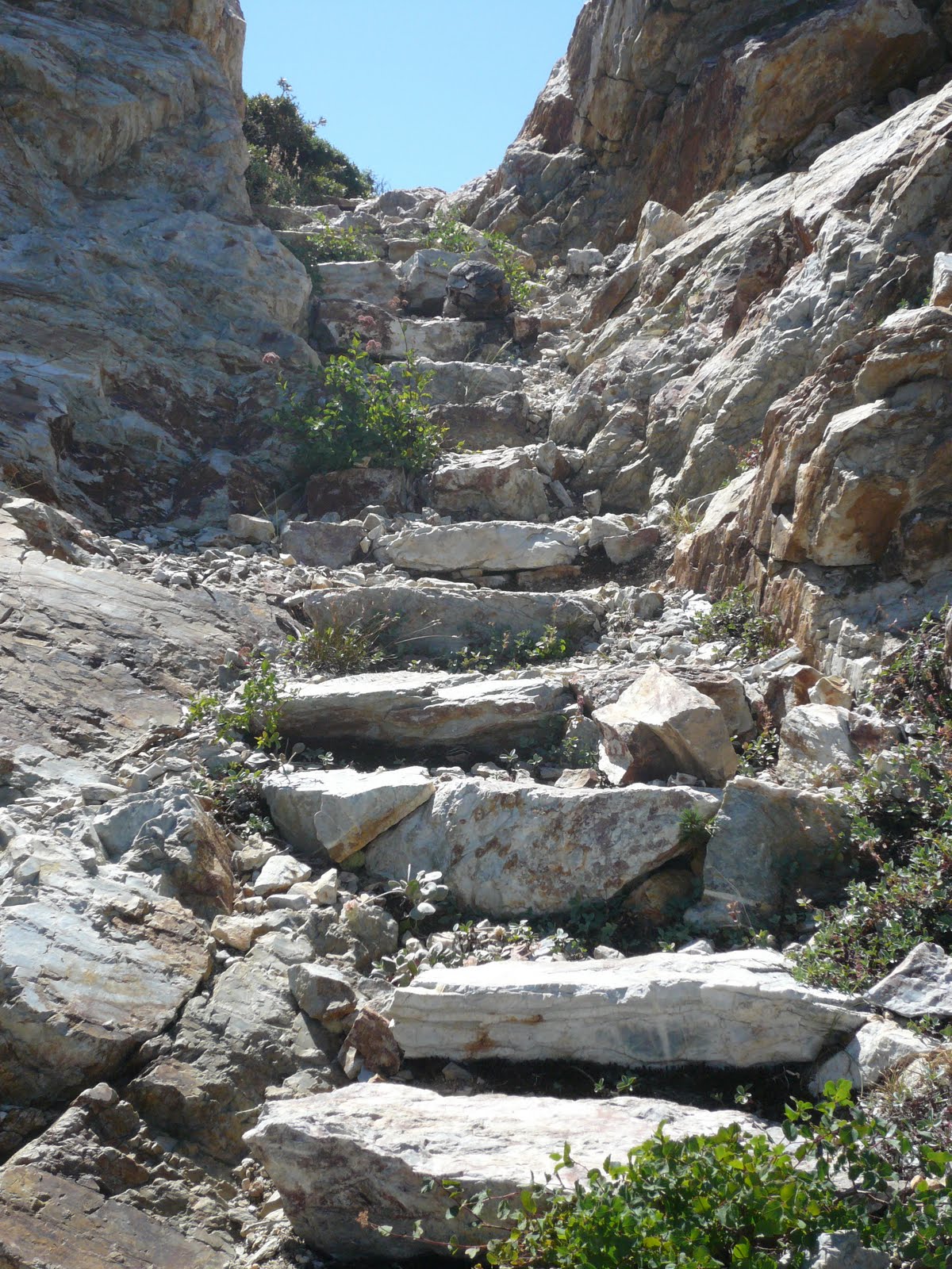
A trail coursed between the pine-mat Manzanita and climbed the slope. Long ago workers had hewn steps through a fissure in the granite.

A few out-of-breath minutes lead me to the remains of the fire lookout: A sixteen by sixteen foot splintery wooden platform perched atop solid rock.

One has to wonder how they got materials up here for this structure, and how they got them to stay grounded over the years of its use.

The view to the north included the abandoned tower at Grouse Lakes – some thirty miles away; and beyond that, another score or more, the tower on the Sierra Buttes appeared as a mere speck.

To the south, the current lookout gleamed in the mid-day sun. I stood next to the platform and waved for a moment or so, thinking Ranger John might like to know I’d arrived.

Lunch involved some dried beef and bottled water on a sun-silvered, splintery perch with a 360 degree view that most will never see. I took some notes and started back down.


BACK AT THE PUMP at Robinson Flat, I drenched my head before donning my helmet. As the vents carried the cool air through, I considered this a good ride, a good walk and a good new discovery. Therefore a really good day.


NOTE:

Photographer Keith Sutter offers some great shots of the Duncan Peak Lookout.  Find his work on line by Googling Duncan Peak Photos.

© 2011
Church of the Open Road Press