Showing posts with label Oregon. Show all posts

Monday, September 23, 2024

FLY-OVER COUNTRY

 Notes from a visit to Eastern Oregon

Oregon east-of-the-Cascades is a mystic, even ethereal place.  Not much there, but so much hidden and so much to explore.  I think this as I drive the Subaru out of Bend and Redmond toward who knows what or where.  My brother from another mother – a chum I met back in college – rides shotgun. 


Our usual mode of exploration transit involves two wheels attached to a righteous amount of horsepower. But this trip, in mid-September, found us nursing ailments – knees, backs, joint-related maladies – ailments we never really considered over the fifty years of our shared adventures.  


The west’s Basin and Range, in the rain shadow of the Sierra and Cascades, is a mosaic of lodgepole, sage and pinion, basalt and dry washes and baking desert sun. It stretches all the way to the base of the Rockies. Seemingly desolate and unforgiving, most of us simply fly over from San Francisco or Seattle en route to Chicago, New York, London or any of a thousand historic destinations. Yet, in that jet-plane rush, we’re flying over history that began before time. 


And during that ‘before time,’ the sea floor lifted and buckled to be shaved and carved by ice and wind. Lava oozed from fissures, flowed until cool, and solidified only to be broken into some semblance of dirt by freezing and thawing and the incessant labors of acidic lichens. Winds and rains pushed and scrubbed topsoil off prehistory’s basaltic base. Grasses, shrubs and, eventually, those pinions grabbed hold in protected crevasses. Luck probably played a hand. Luck plays a hand in a lot of life, doesn’t it?


Early man migrating across the Bering Strait during an ice age or two – or seven – left his subtle mark. Ten of thousands of years later, European settlers crossed, lured by the siren song of California’s fields of gold, groves of redwood and fir and soils rich for tillage. Cities were sure to follow.

Some folks trickled back.  Those with a different dream or, perhaps, a recurring one. Looking for the next Mother Lode? Looking for the next verdant valley? Or simply looking. Remnants include rough-hewn cabins protected from rot by decades of arid drought. Fencelines run straight up hillsides begging the question, What was being fenced in or fenced out?


Rutted dirt two-track roads followed emigrant routes. Highways followed those. But off those highways, wading through the sage and yellow pine, traces of the steel tires of Conestoga wagons and primitive ox-drawn carts can still be found scratched into the land. One wonders how many head can graze on one’s 160 acre grant. Did they have the land grant program here? They sure as hell couldn’t depend on row crops or grain. There surely was no sod to bust.


We drive past a basalt bluff, one that looks like an 11th century Scottish Castle. (Note: I had visited a Scottish Castle only three weeks before.) The formation long preceded man and will live long after we’ve departed. 


Etched into the base are the pointillist stories of the Utes or their predecessors. The message is probably simple, but we’re left only with conjecture. These humans were independent relying only upon their skill and wit and the stuff they learned from the prior generations. Let’s call that ‘history’ in its most basic of applications.


The contemporary folks who live out here, likewise, are independent souls.  As my companion and I see signs in support of a presidential candidate he and I both disdain, a realization – or maybe just another conjecture – rises. These people depend first upon themselves and then their neighbors. In this lonesome territory, I suspect the sheriff is an hour or more away, as is the tractor repair guy. A trip to a big box store might consume a whole day.  And you might not make it to the hospital in time. So the signs I may disdain might really be saying, Leave me the hell alone. I’ve got this. I’m good out here on the high lonesome. Followed, perhaps, by: You likely wouldn’t be. (In my case, they’d be right.) Hard working, rugged folks with well-honed views of things different from those of two guys cruising around these parts in some damned Subaru.


We pass through a small town, no bigger than a wink. Jean Baptiste Charbonneau may have come this way when relocating from Murderer’s Bar on California’s American River (near my one-time Placer County home) to the Idaho mines.  
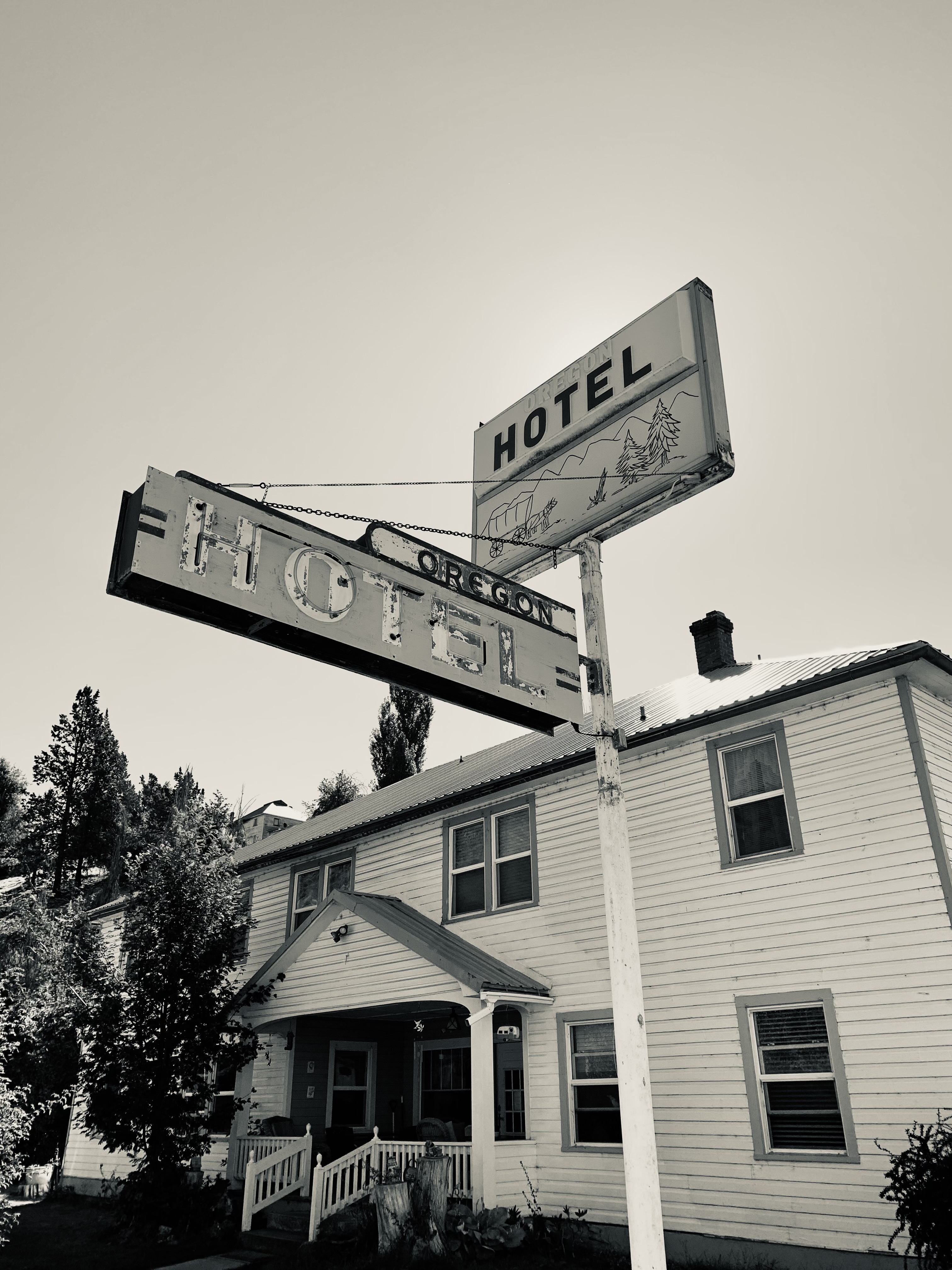


Up the road a bit we pause where the Bhagwan Shree Rajneesh escaped from India and set up a colony four decades back bringing with him seven Rolls Royces and much consternation.  


Further on we visit a site where their-workday-is-done trucks rest scattered about a field like a graveyard, their once robust bodies dissolving into the sage, destined to be lost to history long before the aforementioned bluff.


Throughout the journey
 we are moved by the melding of horizon and sky, the vastness of geologic time, the incessant workings of the elements, and realization that there is so much more to explore, so many more stories to conject about and – as we both stare into our mid-70s – so little time left to do it.  


Perhaps that is the one great lesson of Oregon’s high desert: never will we see it all or grasp the enormity of its time and space, but never should we stop trying. 


o0o


This day’s route: US 97 north from Bend; OR 126 east to Prineville; US 26 to Mitchell (Charbonneau?); OR 207 north to Fossil (check out the John Day Fossil beds scattered through here); OR 218 west to Antelope (pop. 39 ~ former locale of the Shree Rajneesh); continue north to Shaniko (field of rusting vehicles, but, sadly, no trace of a Bhagwan’s Rolls); US 97 south to Bend.


Nearby? Oregon’s High Desert Museum about ten miles south of bend on US 97. All kinds of history! Plan on a half a day.  Bring the youngin’s. https://highdesertmuseum.org


A bit further east? National Historic Oregon Trail Interpretive Center near Baker City, Oregon. Come see the privations immigrants endured and check out the wagon ruts still visible in solid stone. Allow another half day. https://www.blm.gov/learn/interpretive-centers/national-historic-oregon-trail-interpretive-center


© 2024

Church of the Open Road Press


Saturday, July 18, 2020

CENTRAL OREGON CASCADES – CENTRAL OREGON COAST - ii

Part 2 of 2 – the Coast

In the collection of North America’s great motorcycle routes, it’s a gift  to find so many out here in the west – an even greater treat when one can experience two on the same trip.  Oregon’s State Route 242 over McKenzie Pass is world class: great pavement, challenging curves, wonderful views and a bit of history both recent and Cenozoic.  Tough to beat, unless...


...unless one can make it out to the Oregon section of US 101 which traces our Pacific shoreline.

Departing Camp Sherman, we descend Oregon Route 126 along the McKenzie River.  Back at the pass, we’d learned that the heavy winter snowfall melts into a subterranean basin – the chunks of basaltic aa are too coarse to allow pond to form or streams to flow.  Snow melt rests in that underground lake for “from three to ten years” until it filters out into either the Metolius or the McKenzie River.


OR 126 is a delightful series of rises and falls, curves and twists, campgrounds and tiny bergs.  It is a wonderful experience on most summer non-weekend days.


Crossing the Willamette Valley at Springfield and Eugene is a complex chore involving traffic signals and turns at intersections that sneak up on the unexpecting – but the whole process only takes about twenty minutes.  Soon we’re on the road to coastal Florence rising over the folded Coast Range and following the Siuslaw River to the sea.

Huge sand dunes separate US 101 from the ocean south of Florence, but with moderate traffic and a few glimpses to the west, the ride is entertaining.  A masterful bridge crosses Coos Bay – certainly worth stopping for a photo – which I did not.  Why?  Why?  WHY?


Mid-afternoon finds us arriving in Bandon, a coastal village with all those coastal village charms: a wharf, a lighthouse... 


...a quaint downtown with plenty of eateries and a soundtrack of seagulls and sea waves.

The coastal prairie in these parts... 


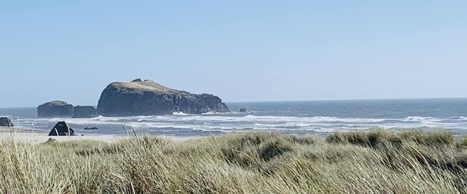
...gives way to large expanses of sand and not-so-distant sea stacks.


I call this picture “My Dancer.”


Within walking range of the Inn at Face Rock (a Best Western property) are several Oregon State Park vista points from which one might catch a shot of the setting sun.  


The following morning I realize I didn’t get a photo of the namesake rock, so we seek out that particular view point.


See the tilted face looking skyward?


On the road, south of town, we arrive Port Orford and while 101 swings east, one is encouraged to keep going south because painted on the tarmac like something the road department wouldn’t do are the words: “Ocean View ahead.”  I always succumb.


A great place to pause.

Further south, we enter a twelve mile stretch of protected coastline dedicated to the efforts of Oregon’s first director of state parks (and visionary, I’d opine): Samuel H Boardman.  


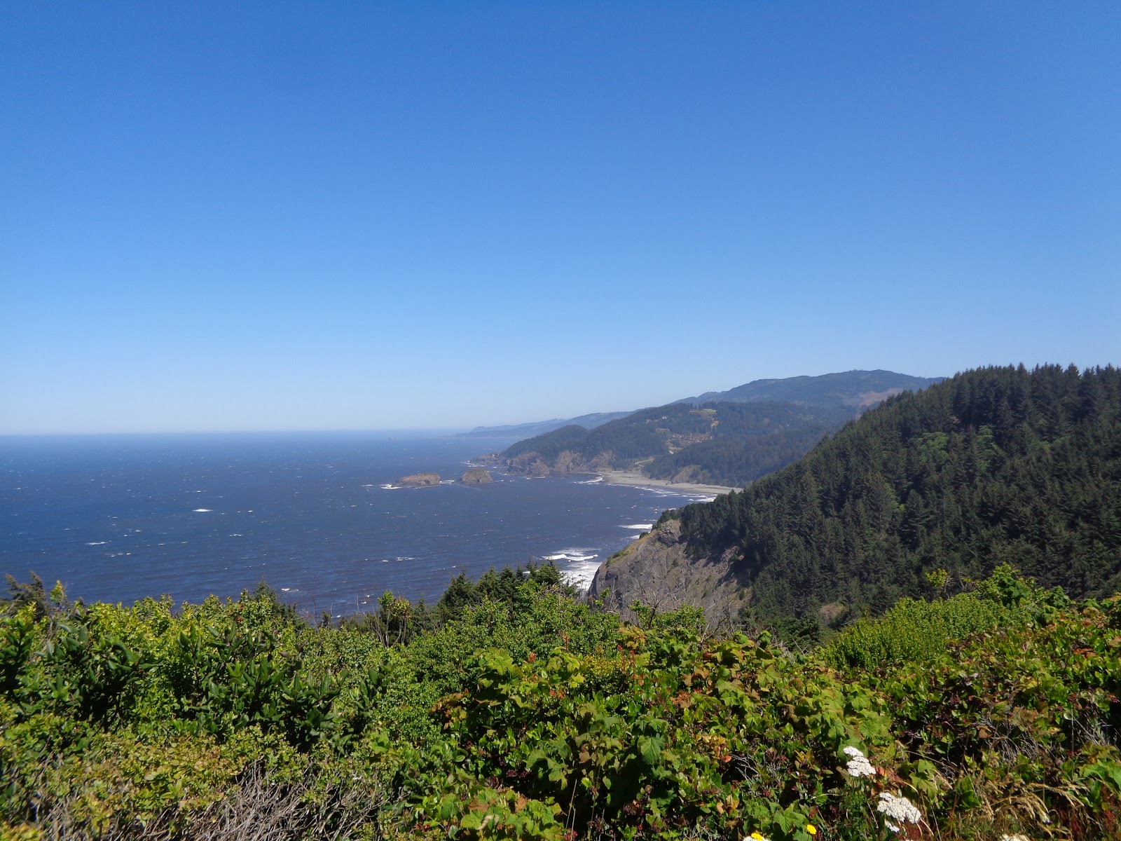
Several scenic overlooks dot the roadside, each connected by a coastal trail.  Each beckons.


We had hoped to stop at the Oregon Welcome Station and, with GPS in hand, hiking over to the 42nd parallel and the northwestern corner of California, but the pandemic had rendered the Welcome Center unwelcome...

We motor through California’s Smith Redwoods and on into Crescent City where the great Alaskan earthquake of ’64 and its resultant tidal wave - here some 1500 miles south - wiped out blocks and blocks of downtown.  Now the area is an open space park where ravens and squirrels are happy to prance around and steal your picnic...


Late afternoon finds us in Eureka – a favored destination for an evening at the historic Eureka Inn and al fresco dinner on the wharf.


Tomorrow we’d be home savoring two great experiences on one grand trip.


Where’s Dad?  When I’m on the road, I enjoy many things, but I miss some things as well.  One of those “things” is Edward, out loyal eleven-year-old lab mix.  He’s such a good boy.  I think of him often, especially when I see someone walking their Edward look-alike.  I always wonder if Ed goes to sleep each night with a bit of a whimper as he pines for me as much as I pine for him.

Out at Face Rock, while setting up for a shot or two of what would be a marvelous sunset with about fifty or sixty other folks, I espied this guy sitting shotgun in a Mercedes camper van while whomever was out taking photographs.  I couldn’t help but feel that this pup didn’t give a rip about the sunset; rather he had to be asking his lonely self, “Where’s Dad?”

And I thought of Edward.


(c) 2020
Church of the Open Road Press

Friday, July 17, 2020

CENTRAL OREGON CASCADES – CENTRAL OREGON COAST

Part 1 of 2 – the Cascades

We always vacation someplace new.  Never return to the same place.  The west is so vast, so enchanting.  So many things to see.  So much history to discover.  So many roads to explore.


Yet, this would be our fifth trip to the Metolius.


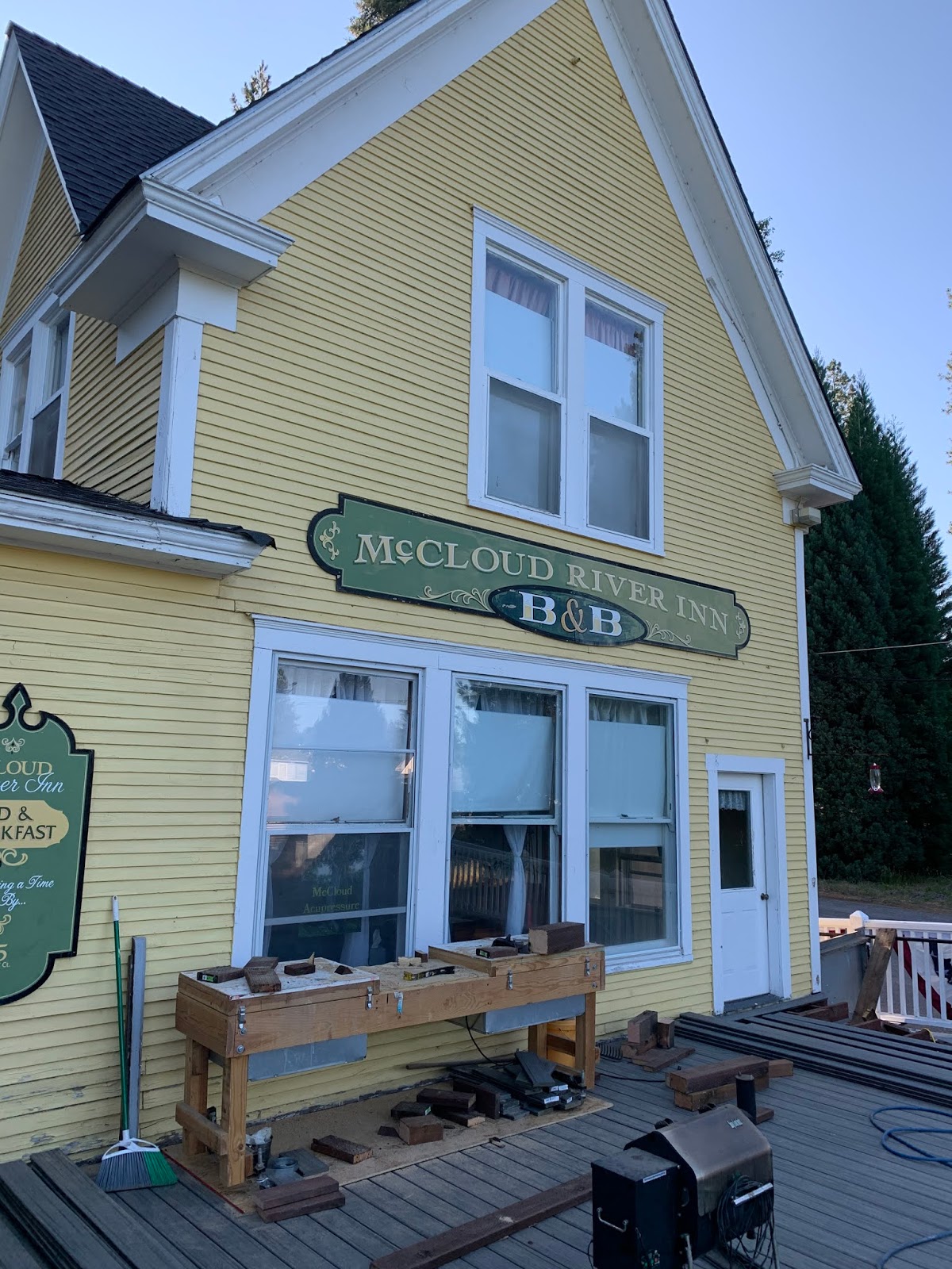
The two-day run afforded us an overnight in lovely McCloud where stayed at the newly acquired McCloud River Bed and Breakfast.  https://mccloudriverbnb.com
  

Formerly the main office of the McCloud River Lumber Company, the grand old house – just a block or so from “downtown” –  is undergoing restoration.  


We even got a peek in the old company vault where records for every employee were kept.  It was like walking into history...


Up the road, what would have been an annoying traffic delay was mitigated by this view of the queen of Northern California: Mount Shasta.


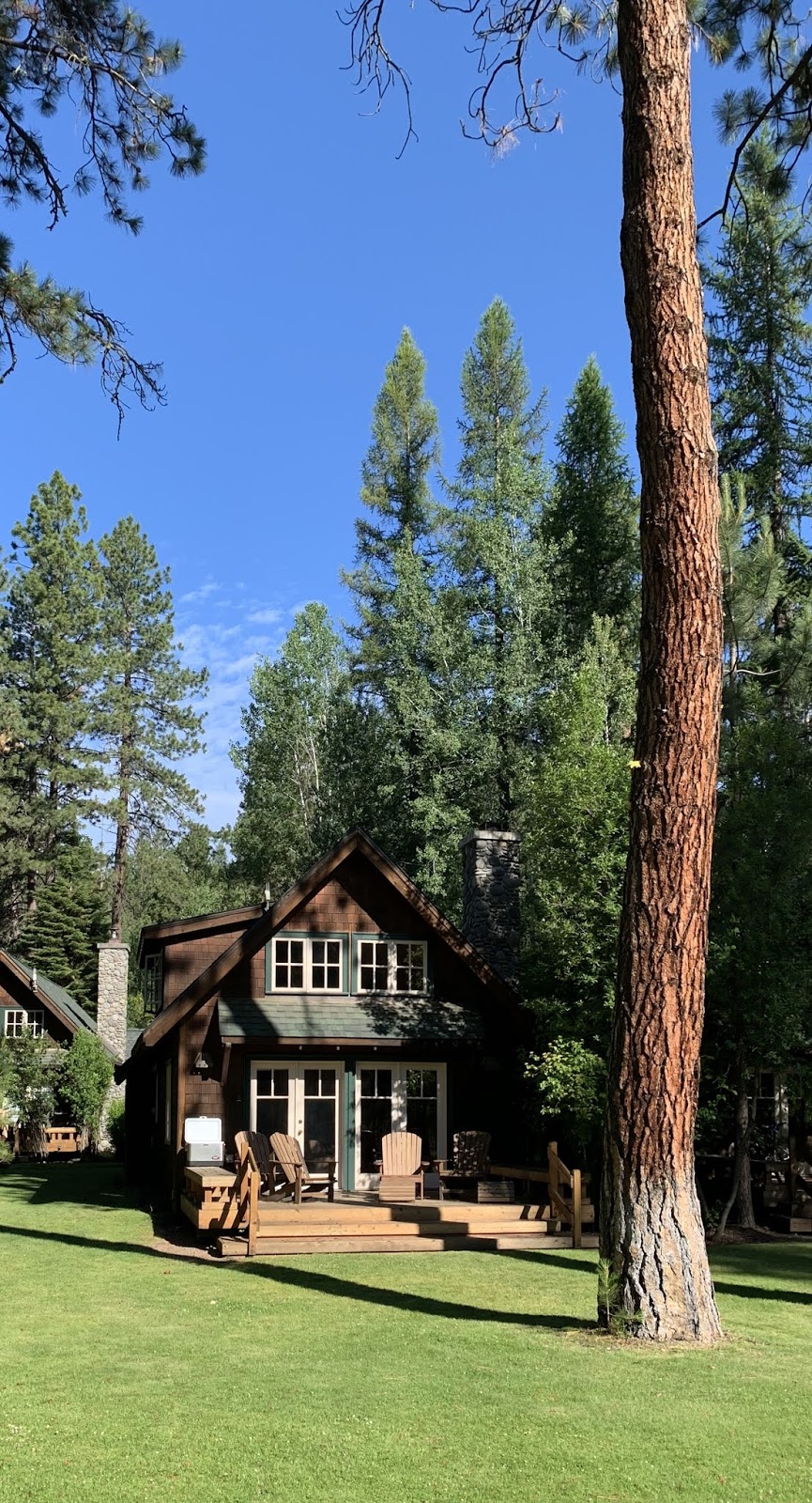
Arriving Camp Sherman, we returned to the delightful accommodations of the Metolius River Resort.  https://metoliusriverresort.com  Twelve privately held cabins stand just a few manicured yards from the pristine river that slips past.


Trails trace each side of the river – one leading to the fascinating spring about two miles upstream from which the entire river emanates.  (The next day, up at McKenzie Pass, we learn why.)


By mid-July, the spring season is almost a memory, but a few wildflowers dot the meadows, stream sides and even the fallen logs in the river.


The evening lullaby includes the symphony from the river and soughing of the sweet ponderosa pines.


The following day finds us traveling Oregon State Route 242, through several of the west’s more signature scenes – wild land burn scars... 


... to McKenzie Summit, and a stunning display of the area’s volcanic heritage.


A paved trail offers views of the Three Sisters, Mounts Jefferson and Washington...


... leading to an observatory hewn from area basalt.


On a clear day, the views are dramatic...


Perhaps only more dramatic when some cloudscape is added.


The interpretive trail is an easy stroll where the nuances of the landscape are detailed.


We learn that Mt. Jefferson is the newest of the area volcanos by tens of thousands of years and that is why it appears far less jagged and weathered.


The ride back down OR 242 to Sisters is a delight on a bike that handles like Enrico, the Yamaha, but equally pleasant, I’m told by my travelling partner, in the accompanying Subaru.  


When in Sisters, check out the Stitching Post Quilt Shop. https://stitchinpost.com We actually planned this trip to correspond with their world-renowned Sisters Quilt Show, an annual July affair which had to be canceled this year due to the pandemic.


Back at the cabin, we enjoy a few more walks and a few more evenings of peaceful rest and, upon departure, figure we’ll break that always-someplace-new rule and return again soon.


In the late 1950s, there was a little old lady that lived down the street from us when I was growing up.  Her name was Mrs. Carah.  Her first name was Rose.  She was the oldest person I think I ever knew when I was seven or eight. She would invite neighborhood kids – mostly boys –  to take a break from our playing in the creek and come to her house for store-bought cookies, Kool-Aid and Bible stories and talk about the old times.  She once told us about coming to California in a covered wagon.  She said they came through Yellowstone before there were automobiles.  Along the way, she met a man named Bill Carah.

Over time, we got to know Mrs. Carah rather well.  It turns out her maiden name was Wild.  She was one of those people you meet when you are growing up that you never forget.  Every time I’m in the woods and I see these, I think of Rose Wild.


(c) 2020
Church of the Open Road Press

Tuesday, August 21, 2018

A FEW DAYS IN THE SHADOW OF CHIEF JOSEPH

notes from an eastern Oregon road trip – part 2 of 4


Wallowa Lake and the surrounding Wallowa Mountains are the enchanted northeastern Oregon home of the Ne-moo-poo.  Cycles of glaciation over eons created a topaz-blue lake flanked on the north and east by moraines of till scoured from the mountains that form the southern and western shorelines.  Forests are rich and deep in those mountains, and grasslands in the nearby hills and plans fertile and fruitful.  No wonder the Ne-moo-poo fought to valiantly when the whites arrived.

In Thunder Rolling in the Mountains, a piece of young adult historical fiction by Scott O’Dell, the maiden daughter of Chief Joseph says: “The whites called us Nez Perce, although that was not our name.  They said it meant ‘Hole through the nose.’  None of our people ever put ornaments in their noses, but when the whites decided something was so, nothing could change their minds.”

Something the whites had also decided was so, I thought as I read that line, was “Manifest Destiny.”

Joseph famously lead his people on a grueling journey of escape from the relentless efforts of the US cavalry lead by General Howard.  After months and nearly to Canada, worn out, starving and with children freezing and many young men dead, he surrendered to Colonel Miles saying, “Hear me my chiefs.  I am tired. My heart is sick and sad.  From where the sun now stands, I will fight no more forever.”

He would never return to Wallowa.


This would be our second visit to Joseph, Oregon and to the impressive mountains and waters of Wallowa County.  Joseph, the town, has preserved its rustic western heritage adding a few hip eateries and a couple too many t-shirt shops.  

The museum in the old bank building is musty and great https://co.wallowa.or.us/community-services/wallowa-county-museum/and the street side displays of public art is engaging.

Securing lodging in a lovely ranch style house at the north end of the lake, our initial view was breathtaking.


Shifting winds, however, brought smoke from area wildfires as far away as both California and British Columbia.


Still, the serene view provided ample respite between the three days spend riding north and the three days of returning.


Hells Canyon is an hour of serpentine pavement away. Somehow my camera didn’t make it into my tank bag – a bane of being an old guy on a motorcycle, I suppose.  https://www.fs.usda.gov/detail/wallowa-whitman/recreation/?cid=stelprdb5238987


Long time readers may note my railroad-buff-ness.  So, the opportunity to ride the rails – well pedal the rails – from Joseph to nearby Enterprise would not be missed.

The grade is slight between those two villages with the return trip being the uphill – though gentle – portion.  


The two-person pedal cars are quiet, light and easy to propel.  The one we piloted provided excellent exercise for my game knee – exercise said knee does not receive while riding on the big Yamaha.


Heron, osprey, crows, cattle horses and even a coyote were seen from the right-of-way. All in our party wondered how many other abandoned rail lines might offer a similar experience.


Given that we’d rented a house, we elected to eat in rather than out. The nearest big grocery store is located in nearby Enterprise.  Also, in Enterprise is the Terminal Gravity Brewery. We loaded ourselves in the chase car and stopped in for some suds.  http://www.terminalgravitybrewing.com  


Ten years ago, I’d ridden the Wallowa Lake Tramway to the top of Mount Howard (to the victors go the spoils) too late in the day to explore.  http://wallowalaketramway.com   


This time, the timing mistake would not be repeated. We enjoyed the ride up with its 4,000-foot elevation gain, the two-plus miles of trails around the summit, inquisitive little kids being coached, counseled and exposed to these wonders by their parents, and the views afforded though limited by a smoky haze.


The wildflowers seemed to have reached the end of their season.


But reason was offered for their existence and a rationale for us caring for them.


From lake level, we’d notice hang-gliders drifting off the mountain and sailing over the waters.  Atop Mount Howard, we came across their launching point.


Not the sport for me, I’m afraid.

The trail back to the tramway offered breathtaking views of the surrounding mountain, or perhaps that breath-taken-ness had more to do with hiking at the 8500-foot elevation.


We caught up on a lot of reading and solved many of the world’s problems during the placid evenings on the cusp of Wallowa Lake.


Mounting up and heading off the next day, we lamented that this beautiful place wasn’t just a bit closer to home.


Chief Joseph’s story, and that of the Nez Perce – as well as pretty much all of the native tribes of North America – is not unique in human history.  Theodora Kroeber, in her book Ishi in Two Worlds (University of California Press, 1961) suggests:

Such invasions have occurred many times, and continue to occur in the history of mankind, but also as well in the history of all forms of life; they are part of the biological urge of each plant and animal to make or to take a place for itself and its descendants.  Invasion, then, is a necessitous act in the Darwinian sense of struggle and survival; it is instinctive, primitive and in itself inhumane.  [page 48]

For more insight into Chief Joseph,
Moulton's book is an excellent resource.
Over fifty years of motorcycle touring, I have ridden through once lush meadows now crept in with sage, or once verdant forests now burn scarred due to lightning and populated by chemise and manzanita, due, in large part to environmental changes that benefit the newcomer over the species choked out.  I appreciate and understand the rather sterile, biological explanation Kroeber offers. In the human circumstance, the environmental change has to do with the introduction of disease as well as the employment of technologically advanced weaponry.  So, I get it.

But, having visited the Wallowa Mountains so sacred to Joseph and his people, I don’t particularly like the role my predecessors played in this natural progression.


o0o

Next: Returning home – by a different route.  That’s what the wise men did, isn’t it?

© 2018
Church of the Open Road Press