“The only constants are change and beauty”
It is quite impossible to assume one can ride California’s spectacular coastal highway 1 too many times. Each day is different. Each bend always a delight. Each vista a bit different from last time.

I start my journey with a stop at the Cape Fear Café in Duncan’s Mills for a late breakfast, because they don’t open early. I opt for a simple omelet and some great hash browns, although their locally sourced menu is much more expansive. Note to self: Come for Sunday Brunch.
 |
| file photo |
Because I want to make the most of the coast, I circle back on to the Bohemian Highway at Monte Rio and cruise through stands of redwood on my way to Bodega Bay, where Hitchcock filmed...

Driving out to the head, I cross the San Andreas fault to stand upon samples of Salinian granite, the geologic identical twin of which is found some 140 miles south in the Salinas Valley on the other side of the rift. (The northwesterly movement of the Pacific Plate relative to the North American is about the same at the growth of a human fingernail: 1.4 inches per year. This fact invites a little math calculation, now doesn't it?)

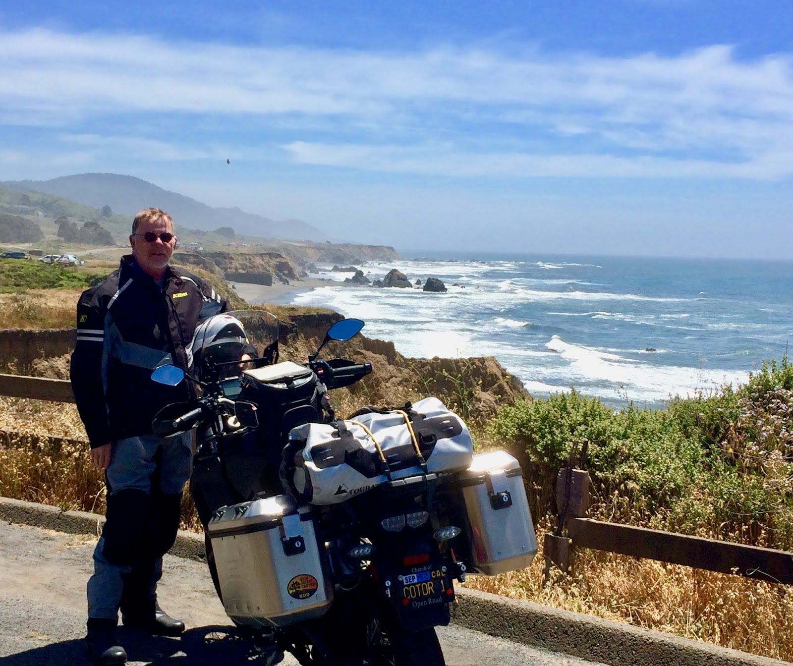
Enrico poses in the parking area on Bodega Head…

…and, again at Portrait Point – my name, not anybody else’s, for a switchback curve with just enough shoulder north of Jenner – a few miles north of the mouth of the Russian River.
 |
| file photo |
Sunshine and salt brine antiques the structures and fence lines we see along the road. Nothing stays new forever; aging just happens more urgently here.

Coastal access is plentiful and it’s a shame one can’t explore each trail.

The views are as stunning as anywhere in the world, I’ve been told, and living this close… well… why not keep comin’ back?
Redwood groves don’t hug the coastline but grow only a few hundred yards east. As much as the rises and curves of highway 1 beg us to keep moving, trails in the redwoods provide respite from the saddle.

And the details nearly underfoot are worthy of a pause.

On the costal side, the Mendocino Land trust has acquired sections of coastal prairie with signed parking…

… and access to formerly inaccessible acreage.

On my first visit to Pelican Bluffs, just south of Point Arena, two Peregrine Falcons swooped overhead and dived to their cliffside residence. Best I could do was snap a shot of a seagull at a beach a bit further up the road.

The historic Point Arena Lighthouse is maintained by a volunteer organization.

The little museum houses the original Fresnel lens and a bit of history about its origins, power and preservation.

For seven bucks you can climb to the top to look through the glass at the mouth of the Garcia River,

Or brave the catwalk and check out the bluff and surf far below.

Further north, Elk has a funky and hip general store, Albion hosts the last wooden trestle on the highway – a battle royale currently rages about its replacement – Little River offers a classy and pleasant inn and restaurant, Mendocino maintains a quaint but touristy down town and gorgeous trails along the bluffs, Caspar has another restored lighthouse (state operated, fee, worth it!), Fort Bragg overlooks the Noyo fishing port – Silver’s at the Wharf perhaps the freshest, lightest fish and chips on this section of coast (Says who? Says me, and a visitor from Massachusetts who hailed my choice as he finished mopping up his own) – Westport proves to be the last (though scant) civilization one will see before heading into the redwoods 28 miles to US 101.
As I stopped for a final view of the Pacific and a look toward Cape Mendocino and the Lost Coast – this day, lost in a gathering marine layer – a visitor from British Columbia pulled in and asked if I would take her picture: "It’s my first time on the coast this far south,” she said, adding, “but you must let me take yours.” Those Canadians...
o0o
Notes and Resources:
More about Bodega Head and environs: https://www.sonomacounty.com/articles/explore-bodega-head-sonoma-coast
More about the Point Arena Lighthouse: https://en.wikipedia.org/wiki/Point_Arena_Light
More about the Mendocino Land Trust: https://www.mendocinolandtrust.org
And these riding tips:
 a) Pack layers because weather is variable at any given time on any given day;
b) plan to not hurry: road slugs, motorhomes and travel trailers – particularly in the summer – are doing their best but are not very nimble;
c) keep an eye out for single-lane driving conditions as sections of California’s Highway 1 are no match for the relentless power of a hungry sea.
Today’s Route: Exit US 101 north of Santa Rosa on River Road; west through Rio Dell, Rio Nido, Guerneville, Monte Rio; continue west to historic Duncan’s Mills, if so inclined, for b’fast; otherwise south on Bohemian High through Camp Meeker (check out the zip line) Occidental to Freestone; wet on Bodega Highway to Bodega and Highway 1. North on Highway 1to Leggett and US 101.
o0o
Closed Circuit to Readers: I enjoy reading your observations, comments and corrections. Lately, the Blogger Gods at Google have changed the way I must log in to respond to show appreciation for your comments. I haven’t figured out what that change is – and, as far as I can tell, they didn’t tell me – so until I figure things out, you may not receive my thanks for your thoughtful attention.
© 2019
Church of the Open Road Press
No comments:
Post a Comment