Showing posts with label OR-WA-ID-BC Loop. Show all posts

Friday, December 28, 2012

2012: THE CHURCH OF THE OPEN ROAD’S YEAR IN REVIEW

…in pictures


Click on any picture, and SHAZAM! it expands.
Third Runner Up for Picture of the Year:  The quintessential theme of the “Church” is “the Open Road.”  This shot typifies the feeling of distant horizons and miles left to go.

January calls us to stray relatively close to home.  The Sacramento Valley offers nearly year round riding. 

The Cosumnes River Preserve is a nice destination with miles of paved trails through bottomlands populated with migratory fowl.

February of a dry rain year:  Let’s see what had been inundated with the construction of Folsom Dam.  This old bridge once carried traffic from the El Dorado side to the Placer side.

Fourth Runner Up for Picture of the Year: Stuck in the mud, a more recent artifact may be this slipper.  One wonders the tale it has to tell.

March’s longer days invite us to revisit old friends like the Capay Valley on SR 16 passing old farm houses…

…and, beyond where 16 intersects 20, a great old derelict truck.  There seemed to be a lot of great old truck photos this year.

April found us exploring the Grand Canyon, having left the bikes at home.  Stunning photos of this wonder abound, but there was this maiden sitting atop a rock wall awaiting the sunset.  Unless she shows up every day about the same time, I’m thinking this is a pretty unique shot.

The warmth of May demands more saddle time.  Taking turn-offs to places we’d passed by saying “maybe next time” – like Fiddletown (Amador Co.)

 Or revisiting places we’ve come to cherish: Malakov Diggins State Park...

...via Edward’s Crossing…

And Dutch Flat where the Big Four contracted with Theodore Judah (in this very house) to engineer the first rail crossing of the Sierra…

…where this critter served as my guide-about-town.  (He shows everybody around town, I am told.)

June: the old stompin’ grounds north and east of Chico…

…including the near-mythic Humbug Valley…

…and circling home under Robber’s Roost.  There are "Robber's Roosts" everywhere throughout the Sierra.  This one is just east of Humboldt Summit (Plumas Co.)

A July family vacation to Colorado prompts me to think I must return on two wheels.

August sees a return to Modoc County via the in-flames Feather River Canyon…

…to visit an old friend…

…and enjoy a bit of prairie shared with horses.  Nice spot in Modoc, perhaps, the most western of all California Counties.

North from there found us crossing MacKenzie Pass outside of Sisters, Oregon.

Staying close to home in September: the high country gold rush era skeletal remains of Graniteville…

…returning home via the delightful Relief Hill Road.  (This is the area from which rescue parties staged their attempts of save the Donners.)

In October, we broke into Canada, creating an international incident by having left the passport at home.

Kootenay Lake on the Selkirk Loop in BC offers some nice sweeping curves and crystal clear views of the Canadian Rockies.

Returning over WA SR 2, the high grasslands and wheat fields allow lovely panoramas and glimpses of days gone by including this old schoolhouse…

And (second runner up for picture of the year) this great old Chevy.


As 2012 closed, time claimed yet another of what Tom Brokow titled “The Greatest Generation.”  The Church’s Picture of the Year is an attempt to record the strength folks of that generation tried to pass unto us. 

Most interesting this year was the discovery that the gentle man who is subject of this photo, while clearly leaving this plane, isn’t really all that far away.

© 2012
Church of the Open Road Press

Sunday, October 14, 2012

THE BEAUTIFUL SELKIRK LOOP – at night!


Second in a series: 
The Oregon-Idaho-BC-Washington Autumn Tour

The whole point of our October journey to the far north was to enjoy the International Selkirk Loop.  The loop is a scenic highway incorporating farms and fields in Washington and Idaho with mountains and glacial lakes in British Columbia.  Our day started in Spokane as we jetted east on I-90 then north from Coeur d’Alene on US 2/95.  Approaching the border, the rolling prairie gives way to blue mountains and delightful curves. 

Vistas to the north prompt anticipatory salivation and twitchy throttle wrists.  The design was to travel the loop in a counterclockwise direction, tracing the east side of Kootenay Lake for 100 km, crossing the ferry between Kootenay Bay and Balfour and overnighting in historic Nelson, BC.  Idiocy on my part (see below) caused a delay entering BC, forcing a change in plans.

Entering the province around 5:30 PM, we opted to reverse our course, heading west on BC 3.  As dusk fell, so did the temperatures.  The route rose over what was probably a glorious mountain pass with undoubtedly spectacular views north into Canada and south into the States, but in the gathering dark, all I could focus on was the thermometer on the big BMW’s dash flashing 36, then 35, then 34 degrees.  I cursed the irony of taking a scenic route after dark.  A northward jog BC 6 heads us northward through Salmo.  The nicely groomed road banks into and out of increasing levels of gloom.  Lights from farmhouse windows flicker through the spruce and fir.  I think about suicidal elk.  We enter into and pass out of valleys carved by streams we know we flowing based upon the moist coolness that violates our riding gear.  Each exhale clouds our helmet shields; cracking them vents away the moisture but freezes my punk, fleshy American face.

Ninety minutes or so on, a road sign indicates Nelson is but 27 km away.  I do some quick “point 6 multiplication,” estimating our time of arrival to be about 40 minutes.  A second road sign invites us to stay in the historic Ymir Hotel central focus of the little berg bearing the same name.  It would have been interesting to explore that little place in the daylight, but frosted face shields, frozen fingers and all and only a little more than 30 minutes to go, we press on. 

Our thanks for this decision appears in the form of a third sign, perhaps five minutes further down the line cautioning “Road Work – Pavement Removed.”  I slow down and crank up the Krista running lights just installed on the Horse.  They illuminate those terrifying grooves that, on a good day, cause the back tire to dance a wicked jig at speed.  Additional warning signs threaten: “Caution: Guard Rails Removed.”  Cursing more than a visitor to Canada has a right to, I slow further.  Would we ever reach Nelson?

After endless descending curves, the sign for a Best Western glows blue and gold and pure.  Not pausing to check with my riding partner, I find the parking lot, set the Beemer on the side stand and secure a room.  We’d made Nelson.

The lovely hostess there suggests that, “Yes, the BW’s dining is fine, but if you want to do the town, you should try the Library over at the Hume Hotel.”

Warm light pours onto the sidewalk as we hoof it toward the Hume.  Strains of what sound to be Paul Desmond – arguably one of the best sax men ever – waft from an active and cheery indoors.  We enter, are seated, handed a menu and realize that the late Mr. Desmond has come back from heaven to engage in a live performance this Thursday night along with a guitar man, a keyboard man and a snare.  A few morsels into a healthy portion of just-right beef filet and after a couple of sips of a very suitable red, the terror (or just plain stupidity) of the preceding two-and-a-half hours slips into some sort of kismetic balance.


The dawn breaks clear, but the waters of nearby Kootenay Lake kept the temperatures right for continued travel.

The 40 km run to the ferry crossing at Balfour follows the northern rim of an arm of the lake.  Lucky Canadians own homes along this stretch, awakening daily to grand vistas of mountains and water.

The wait for the ferry offers an opportunity to grab coffee, visit with others and find out that we were on the leading edge of Canada’s Thanksgiving weekend.

Our bikes are positioned at the front of the starboard lane.

From atop the ferry’s passenger deck we enjoy great views of the region during our forty-minute crossing.

Once ashore, we travel the sinuous east side of the lake – a ride so reminiscent of a run along the Nevada shore of Lake Tahoe – only one that lasts for 50 miles rather than just 20.  And one with far less traffic.

We pause for portraits of the bikes…

…and a final glance at Kootenay Lake.  A stop in Creston, BC affords us some pretty fair Thai cuisine before we return to the States and a second night in Spokane.

o0o

Notes and Resources:

Travel information on the International Selkirk Loop is located at: http://www.selkirkloop.org/ Allow more time than we did.  Plan better, too.

The Historic Hume Hotel in Nelson, BC is worth a visit.  Details at: http://www.humehotel.com/

Clearwater Krista lights: http://clearwaterlights.com/ These paid for themselves on this trip alone.


Last time I visited Canada there was a screening process to get in.  It went like this:

Border agent: Pronounce a-b-o-u-t.
Me: Aboot.
Agent (seeking clarity): Rhymes with?
Me: Hoot.
Agent: Have a nice day.

Twenty or more years later and a heckuva lot of history has intervened.  Thanks, Osama.  “No, honey, I don’t think I’ll need it,” I’d said to my wife before departing.  “Besides, I don’t think I know where my passport is.”

Arriving at the border, sure enough, the request was made.  My reply was sheepish.  My application denied.  Our planned trip to Nelson, BC appeared scuttled. 

(c) BBC
Attempting entry at a second crossing, apparently my piercing blue Steve McQueen-like eyes did the trick.  That and the fact that the agent realized my loaded BMW GSA could probably leap the fence far more efficiently than McQueen’s Tiger – whether or not it was me or stunt double Bud Ekins actually piloting the thing. 

The truth of my crossing is sworn to secrecy but the lesson is carry your passport or your birth certificate when desirous of entry into Canada.

© 2012
Church of the Open Road Press

Friday, October 12, 2012

EASTERN WASHINGTON – EARLY OCTOBER


Crossing on WA 2

If there’s an upside to this whole climate change thing, it is that my Puget Sound area buddy gets a few more weeks to acquaint himself with his cool Moto Guzzi Stelvio – a purchase he’d made only last June. 

Washington’s previously unheard of “Indian Summer” stretched into October this year, so, as luck would have it the weather was perfect for our final day of a five day tour, an east to west crossing of the state on Route 2.

We parked the bikes in a “secure location” the night before…

…only to awake to 36 degree temperatures.  The GSA’s heated grips helped, as did loads of layers of fleece and Gore-Tex and Denier.  But once we got going, slipping away from I-90 only a few miles west of Spokane, we opt not to stop until the sun has plenty of time to warm things up a bit. 

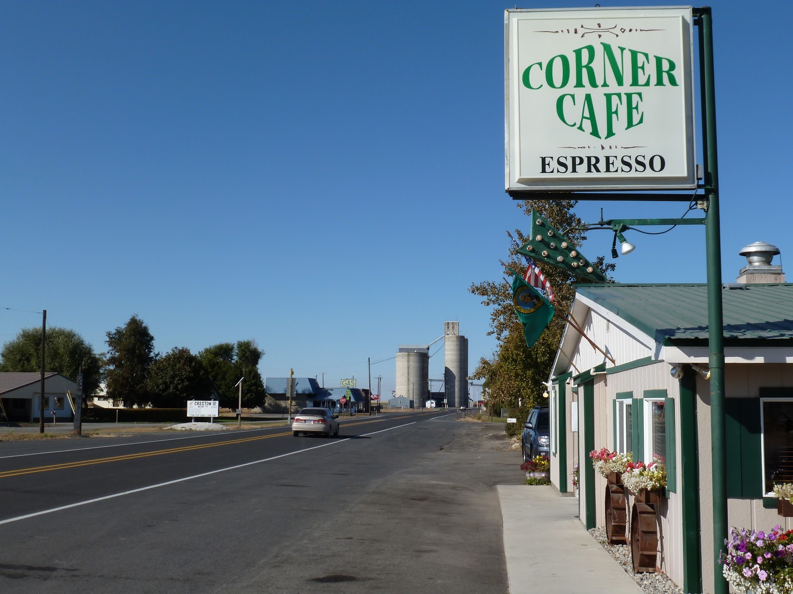
Creston, an hour or so on and billed as the highest point on the Burlington Route between Wenatchee and Spokane, offers a quaint place to wrap cold fingers around welcome coffee mugs and catch up on the local gossip.

A pair of Harleys rest outside, so we figure the place would be welcoming.  Two couples had ridden the 32 miles from Coulee City and our parking lot conversation with them devolves into how pristine their bikes looked compared to our bug-encrusted models followed by laughs, handshakes and “ride careful” comments.


Somewhere back toward Davenport, things had gotten really good.  The traffic all but disappeared.  Fine pavement split Americana scenes from today that just as easily could have been captured 50 or 100 years ago.

The road rising and falling over eastern Washington’s vast prairie reminds us that the west begins about 50 miles east of the Pacific Ocean.  From there it goes on nearly forever.

Dotted along the way are the remnants and whispers. In the not-too-distant future, the incessant north winds blowing out of Canada will tear this old farmhouse asunder.  In the meantime, this stands as a monument to folks who turned their backs on the security of a populous for a chance to be part of something large and beautiful and romantic.  And the work attached thereto.

A derelict schoolhouse sits atop a rise.  Vandals tried burning this place down, but it persevered against this and other elements.  Walking the grounds, the echoes of rural tots still ride on the wind as they kick the can in the play yard at recess. 

With the advent of state routes and inter-states, these farmers could move into towns like Reardon or Wilbur or Hartline or Douglas for a more convenient life.   The entrepreneurial among them rented out their barn sides and roofs for commercial purposes.  Outside of Coulee City, one has been restored.

On that vast plain I am reminded that retirement is the workingman’s reward for his efforts over a long career.  Those who work the land – because the work is never done – may be less able to enjoy a few golden years of leisure.  Perhaps it was the sight of this old Chevy: knee high in weeds, watching the traffic slip by on the state route, patina deepening with each passing day.  This old boy appears to enjoy a richly deserved rest.


After a delightful descent between Waterville and Orondo, we follow the Columbia though rich orchards to Wenatchee, Cashmere (great barbecue place there) and beyond.

Crossing Stevens Pass, we find that the little dots the 3-A places next to this scenic route are justified with sweeping curves, expanses of fall color, gorgeous peaks and glimmering rivers.  However, with those dots come increased traffic – many of the drivers, perhaps, amateur.  We find an alternate route from Monroe to Snohomish, where we’ll call it a day.


This day’s route:  From Spokane, west on I-90, taking airport exit; Continue west on Rt 2 through Davenport, Creston, Wilbur, Almira, Hartline (zealous patrol presence as the route slips through many of these bergs) Waterville and Orondo.  Conflue with US 97 south toward Wenatchee, but resume westward movement as Rt 2 splits and heads toward Cashmere, Leavenworth (Germanesque-themed touristy enclave), Stevens Pass, Monroe and off to the Sound around Everett.

© 2012
Church of the Open Road Press