Showing posts with label Coast Range. Show all posts

Sunday, October 6, 2024

REPEAT PERFORMANCE

 Riding the Mendocino/Sonoma County Coast 

for the Umpteenth Time


I am writing this piece for myself so I can remember.  Remember what it’s like to have a day – an unplanned day – to do whatever the hell I want to do.  And a recent Saturday it involved ratty little roads to and from the coast split by a glorious run from Mendocino to Fort Ross on State Route 1. I’d jettisoned the voluntary time commitment associated with a vital community group – it was someone else’s turn – and rewarded myself with this.


Orr Springs Road connects Ukiah with Comptche and the coast at Mendocino.  In October the narrow route crosses ridges of grasses dry since April…


…and descends into seasonal creeks surprisingly not dry.


Remnants of the region’s past are evidenced by this little jack-stabbed teepee burner long ago used to incinerate slash from a small logging operation.  Constructed of corrugated metal, it is a rusty one-of-a-kind structure.


I wonder where the associated mill might have stood.


Also out Orr Springs is a clothing optional camp and/or resort indicated by a substantial and effective privacy fence built along the edge of the pavement. This is a good thing, I’m thinking, as I certainly wouldn’t want anyone hidden in the woods or down by the creek ogling or leering at my curvaceous and sweet sounding Italian motorcycle as we motor by.


Next, I roll past a lovely Montgomery Woods State Preserve – simply a grove of redwoods – with picnic tables, easy hiking along the creek and whispers of angels above when the breeze is just so.https://www.parks.ca.gov/?page_id=434 If you packed a sandwich, this is the place to pause.


A short distance beyond I come to a dilapidated homestead or a ranch of some sort with a roughly spray painted plywood sign stating, “You loot.  We shoot!” underneath this not-so-cryptic addendum: “Let’s Go Brandon.”  Desiring not to get shot, I didn’t stop for a photo, but looking at the state of things there, it appeared the place had already been pretty well looted.


The mid-morning air is cool and pleasant and the fall colors are beginning to turn. The road is both narrow and twisty enough that one can’t rush past this early-autumn display.


Comptche is out this way.  A small berg clustered with, perhaps, fewer residents than the number of consonants in the village name. (That’s not at all true, but it is a cute line I thought of from the saddle.)


Highway 1 is fifteen miles further. The two-lane I’m enjoying tees into it.  A quick jog north brings me to Mendocino, the picturesque coastal community of both legend and postcard.


The loop over to the headlands never disappoints and I found myself following a gent on a big BMW GS who was enjoying the same experience. 


Home-based near San Jose, this fella was completing a loop that had taken him to Alturas, then out CA 299 to near Eureka, then down the Coast.  “No hurry to get home,” I recall him saying.


Having taken this route or an iteration of it several times, I found myself not stopping for pictures I already knew I had.  But this one begs the caption, “The coast is clear.”


There’s a little devil in me that always suggests it’d be cool, less pressurized, to live in a small middle-of-nowhere hamlet or village.  No stoplights.  No superstores.  Fresh air.  Starry skies at night. All that stuff.  But, I argue, I’d at least like a bank where I could access my meager savings (Point Arena has a branch of my Credit Union) and a reliable place to keep my motorcycles tuned and running (I’ve engaged the independent whose shop is here to refurbish brother Beebo’s old BMW) and…


…the restaurant out at the pier has been closed the last several times I’ve gone out seeking chowder.  (Not anymore.)  Worry not, Church of the Open Road followers, I’m not feeding that little devil by entertaining relocation to Point Arena, (or Cedarville, CA or Tonopah, NV or Joseph, OR) but I will feed myself at Pier Place https://www.pierplacepointarena.com anytime I’m out that way.  The food was hearty and substantial, the list of on-tap micro brews copious and tempting.  But being on the bike, I opted for bubble water.  A cold bottle of Fort Bragg’s Scrimshaw pilsner is waiting in the fridge at home.


Lollygagging south through Sea Ranch, discouraged to take favored Stewarts Point/Skaggs Springs Road due to construction, I’m facing a longer day than I had (un)planned.  A left hand turn up Fort Ross Road found me leaving the temperate 72 degree coast and climbing into 90 plus degree territory on a road more pothole than pavement. 


The Guzzi’s “adventure” suspension absorbed the punishment as I crested the ridge and corkscrewed through redwoods and chamise into a half-century’s ago Cazadero.  This community has the requisite school, church and country store – but it also has an attraction unique and enticing.  A businessperson there has taken to restoring, trading, perhaps collecting pre-mid-60s Willys-era vehicles ranging from military flat fenders* to wagons and pickups. (* Quick! Name the two other manufacturers of WWII era jeeps.)
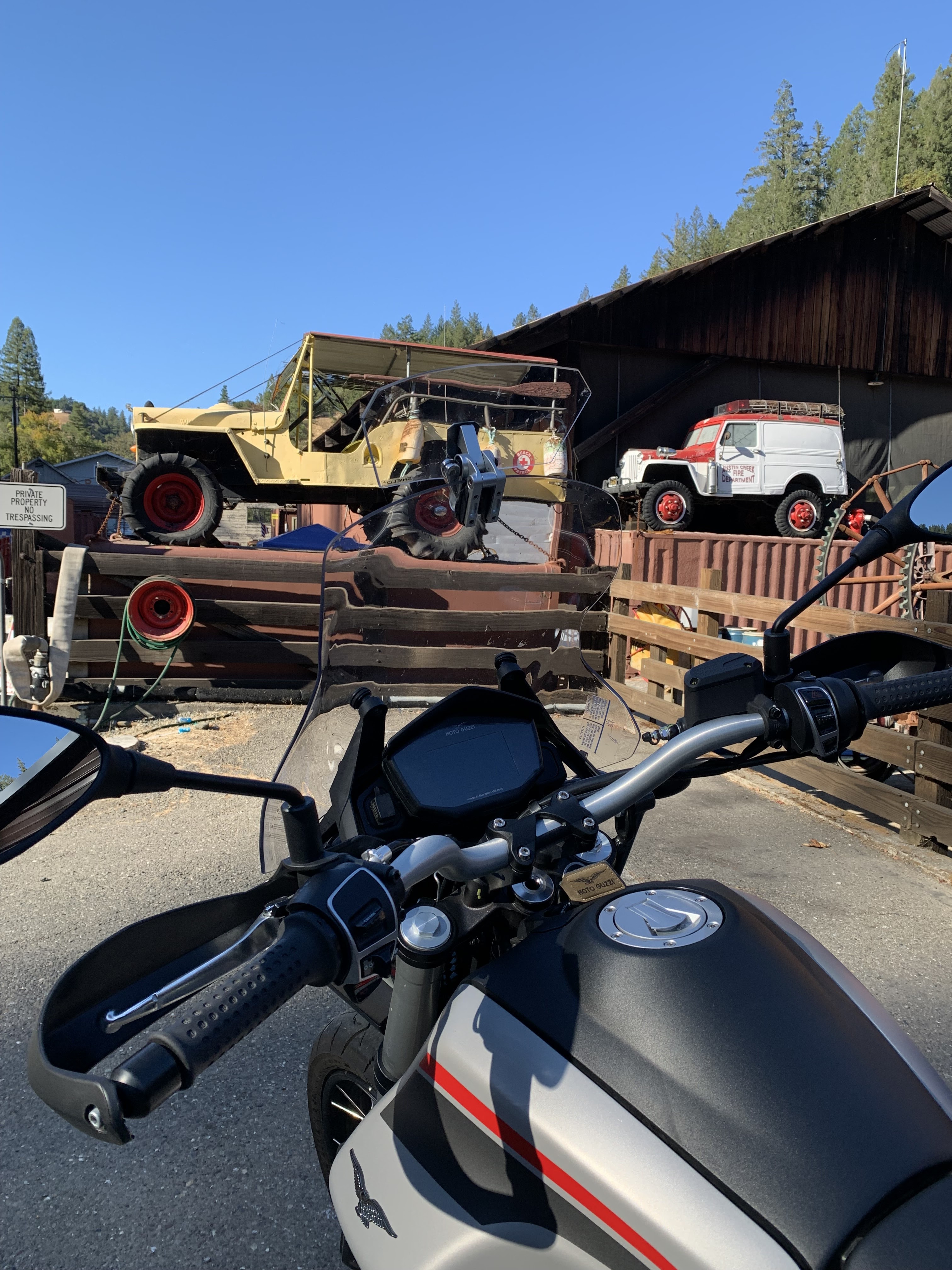


I suspect he may even have (or has had) those wonderful two-wheel-drive phaetons known as the Jeepster.  Dad had a ’50.  Brother Beebo later had a ’49.


Someday I’m going to muster up the courage to wander in there and ask if I can nose around a bit.


Eight hours and nearly 250 miles proved a bit too long for an old cuss like myself.  The hundred degree ending temp didn’t help.  But I gotta admit, a day on the bike traveling through remote sections of the Coast Range with a nice lunch thrown in for good measure, did wonders for my mental health.


Edging toward my mid-70s, I’m not sure how many more days like this I’ll confidently enjoy on two wheels.  Better grab ‘em while I can.


o0o


Today’s Route: North on US 101 to Ukiah, take last exit; north on State St (under the freeway); left (west) on Orr Springs Road to Comptche and CA 1.  South on CA 1 through Little River, Albion, Elk, Manchester, Pt Arena (lunch!); left (east) on Ft Ross Road; right on Seaview; left (almost immediately) on Ft Ross Road to Cazadero.  Continue to CA 116; head east (redwoods, Russian River, vineyards) to US 101.


© 2024

Church of the Open Road Press

Friday, May 3, 2024

BAITED BY A BUZZARD

 Sorry, No Photo of the Incident…


A good day’s ride on a motorcycle should include at least one breath-taking moment or heart stopping view.  (Note to reader: According to my doctor, I’m ‘spozed to be consistently wearing a heart monitor for thirty days, but I knew I’d be off the grid for a spell.)


The road from State Route 20 to Leesville and Lodoga is rarely taken by civilized man.  Civilized ranchers, yes, but few others.  The route traces the eastern edge of the Coast Range in Colusa County, winding through expansive pastures and past elegant aging barns from a century or so back. (Jerry Brown, I’m told, now lives out this way.)  I’d last taken this crusty road in a nearly new 1991 Jeep Wrangler so how many years ago might that have been?


Straddling the Moto Guzzi, I motored and bounced up a steep section of roadway – more pothole than pavement – twisting up the north end of a lovely rangeland valley.  Around each turn the view became more magnificent in either direction.  To the south, that springtime green valley on the cusp of turning golden.  To the north and west, the still white-encrusted peaks of the Snow Mountain wilderness area. Narrow, with blind turn after blind turn, there was no place to stop for a “Shot of the Day.” 


I reached the summit where the road turned from what they called pavement to a graded dirt and gravel affair that was much easier to negotiate on the motorcycle.  I relaxed my grip on the grips just a bit.  Just as the prior miles were upward twisting, these corkscrewed downward.  To my right, the hillside was steep, covered with tight thickets of chamise and scrub oak.  To the left, the hill was equally precipitous.  I’m sure there was a seasonal creek at the bottom, but it was too far down to see, if I’d hazarded to take a glance off the road.


Rounding a bend, something stirred to my right.  Something big.  I gently touched the brakes when that something burst out of the underbrush.  A buzzard.  A turkey vulture.  Perhaps the grandpappy of all turkey vultures, undoubtedly annoyed about my interruption of his lunch.  Liftoff for this winged behemoth would prove to be a struggle. The massive scavenger slipped below the level of my windshield.  Wings pumping, it couldn’t seem to rise above the brush on either side.  His route was the same as mine.  Dirt road conditions as they were, my speed was cautious. The buzzard’s?  Slower.  


I was gaining on him.  From about three feet behind I could see the gray undersides of his wings, count the feathers that looked like disjointed fingers at the end of those wings and I could even make out the needle-like talons on his red-stockinged feet.  I may have followed him for fifty yards on that pebbly route at one point thinking, if I just goose the throttle a bit, I bet I can probably grab that fella and… But ‘goosing the throttle’ would likely send me off the edge, plummeting into the abyss to come a cropper where my cell phone wouldn’t connect. And there I would lie, squashed beneath the Guzzi, waiting to become the big guy’s next meal.  


Of this, I think the vulture was aware.


In perhaps fifteen seconds, the big bird rose out of reach, tipped his wings slightly to catch the updraft out over the canyon and drifted away.  


I’m not sure what that heart monitor might have recorded, but it woulda been something interesting to explain to the doc.

© 2024

Church of the Open Road Press

Wednesday, April 27, 2022

A DAY TOUR OF THE EEL RIVER RIM

…Ahh! The simple remoteness of it all…


A long-time riding pal looks at a map of Northern California and comments, “You’ve been on pretty much all of these roads!”  While that’s more than a bit of an overstatement, it’s true that I have been on a lot of ‘em.  And yesterday, I bagged two more.


         My recent fascination with the Eel River environs has found me looking at remote sections of our Coast Range in Mendocino, Trinity, and Humboldt Counties.  The geography of this area is a jumble of volcanic spasms, tectonic folds deep river canyons all animated by the occasional earthquake or storm induced landslide.  The fascinating history is far less impacted by white presence than the gold-infused Sierra-Cascade to the east.  It’s easy to disappear into these hills and imagine tens of thousands of years of untrammeled life by the area’s first peoples, and clear to see the brunt of 19th century loggers and ranchers and the railroaders who tried to link everyone together.  Which doesn’t mean our conquering culture didn’t do immeasurable harm to those who came before.  See https://thechurchoftheopenroad.blogspot.com/2018/06/killing-for-land-in-early-california.html

         A good map or atlas (I carry DeLorme’s California Atlas and Gazetteer) indicates place names you can drive right through and never see, because whatever was there, no longer is, or isn’t much. Owing to the fact that I’ll be traveling dirt roads, I’m in our Subaru Forester this trip.  Given a suspect right knee, my days of confidently riding a big dual sport like my late Yamaha Super Tenere are over.  Plus, in the 100,000 miles I’ve put on the Sube, I’ve never once worried about tipping over on the thing.


I left US 101 at Laytonville following a well-graded Dos Rios Road into the Eel River Canyon.  Dos Rios is a small enclave of a dozen or so houses perched above the confluence of Berger Creek (I’m thinkin’) and the Eel. I think I spotted a school, but I’m not sure I saw a store.  


         Picking up State Route 162, I head north and east and over a ridge into Round Valley and Covelo.  The valley floor is lush, perfect for raising cattle, the cash crop that spelled the demise of the native peoples to whom that slice of heaven had been promised.  The town offers a number of services, but a number of services seem to have left as well.  There’s a Tri-Counties Bank in a newer building, but the old bank building stands as a burnt-out hulk.  The US Forest Service anchors a Mendocino National Forest ranger district there, but Georgia Pacific (or was it Louisiana Pacific?) mill, a long-time big employer, is long gone.

         Route 162 angles east, but north through Mina toward Zenia is the road I’ve long wanted to traverse.  Mina Road pavement ends just outside of Covelo, but the road is well graded, and signs ask folks to “use four-wheel-drive to protect the road from washboarding.”  I’d never thought of the connection, nor do I understand the physics of the deal, but my Forester is all-wheel drive, so I hoped I was doing my part.  The road twists and rises through oak woodlands into mixed deciduous forests, one side posted as reservation land for the consolidated tribes.  Kindly do not enter.  Okay.


The top of the ridge finds yellow pines and broad, high meadows suitable for grazing.  Mina, the berg, is little more than a framed gatepost entry to a ranch.  Without glancing at the GPS, one wouldn’t know that now they are traveling on Zenia Lake Mountain Road.  I check the map to see a Lake Mountain Ranch but see not a Lake Mountain.  Will there be a Zenia?


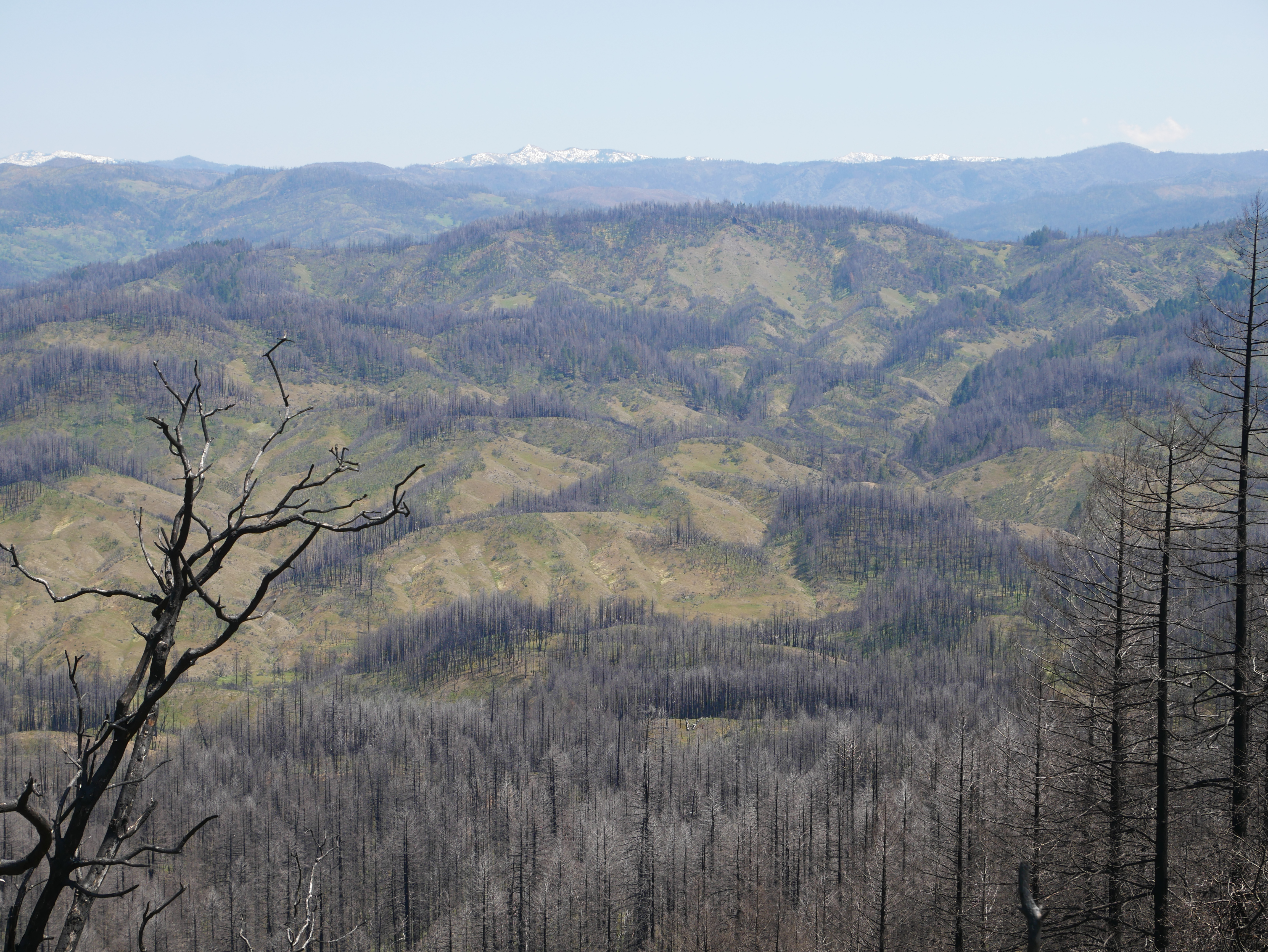
         Just when I’m noting the freshness of the high-country air, I encounter mile after mile of the Mendocino Complex burn scar of 2020. This fire, geographically, the largest in state history, took out Simpson Camp, a childhood Shangri-La, maybe fifteen to twenty miles east southeast of where I found myself this noon.  

        The big fire raged south of Kettenpom, a placename on this road, one that supports a small general store, what looks like an ag supply with bundles of PVC irrigation pipe ~ I wonder what for? ~ and even has a bright orange “76” gas sign.  Not sure it there’s gas.  A good-looking albeit laconic dog lazed in the road directly in front of the store as I wheeled around and on to Zenia.  Perhaps there, I’d pull in for a Snickers bar.


         Zenia, a bigger dot on the map than Kettenpom, has a post office.  And it once had a store.  There would be no Snickers bar this day ~ at least not one from the Zenia General Store. 

         From this point, there’s an inviting road that leads north into Van Duzen River Country, but that’ll be for some other time.  I turn west to wind beneath the Zenia Bluffs and into Alderpoint.  Alderpoint was a workstation on the now-defunct Northwestern Pacific Rail line. For 75 years, the NWP fought a losing battle with the forces of nature in the Eel River canyon.  Remnants of the rail grade can be seen paralleling the river from a fine bridge upon which I crossed.  Town, itself, is a relative city.  Big(ger) store.  School.  Businesses that support logging, ranching and, perhaps, extraction industries.  Lots of little homes.  Maybe not a lot of wealth, unless one considers that value of living in a scenic jumble of hills and ridges, oaks, pines, and meadows, with background music provided by the Eel River.  Not bad!


         The nearest closer-to-full-service town in Garberville, twenty winding miles west at US 101.  The pavement is nice and I’m sure that Alderpoint residents know the route well as they seek a little more selection on the grocery or hardware shelves.  But I don’t want to go to Garberville.  I want to bag Bell Springs Road.


All morning, I’d driven the eastern edge of the Eel River watershed.  This afternoon, I’d head south on the west side.  After heading southwest on Alderpoint Road, I exit south on primitive Harris Road.  I’m going to Harris!  Another labelled dot on the map.  Roughest route of the entire circuit, the Subaru handles it with aplomb.  I’m happy to not be on the bike, rolling over rolling gravel and small boulders.  I’m too old to pick the thing up off its side, and nobody’s coming along on Harris Road to help me out.  


         I’m not surprised to find that Harris once had a country store, but no more.  The skeleton of the place still stands with a long, low overhung porch, whitewashed walls the whitewash of each dates back about 70 years, and nothing but ranchlands nearby.  I am shocked, however, to turn south on Bell Springs Road when I come to an unmarked placename: New Harris.  Outside of a road junction not even a derelict store.


         But I am enjoying Bell Springs Road, another one of those routes I’ve coveted.  Rising and falling over pasture lands and across high meadow grazing lands, there’s a remote on-top-of-the-world feeling with 360-degree views.  To the east, the Yolla Bolly wilderness peak still have snow, between here and there rises Cain Rock where the NWPs golden spike was driven in about 1916.  Cattle dot some areas, trees forest others.  Random roads track over the ridge and down into the Eels River’s deep canyon.  At some point down there is Island Mountain, site of a 0.8-mile tunnel, longest on the NWP route.  But, in reaching the site of Bell Springs, I realize I’ve missed the necessary road had I wanted to use to trundle down and see that engineering marvel.

         Bell Springs is home to a fire department with a red pickup and a third- or fourth-hand fire truck.  The company’s sign may have been hand painted by a fourth grader with an affinity for balloon letters.  Yet, a lovely slice of ruralness.

         It’s about twelve miles down to the junction of US 101.  Closer to the highway, population seems more dense and less rancher-like.  Once on the Federal Route, I have to remind myself to wick things up a bit in the Subaru as folks like to travel 65 miles per hour, not the 27 I’ve been enjoying for the bulk of the day.  It’s two hours to home.


I’m enamored by the remoteness of our nearby Coast Range.  I’m easily mesmerized into fantasies about life there when the nearest neighbors were mule deer, bald eagles, and the occasional mountain lion.  


         After seven hours of bumping around, it seems to me that, other than timber and some grazing, there has never been much that could be monetized or Europeanized or exploited in these parts. Which is good.  The true value of this region may be where this region takes you when you visit.

         Let’s not tell anyone about it.


© 2022

Church of the Open Road Press

Monday, February 14, 2022

THE GREAT REDWOOD TRAIL: DREAMS AND CHALLENGES

 Part 3 (of 3):  Rails to Trails in Our Backyard


In my garage rests a beautiful Peugeot ten-speed that I purchased new in 1972.  Back then I used it to commute to class at Chico State and later, occasionally, to my teaching assignment eight miles south in Durham on a bike path that once was the route of the Sacramento Northern Railway. 


         So, the idea of a hiking/biking path from Cloverdale to Humboldt Bay sets my mind to dreaming of hopping on the Peugeot and pedaling the entire distance.  Imagine! Following the route of the old Northwestern Pacific through vineyards and foothills to Ukiah and Willits then though the rugged and remote Eel River canyon, tunneling beneath stands of redwoods and madrone, ultimately arriving at the coast with its sea gull calls and wisps of salt air.  [Understand that I get a bit tuckered out just cycling back from the coffee joint just a few blocks downtown, but that’s beside the point.]


In the early 1900s, the NWP appeared to be a good transportation idea, one that would link the Eureka area with the outside world, sending redwood south and agricultural goods, manufactured products, and tourists north.  But geology, geomorphology, and weather ~ essentially Mother Nature, herself ~ had other ideas.  So, railbanking the route (preserving the grade but no longer enabling rail traffic) and repurposing it as a recreational trail seems a good use of her remains.  

         A roadblock may be around the bend, however.  A group interested in transporting coal from Wyoming’s Powder River Basin (Hey!  That’s Walt Longmire’s neck of the woods!) to export markets in Asia has proposed revitalizing the old NWP as a critical link from the Union Pacific right-of-way near Suisun to a yet-to-be-built transshipment facility at Humboldt Bay.  Called the North Coast Railroad Company, the group has filed formal opposition to the proposal to railbank the old NWP route and convert it to trail.  The Company intends to acquire the line “and restore it to operating condition to support future, high-volume traffic flows.” The company claims that it has $1.2 billion in their pocket(s), but those in the know suggest it would cost twice that to restore the line.  


        Political leaders ranging from local city council members to area Congress-folk are lining up against the efforts to return freight traffic for a couple of reasons.  1) Globally, the growing belief that burning fossil fuel such as coal is harmful to the planet; and 2) locally, the persnickety nature of Mother Nature and her inclination to toss a trainload of subbituminous coal into the Eel in the event of a track failure or landslide.  

         It will be interesting to see if the coal train somehow derails the Great Redwood Trail.


Absent the above, it may be ten or more years before the Great Redwood Trail comes fully to fruition.  In those years, issues like the protection of neighboring property, accommodation of overnight campers, infrastructure maintenance and trail security will be addressed and resolved.  However, given that time frame, my dream of pedaling from here to Eureka on a then-60-year-old bicycle ~ at age 80-plus myself ~ may always be just a dream.  

         But that old Peugeot is a darned good bike and I have a strapping grandkid or two who’ll be about 25 at the time. 


Hmmmm…  Guess who might be getting an antique ten speed and, along with that, a mission…


Resources:

For more information on the history of the Northwestern Pacific Railroad, check out: http://www.nwprrhs.org/history.html

For progress and details on the Great Redwood Trail, see:  http://www.thegreatredwoodtrail.org


© 2022

Church of the Open Road Press
Monday, January 31, 2022

THE GREAT REDWOOD TRAIL: CONCEPT AND PROPOSAL

 Part 2 (of 3): Rails to Trails in our Backyard


The completion of the transcontinental railroad in 1869 linking east to west ushered in the golden age of railroads in the United States. Midwestern wheat easily shipped to east coast flour mills, Kansas feedlot cattle mooooved almost effortlessly to east coast markets, and folks could cross from east coast to west in days rather than months. The magic carpet made of steel sealed the early 19th century doctrine that American expansion across the continent was inevitable.  And, until the 1950s, rail was most certainly king.


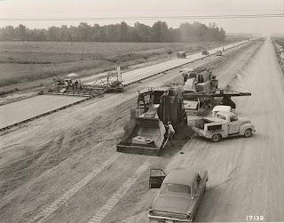
         In 1956, The Federal-Aid Highway Act authorized the construction of a 41,000-mile network of interstate highways that would span the nation, and rail transportation’s dominance began to fade.  Some opine that the last most profitable year for the freight rail industry was when trains transported the cement that was used to build the interstates.  That may or may not be true, but as trucking allowed more flexibility, rail lines became less feasible, and many were ultimately abandoned.

         The “Rails to Trails” movement sought to repurpose these rights-of-way.  Given that out of necessity, rail lines rarely exceeded a grade of 2% ~ that is two feet of rise for every 100 feet in distance ~ rail grades could and do offer easy walkin’ and ridin’ for hikers and bicyclists.  Many provide access to some of the most beautiful, rugged, and remote quarters of the west: The Bizz Johnson Trail on the old Pacific Fruit Express line skirts Fredonyer Pass in Lassen County; miles of the old Tonopah and Tidewater slip toward the edge of Death Valley at Rhyolite (my dad worked for the T&T); and the original route of the Central Pacific over Donner Pass invites hikers through tunnels chiseled and blasted back in the 1860s.  (Even today, if you listen carefully, you can still hear the echoing ping of the picks striking the granite.)


The Great Redwood Trail is envisioned as repurposing the old Northwestern Pacific line from Cloverdale, through the Eel River canyon to Rohnerville and Eureka.  The route will use existing bridges and tunnels ~ work around them where necessary ~ and split the third largest watershed in the entire state.  Travelers will hike through the ancestral homelands of the Yuki people, cross ranchlands that date back to the mid 1800s, and ultimately follow the edge of a languid Eel River as it meanders along the coastal plain en route to the sea.  Along the way, the adventuresome will observe flora and fauna in nearly pristine environs while stepping back some 200-plus years from the pressures of the 21st century into the pleasantries of… well… not the 21st century.


         Access points may serve to revitalize dot-on-the-map communities including Outlet, Dos Rios, Bell Springs, Island Mountain, Alder Point, and Fort Seward. Each of these places holds a unique history associated not only with the railroad, but with the First Peoples who resided in the region for over 10,000 years as well as the ranchers and lumbermen that followed.  Users may choose to day hike or bike out of each locale or engage in a point-to-point-to-point for all or part of the two-hundred-mile section north of Cloverdale.  Camping and sanitation will be available as well as security for local landowners.  (SMART is committed to construction of a bikeway along its tracks from Cloverdale south to the Bay.)

         Though currently only in the planning stages, if all goes well, within the decade a vast and wonderful experience will be open to us and our children. Many communities are already on-board with the project.  


Besides: What could possibly go wrong?  Could the Great Redwood Trail possibly get… dare I say it?... derailed?


Next: The Great Redwood Trail: Dreams and Challenges 


© 2022 

Church of the Open Road Press

Thursday, January 27, 2022

THE GREAT REDWOOD TRAIL: A BRIEF HISTORY OF THE NORTHWESTERN PACIFIC RAILROAD

 Part 1 (of 3):  Rails to Trails in our Backyard


In Northwest California lie Humboldt and Mendocino Counties.  The region, with its steep terrain and large redwood forests, remained isolated from the rest of California until the completion of the Northwestern Pacific Railroad (NWP) in 1914.  After being settled by immigrants in the 1850s, the coastal regions of both counties were easily accessed by sea, but an overland route was slow and difficult to traverse.  Particularly vexing was the transport of redwood lumber ~ often referred to as “red gold” ~ from area mills to San Francisco markets.  In the 1850s, doghole schooners were the main vehicle for shipment, but mill owners were only paid once their timber arrived in port.  When a ship went down ~ as happened frequently ~ so went the profit.


         In 1884, two Humboldt mill owners, John Vance and William Carson (…recall Eureka’s elegant and gingerbready Carson mansion?  Same guy…) joined forces to begin a railroad that would connect Eureka with the outside world.  A rail line was constructed to link Eureka with Fortuna and Rohnerville.  Fifteen years later, the Pacific Lumber Company in Scotia began building lines south into the Eel River. Soon the area was webbed with tracks servicing mills and towns, but shortly after the turn of the century, none were yet connected to the economic hub of the San Francisco Bay Area. 

         Enter the owners of the Santa Fe and the Southern Pacific.  In 1906, they joined into an agreement that would link the north country lines with those owned by the S.P. which already extended from the Bay to Willits.  The trick would be to construct something through the rugged and remote Eel River Canyon.


         Over the next seven years, crews prepared grade, built bridges, bored tunnels and laid track along the river course finally driving a “golden spike” at Cain Rock in 1914.  At a cost of $14 million dollars the rail line was finished.


But the fun was just beginning.  California’s Coast Range is a complex mixture of geologic features.  Mother Nature’s favorite toys, tectonics, volcanism, and the weather, play havoc with the plans of mere humans.  Movement along faults and fissures like to nudge and sometimes shatter stuff we build in the coastal mountains.  Huge plugs of basalt speak to her volcanic past.  And, at cut banks we can see today, bent and tilted layers of unstable clay indicate that the NWP traverses an ancient, ever-uplifting ocean floor.  (So does US 101.)

         Heavy winter rains, working in concert with these elements caused bridges to wash out, tunnels to collapse and rails to give way under the weight of passing freights. Like dots on a timeline of misfortune, one washout or collapse was soon followed by another.  Among the more notable?  In a 1964 flood ~ one that some of us may remember ~ the entire rail route through the canyon was washed away. Remnants of fallen rail cars can still be found in the riverbed.  Tenaciously, the tracks were rebuilt.  Then in 1978, the tunnel at Island Mountain caught fire ~ arson is still suspected ~ and the redwood ties and tunnel support structure burned, collapsing the thing. That, too, was repaired.

         But the die was cast.  While shipping lumber by rail was cheaper and more efficient than by schooner, it wasn’t much more reliable.  Construction cost for the route proved to be a fraction of the cost of keeping things up and running.  Plus, with the advent of the state and federal highway systems, diesel trucks proved more reliable and more flexible in getting product to market.


         70 years battling the greater forces of Mother Nature proved to be enough ~ she always wins, doesn’t she?  The last NWP train ran on the northern line in 1984.  


What might become of an abandoned rail line through such a scenic ~ yet unstable ~ corridor?


Reference:   Northwestern Pacific Railroad: Eureka to Willits.  Susan O’Hara and Alex Service.  Arcadia Publishing.  2013. $22.  (Locally available, this is a delightful book with tons of information and lots of old photos.)


Next:             The Great Redwood Trail: Concept and Proposal

© 2022 

Church of the Open Road Press

Wednesday, April 21, 2021

ASHES TO ASHES


…another visit to Simpson Camp…


A lucky person finds his or her special Eden.  In my case, it is a place where the only sounds are of soughing pines and the occasional cry of a hawk, where the passing air is fragrant and fresh, where views stretch from my feet to forever, where memories are rich and fulfilling, where decades dissolve each time I visit.


Click on any photo to expand 'em all.


The old sheep camp near Mendocino Pass is that place for me.


In the 60s, our family met up with the sheep man’s clan for long weekends in the lost high country of the Coast Range.


An easily forgotten Jeep road wound away from the forest highway climbing to the top of a ridge that overlooked a sweeping glade and a distant stand of firs.


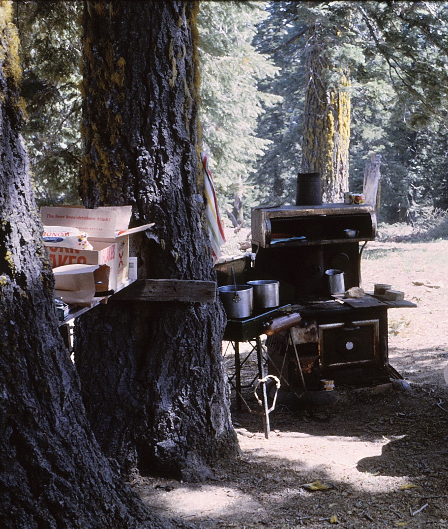
Mom and Ellie cooked on an abandoned Wedgewood.


When it came time to allow Mom her rest last year, this would be the place.  We left her shillelagh – a hickory walking stick she'd purchased when visiting Ireland – under a fallen log on the off chance her spirit might want to hike over to the Yolla Bollys and catch up with Dad who’d had a twenty-five year head start.


Scanning up the meadow to the top of the ridge, a copse of oaks stood “like a Greek Chorus,” Dad had said all those many years before.


The 'chorus' still stood in 2020.


From the vantage point of this little grove, on a clear day, you can see the fog hugging the Pacific coast forty miles to the west and the crest of the Sierra 90-plus miles east.  Eden indeed. Accompanied by my granddaughter and my nephew, I drove a stake into the ground in that stand of oaks. Eye contact with the two told me they knew why.


 Then, on August 16, 2020, all hell literally broke loose.  The word ‘literally’ is often misused – not in this case.


Source: CalFire


Folks at CalFire suggested that the August Complex fire started as a result of lightning strikes, but I wouldn’t be surprised if investigators ultimately found that the devil himself had slipped out of a fissure somewhere in eastern Glenn County and exhaled his damnable, fiery breath over 1,032,000 acres of mountain and range land.  Large areas of the Yolla Bolly and Yuki Wilderness would be burned.  And my little Eden lay smack in the middle of the largest wildfire California had ever experienced.


On a Monday in April 2021, we decided to revisit Simpson Camp, see what survived and maybe grab Mom’s stick.  Here’s what we found.  


Turnoff to Simpson Camp – May 2020:


Turnoff to Simpson Camp – April 2021:


View up the glade – May 2020:


View down the glade – April 2021:


Simpson Camp kitchen – circa 1966:


Simpson Camp kitchen – April 2021:


Ash from Mom’s hickory shillelagh:


The fire roared through the treetops and turned the grasses and skunk cabbage and understory to ash… 


…revealing artifacts (read: refuse) from earlier days…


…including a church-keyed Coors can…


… and a remnant of the old Wedgewood.


The trek up the hill would prove melancholy.  The beauty of my Eden was gone.


Or was it?  At the top of the hill, that copse of oaks was in the process of budding out.  And a little white fir had joined the chorus.


Taking a closer look…


Simpson Camp’s rebirth may be slow, and it may be painful but I’m thinking I’ll be close by to monitor things.


© 2021

Church of the Open Road Press