Showing posts with label State Route 116. Show all posts

Saturday, April 20, 2019

JENNER HEADLANDS PRESERVE

a tale of two visits

I like discovering a new road and I like discovering a new trail.  This is about the latter.


We hadn’t enjoyed too many sunny seventy-degree days this wet spring, so at the crack of 9:15 one recent Wednesday, I hopped on Enrico, the Yamaha, for a return trip to the Sonoma Coast.  

A late start, it may seem, but a favored breakfast spot in Duncan’s Mills doesn’t open ‘til 9:00 and job one would be to enjoy some Bella Rosa coffee (local to Sonoma County) and a perfectly-turned omelet.  


[Note to self:  Must return for the Cape Fear CafĂ©’s Sunday Brunch.]

West on CA 116 and north on CA 1, a cluster of automobiles are pulled off to the coast side of the highway.  A new sign indicates that at the base of the cliff and at the mouth of the Russian River, harbor seals calve.  This was their nursery.  Nice to know. Lots of pups this morning but too far away for a picture.  I’d left my long lens home.


So I took a picture of the bike.

A couple of clicks further north, the gates to the Jenner Headlands Preserve were open.  These coastal hillsides were dedicated by the Sonoma Land Trust and the Sonoma County Agricultural Preservation and Open Space District as a space for exploration and enjoyment.  Now administered by the Wildlands Conservancy, I motored in for a look.


A lovely green promontory north and slightly east of the parking area beckoned. 
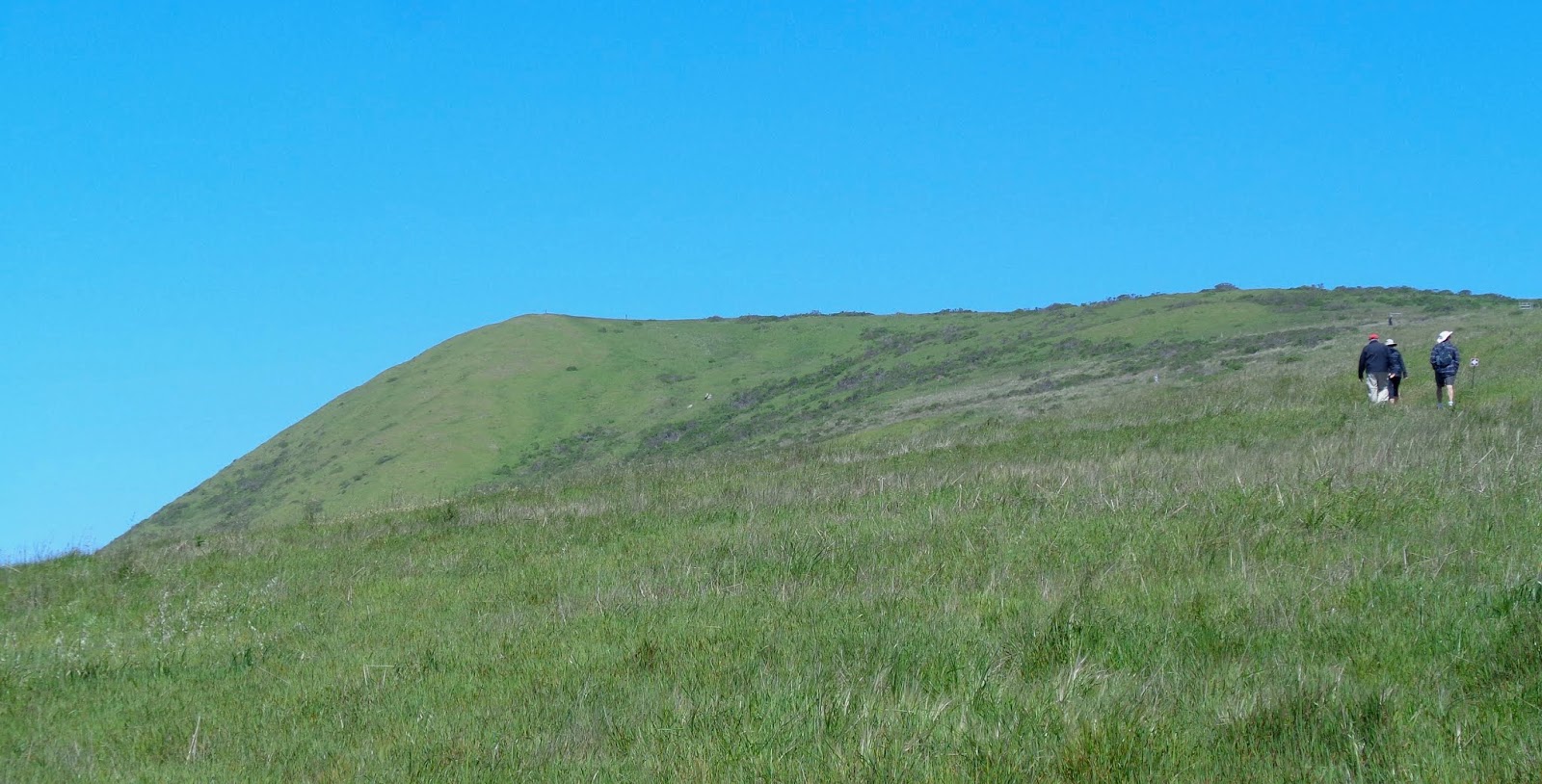

And the wild flowers were profuse.


But this was to be a day on the motorcycle, not on shank’s mare.  I cataloged the spot as a place to return with my spouse and Edward, the lab mix.  [Leashed dogs are welcome on the park’s trails.]


The return visit would be only two days later…


… and the morning coastal fog which had crept in on little cat’s feet the night before, chose not to creep away this afternoon.

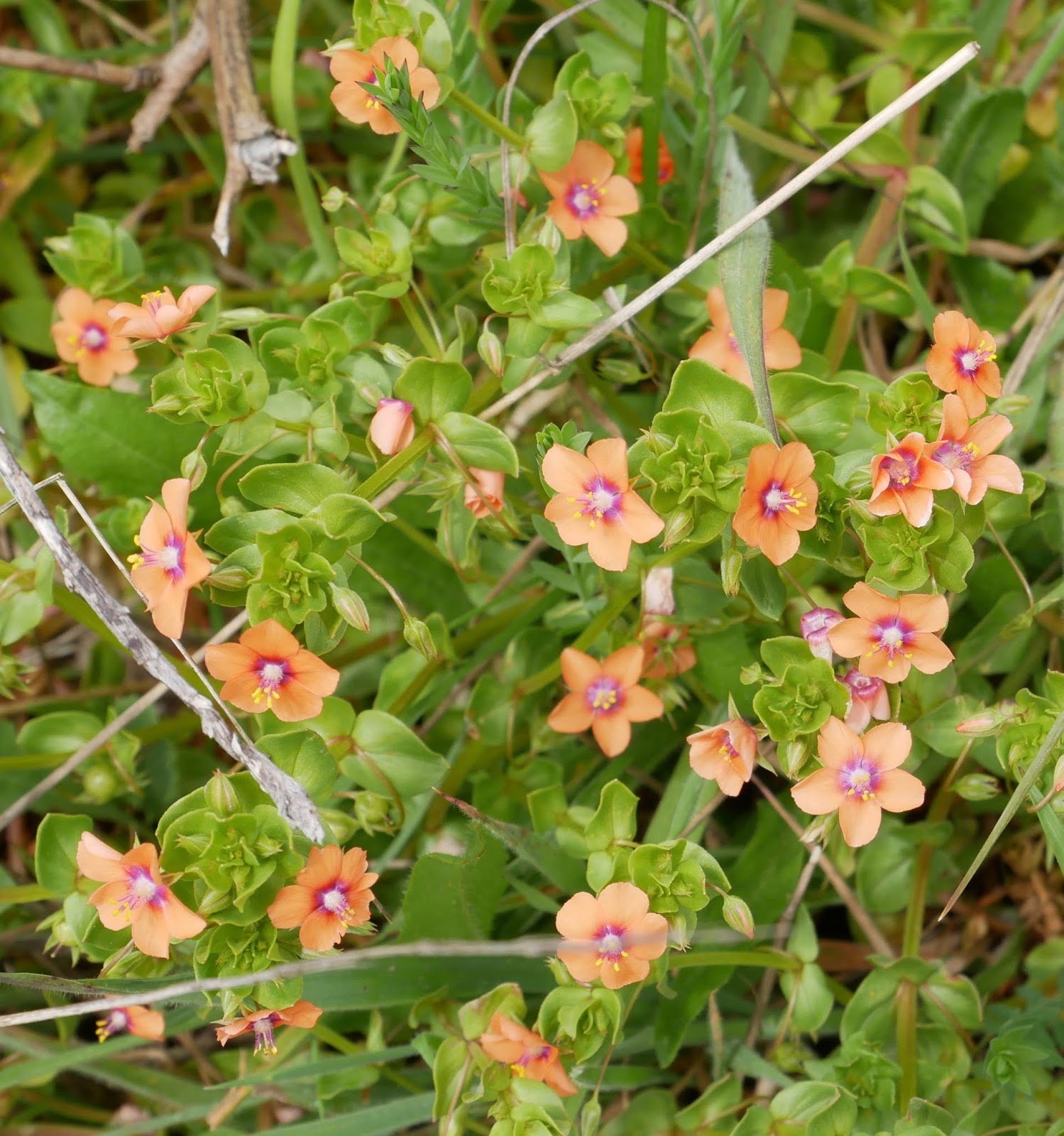
But the profusion of wildflowers would not disappoint.  Here are a few clusters and portraits.


The Sea to Sky Trail winds 7.5 miles over coast prairie and through mixed woodlands ending at Pole Mountain.  


With lots of up and down, the hike is a bit strenuous but with afternoon mist, never too heated.


The route is a combination of rutted ranch roads and glorified - but glorious, given the view and environs - cattle trails.


Ranching is still active in the area and as we departed the Sea to Sky Trail onto the Raptor Ridge Trail – thus offering us a nice five-mile loop – we passed between the ranch house and barn…


…weaving our way through a herd of cattle enjoying a marvelous existence that includes acres of fresh green grass and magnificent Pacific views…


…each head blissfully unaware of one upcoming really bad day for them.

The Raptor Ridge Trail winds down a steep and sometimes muddy track into a ravine.

Along the way we are afforded a mysteriously blanketed view of Goat Rock, a popular coastal destination just below the mouth of the Russian River.


We enjoyed just five of the 14 miles of trails in this new reservation, which only means we’ll have to return again to enjoy the rest.

o0o

Notes:  Wildlands Conservancy website:  https://www.wildlandsconservancy.org/preserve.html

Their efforts specific to Jenner Headlands:  https://www.wildlandsconservancy.org/preserve_jenner.html

Today’s Route:  River Road exit from US 101 north of Santa Rosa; west toward Guerneville (where River Road becomes State Route 116), Monte Rio and Duncan’s Mills.  North on State Route 1 through Jenner.  Look for the gate on the east side of the highway about two miles north of town.  Access is free but do consider leaving a donation with the iron ranger.

© 2019
Church of the Open Road Press

Monday, March 17, 2014

SAVORING A CALIFORNIA COASTAL TIDBIT

(Tidbit Number 1)

The niece of my long-time riding buddy is a restaurant critic in the Bay Area.  Dining with her is a delight not only because she is knowledgeable about food and wine pairings, but because instead of chowing down on one wonderful entree with associated sides, we generally taste a smidgeon of this and a dab of that until we’ve enjoyed the best of the entire menu.  Along the way we are charmed by her culinary impressions and delighted by an unexpected flavor.  We’ve learned to savor these adventures.
 California’s State Route 1 from Marin County, along the Pacific shore to its junction with US 101 near Leggett is a 213 mile feast of tide pools, ocean bluffs, quaint villages, lumber towns, fishing harbors and history.  Luscious curves and pretty good pavement make it easy to bat right through it.  I know, because I’ve done so.

Having a new home base closer to the shore, I took a tidbit the other day, instead of the full meal.


The springtime called me to head west on Westside Road out of Healdsburg.  The valley floor is scribed with vineyards and dotted with tasting rooms.  Up the hillsides, verdant coastal forests over a sublime counterpoint as they loom over the farmlands.

At CA 116, we follow the route of the Russian River through redwoods and quaint enclaves.  Liking, as I do, to celebrate a good ride with a good cigar, I stopped in at a “Smoke Shop” in Guerneville, but was informed that if I wanted to get a cigar, I should check the filling station’s convenience store right next door.  Welcome to the Emerald Triangle.

116 heads west to the coast through the charmingly tattered Monte Rio then along a broadening Russian River to its mouth.  About a mile inland, it joins CA 1.  South would be Tomales, Point Reyes and Marin; north (today’s route) would be Jenner, Fort Ross and Stewart’s Point: a mere 26 miles.  Just a tidbit.

I paused in Jenner to find that cigar – again, no luck – then continued north on CA 1.  Three or four miles up the road, the pavement begins to wind and switchback up the hill.   

The endless view beneath an azure canopy prompts a stop for a portrait of the Breva.   

I have pictures of two formers (read: "bikes") at this very point.


Back when our west was young and we were break-necking our way to the Pacific Coast, folks in Central Asia were doing the same thing.  Only they were heading east.  Encountering the ocean, they arced north finding their way to Alaska and its abundant population of otters for pelts.  They moved down the coast, but not so much for a bridgehead for further expansion.  Their intent was to farm the coastal bluffs in order to provide groceries for their far northern colony of trappers.

A bunkhouse, a cookhouse and an orthodox church were built.  Trade was established with the locals (and with John Sutter)... 

...but a Putin-esque raft of firearms was kept oiled and ready should relations falter.  A colonnade was built to encircle the Russian encampment we now know as Fort Ross.

I remember when CA 1 actually traversed through the parade ground – drove through in my VW – but in the 70s, the highway was rerouted in order to preserve this unique piece of California’s heritage.  An interpretive center has been erected and the .3 mile walk to the original site is paved and more than worth the effort.  Pack your camera and your imagination.


State Route 1 continues to spindle north, in and out of rivers’ mouths and up and around bluffs and hills.  The ocean is never far away.  Its mist often drifts across the highway.  The luckiest cattle and sheep on earth graze here – if beef or lamb on the hoof might be considered lucky.

At Stewart’s Point a general store sells gas and freshly prepared baked goods.  On a foggy morn a cup of their coffee goes down particularly well.  On this afternoon, a Stewart’s Classic Root Beer slaked nicely.

My coast tidbit ended here as I coursed east along the famed Stewart’s Point / Skaggs Springs Road.  It tunnels through redwood groves then rises to grassy ridge tops as heads past Lake Sonoma and back to US 101 at Healdsburg.

o0o

Resource: 

If you find yourself in San Francisco needing a dash of hipness with your dining, and you really want to impress those who are with you with your where-we-gonna-eat prowess, hook into the Tablehopper for good reviews on Bay Area places you might otherwise never know of.  Bookmark this one: http://www.tablehopper.com/

Info on Fort Ross: http://www.fortross.org/

o0o

Today’s Route:

From US 101 at Healdsburg, CA: west on Westside Road to CA 116. West on 116 to CA 1.  North on CA 1 to Stewart’s Point.  East on Stewart’s Point Skaggs Springs to the Dry Creek Valley, Healdsburg and US 101.

© 2014
Church of the Open Road Press