Showing posts with label State Route 299. Show all posts

Tuesday, July 9, 2019

MY HYAMPOM MOMENT

every road leads somewhere and
every somewhere has a story

I’d never been to Hyampom  before, never driven the busted, winding pavement that would take me past Underwood Mountain to the town.  Or had I?

“Every old road, every set of ruts that clears a ridge, everyone of ‘em goes somewhere,” says a travelling buddy.  After hearing that about a decade ago, a sometimes pastime of mine is to find a place name on a map, research a little about the spot, then take the road that takes me there.

Hyampom, according to Gudde’s California Place Names, may be from the Wintu meaning ‘slippery place.’  Located on Hayfork Creek in Trinity County, it is represented by bold print and a fairly big dot in DeLorme’s California Atlas and Gazetteer.  I decided to pay a visit.


Highway 299 runs east-west from Arcata, north of Eureka, through Redding and out to Alturas paralleling the state’s northern border.  It is a luscious ride with sweeping curves, forever vistas, tall timber, tumbling rivers and lots of climate zones.  In a matter of hours one can drive from ocean fog across ice-carved granite passes and into arid high deserts dotted with irrigated pastures or grain fields.  The last few times I’ve gone Redding to Eureka, the route has been choked with wildfire smoke and related emergency service vehicles.  Not so this day.  Late June morning mists carried from the coast into the nearest redwoods.  Up a rise and into the sun, the fog looks like a blanket of fleece extending out over the Pacific.  
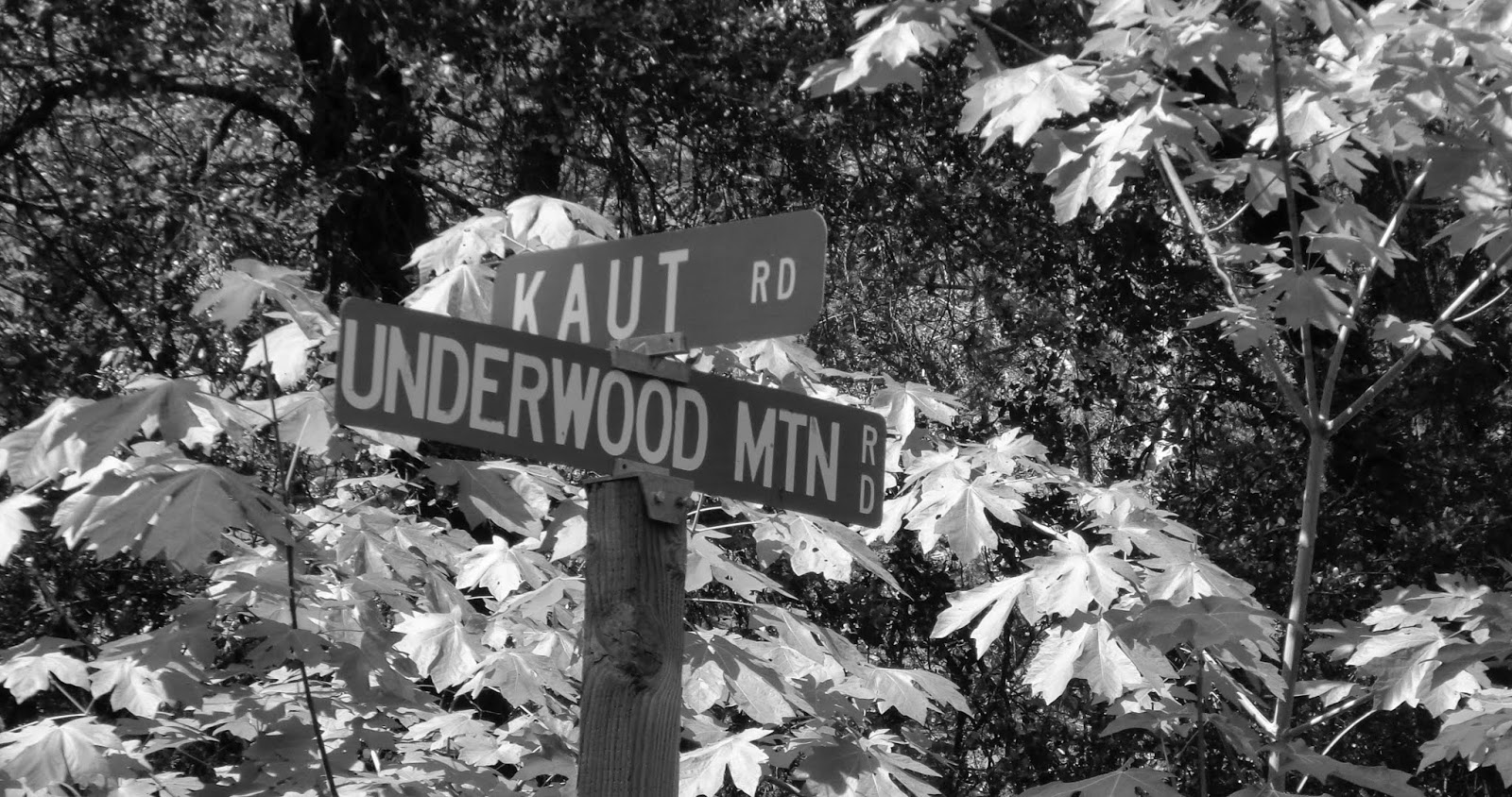
My turnoff is just east of Burnt Ranch.  Underwood Mountain Road (FR 60) follows a stream through some broadleaf riparian forest before climbing across the shoulder of a repeatedly burn scarred Underwood Mountain. 

The road is as potholed as it is paved.  Little used, in my 70-minute drive, I made way for a caravan of three dump truck doubles and only one other vehicle, making dodging the major of the potholes a bit less sporting but far safer.

Once over the top, I wound down and around catching glimpses of the valley that would be home to Hyampom.  I looked forward to a walk around.  At the wye, a sign pointed me to town and to the airport; the other direction would take me to Hayfork.  The road traced the edge of the valley.  Over a rise, a grand barn stood presiding over a cattle-dotted pasture.  Another could be seen in the distance. I motored past a rustic general store and an auto repair shop decorated with junked versions of the cars I grew up with.  

The place looked a lot like Iowa Hill – a berg on a similar road back in Placer County’s Sierra.  Actually, it looked like a lot of other places I’d visited as a result of my map-quest pastime.

I parked in front of the one-room schoolhouse turned antique emporium not open this day.  Outside of an offended Steller’s jay and some soughing pines, the place was as quiet as ten thousand yesterdays.  Ranching seemed to be the Hyampom’s economic base, although rusted teepee burner evidenced a mill that once serviced the local forest lands.  The airstrip was in better condition than the one up on US 395 in Wagontire, OR, and looked quite similar to the landing strip at Dinsmore down on CA 36 – a town different only because it had active gas pumps in front of its general store.  I thought about ambling back toward the car “dealership” but always feel sorta rude about taking pictures of folks’ private spaces or businesses, especially if I wasn’t in the market for what they had on hand; and I didn’t think I’d have any use for that rusty – no, make that patinaed – ’64 Fairlane or any of its stablemates.

No one was on the street as I noodled the big Yamaha back through town. No one to wave at.  No one to ask directions from in an effort to start a conversation.  


At the wye, I headed east on the county road wondering where the Wintu slippery spot might have been.  I didn’t pass any graveyard.  If I had, I’da paid some respect to the lumbermen, ranchers, farm hands and business people who once contributed to a thriving Hyampom.  So many stories can be extracted from a cemetery. The road east pointed toward Hayfork a town designated by the same size print on the map, but one with a grocery store, gas station, downtown, senior center, eateries and traffic.

Courtesy: Trinity County Road Dept.
On the way, I came to a roadwork delay.  The only one in line, I chatted with the young man holding the stop sign. The conversation went something like this, as I recall:

“Business is pretty slow today?” I asked.  “Is it ever not slow?” he said with a laugh.  “You from around here?” I asked.  “Yep.”

When the one-room school closed, he told me, students were bussed to Hayfork, 22 miles away. “If this here road washed out or there was a landslide, we didn’t have to go to school,” he said.  

“So,” I said, “you’re doing this for the kids of Hyampom, right?” “Nope.  I’m just doin’ it for the money.  Mom sold the ranch after Dad passed.”  Then he added: “Sometimes I do have to apologize to the school kids.”   

From the saddle of the Yamaha, I glanced at the pastoral scene in my rearview mirror.  Placid stretches of Hayfork Creek laid across a green valley floor.  A kid might learn more about physics by skipping stones across one of those pools or tossing a lariat over the head of a bawling calf than he or she’d get from several pages of text and theorems, I thought. This wasn’t a bad place to play hooky.  

I couldn't suppress my chuckle.

So, this’ll have to serve as my Hyampom moment: Me, a former school principal, yukkin’ it up with long-time resident: one who’s content to see local scholars miss a day or two of school.  


I drove away reminded that all of those little spots on the map – whether it be Iowa Hill, Wagontire, Dinsmore or now Hyampom – all of those little spots have stories.  When tip-toeing along some decrepit secondary road in the middle of no-where, if we’re lucky, along with a great ride, we might, in a moment, get a piece of one of those stories. 

o0o

Notes:

The Trinity region is located in the distant northwest corner of California. Remote springs to mind whenever traveling any secondary road in the area.  Fuel up before leaving CA 299 and if you find more fuel somewhere along the way, fuel up again.  The cell phone becomes a paperweight in these parts.

A problem with Erwin Gudde’s California Place Names (University of California Press, 40th Edition © 1998) is that once you look up a place name on a page, there’ll be another place name you’ll look up that will link to another and another.  With this book you run the risk of blowing out your bucket list.

© 2019
Church of the Open Road Press

Sunday, October 7, 2018

TOURING THE DEPTHS AND MYSTERIES OF THE KLAMATH

fabulous Klamath Country adventure


October finds Seattle-based riding buddy connecting with California-based me for an annual ride.  Favorite haunts include Eureka’s Eureka Inn 
and McCloud’s McCloud Hotel.  This year, we’d partake of both – and the roads in between.


A first night in Eureka https://www.eurekainn.com found us enjoying the city’s public art… 


…pleasant wharf… 


and multiple dining options.

California’s State Route 299 is the northernmost major thoroughfare between the coast and the Sacramento Valley.  Well-maintained, this delicious route winds from sea-level marshes and meadows just north of Eureka, tunneling through redwood groves and over the southernmost ridges of the Trinity Mountains, past mining towns oft-overlooked when studying California’s Gold Rush, into oak woodlands finally arriving at Redding. Fairly heavily traveled, it is still a good introduction to the rugged and remote Klamath area of northwestern California.


Better still, however, is California’s State Route 96 that splits north from 299 at Willow Creek first following the Trinity River, then the Klamath which it traces some 140 miles east to Yreka and beyond. Winding through bergs offering no gas (fill up in Willow Creek) and little eats (fill up in Willow Creek), the ride becomes an exploration of the rugged environs that somehow supported five of the least-known tribes in all of the state – until demon gold was discovered in the sands and silt of the riverbed.

Vast numbers of the native population died within the first five years of contact with Europeans.  It took a bit longer, but many of the gold-era settlements have fallen into the little-known category as well.  We stopped for a calzone in Happy Camp, after about two hours, at the first eatery we would find along the route.

Highway 96 heads east following the Klamath past post offices of place names whose claims to fame have long since gone bust. But the road is built for touring and we find we’ve left the lush coastal landscape behind to be replaced by grasses and stunted chaparral dotting rocky canyon walls.


A detour over to Siskiyou County’s Living Memorial Sculpture Garden


https://www.fs.usda.gov/recarea/klamath/recarea/?recid=81810 - a moving tribute to all of the county’s military veterans – is required if in this neck of the woods.  


Only eleven miles north of Weed on US 97 and under the watchful gaze of Mount Shasta, queen of the north country, this stark and beautiful park invites pause and reflection.


An overnight at the historic McCloud Hotel https://mccloudhotel.com is restful and comfortable.  Breakfast is filling. And a morning stroll around town before mounting the bikes is always in order.


Riding pal departs north as responsibilities called him home – responsibilities a retired guy, such as myself, can only vaguely recall. Thus, I embark on a solo adventure which starts at the Stewarts Springs exit from I-5 north of Weed.  

Shifting from county-maintained to Forest Road 17, the pavement narrows.


Rising from the hayfields of the Shasta Valley an over-the-shoulder glance offers a view of the queen cloaked in an early autumn mist, her crystalline peak sparkling just above the cloud.


At FR17’s summit, I cross the Pacific Crest Trail for the first of three times this day.


The view to the west recalls the uncertainty with which I tried to explain the Trinity Alps and the Marble Mountains to my fourth graders 35 years ago.  The Coast Range was easy: ridge upon ridge folded and bent by the eons-long collision of the North American and Pacific tectonic plates.  The Sierra, too: a massive granitic fault block tilted from a fissure on the Nevada side of the range.  The Central Valley’s fertile loam and the Mojave Desert’s dryness equally easy.

Expand this image by clicking on it.

But, the mountains of Northwestern California – a combination of faults and volcanism and ice and erosion – were harder to define to little kids.  “You just have to see ‘em,” I’d said.

The road I was on would snake ten or more miles down to trace a remote stretch of the Trinity River.  Rock strewn and narrow, I hadn’t seen nuttin’ yet.

My forest route ended at State Route 3. Turning right (north) twelve well-paved but twisty-downshift-to-first miles would lead me to Callahan.  There, there is a small store and bar and there, the skies opened up. 

Rather than dismount – although I should have – I relied upon my KLIM riding gear to keep me cocooned in Gore-Tex and dry.  https://www.klim.com/Latitude-Jacket-5146-002 This would be the first test of the rather pricy outfit’s weather-proof-ness.  It did not fail.  Money well spent because as it would turn out, most of the rest of the day would be ridden in showers.


The Callahan-Cecilville Road is yet another of those routes that gets lost in the folds and rises of the Trinities.  Nicely banked and paved at the beginning, it’s all just a ruse. Soon I find myself coursing under the fall colors of black oaks, following this stream and that, climbing over ridges and rises I cannot name while hoping in the ability of my Bridgestone tires to navigate chuck-holed and drenched pavement.

Around a bend I splice a pretty good pile of horse poop and then find the offending equine standing on the shoulder of the road. With several pals.  I’d arrived at Cecilville where pastureland, front lawns and thoroughfares are not cordoned from one another by fences and where the only business I was interested in open four days out of the week and this wouldn’t be one of those days.  I purchased a bubble water and a Slim Jim from the self-service frig in front of the shuttered bar.  Why no pictures?

From Cecilville to Forks of Salmon, the road clings to the side of the canyon wall.  Why no pictures here?  Because there is no wide spot to stop on this one-lane-width of busted pavement where I wouldn’t be at grave risk of obliteration by someone rounding a blind curve. That, or pushed off the 125-foot cliff where today’s rains would rise the river and carry my carcass away downstream to the nearest log jam.  Though slow, the ride is stunning and – all the while – reminding me why they call this big Yamaha an “Adventure Tourer.”


At Forks, I run into the improbable: A teacher and a bunch of 10-to-12-year-old students from Bend, Oregon riding bicycles and discovering first-hand those elements of the Trinities that I could not find the words to describe to my students so long ago.  


I suspect they’ll do just fine on their standardized test coming up this spring.


Forks of Salmon – where horses, too, roam the streets and front lawns – is a pretty long way from anywhere and that long way continues to involve a narrow, rock-strewn, paved single-lane somehow hung on the canyon wall.


I grip tightly, drive slowly, contemplate any missed curve with dread and finally, after about 2 hours of thirty mile-per-hour bliss and distress, wind up at State Route 96 where I retrace my steps back to Hoopa, 299…

…101 and the comforts of the Eureka Inn.


That evening, over a dram of Whistle Pig, I think about the hearty souls that populate Cecilville and Forks and the deep canyons of the Salmon River, how rugged and independent these folk must be and how similar they are to the sourdoughs and gold seekers of 150 years back.  Or, for that matter, the Hupa, the Chilula, the Karok, or the Wintu – all inhabitants of the Klamath region for so many centuries before.

Dropping off into feathered slumber, I have to admit to myself that while I like a good adventure ride, I’m really not all that tough.

© 2018
Church of the Open Road Press

Saturday, June 18, 2016

THE INCLEMENT EUREKA, YREKA, BURNEY ADVENTURE


“Unseasonable weather is typical this time of year.”
- Dad

This would be the first “tour” on the Thunderbird LT.  LT reportedly stands for “light touring.”  We’d find out.  Our goal was to drive north to Eureka, east to Yreka, where brother Randy would split north on his Guzzi Stelvio, and I would head further east to Burney and Lassen Volcanic National Park.  Summer being but a week away, the weather should be perfect.  But, as things turned out, unseasonable weather is typical this time of year.

Upon my return home, I realized I did not stop frequently enough for pictures, as is so frequently the case.  But oh, well…


Every good ride starts with a good breakfast and we are never disappointed with the fare at the Bluebird Café in Hopland, California.


We pose the bikes at a lovely rest stop north of Willits on US 101.  A nice place to pause even if you don’t have to “rest.”


Having stayed at the historic Benbow Inn http://www.benbowinn.com/, just south of Garberville, I insisted we stop there for coffee just to show the place off to my riding partner from Washington State.  The historic bridge and the inn are sublime.


North of Garberville on the old 101 at Redway, a route heads west toward the Kings Range National Conservation Area (great, remote Lost Coast hiking) and Shelter Cove.  Bearing right on Ettersburg Road toward Honeydew the pavement tunnels through oak woodlands and across dry pastures.  I’d taken this route on the more capable BMW GSA a year ago and, about forty-five minutes into this leg of the trip, I realized why I swore I’d never take it again.  Just two-and-a-half miles from Honeydew the road begins a very steep descent, corkscrewing down perhaps 600 feet in elevation in what seems like about a four hundred yard section the way the crow flies.  The problem is that, with no turn around and with a stupid desire not to revisit the previous forty-five minutes of travel, this is where the pavement ends.  Hidden beneath a four inch layer of dust and grime is a jumble of brick-sized rocks each intent on throwing the unsuspecting motorcyclist off his or her mount.  And I was on my pristine, new, 800-plus pound Triumph Thunderbird with, as yet, no scratches.  Second note to self: Don’t do this again!

Mattole Road is paved, sort of.  We follow it west of Honeydew and past Petrolia, the little wayside where oil was first discovered in the state.  We find reward for our gritty recent travel after several chunkily paved miles: a six-mile run just north of the Lost Coast.


Brother Randy opines that the Mattole Road could provide someone engaged as a pothole filler employment for life.   


From this remote section of coast, we climb over Bear River Ridge and drop in to Ferndale for a slice of pie and a little time out of the saddle.

Day 1 ends at the historic Eureka Inn http://www.eurekainn.com/Pages/default.aspx a short stroll to that city’s picturesque fishing port and some pretty good dining at the Café Waterfront http://www.cafewaterfronteureka.com/.  


The route from Eureka to Yreka would be less challenging to either bike’s suspension.  US 101 north along Humboldt Bay is a delight in the early morning mist.  East on CA 299, we pause at a vista point to glimpse the coastal-most hills, but the big blue Triumph somehow gets in the way of the photo.


CA 96 junctions 299 at Willow Creek where we’d stopped advisably to top off and inadvisably for coffee.  96 passes through Hoopa, crosses Mill Creek Ridge and then drops into the Klamath River Canyon.  With sweeping curves through rocky canyons and into and out of remote burgs, state route 96 may be one of the great motorcycling roads in all of northern California – which is saying something.


An oft-forgotten historic fact is that California’s gold rush reached this far north and west.  Mining claims are still active.


A fine suspension bridge crosses the river at Orleans, worthy of a photograph, but, once again…


To further animate our ride, an early wildfire was active west of Happy Camp; helicopters swoop into the depths of the canyon to capturing Klamath River water to be dumped on the blaze.  Seeing the various stages of fire-scarred hillsides on this drive, one wonders: Is there ever a time when some portion of the Klamath National Forest isn’t on fire?


All in all, it is 156 miles from Willow Creek to Yreka.  The highway traces the Klamath in a most engaging fashion, but toward the end of the run, the limited fuel capacity of the ’09 Stelvio becomes a concern.  Topping off in Willow Creek was the right call, indeed.


After a late lunch in Yreka, brother Randy headed north while I sojourned east into the Cascades.  A leadened sky portended showers, but it wasn’t until twenty minutes down I-5 that I stopped to wriggle into my rain gear, placing my camera a layer or two out of easy reach.

California’s route 89 is also a keeper.  Coursing from Mount Shasta City south to Topaz Lake on US 395, it crosses the Cascades and the Sierra past lovely lakes (including Tahoe) warranting several days simply to appreciate its diverse beauty.  I’d get only as far as Burney, enjoying high pine forests illuminated by dappled sunlight as the series of thunderstorms bumped overhead.


Arriving at my lodging early evening, I shuddered to think of my newly beloved Thunderbird getting soaked as the night’s rain set in, but there are some things you can help and some things you can’t.


My plan for day three involved touring Lassen Park on CA 89.  Reports indicated that its winter closure ended two days ago, but by morning, the snow level had dropped to 5,000 feet.  With the park road’s summit at over 8,000, I chose a westerly escape route down a curvaceous, but wet, CA 299 to Redding and then home.

Disappointed?  Nope.  As a six or seven-year-old on my first backpack trip – mid-June in Lassen Park – sleeping bag in a plastic tube tent as rain and hail pounded Dad and me to sleep, I’d learned early on that, in these parts, unseasonable weather is typical this time of year.  Dad said so.

o0o

Tour Route – Day 1:  US 101 north; at Garberville/Redway, west on Briceland Road bearing right onto Ettersburg Road (I’m tellin’ ya: don’t ever do this!), at Honeydew west on Mattole Road to Ferndale; north on 101 to Eureka.  Day 2: US 101 north to Arcata; east on 299 to Willow Creek (get fuel!); north on 96 toward Happy Camp and Yreka.  South on I-5 to Mt. Shasta City, east on CA 89, west on 299 to Burney.  Day 3: Live right and it won’t have snowed in Lassen Park, otherwise, continue west on 299 to the North Valley around Redding.

© 2016
Church of the Open Road Press

Wednesday, August 12, 2015

ALL SMOKE, NO MIRRORS


The Aborted Nor-Cal – Oregon Tour

The idea was simple.  Coordinate with a colleague on his ride north from the Bay Area to his home near Seattle.  Spend a night in Redding, and then head to Bend, Oregon, with a detour around Crater Lake.  Part there and return south, exploring some of the few Southern Oregon and Northern California roads I’d ridden only once, or better yet, only heard about:  OR 62 from Crater Lake along the Rogue River to I-5; CA 3 from Yreka down past Trinity Lake with, perhaps, a side trip out to Ramshorn Summit; Alder Point Road from Bridgeville through Blocksburg and down to Garberville. 

I looked forward to taking pictures of old barns and old bridges and old trucks, pausing at bergs and farmsteads one may fly over yet never see; places where people make a living but it’s not clear how they do (dismissing, perhaps, medicinal herbiculture.)


Fire season in the west, much like the presidential campaign season in the US, never really ends.  Two years ago, a wild fire coughed choking smoke over our home in Sonoma’s Alexander Valley at Thanksgiving.  This year, in mid-July, a wild fire across the ridge in Lake County would grow to over 70,000 acres – 20,000 of them in a three-hour run one Saturday afternoon.  And it wasn’t the first one in the area this go-round.

Meeting up with my riding partner in Winters (after lunch at the incomparable Putah Creek Café) we bolted up Interstate 505 to Dunnigan and I-5 toward the Shasta-Cascade Wonderland hubbed in Redding.  The further north we traveled, the more the blue sky deteriorated into a yellow-gray haze.  He on his Stelvio and I on the GSA, we reveled in being able to legally bat along at 75 mph through the smoky, 100-degree Sacramento Valley. 

At a stop in Orland, we were informed that a bunch of lightning caused blazes were torching the far northern part of the state.  Cal Fire’s central command post was set up at the Shasta County Fairgrounds in Anderson.  Perhaps we could worm our way in and take a look at the current incident map.


“How can I help you fellas?” The Public Information Officer (out of Riverside County) wore a snappy blue uniform – one that looked as if someone engaged in cutting much line hadn’t been wearing it.  The PIO extended a hand and welcomed us with a smile.  Pointing to the incident map, there were, indeed, over seventy active fires within this camp’s sphere, stretching from Del Norte County in the north into Napa and Solano Counties in the south.  It didn’t look good.

The Coast Range had been seared by a wave of dry lightning a few days prior and another wave was forecast to swing north this very evening.

After a gracious forty minute tour of the camp, covering personnel, sleeping arrangements, shifts, the difference between state and federal fire fighting protocols and technical improvements to assist the guys on the line, the PIO concluded:  “You’ll want to get out of Redding early tomorrow in case more of these things blow up.”  He swept his hand over that incident map.

We would hightail it in the morning.


Or would we?

I own a Moto Guzzi: a hoot to ride and, in my 11,000 miles of ownership, bulletproof.  But for longer trips, I take the BMW.  My riding partner’s ride of choice is his ’09 Guzzi Stelvio.  Quirky looking, tank a bit too small for long distance runs, but infused with Italian passione.  He loves the thing.

Unfortunately, some of that passione decided to burst through a blown gasket just beneath the left side cylinder head about fifteen minutes north of Redding that next morning.  The fix may have been simple and the tow to the nearest dealer would be covered by insurance, but the nearest dealer was 194 miles to the south.

The rest of my trip would be solo.


There was no reason for me to continue to Bend so I retraced steps to Redding.  The fire incident map had indicated that CA 3 from Yreka was closed south of Hayfork due to wildfire.  Alder Point road was closed at CA 36 at Bridgeville due to wildfire, which proved a moot point since I wasn’t going to be able to get to 36 via 3.

Recalling that incident map, I knew CA 299 was one of the few roads traversing the Coast Range that would not be closed by fire activity.  I opted to take it from Redding through Weaverville to Arcata on the Humboldt County coast. 

A 30-minute roadwork delay afforded the opportunity to visit with a distance running coach from Utah State U. and a young couple from Iowa – both parties concerned about the area’s thin pall of smoke.  “Unseasonable smoke is pretty common this time of year,” I said.

Beyond Weaverville, CA 299 crests at Oregon Mountain Summit and descends into the Trinity River drainage.  On a normal day, the view from that high point prompts the rider’s pulse to quicken in anticipation of a nicely paved highway twisting in and out of forests, through rustic, tiny villages and along a delightfully tumbling wild river.

Today?  Only smoke.

In cool mornings through early afternoons, airborne particulates settle into lowlands, valleys and canyons.  As the day warms, the smoke rises and dissipates.  The day hadn’t warmed yet.

The further west I drove, the thicker the smoke became to the point that, if there were city blocks in the area, you couldn’t see further than two of ‘em.  I stopped for a picture near Burnt Ranch wondering if they might rename the place “Reburnt” or “Twice Burnt” Ranch by the time these conflagrations played out.


Near Blue Lake, now following the Mad River, the valley opens to the sea.  On-shore breezes mercifully pushed against the burgeoning blanket of smoke.  Thus, the air was a clear and lovely azure.  Deep breaths yielded only freshness, no cinders.   

The ride south on US 101 into Eureka emphasized just how strongly that cross wind, on-shore breeze can blow.

A quick shower to rid myself of soot.  Dinner near the historic wharf, followed by an evening walk along the waterfront, then a night’s rest at the Eureka Inn.


Morning of the final day dawned gray and drizzly, a pleasant, fresh change from the hot, murky interior. 

South on US 101 and west on CA 1 led me to a crystal view of the Pacific over the rugged Mendocino coast. 

Dubbed the Shoreline Highway, California’s State Route 1 is one motorcyclists, worldwide, come to experience this most entertaining road. 

Along the way, riders enjoy quaint fishing villages, stately redwood stands, inviting strolls to the bluffs and views that reach beyond forever.   

I dawdled in the clean maritime air, and stopped for a plate of clams at Noyo.

Ninety minutes inland and I would be home.


Whether this loop at this time could be categorized as a great trip, I’d have to offer doubts, given the conditions.  But all in all, it was an excellent experience; just one I’d rather not repeat any time soon.

© 2015
Church of the Open Road Press