Showing posts with label Sierra Nevada. Show all posts

Sunday, October 27, 2024

ABOARD THE CALIFORNIA ZEPHYR (FINALLY!)

 A life-long dream come true ~ maybe

The California Zephyr has always been mythic to me. Winding like a silver ribbon up the Feather River Canyon, occasionally, we’d be lucky enough to see it as we drove California’s Route 70 in our ’54 Ford toward Quincy and Bucks Lake. Crisscrossing the canyon, if we were really lucky, we’d be crossing the river on a bridge as the train crossed above us, switching sides of the canyon. The silver beauty was always on the other side ~ always just a bit out of reach.  


The Zephyr ran from San Francisco to Chicago under the combined efforts of the Western Pacific, the Denver, Rio Grande Western and the Burlington Route. It had always been my dream thunder across our vast western expanse on this train. Alas, come the early 70s, service ended. As did my dream.  Or so I thought.


But along came Amtrak, the Federal government’s attempt to keep rail traffic alive. More successful along the eastern corridor of the United States, cross-country routes would enjoy less ridership. Yet, the Zephyr was revived. Now, however, using the historic Donner Pass Route initially carved by the Central Pacific, silver streamliners no longer grace the Feather.


 We board the Zephyr in Sacramento.


From the Sacramento Valley Station, the route winds and twists up the western slope of the Sierra with pauses in Roseville, Colfax, and, following the river courses of the American and the Yuba, cresting the Sierra on the highest trackage anywhere in the States. We enjoy a view of Donner Lake…


…before descending into Truckee for a twenty minute fresh air and, ironically, smoke break.


The route traces the Truckee River through the rain shadowed environs of the east slope of the Sierra. Conifer forests begin to give way to brittle sage and autumn’s golden grasses.  


East of Reno, we begin to get a feel for the vast and vacant high desert. Miles of that sage and mineral wealth (I suppose.)


Our rail journey will take 50 hours, several of those spent lightly sleeping in our rocking accommodation. But, as night falls, I snap this haunting image of a western sunset and wonder about the Shoshone and Paiute peoples who, for centuries, came to an understanding of that whole living in harmony with nature thing that we successors to this space don’t quite get.


Sunrise finds us coursing along the Gunnison River.


Rolling into Grand Junction, CO on the historic Denver and Rio Grande Route, we see one of many grand old stations left to decay.


A few miles of browning hills relentlessly shaped by river and wind…


…and we rumble into our first glimpse of the Great Plains.  I write ‘rumble’ because, to my untrained train butt, the Burlington Northern / Santa Fe right-of-way east of Denver seems a bit less well maintained than the UP to the west.


Lots of flat. Lots of grain ~ amber waves of it ~ mainly, it seems, corn. And lots of endless vistas. One can fly over this country, which we did on our return to California, and not grasp the distances, the vastness and the towns that look like nameless grids or checkerboards from 36,000 feet. We slept through all of Nebraska. 


Here’s Burlington, Iowa …


… and an aging Burlington Northern Pullman, Railway Express car and vintage loco. Glad these rolling stock examples are being preserved.


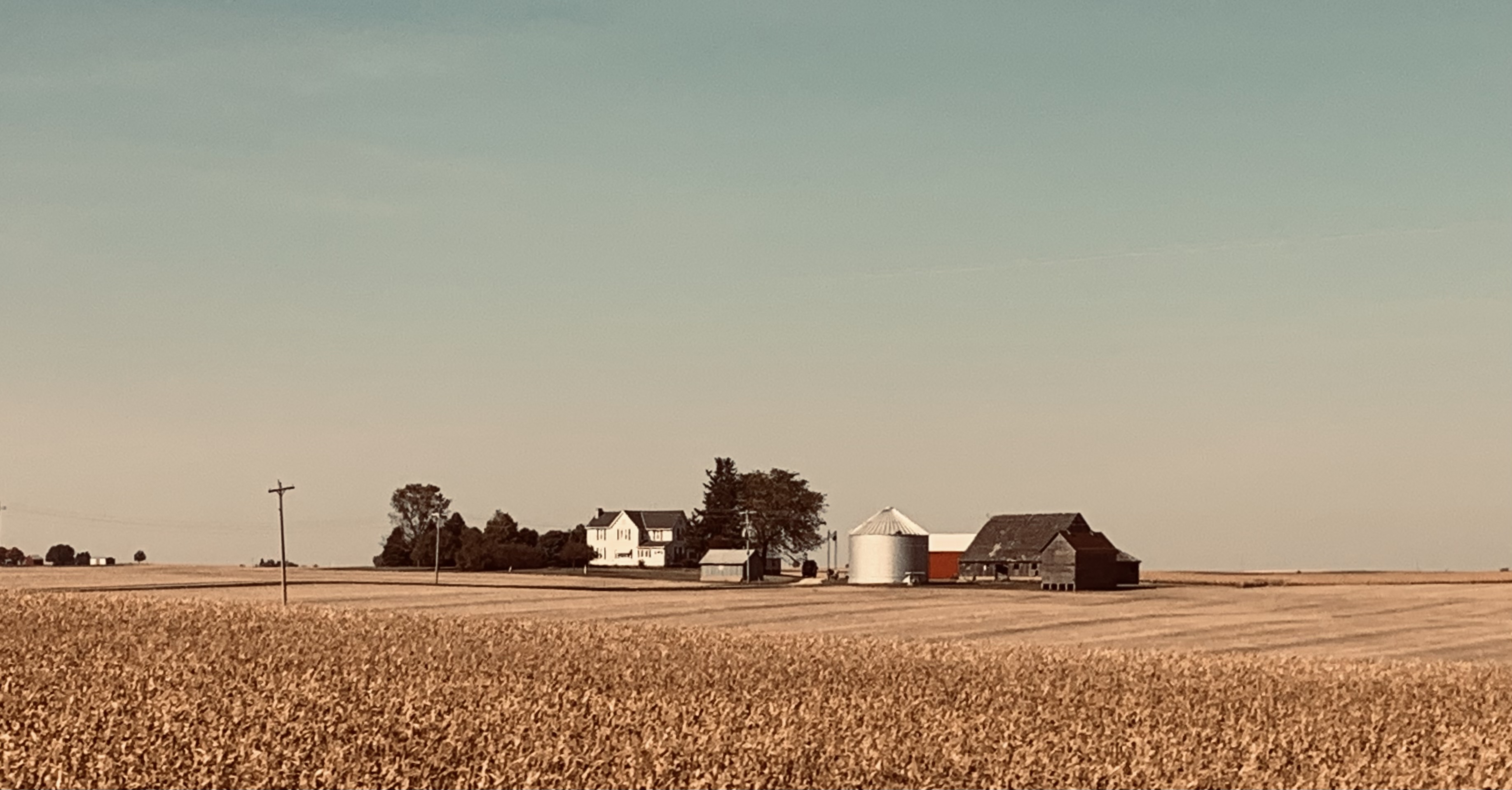
An hour or so further and an hour or so short of Chicago, this solitary farmstead captures a contemporary way of life we don’t experience on our western seaboard. And, while not wishing to wax political in this post, I believe I can understand why folks in these parts may see things differently than I do.


Chicago would be our literal end of the line. It’s where the Zephyr has always terminated. Chicago: with the ‘El’; the commuter lines to the suburbs; lines to the stock yards, steel and other industries; and the historic Union Pacific; Burlington Route; Chicago and Northwestern; and several other routes. We are informed that within the Windy City’s confines exist more miles of rail line than in the rest of the continental US combined. Rolling the final twenty minutes into Union Station, it’s a claim that’s hard to dispute.


After fifty hours on the train, I ask myself, “Did my long held dream of riding on the California Zephyr come true?”  


I recall myself in Dad’s ’54 Ford waving at passengers on the Zephyr as it wound through the Feather River Canyon. I question whether some little kid traveling up Highway 70 in the back seat of his dad’s current day SUV might be missing the opportunity to form his own romantic dreams about boarding this silver wonder and seeing where it takes him.


ResourceThe Story of the California Zephyr, by Karl Zimmerman. Quadrant Press. © 1972.  Nice historic photo and narrative about the early days of the original Zephyr. (Good luck finding a copy. You might want to check out your neighborhood model railroad shop as they often have these kinds of books.  Plus, model trains are kinda cool.  They bring back the little kid in many of us.)

© 2024

Church of the Open Road Press

Friday, August 16, 2019

DESTINATION: BUCKS LAKE

…a glorious childhood haunt…

I wasn’t expected to show up.  Barbara was the last of the three great moms who cared for a bevy of neighborhood youngsters – myself included – in 1960s Chico.  The memorial gathering for her was to be held some four and a half hours away from Cloverdale.  But it was a summer weekend; Enrico, the Yamaha was due for a road trip; and the canyons and ridges, rocky outcrops and pristine lakes of Plumas County are to travel what whipped cream and a cherry is to a sundae. 

California’s highway 70 traces the rugged Feather River Canyon between Oroville and Quincy.  Pioneered by James Beckworth in the mid-1800s, it is the lowest of the Sierran crossings, though the last to see a railroad.  The highway and the old Western Pacific swap sides of the canyon as both routes pass small hydro facilities, historic whistle-stops and bergs all under gleaming granite cliffs and cool pine forests.


Bucks Lake, itself, is a high-country reservoir dotted with forest service cabins – a little known playground for residents of the northern Sacramento Valley and beyond.  


Kayaks and canoes co-exist with jet skis and fisher-boats while bald eagles and osprey circle above and black bear roam in the woods.  

The road I remember as graded dirt is now long-ago paved. Camping and day-use spots are abundant. The dam I once crossed on foot is now gated off.  I park nearby and walk back to the cabin I’d last visited decades ago.

Barbara, the neighborhood mom, had battled dementia for quite some time, but family made efforts to see that she would spend weekends at “the lake” almost until the end.  It was her happiest place.  

Looking out a picture window, I recalled splashing on the beach, the smell of Sea-n-Ski, sandwiches wrapped in wax paper washed down with Cragmont sodas, and my failure to master the sport of water skiing.  Barbara was laughing and splashing and skiing right along with all the kids.  Happiest place, indeed.


My return home would be a different route.  East of Quincy, a the LaPorte Road winds from Route 70, crossing a diminished Middle Fork of the Feather then climbs Buzzard Roost and Gibsonville Ridges, past the alpine head waters of the South Fork. Each turn offers another breathtaking view.  

August-spring wildflowers carpet the high, cool meadows and it feels as if I am riding through the ground floor of heaven.  

Further west, the LaPorte Road routes past historic mining and lumbering villages – some little more than place names.  Sixty miles on, I am driving through the dry, 95-degree grazing land of the Yuba foothills outside of Marysville, wishing I were back at Bucks Lake reveling in the cool breeze rising off the water.

The day before, when I had entered the cabin, I worried that I wouldn’t be able to identify the neighbor-kid-now-cabin-owner I hadn’t seen in perhaps forty years.  He stood and called me by name.  “Greg,” I said, a bit breathless from climbing the granite stairs to the house, “this still is among the most beautiful places in the world.”  Greg took my shoulders, turned me around to look out that picture window with the stunning view of water and forestlands crowned with fair-weather clouds.  Then he pointed to the hand painted sign above.  It read: “Welcome to the most beautiful place in all the world.” 

© 2019
Church of the Open Road Press

Monday, April 8, 2019

YOSEMITE: 1954

My first visit to the Sierra…

The ’54 Ford Ranchwagon was brand new.  Not that I remember.  Dad had banged up a ’46 Chevy in a collision at an intersection – a collision that, to his dying day, Mom would not let him forget – so we needed a new car.  All this I was told.  I was also told that in celebration of this new family car our first road trip would be to Yosemite.  In later years, Mom always prided herself in packing our succession of station wagons such that no cargo rested above the lowest portion of the windows.  “Safest to drive if you can see out the back,” she’d said.  Also safest to have a two-door car rather than a four-door car because, so she explained, when she was growing up in Houston in the 30s, some poor kid fell out the back door of a four-door Hudson or a Plymouth or something, landed on his head on the pavement and “…was probably addled for the rest of his life.”
         
I’d just turned two so I don’t remember anything about this first-trip-for-me to Yosemite or how the car might have been packed. I know only what I was told.  And only what I was told after once, when as a teenager, I happened across a yellowing Kodachrome slide – shot by Dad with his trusty Signet 35 – of me standing in a wet didee on a picnic table, shoulders just unclutched by a red-sneakered Mom whose skirt was soaked nearly up to her waist.  The Merced River slipped by in the background of the frame.  Brother Bill looked on.
  
       
The ride from LA’s Altadena suburb to the valley floor had been hours long.  And, in the days long before car seats or seat belts – how ever did we survive?– I had a lot of time to rumble around in the back seat with brother Bill.  At twenty-seven months, I wasn’t much interested in the scenery, I suppose.  And even if we did have that travel bingo game – the tagboard gameboard with the little plastic windows – I would more than likely have occupied myself chewing on the gameboard’s corner than matching what was outside with what was illustrated on the card.
         
Anyway, upon our arrival in Yosemite Valley, apparently Dad pulled into a lovely spot in a valley floor campground backed by the river.  Apparently, also, was that once the seat in front of me was unoccupied, I could easily push the seatback forward and tumble out through the open passenger door.  And speaking of apparent, the rushing water of a snow-melt-flush Merced River must have been quite inviting because within moments, I was “bobbing up and down like a little red-headed cork,” according to Dad, who always chuckled when he told this, “as the river sorta carried you away.”

I didn’t hear Mom shriek or Dad swear.  All I have to recollect with is a once-obscure bit of family history linked to my discovery of an old Kodachrome slide depicting a two-year-old me atop a park service picnic table and a terrified, half-soaked – and likely infuriated – mother, undoubtedly at a loss for what to say or do next.  
         
We camped elsewhere that night.
         
And for the rest of Dad’s life, once the story was… well… public, Mom’s telling always concluded with, “I told Clayton not to pick a campsite so close to the river!” followed by: “I had to go in there and rescue you because he was fumbling with that damned camera of his.”


© 2019
Church of the Open Road Press

Friday, April 5, 2019

YOSEMITE: WINTER INTO SPRING

Visiting America’s BEST idea


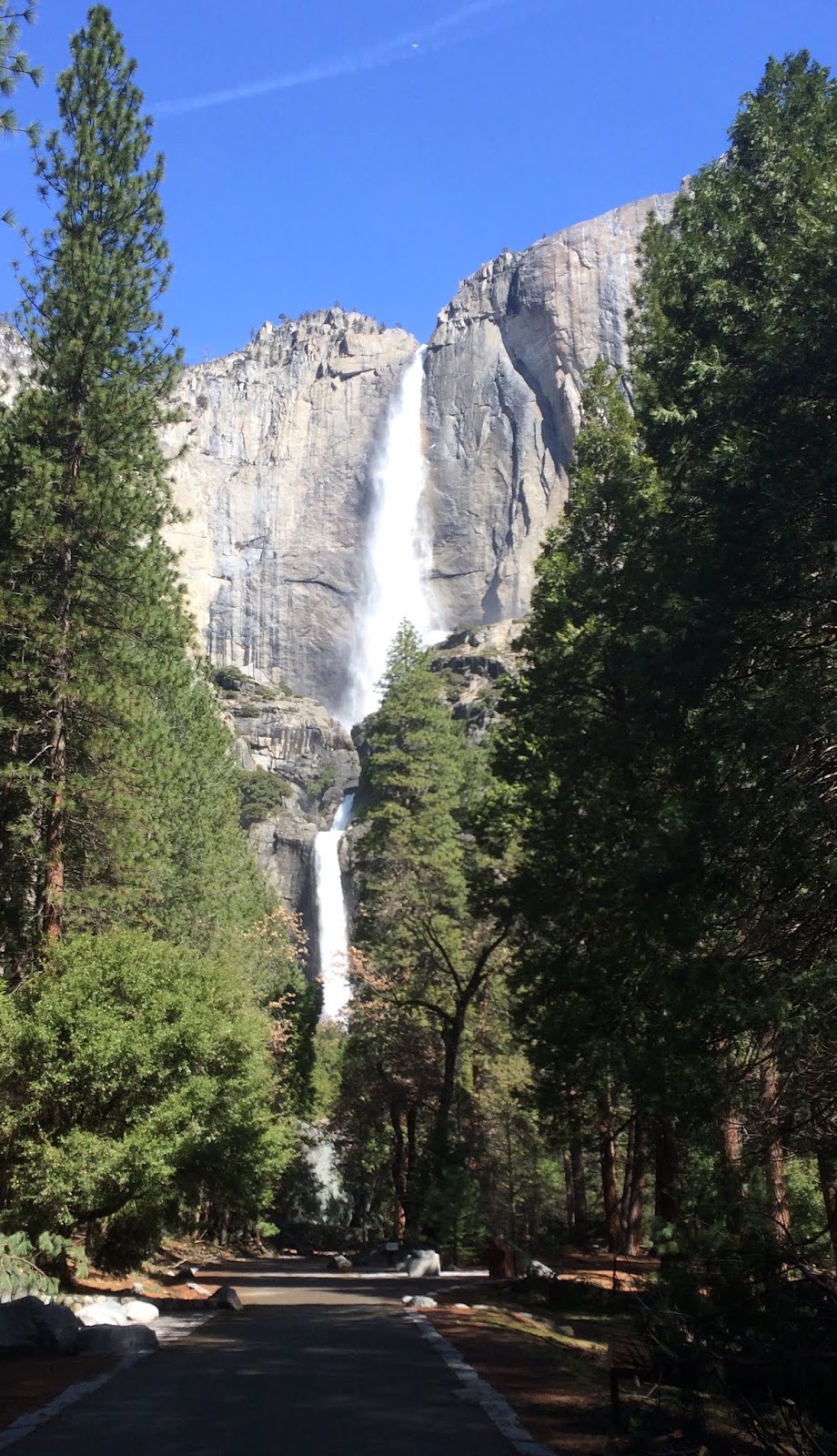
Only the calendar suggested that spring had come to Yosemite. Winter was not quite finished. Vigorous intermittent cloud bursts were rolling through, shrouding the panorama across from our Yosemite West rental creating a cat-and-mouse display of tumbling cataracts on the canyon wall opposite.  The term shower curtain suddenly had a new meaning.        
         

Descending some 2800 feet to the valley floor, the waterfalls run gloriously full.  El Cap stands like a granite gate keeper, only one with its head in the clouds. 


Mirror Lake, a two-mile walk from parking, both mirrors and mutes Half Dome.


I find myself thinking of Theodore Roosevelt and John Muir and their embrace of the subtle beauties of a magnificent place during inclement weather.  The softness under foot.  The aroma of dampened pine and fir.  The symphony of falling water.  


The near perfect blackness of a cloud-blanketed night.  Annoyances to the contemporary traveler were simply elements of an environmental tapestry these early twentieth century futurists felt worth preserving.

The following dawn: Overnight, spring had bullied that late-winter storm over the Sierra and out across Nevada.  


The air is crisp, the mountains and domes glazed in fresh snow and the forest floor washed clean.
   
      
A hooded Junco pecks at the duff until a Stellars Jay swoops in to claim some sort of grub.  The crok-crok of a distant Raven breaks the silence while a Cooper’s Hawk turns cartwheels on the sub-floor of heaven.

        
Our road to the valley floor (California’s State Route 41) is a patchwork of lush forest and year upon year of burn scar. Fire fighting in the wilderness of the national park, unlike that of the national forests, is a practice of letting nature take its course.  As we pass from one fire zone to another, we can see the succession of life: sprouting grasses, and brave fledgling sprigs of scrub, oak and pine.  It is the rebirth of the forest as God probably intended and as John Muir probably concurred.

         
Gazing up from Yosemite Valley, Bridal Veil, Yosemite and so many other many nameless cascades leap over cliffs, their falls looking like silver ribbons on a package that, when opened two or three weeks from now, would yield the priceless gift of a wildflower burst in the valley floor. 


At the foot of one tumbling rill, mist dampens my cap and clothes and offers the mid-day sun a palate with which rainbows are painted against a deep azure canvas.

The day would be spent chasing those rainbows and vistas, peering up at the cliffs and down through the crystalline waters of the Merced.

        
To Muir’s pleasure – or perhaps his chagrin – the paths are now paved and choked, in places, with visitors.  


Visitors from around the world whose voices and dialects provide another tapestry for me to consider: a reminder that our National Parks, starting with Yosemite, may well represent America’s best idea.


o0o

More photos


Muir’s musing.


Morning view from Hwy 41’s Tunnel View.


Unnamed and temporary.


Valley floor awaits spring.


Tenaya Creek crossing.


David Brower’s admonition.


Winter returns.


Our trip to Yosemite was awe-inspiring and too brief.  But evident, after a rather rugged winter and visits to both Yosemite and the Carrizo Plain, is that our National Park system is woefully underfunded.  Signage is down.  Roads and pathways deteriorating.  Meadow restoration, in some places, on hold.  Clean-up after neglectful visits has gone from daunting to undoable.

In a nation that can afford massive budgetary increases to an unaudited military and huge tax decreases to the uber-wealthiest among us, support for our National Parks must not be an afterthought.  These palaces of history, science and beauty must not become available only to the well-to-do. 

Somewhere in our nation is a young John Muir.  He (or she) - no matter the socio-economic caste - must not be denied the opportunity to experience and be inspired as Muir was.  Our parks must be affordable and available to all or they can no longer be referred to as "America's best idea."

© 2019 
Church of the Open Road Press

Thursday, October 12, 2017

AUTUMN ON 89 – PART 3


Into the Rain Shadow


Here is the precept this series of three posts will set out to prove: California’s state route 89 is among the most beautiful highway routes in the entire country. 


On a chilly October morning, it’s tough to get out of bed, especially when being nuzzled by a canine heater.  The cozy cabin at Sorensen’s with its knotty pine interior seems an inviting place to hibernate until April.  I asked about this at the front desk but was informed that the resort is pretty much fully booked year round.

Given a distance yet to travel if we were to complete our exploration of California’s State Route 89, an early morning constitutional seemed in order.

The early rays of sunlight illuminate this juniper…

… but in the sheltered mini-canyon of this brook, rocks were layered in ice.


At Woodfords, Highway 89 heads south to Markleeville, seat of Alpine, https://alpinecounty.com/ California’s least populous county and perhaps the only county seat lacking full service banking.  Through town, the road rises to another of those 1800s scenes…


… then follows the East Carson River, another grand playground for the fisherpersons among us…


… where the autumn blossoms from roadside sage (?) contrast with the standing deadwood of a two-years-ago wild fire.  Still, a river runs through it.


Monitor Pass feels like little more than a rise, then fall, of the roadway.  It is marked by a weathering stone marker…


… set among aspens growing on either side of the route.


Clearing that copse of trees, it is clear we’ve moved to the rain shadow of the Sierra.  The lush forests of ten miles back are gone, replaced by largely barren hills dotted with stunted pines and juniper and scruffy brush.  Cattle country, if you don’t run to many of ‘em.


Off to the north, a fire lookout perches atop a wind-worn Leviathan Peak.  A rugged dirt road winds up the hillside.  The Subaru begs us to take it.


About two hundred yards short of the top, a substantial steel pipe gate blocks the road.  We disembark for a little hike.


The view from fire lookouts is always outstanding.  Go figure.


I figure out how to do a panorama shot on my Sony pocket camera only to return home to discover that the computer screen wide enough to do justice to the vista has yet to be invented.


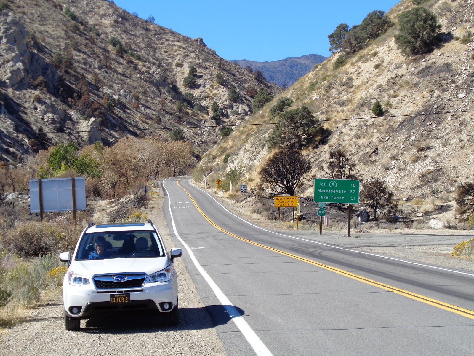
Creeping back down the dirt track and resuming our tour, Highway 89 winds over and around dry, desert ridges, and, in its final few hundred yards, traces a stream course down to the floor of Mono County’s Antelope Valley.

Many times, I’ve seen motorcycle riders throttle through this canyon, ending up on US 395 bearing a grin bright enough that it could be seen through their full-face helmets.  I recall feeling that grin myself after running the route on one motorcycle or another.


But 395 is where this glorious state route ends. 


After more than 300 miles and having visited lumber towns, volcanoes, pristine meadows, snowfields, granite arêtes and countless turns and summits and tastes of history, the premise of the little tour I’d planned held true: State route 89 is among the most beautiful highways in the entire country.

The only question that remains is: How long until I can do this again, heading the other direction?  (…on the bike?)

© 2017
Church of the Open Road Press