Showing posts with label Sacramento Valley. Show all posts

Sunday, May 7, 2017

SEEDS OF LITERACY IN THE MIDDLE OF NOWHERE


Stumbling across the Carnegie Library in Bayliss, CA

Circumstance has dictated that once every two or three weeks, I drive from northern Sonoma County to Chico, California.  An aging mother enjoys her son’s visits.  The route from Cloverdale to Williams is pretty static, involving a good chunk of CA 20 over the top of Clear Lake and through the Coast Range.  Wonderful ride even after the first dozen or so times.


Once in the Sacramento Valley, a grid of state highways, secondary roads and gravel byways offers almost unending choices to get from point A to point B. 

Some routes cross vast rice fields that in the winter months are thick with migrating geese and cranes and throughout the rest of the year visited by herons and egrets. And other waders. 
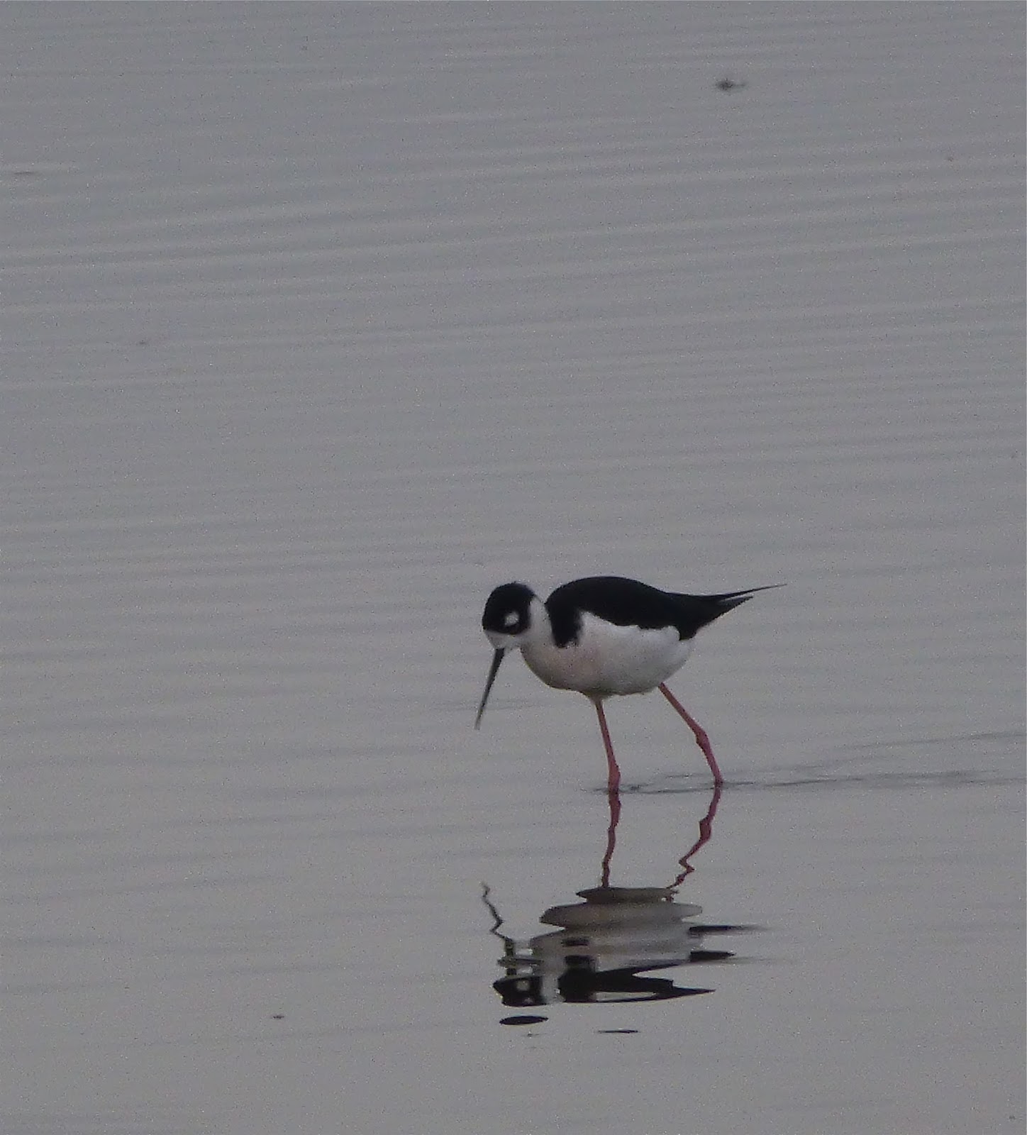
Their reflection in the glassy, flooded fields against an azure sky (or a gray one) is always a delight.


Other routes split walnut orchards that in summer invite the passer-by to seek the cool shade and pause for a roadside picnic. 

There’s a great collection of long dead Chevy and GMC trucks near the intersection of River and Ord Ferry Roads. 

And lots of old barns both nearby and distant.


The old US 99 W parallels a frenzied I-5 passing through one-time bergs established as whistle stops along the old California Northern Railway: Maxwell, Delevan, Logandale, Artois, Grapit…

Boarded storefronts and tiny crumbling streets remind us of what once was. 


In some places, nothing reminds us.

Ten miles east of the freeway, CA 45 traces the west bank of the Sacramento River. 

The portions atop levees offer sweeping views of a riparian forest with peeks at sloughs now filling what used to be the river’s channel. 

There’s a nice little store in Princeton to stop for a beverage and a snack, a high school and an elementary school and a little other commerce. No working gas pumps, however...

Just north of town, the skeleton of the Princeton Ferry rests, pulled up to the landing where cars – including our ’54 Ford – once boarded to cross the river.


Glenn has a post office and little else.  Same with Ord Bend although a manufacturing plant churns out something at the crossroads. 

Butte City, Afton, Jacinto, all have pretty much come and gone.


Recently, I traversed the valley on Bayliss-Bluegum Road; Bluegum being the out-of-town spot where many young high school boys may have – or may not have –  “become men” after the prom or some other such celebration.  The motel there is now no longer a motel. 

Heading south on CA 45, I turn west.  Signs indicate the Jacinto Grange would hold a pancake breakfast on an upcoming Saturday morning, and if I miss that one, there’d be another next month.

The walnut orchards near the river give way to rice fields on the fertile flood plain of the Sacramento.  Lettered roads – “County Road S, County Road T,” etc – that are little more than driveways, lead to houses and barns a mile or so north or south.  Wading birds stand like statues in the still canal waters next to the road. 

Weed encrusted implements dot the field edges, coated in rust and field dust.


Then, just ahead on the right: a copse of elms or cottonwoods at a crossroad.  Perhaps something major?  I hadn’t seen a store, a post office or a filling station.  Not even a bar.  But I was coming to a something.


Andrew Carnegie was a Scottish immigrant businessman and philanthropist.   Pivotal in expanding the American steel industry, he founded the company that would become US Steel.  By the late 1900s, because of his investments in railroads, railroad sleeping cars, bridges and oil derricks, he became one of the richest people ever in America.  Palling around with the likes of English poet Mathew Arnold, English philosopher Herbert Spencer and American humorist Mark Twain, Carnegie’s affinity for the written word and the import of literacy manifested itself, first with the construction of a public library in Dunfermline, Scotland.  His efforts led to there being more than 3000 libraries built throughout the world with nearly 1700 built in the United States.  There’s probably one near you.  (Chico people, check out the Chico Museum on Salem between 1st and 2nd; folks in Roseville, check out the building adjacent to the arched bridge crossing the UP tracks heading north out of town.)


A placid white building, circa 1910, stands near the shade of those elms in what once was Bayliss. 


I stop for a look.  The paint is fresh.  The lawn is trim.  The hours are posted.  Serving the southern section of Glenn County, California, they’re still loaning books.  


Just not the day I happened by.  Besides, my library card expired decades ago.

I stand on the lawn thinking about the visionary accomplishments of this immigrant industrialist, glad to see that the fruits of his love of literacy still flourished.

What else is to be found by the casual visitor to Bayliss?  Not much.  There’s the store.
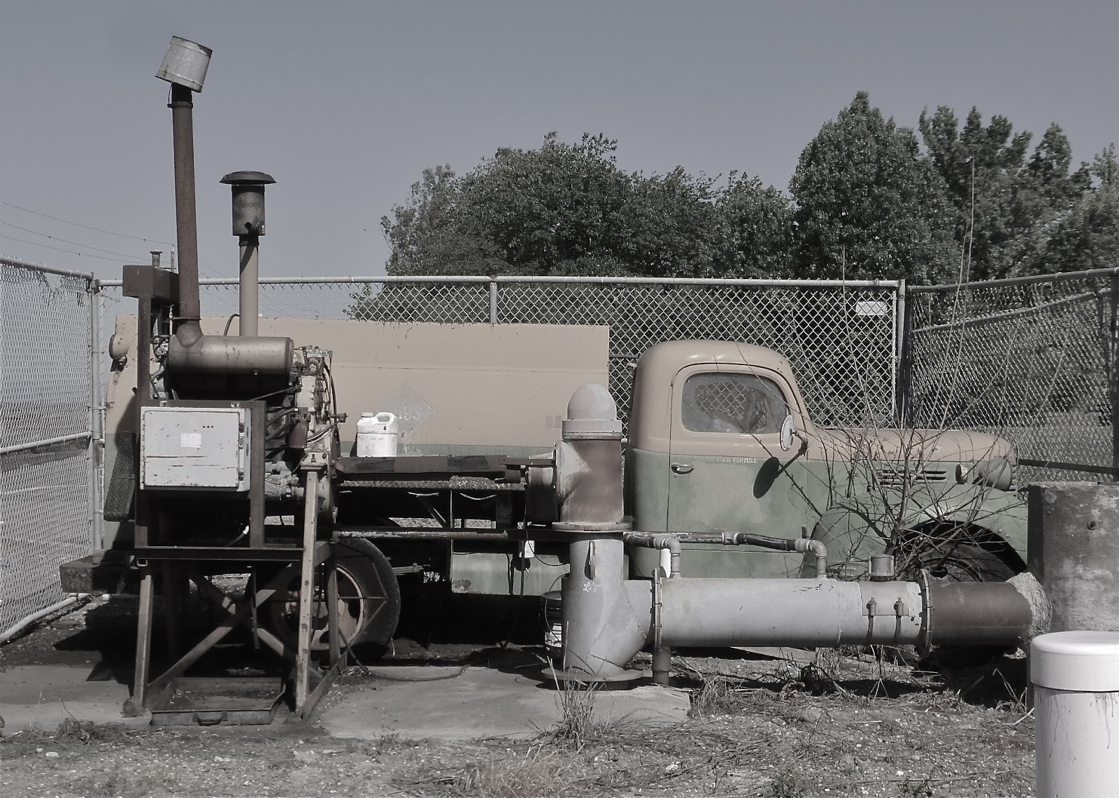
And an excuse for me to take a picture of an old truck repurposed as a source of power to pump water into an irrigation canal.  Or maybe it’s just stuck inside a cyclone fence.


A few miles further on, I come to I-5 with all of its frenzy and fury and high-speed, gotta-be-there-yesterday travel.  In moments, the Carnegie Library of Bayliss, California is a century behind me.

© 2017
Church of the Open Road Press

Monday, November 30, 2015

THE LIFE CYCLE OF A PLACE NAME


Dusk may be the time
when history speaks
in greatest clarity

I drove through Artois, California the other day.  I recall stopping there about five decades back, my parents looking to buy me a Nehi Orange at the local market.  

Long ago, the old store was boarded up.  The main highway through town, upon which this day I was the only traveler, used to accommodate all the major north south traffic on the west side of the valley.  I turned down a back street and explored its crumbling pavement.  A couple of dozen homes, many dilapidated, stand among vacant weedy lots. 

Artois, once a shipment point for wheat, later rice, on the old SP line; once a pit stop for travelers on the old 99W; once a minor crossroad for those heading to the Sacramento River; Artois, now houses the production facilities for California Olive Ranch Oils and the occasional well-preserved Victorian, but little else.

Fort Bidwell is located at the north end of the Surprise Valley.  With a good tail wind, you could spit and hit Oregon.  Driving up that way is a lot like travelling back through time. Peter Lassen led immigrants through this country in the 1848.  Modoc leader Kintpuash (Captain Jack) was hung here in 1873 having killed US General Canby in the Modoc War.   

The vast expanse of the valley floor now supports cattle operations and small time hay farms each whose ownership goes back generations.  The main street through Fort Bidwell is utilized by equal parts pickup trucks, horses and those little four-wheelers made by Honda or John Deere or Kubota. 

It is easy to imagine when there might only have been horses.  Now, however, the school is closed, the general mercantile is closed and the Chevron closed about two years back, or so I’m told.  If a dime were burning a hole in your pocket up this way, well, you’d just have to let it burn.

Sites, California is nine miles west of Interstate 5.  It is just past the easternmost ridge of the Coast Range.  The road is rifle shot straight from Maxwell to a spot called Mills Orchard, where it twists and turns to follow the course of a seasonal creek up into the hills.  There was a town here, once.  We know, because there’s a sign that says we’re looking at the town square (circa 1887).  Sites, the town site, is at a crossroad.  West, one would travel to Lodoga; south, one would find the remnants of Leesville; east, one retraces the route down to Maxwell and a rail connection north and south. 

Whatever they once did at Sites – range cattle? – they’re not doing much of it anymore.  Recent talk has centered on damming that seasonal creek and using the resultant basin as surface storage for pumped in Sacramento River water in case the state should ever find itself in daunting drought conditions.


There is mystery in old places that are on their way to no longer existing: mysteries involving their birth, their heyday and what brought about their demise.   

My mind often wanders to the hearty families that busted ground and settled the area. 

I’m curious as to whether the old time residents thought it as beautiful or as romantic as I do from the seat of my motorcycle, or if it was just a place that, like a tool, they used until they found no value in any longer and moved on.  Then I wonder if any descendents ever come back to check on things.

Generally, the road to a near-forgotten place name is an interesting one. 

It may or may not be paved.  It likely never was engineered. 

It probably goes over and around the streams, scenery and hillsides rather than through.

On the off chance you encounter someone coming from the opposite direction, two things are practically assured: somebody’s going to pull over and both you and s/he will offer a neighborly wave.  I wonder about those who walked the road to market or to school or to the rail line and what they may have thought about those who later drove it with our smoke-belching mechanicals.  It’s easy to get lost in that or some similar reverie. 


Place names are born because something was about to happen here.  They die because that something quit happening.  The whys are innumerable: the gold played out, the wind blew the topsoil away, there was a flood, there was a drought, someone built a dam, someone built a freeway, someone built a Wal-Mart in the next town over.  Or, the off-spring saw that proverbial “Par-ee” and decided not to return “down on the farm.”

I enjoy a little first-hand visit with history perhaps staying to watch the sun dip behind a hill and darkness creep across the landscape.   

Dusk, I’ve found, may be the time when history speaks with the greatest clarity.  At these times I counsel myself: It is wise to have this little visit before all the history is erased by the winds of time and our relentless march toward efficiency. 

It is good, I conclude, that there are so very many little roads: each going somewhere.  Each going to a place name.

© 2015
Church of the Open Road Pres

Tuesday, January 27, 2015

WILLIAM B. IDE ADOBE – A VISIT TOO LATE


It ain’t what you don’t know that gets you into trouble.
It’s what you know for sure that just ain’t so.
- Charles F. Kettering


For as long as I have lived in northern California, Interstate 5 has run the length of the state.  I’ve utilized it dozens of times flying toward adventures in the Siskiyous and points north in Oregon and Washington.  Just one exit beyond Red Bluff, after a crossing of the Sacramento River, a posted sign reads William B. Ide State Historic Park.  Racing by time after time, I think to myself, “I’ve gotta stop there and check it out.”

On this day I would.
(c) California State Parks


William B Ide arrived in California in 1845. He proved to be a pivotal figure in the historic “Bear Flag Revolt.”  Our state was once known as Alta California, a Mexican territory.  The Californios of the region became intent of separating from Mexico’s governance due, in part to its distance (Mexico City) and its indifference to the Mexican citizens that lived here.   

A handful of Americans who’d come to settle in the Great Central Valley – Ide among them – traveled to Monterey to embrace the separatists and play roles in establishing California as an independent republic in June 1846.  As a result of a rousing speech he delivered, Ide was declared President of the republic.  That circumstance would stand only until the United States declared war on Mexico in July 1846 – about 22 days.

The history I’d learned and the history I subsequently taught my Fourth Graders fifty miles south in Durham, CA, was that Ide was an up-river settler who became the only President of the California Republic – and that he lived just up the road in Red Bluff.   “You can even visit his house, up there,” I advised my kids, although I’d never visited myself.

On this day I would.


The William B Ide Adobe State Historic Park is located on a bluff overlooking the Sacramento River.  


Listening to the river whisper by, the soft breeze through the oaks and the occasional twitter of some native little brown bird, it is easy to imagine oneself settling in this bucolic piece of heaven about a hundred and seventy years back.  The land was rich and fertile, the river rife with salmon and game roamed within easy range of even the most primitive firearm.  Just add Maureen O’Hara…

I like to drop into the visitor center first, pay my fare and check out any exhibits there in – and thus be better informed about that which I will experience outside.

“I’ve been meaning to come here for about fifty years,” I chatted with the young docent on duty.

“Well it’s good you finally made it, but I’m afraid you’re about eight months late.”  He saw the quizzical look on my face.  “Did you read about us in the paper?”  I shook my head.  “Well, did you happen to get a look at the oak tree?”  Again I shook my head.  “Well go take a look.”

East of the visitor center a about fifty yards stands the trunk of a five hundred year old oak, pared back to about two stories in height.   

A few feet further on, wrapped in industrial grade plastic and surrounded by a temporary fence, is the shell of what once was called the Ide Adobe.  I walked around the building unable to capture a decent shot of what it once was.

“Yep,” the young man said, “Storm blew through last March and most of the tree collapsed on the building.  Wiped out the roof and the floor but the walls seem to be okay.”

Roof Detail from Smokehouse
The State Park System is restoring the adobe, but it will take some time.  My once-again-lesson-learned has to do with putting off those places you’d like to visit for another day.  I’d missed this one by a mere eight months.


A footnote to this whole visit is that Ide probably never lived at the adobe.  He likely lived further down-river as he spent quite a bit of his political career as a bigwig down in “Colusi” County.  There was a river ferry just down stream from the adobe known as Ide’s Crossing.  The state or the locals assumed – according to the docent – that William B Ide had something to do with that enterprise or at least its name.  But no record exists to suggest anything other than simple coincidence regarding the name.  On top of that, no one is quite sure if the photos of Ide are actually photos of Ide.  Pictures of two different men are on display at the park, both purported to be William B Ide.


Resources:

A stop at the park is well worthwhile, even in its current condition.  It is a pleasant break and a short jaunt off I-5 north of Red Bluff.  California State Park System information on the Ide Adobe may be located at: http://www.parks.ca.gov/?page_id=458

© 2015
Church of the Open Road Press

Thursday, March 7, 2013

WEST SIDE OF THE RIVER

on California’s State Route 45

Click on any picture, if you must, to expand
State Route 45 provides a welcome alternative to I-5 when traveling the valley north of Woodland.  Coursing through farm lands, orchards and tiny bergs, the two-lane carries us back in time a bit. 

Along the way it tempts us with occasional views from the west side of the Sacramento River.  Although many lanes lead to the leveed banks of the Sacramento, few provide an alternate to Route 45.  Most of these little avenues offer access to farmers and fisher-people simply dead-ending at the river.


The run south from Hamilton City is straight and smooth.  Once past the Tehema-Colusa Canal levee, undeveloped land allows for nice views of the Coast Range off to the west and riparian stands of oak and black walnut nearer the river. 

Within a few miles, almond orchards present row upon row of, on this day, delicately blossomed trees.  Their fragrance is high on my list of favorites: a virtual tie with my local cigar guy’s humidor.

The highway passes through bergs that, before interstates, served as mercantile hubs farmers and ranchers. 

An equipment repair shop may or may not stay open along with taverns, small, whitewashed churches and tiny country stores.  I stop for bottled water and an apple, not because I need the water or the apple, but because, I figure, they need the business.

Route 45 intersects 162.  I cross the river here to visit Butte City and see what’s going on.  Not much…

…except for this pleasant reflection of peach blossoms.

Area kids go to school in Princeton with those making it through the twelfth grade legitimately called “Princeton Grads.” 

In the 50s, the Princeton High School Band made regular treks to South Bend, Indiana to perform at Notre Dame football games.  No longer.  No money.  Heck, there may not even be a band any more.  Where’s Harold Hill when you need him?

Out this way, the almond orchards have yielded more to English walnuts.  These black-stumped, silver-barked trees are spaciously organized into cool groves that might invite a nap on a hot summer day.  Cautiously wondering how the landowner might react, I don’t do this.


Colusa provides a respite from the saddle.  Once among the largest wheat transshipment points in the country, the town nestles the west bank of the Sacramento about half way through a sojourn along state route 45.  Devoid of big box stores, the main street seems to be weathering some less-than-the-best economic times. 

A stroll through the neighborhood backing the business district, one finds a nice collection of Victorian and craftsman style homes on spacious lots along tree-lined streets. 
 
125 years ago, the state powers-that-be strongly considered Colusa for the location of the northern Normal School, an institution for training teachers. Fifty miles distant and home to US Senator John Bidwell, Chico won the bid for this school.  One can only imagine the flip-flop of town fortunes had the decision gone the other direction.


Beyond Colusa, the valley has become more of a sink, a low land in which water may collect for weeks at a time in winter.  Rice is now king as are wintering fowl.

Heading south from a junction with SR 20, highway 45 slips through glens of standing oaks, then veers onto the tilled valley bottomland.

Soon, it curves back riverward at Grimes.  Another country store and little church make this a community.  From here, the highway appears to follow straight lines, making ninety-degree turns at, perhaps, historic property lines. 

A nice alternative is Wilson Bend Road. 

This little gem wanders through a few more fields and orchards and offers few more miles of levee top views of the river. 

The pavement isn’t great, but I’m not in a hurry or I’d be over on I-5.

The final stretch is a pleasant jaunt through the Great Valley, although I always get to Knight’s Landing wishing there were a few more miles of state route 45 to enjoy.

o0o

Today’s Route:  I-5 to Orland or State Route 99 to Chico; SR 32 to Hamilton City (Glenn County).  From Hamilton City, south on SR 45 through Ord Bend (what’s left of it), Glenn (ditto) to Four Corners.  Here, consider a side trip over to Butte City just to check things out across the river.  Continue south of SR 45 through Princeton (find the old ferry pulled up on the bank in the shadow of a warehouse; but watch out for the little yip-yip dog who guards it!) to Colusa.  SR 45 joins SR 20 through town splitting about five miles south of town.  Bear right, through Grimes, Grand Island and on to Knight’s Landing.  Alternate south of Grand Island: left on Wilson Bend for a few miles of levee riding.  From Knight’s Landing SR 113 leads to Woodland or Yuba City; county road E-10 hooks up with I-5 at Zamora.

o0o

In Colusa, I pulled onto a side street, visited the nicely maintained city park and then hoofed over to a newly opened tacqueria occupying once-vacant and dusty storefront.  The carnitas tacos were subtly smoked and gently spiced.  They came with homemade refrieds and well-seasoned rice.  The proprietor, who may or may not have been born on this side of that new fence folks seem to be so excited about, made chipper conversation with customers, asking me about what I was riding and where I might be headed.  He was equally deft engaging a Hispanic gent who’d parked a working copy of a Chevy truck out front.  As I departed, the young restaurateur bid me “safe travels.”  I left feeling gastronomically satisfied.  I couldn’t help but reflect on the opportunity this young man had sighted and seized.

© 2013
Church of the Open Road Press