Showing posts with label California History. Show all posts

Sunday, October 27, 2024

ABOARD THE CALIFORNIA ZEPHYR (FINALLY!)

 A life-long dream come true ~ maybe

The California Zephyr has always been mythic to me. Winding like a silver ribbon up the Feather River Canyon, occasionally, we’d be lucky enough to see it as we drove California’s Route 70 in our ’54 Ford toward Quincy and Bucks Lake. Crisscrossing the canyon, if we were really lucky, we’d be crossing the river on a bridge as the train crossed above us, switching sides of the canyon. The silver beauty was always on the other side ~ always just a bit out of reach.  


The Zephyr ran from San Francisco to Chicago under the combined efforts of the Western Pacific, the Denver, Rio Grande Western and the Burlington Route. It had always been my dream thunder across our vast western expanse on this train. Alas, come the early 70s, service ended. As did my dream.  Or so I thought.


But along came Amtrak, the Federal government’s attempt to keep rail traffic alive. More successful along the eastern corridor of the United States, cross-country routes would enjoy less ridership. Yet, the Zephyr was revived. Now, however, using the historic Donner Pass Route initially carved by the Central Pacific, silver streamliners no longer grace the Feather.


 We board the Zephyr in Sacramento.


From the Sacramento Valley Station, the route winds and twists up the western slope of the Sierra with pauses in Roseville, Colfax, and, following the river courses of the American and the Yuba, cresting the Sierra on the highest trackage anywhere in the States. We enjoy a view of Donner Lake…


…before descending into Truckee for a twenty minute fresh air and, ironically, smoke break.


The route traces the Truckee River through the rain shadowed environs of the east slope of the Sierra. Conifer forests begin to give way to brittle sage and autumn’s golden grasses.  


East of Reno, we begin to get a feel for the vast and vacant high desert. Miles of that sage and mineral wealth (I suppose.)


Our rail journey will take 50 hours, several of those spent lightly sleeping in our rocking accommodation. But, as night falls, I snap this haunting image of a western sunset and wonder about the Shoshone and Paiute peoples who, for centuries, came to an understanding of that whole living in harmony with nature thing that we successors to this space don’t quite get.


Sunrise finds us coursing along the Gunnison River.


Rolling into Grand Junction, CO on the historic Denver and Rio Grande Route, we see one of many grand old stations left to decay.


A few miles of browning hills relentlessly shaped by river and wind…


…and we rumble into our first glimpse of the Great Plains.  I write ‘rumble’ because, to my untrained train butt, the Burlington Northern / Santa Fe right-of-way east of Denver seems a bit less well maintained than the UP to the west.


Lots of flat. Lots of grain ~ amber waves of it ~ mainly, it seems, corn. And lots of endless vistas. One can fly over this country, which we did on our return to California, and not grasp the distances, the vastness and the towns that look like nameless grids or checkerboards from 36,000 feet. We slept through all of Nebraska. 


Here’s Burlington, Iowa …


… and an aging Burlington Northern Pullman, Railway Express car and vintage loco. Glad these rolling stock examples are being preserved.


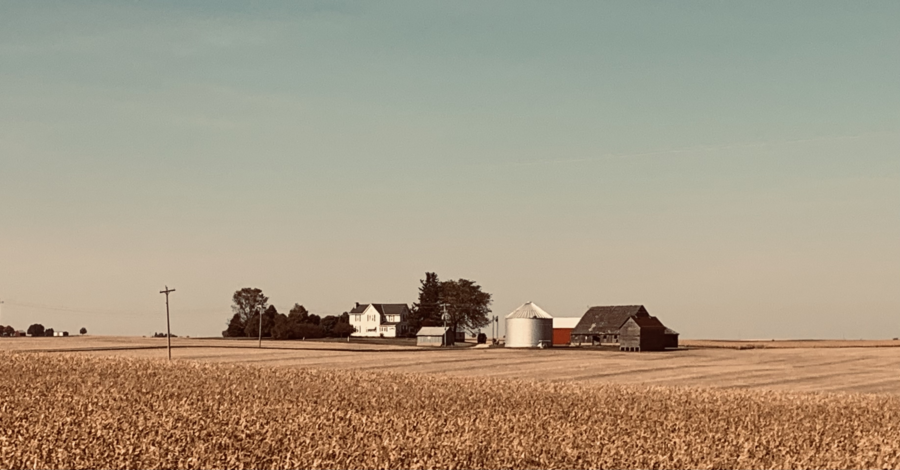
An hour or so further and an hour or so short of Chicago, this solitary farmstead captures a contemporary way of life we don’t experience on our western seaboard. And, while not wishing to wax political in this post, I believe I can understand why folks in these parts may see things differently than I do.


Chicago would be our literal end of the line. It’s where the Zephyr has always terminated. Chicago: with the ‘El’; the commuter lines to the suburbs; lines to the stock yards, steel and other industries; and the historic Union Pacific; Burlington Route; Chicago and Northwestern; and several other routes. We are informed that within the Windy City’s confines exist more miles of rail line than in the rest of the continental US combined. Rolling the final twenty minutes into Union Station, it’s a claim that’s hard to dispute.


After fifty hours on the train, I ask myself, “Did my long held dream of riding on the California Zephyr come true?”  


I recall myself in Dad’s ’54 Ford waving at passengers on the Zephyr as it wound through the Feather River Canyon. I question whether some little kid traveling up Highway 70 in the back seat of his dad’s current day SUV might be missing the opportunity to form his own romantic dreams about boarding this silver wonder and seeing where it takes him.


ResourceThe Story of the California Zephyr, by Karl Zimmerman. Quadrant Press. © 1972.  Nice historic photo and narrative about the early days of the original Zephyr. (Good luck finding a copy. You might want to check out your neighborhood model railroad shop as they often have these kinds of books.  Plus, model trains are kinda cool.  They bring back the little kid in many of us.)

© 2024

Church of the Open Road Press

Monday, January 31, 2022

THE GREAT REDWOOD TRAIL: CONCEPT AND PROPOSAL

 Part 2 (of 3): Rails to Trails in our Backyard


The completion of the transcontinental railroad in 1869 linking east to west ushered in the golden age of railroads in the United States. Midwestern wheat easily shipped to east coast flour mills, Kansas feedlot cattle mooooved almost effortlessly to east coast markets, and folks could cross from east coast to west in days rather than months. The magic carpet made of steel sealed the early 19th century doctrine that American expansion across the continent was inevitable.  And, until the 1950s, rail was most certainly king.


         In 1956, The Federal-Aid Highway Act authorized the construction of a 41,000-mile network of interstate highways that would span the nation, and rail transportation’s dominance began to fade.  Some opine that the last most profitable year for the freight rail industry was when trains transported the cement that was used to build the interstates.  That may or may not be true, but as trucking allowed more flexibility, rail lines became less feasible, and many were ultimately abandoned.

         The “Rails to Trails” movement sought to repurpose these rights-of-way.  Given that out of necessity, rail lines rarely exceeded a grade of 2% ~ that is two feet of rise for every 100 feet in distance ~ rail grades could and do offer easy walkin’ and ridin’ for hikers and bicyclists.  Many provide access to some of the most beautiful, rugged, and remote quarters of the west: The Bizz Johnson Trail on the old Pacific Fruit Express line skirts Fredonyer Pass in Lassen County; miles of the old Tonopah and Tidewater slip toward the edge of Death Valley at Rhyolite (my dad worked for the T&T); and the original route of the Central Pacific over Donner Pass invites hikers through tunnels chiseled and blasted back in the 1860s.  (Even today, if you listen carefully, you can still hear the echoing ping of the picks striking the granite.)


The Great Redwood Trail is envisioned as repurposing the old Northwestern Pacific line from Cloverdale, through the Eel River canyon to Rohnerville and Eureka.  The route will use existing bridges and tunnels ~ work around them where necessary ~ and split the third largest watershed in the entire state.  Travelers will hike through the ancestral homelands of the Yuki people, cross ranchlands that date back to the mid 1800s, and ultimately follow the edge of a languid Eel River as it meanders along the coastal plain en route to the sea.  Along the way, the adventuresome will observe flora and fauna in nearly pristine environs while stepping back some 200-plus years from the pressures of the 21st century into the pleasantries of… well… not the 21st century.


         Access points may serve to revitalize dot-on-the-map communities including Outlet, Dos Rios, Bell Springs, Island Mountain, Alder Point, and Fort Seward. Each of these places holds a unique history associated not only with the railroad, but with the First Peoples who resided in the region for over 10,000 years as well as the ranchers and lumbermen that followed.  Users may choose to day hike or bike out of each locale or engage in a point-to-point-to-point for all or part of the two-hundred-mile section north of Cloverdale.  Camping and sanitation will be available as well as security for local landowners.  (SMART is committed to construction of a bikeway along its tracks from Cloverdale south to the Bay.)

         Though currently only in the planning stages, if all goes well, within the decade a vast and wonderful experience will be open to us and our children. Many communities are already on-board with the project.  


Besides: What could possibly go wrong?  Could the Great Redwood Trail possibly get… dare I say it?... derailed?


Next: The Great Redwood Trail: Dreams and Challenges 


© 2022 

Church of the Open Road Press

Thursday, January 27, 2022

THE GREAT REDWOOD TRAIL: A BRIEF HISTORY OF THE NORTHWESTERN PACIFIC RAILROAD

 Part 1 (of 3):  Rails to Trails in our Backyard


In Northwest California lie Humboldt and Mendocino Counties.  The region, with its steep terrain and large redwood forests, remained isolated from the rest of California until the completion of the Northwestern Pacific Railroad (NWP) in 1914.  After being settled by immigrants in the 1850s, the coastal regions of both counties were easily accessed by sea, but an overland route was slow and difficult to traverse.  Particularly vexing was the transport of redwood lumber ~ often referred to as “red gold” ~ from area mills to San Francisco markets.  In the 1850s, doghole schooners were the main vehicle for shipment, but mill owners were only paid once their timber arrived in port.  When a ship went down ~ as happened frequently ~ so went the profit.


         In 1884, two Humboldt mill owners, John Vance and William Carson (…recall Eureka’s elegant and gingerbready Carson mansion?  Same guy…) joined forces to begin a railroad that would connect Eureka with the outside world.  A rail line was constructed to link Eureka with Fortuna and Rohnerville.  Fifteen years later, the Pacific Lumber Company in Scotia began building lines south into the Eel River. Soon the area was webbed with tracks servicing mills and towns, but shortly after the turn of the century, none were yet connected to the economic hub of the San Francisco Bay Area. 

         Enter the owners of the Santa Fe and the Southern Pacific.  In 1906, they joined into an agreement that would link the north country lines with those owned by the S.P. which already extended from the Bay to Willits.  The trick would be to construct something through the rugged and remote Eel River Canyon.


         Over the next seven years, crews prepared grade, built bridges, bored tunnels and laid track along the river course finally driving a “golden spike” at Cain Rock in 1914.  At a cost of $14 million dollars the rail line was finished.


But the fun was just beginning.  California’s Coast Range is a complex mixture of geologic features.  Mother Nature’s favorite toys, tectonics, volcanism, and the weather, play havoc with the plans of mere humans.  Movement along faults and fissures like to nudge and sometimes shatter stuff we build in the coastal mountains.  Huge plugs of basalt speak to her volcanic past.  And, at cut banks we can see today, bent and tilted layers of unstable clay indicate that the NWP traverses an ancient, ever-uplifting ocean floor.  (So does US 101.)

         Heavy winter rains, working in concert with these elements caused bridges to wash out, tunnels to collapse and rails to give way under the weight of passing freights. Like dots on a timeline of misfortune, one washout or collapse was soon followed by another.  Among the more notable?  In a 1964 flood ~ one that some of us may remember ~ the entire rail route through the canyon was washed away. Remnants of fallen rail cars can still be found in the riverbed.  Tenaciously, the tracks were rebuilt.  Then in 1978, the tunnel at Island Mountain caught fire ~ arson is still suspected ~ and the redwood ties and tunnel support structure burned, collapsing the thing. That, too, was repaired.

         But the die was cast.  While shipping lumber by rail was cheaper and more efficient than by schooner, it wasn’t much more reliable.  Construction cost for the route proved to be a fraction of the cost of keeping things up and running.  Plus, with the advent of the state and federal highway systems, diesel trucks proved more reliable and more flexible in getting product to market.


         70 years battling the greater forces of Mother Nature proved to be enough ~ she always wins, doesn’t she?  The last NWP train ran on the northern line in 1984.  


What might become of an abandoned rail line through such a scenic ~ yet unstable ~ corridor?


Reference:   Northwestern Pacific Railroad: Eureka to Willits.  Susan O’Hara and Alex Service.  Arcadia Publishing.  2013. $22.  (Locally available, this is a delightful book with tons of information and lots of old photos.)


Next:             The Great Redwood Trail: Concept and Proposal

© 2022 

Church of the Open Road Press

Monday, September 30, 2019

CALIFORNIA’S SALMON RIVER BY-WAY

… by not taking a favorite route, 
I discover a new favorite route…

There are many, many ways to cross from California’s I-5 corridor to the coastal US 101 corridor.  Each is engaging.  Each is repeatable.  Each can become a favorite ride.  State Route 96 from Yreka to Willow Creek can be traveled over and over because it is one of those  favorite rides.

This day – exploring with a riding buddy – I chose an alternative…


After heading south out of Yreka through Fort Jones and Etna on State Route 3, also a favorite route, we head west at Callahan.  Cecilville Road begins as a luscious ribbon of nice pavement, glorious curves and second-gear switchbacks as it winds to a Pacific Crest Trail trailhead at Carter Meadows Summit.  


The view back toward Scott Valley is spectacular and the rugged ridgelines recall alps somewhere in Europe.


An easy descent drops us from alpine forests into mixed deciduous pine and oak along the south fork of the Salmon River.  

Thirty miles and more than an hour on, we arrive in Cecilville…


… where the gas is self-serve…


… and so are the groceries.

Note the box for 'honor system' purchases at the bottom of the chill box which is located just outside the locked front door of the store.

Don’t leave your child unattended!

Also just outside that front door.

Disk golf is available, but we didn’t pack a frisbee.


The stretch between Cecilville and Forks of Salmon gets little use, I suspect as for the entire nineteen miles, we encountered no vehicles.  Which was a good thing.  Even on a motorcycle, passing an on-coming anything would be harrowing.  

The road narrows to perhaps three paces wide except where the gnawing south fork – maybe 300 feet below – has undercut the canyon wall and collapsed a few yards of blacktop.  There, it’s narrower.


Then there’s the rock fall littering what’s left of the pavement.  The drive becomes a delicate, slow dance.  Getting pitched from the saddle after hitting a chunk of schist or quartzite would prove calamitous and, as Butch told Sundance, “The fall’ll kill ya!” 


Forks of Salmon is an even smaller berg with a post office, a campground and, to my view, no mercantile of any kind.  


Horses might be seen loitering in the street – though none this day…


… and near that campground, preserved is evidence of the area’s gold mining past.


Forks is where the two branches of the Salmon meet.  


The main intersection offers a chance for one to follow the north fork of the Salmon east back through Sawyers Bar toward Etna.  


I’ve heard the road is a good one, but it will have to wait as we hold reservations at the historic Eureka Inn out on the coast.  Bucket list it.

West of Forks, the stream carries twice the volume, the canyon is broader, but deeper and the remaining route out to CA 96 is less daunting.  


Latter-day prospectors dredge for gold, fisher people fish and I’m sure the huntin’ is good in season.  I am reminded of this as I round a bend to be stared down by a four-point buck standing in what turned out to be his roadway.


I like remote areas and the roads that carry me there.  I like the echoes of history and admire the rugged people who live in and care for the environs – be they the native Americans of yesteryear or ranchers or miners happy to live off the grid keeping a pocketful of quarters handy in case they need to use the phone.


My imagination wanders and fantasies about the romance of the past abound.  And I think I’ve discovered a new favorite ride.

© 2019
Church of the Open Road Press

Tuesday, February 19, 2019

EXPLORING TOMALES BAY, PENINSULA AND THE POINT REYES SEASHORE

Part 2 of 2


To recap: The Church of the Open Road has been kicked out of the house while Mrs. Church of the Open Road enjoys an annual reunion with former teaching colleagues.  The following recounts day two of exile.

The dawn, this morning, came up like thunder.


Last night, I did a little research using this source: https://pubs.usgs.gov/of/2005/1127/chapter9.pdf?fbclid=IwAR05HiP_9y3bDp80H7g_LhM-tUsS0tvk_cD76PuPDsLHJy-BSdQr3iWeQQE and was eager to get started.

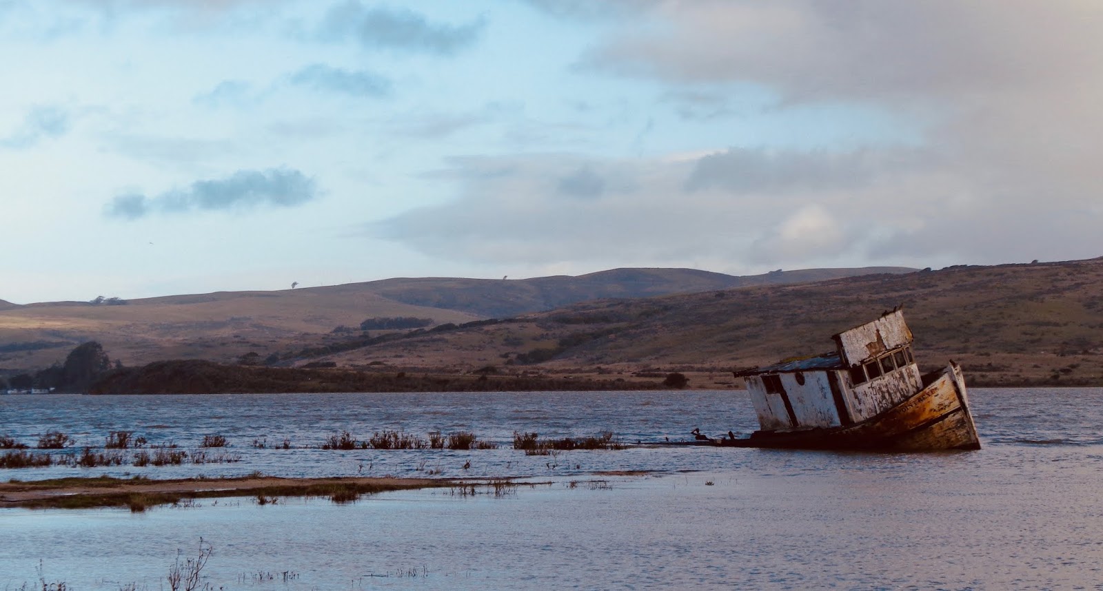
I’d learned that evidence to the conflict between the Pacific Plate and the North American Plate could be seen opposite the run-aground fishing vessel behind the Inverness Store.


The black wedge on the opposite Tomales Bay shoreline to the left of the boat is an uplifted marine terrace near the trace of the San Andreas fault.  Eureka!

I also learned that the Salinian Granite found near Tomales Point is unlike any rock found on the other side of the bay; but it is geo-genetically (my word, not that of a geologist of any repute) geo-genetically identical to the granite found on the eastern side of the fault down in the Salinas Valley some 140 miles away.  At movement the speed of fingernail growth, how long did that take? And – some food for future thought – how long before Los Angeles, California on the Pacific Plate will pull alongside San Francisco which is on the North American?  And will the two rival cities be able to work out their differences before that happens?


The Tomales Point Trail is groomed for three miles.  The 1.7 mile to the actual point is not maintained. 


I wouldn’t make it that far this day.  Cool temperatures – 45 degrees, according to the Subaru, high winds – 35 to 40 mph sayeth the weatherman on channel 5, intermittent rain and slicing hail along with a gimpy knee would curtail my expedition at about mile 2.5.

For moments the air was clear and sunny, but the distant clouds were foreboding and racing this way.


I wanted to get as far as the Tule Elk Reserve…


…and I did.


Then I wanted to get as far as a view of the mouth of Tomales Bay.


Did that, too.  Across the opening a sand spit led to the little community of Dillon Beach, a place I would later visit to catch a view back this way.

Back-tracking, the wind picked up and birdshot sized hail pelted.  The circumstance didn’t seem to bother one young bull.


And, as quickly as the squall roared in, it passed. The view to north looked almost the same as it had two hours before.


The trailhead parking area is shared by the historic Pierce Ranch complex.  The lush pasturelands of the Point Reyes Seashore have long been held by ranching and dairy interests.

From a distance it’s all quite bucolic.


Pierce Ranch no longer operates, but the National Park Service has maintained the site in a state of arrested decay.


Barns and bunks, implements and even a school house are there to wander by and imagine what life might have been like before so much pavement and progress.

A raven stands guard as I tour the grounds. Hitchcock’s Bodega, I remind myself, is only ten or twelve miles distant the way the crow flies; and this was a pretty good-sized crow.


A primitive hinge caught my attention – simply a two-by-eight (or so) bored through with a hole large enough to accept the whittle stub of a gate swing.  The bottom of the gate swing would be stuck in the ground to rot and then be replaced.


Soon it became economically feasible to build a blacksmith shop for this and other ranching necessities.


Tomales Bay State Park (fee required, unlike the rest of the area) shares a small portion of the region.  Sections are on both sides of the bay, therefore both sides of the rift zone.


The peninsular portion includes a nice beach where kayaks can be rented, and a well-appointed nature trail recalling the living arrangements of the Coastal Miwok.


The half-mile path leads under this rather gangly looking coastal life oak…


…and out to a semi-remote beach…


…where replica Miwok bark huts which appear quite similar to those found in the Sierra around Pinecrest Lake (Tuolumne County).


A Great Egret (yellow bill, black legs – as opposed to a Snowy Egret: black bill, yellow/black legs) poses in the creek.


The morning of the third day, I was called to return from exile. Along the way, I wheel into the coast village Dillon Beach to get a view or two of Tomales Point from the North American plate.


From a bit greater distance, the spring grasses catching the mid-morning sun show the graceful lay of the land across the inlet.


And from Bodega Head, perhaps a dozen miles further north, I stand on the “furthest north existence of Salinian Granite” and snap a farewell photo of the San Andreas Rift Zone as it is found in Marin County.


The adventure has been a good one.  If not actually experiencing – but, at least, imagining – the dynamics of a continually evolving landscape helps place me in time. I come away with a deeper appreciation for the beauty of our coastal environment and the science that helps us to understand.

And I look forward to Mrs. C.O.T.O.R’s next “girl’s weekend.”

© 2019
Church of the Open Road Press