Showing posts with label Interstate 80. Show all posts

Saturday, August 23, 2014

A THOUSAND TINY LAKES


Common “Church of the Open Road” Question:
Where do you suppose that goes?

Best Possible Answer:
I don’t know.  Let’s find out.

We knew we wanted to get to the high country.  We just didn’t know quite where.  We perused one of the Church of the Open Road’s bibles:  DeLorme’s California Atlas and Gazetteer, but with an overwhelming number of options, we simply drove.

Let’s find a lookout, came the suggestion.  There’re always good views from lookouts.  Duh.


Grouse Ridge is a lesser-traveled area in the Tahoe National Forest.  The lookout perched there affords a 360 degree panorama that includes the Coast Range and Sutter Buttes to the west, the Sierra Buttes to the north, the Crystal Range rimming Lake Tahoe to the south east and ridge upon ridge of rugged granite and basalt in between.

Dotted here and there like remnants of God’s tears are tiny puddles, pools and lakes.  You see thousands of them as you fly east out of Sacramento on your way to Chicago or Denver.

Walking down from the trailhead – the problem with any trailhead at the top of a mountain is that you know it will be an arduous up hill getting back to the vehicle – a careful survey through the twisted pines, one sees a blue diamond here and a turquoise one there.

A trail forks off to the right.  Where do you suppose that goes?  I don’t know.  Let’s find out.


Ten minutes on, we arrive a jewel surrounded by granite but curiously sporting a bathtub ring. 

Circling, we find that someone, at some time, felt that industry downstream would be enhanced by governing the flow of water out of this lake.  A dam was constructed.

By regulating the flow, the hydraulic miners of the 1870s could use the power of falling water to blast the overburden off the gold deposits on the Yuba drainage year round. 


Wading through pine mat Manzanita and scaling some granite slopes we come to a view of the Sierra’s crest, but at our feet lay another lake.  Tiptoeing down to it, we circle to where its outlet courses through broken rock and duff.  A few yards further down stream: another pool.

Geographers call these paternoster lakes.  As glaciers scoured round-bottomed canyons, they pushed in front of them cubic yards of rock and dirt and overburden.  When the weather warmed, the ice retreated.  At the endpoint of its descent, the stuff pushed ahead of the ice formed a dam or a terminal moraine behind which a pond formed.  As the cycle repeated, if the ice didn’t flow quite as far down the course, another moraine was formed upstream from the first.  And, along with it, another little lake.  


The high Sierra is ribboned with these strings of lakes.  Some have, by this time some 10,000 years hence, silted in to form meadows, which, in late August, are quite dry. 

Some still rest as clear, cold opalescent gems inviting a wade or a swim.  Each makes a delightful end point for a day hike or an overnighter.

Over any granite rise, as we boulder hop here and there, we might find another little lake and several of her sisters.


Intersecting an established trail, we follow it easterly about three high-country miles to a named lake.
Pines and Manzanita take roothold wherever possible along the shore. 

Granite forming the opposite side thrusts upward. Chunks broken free had tumbled down the steep embankment showing us that nature wasn't quite finished forming the Sierra.

We wore ourselves out this day.  We wore out the dogs, too.  That last two hundred yards up to the parking area damned near did us in.  But in the sound night’s sleep that followed, a videotape of what heaven must be like played in an endless loop.

o0o
Today’s Route: 

From Sacramento east on I-80; West on CA 20; Right turn onto Bowman Lake Road.  (Check out the Sierra Discovery Trail about a mile in.)  After eight miles, right on Grouse Ridge Road; Six miles of quite passable dirt to parking area.  Return:  Retrace route to CA 20 then west to Nevada City/Grass Valley, Auburn and I-80.

Resources:

Sierra Nevada Natural History by Tracy Storer and Robert Usinger.  (I’m on my third or fourth copy.)  University of California Press.

DeLorme’s California Atlas and Gazetteer.  Complete set of topographic maps for the entire state.  DeLorme has a volume for most states.

© 2014
Church of the Open Road Press

Saturday, April 27, 2013

ALTERNATIVE TO INTERSTATE 80 – WESTSIDE OF THE SIERRA


California’s State Route 20 to Nevada City

Sometimes traveling east or west between San Francisco/Sacramento and Reno/Truckee, we just have to get there now.  So we mount up and rocket over the Sierra on Interstate 80.  A freeway, I-80 is designed for people in a hurry – and big trucks.

A pleasant alternative, and a “must do” for folks who may pass this way but once involves California’s state route 20.  This little gem departs I-80 about 20 minutes west of Truckee and by hooking in with CA 49 at Nevada City, thence to Auburn, adds only about an ninety minutes to the trip.  That is, if you don’t stop and if you’re not enticed to explore.

A late April day in the Sacramento area felt more like summer than spring.  A trip to elevation seemed in order.  I mounted Aria, the Moto Guzzi Breva – what a fun bike that is! – and headed east to enjoy this favored route.  After stopping at Brunswick, between Grass Valley and Nevada City for breakfast I zipped all the twenty-seven sweeping miles Highway 20 offered before it conflues with I-80.  There, I U-turned, retracing the route, pausing for pictures and sojourns along the way.


West of the interchange, CA 20 slips downward into the drainage of the Bear and Yuba Rivers. 

Bowman Lake Road offers a nice dalliance into the basaltic northern high Sierra.  A nicely engineered Sierra Discovery Trail begs one to stop and investigate the upper reaches of the Bear. 


Although here, it is more of a brook than a river.


Further up this side trip, we cross the more robust South Yuba.  I turn back at this point knowing what the road will become aware that the dual-sport is resting in the garage.


The area is bisected with flumes dating back to the gold rush.  Miners spared no effort in diverting the natural flow of the area’s rivers into these gradual ditches in order to serve their industry.   


The flumes – modernized and upgraded, still carry water for domestic use down the hill.  They also provide easy paths for a nice stroll.  This is one reason why the CA 20-49 scenic route’ll take more than those 90 minutes.


Back on CA 20, the road descends and then crosses a high country valley that seems lush and green any time of the year that it is not blanketed in snow.


A few miles on, a sign advises of a Scenic Overlook.  (Nice restrooms.)  A paved trail loops less than a half-mile to a view to the north.


A substantial viewing platform reaches over the canyon edge.


Affixed to the railing is a panoramic photograph labeling promontories as near as a stone’s throw and as distant as the Coast Range. 


Roads to places like Relief Hill, Graniteville and Bloomfield are clearly visible through the forest.  In less than a moment, about six adventures are added to the bucket list.


Four or five miles further, we find the little-more-than-a-turnout vista point.  The view is similar to what we’ve just seen, so I end up taking a portrait of the bike…


…but a turn-off to the old town of Washington is marked.  The lusciously paved and well-maintained road sweeps and twists down the canyon to this historic site. 


Cell-phone service?  I doubt it.  Good.


Not far beyond town, the roads improve from pavement to gravel and I think about “the Horse” stabled at home.


One stop I’d not made before was to visit a “Point of Historic Interest.”  A small rectangle of white picket fence encloses the marker of a little boy who was carried across the trail west but only made it this far.


Passers-by leave mementos on the fence.  I suspect someone comes through every now and again and cleans ‘em up.  (Be careful exiting due to accumulations of winter road sand.)

 
A few miles further on and we find ourselves in the “standard metropolitan statistical area” of Grass Valley and Nevada City.  There’s a bit more traffic these last few miles and folks are a bit less leisurely in their approach to the road.


Nevada City and Grass Valley ooze history.  Both have inviting main streets with a nice selection of restaurants, galleries, antique stores and mercantiles.  Both are quite walkable.  Both will contribute to that ninety-minute detour becoming a full day.


Old heliport windsock frame
Today’s Route:  Exit I-80 at CA 20.  27 miles to Nevada City.  To rejoin I-80, head south on CA 49 to Auburn (a pleasant but busy stretch.)  Diversion 1: Right on Bowman Road – the paved portion extends several miles through nicely forested lands, past historic power generating dams and flumes, and by several pleasant reservoirs.  The road turns to gravel and head toward historic Graniteville (west) or over Henness Pass (east.)  Diversion 2: Right on Washington Road; five miles into town.  Great views on the sweeping descent.  Two miles beyond town, the road turns to gravel with the right fork heading up to Graniteville and the left fork (poorly signed) heading through Relief Hill to North Bloomfield and the delightful state historic park.

Note:  CA 20 heads west from Nevada City / Grass Valley through the rolling Sierra Foothills, into Marysville, across the Feather, into Yuba City, below the Sutter Buttes, into Colusa, across the Coast Range, past Clear Lake, joining US 101 to Willets, then on through the redwoods to the coast at Fort Bragg.  One could take weeks exploring all of it.  And probably should.

© 2013
Church of the Open Road Press

Thursday, February 23, 2012

BOOM AND BUST AND BOOM, AGAIN: REVISITING DUTCH FLAT

It’s tough to make predictions, especially about the future.
Yogi Berra,
(also attributed to physicist Niels Bohr)


MAYBE A DECADE AGO, an ambitious couple, in love with an out-of-the-way berg called Dutch Flat, settled upon the romantic idea of refurbishing the old hotel there. The massive 150-year-old structure, across from a tiny market, stood through cycle after cycle of boom, bust and decay. The project would not be small, but the results, an amazing transformation. Visitors would wheel up from the city and cross the threshold into an exciting and elegant yesteryear. They would be part of history.

Back those 150 years, four bully entrepreneurs met on the second floor of a house nearby to discuss with a young engineer named Theodore Judah best route for the Central Pacific Railroad to crest the Sierra. Prior to that, there was gold. Prior still, Nisenan Maidu, black bear, cougars and the food chain that supported them; tracks, trails and footprints of each can still be seen today.


DUTCH FLAT is located a couple of miles off Interstate 80, over a ridge that abates the freeway noise. It is an easy blast from Sacramento or the Bay Area up the four-lane.

Old US 40 at Newcastle
A better route involves finding vestiges of the Historic Highway 40 (the same route in some places as the old Lincoln Highway) as it snakes from the valley floor, through towns, former towns and place names like Newcastle, Bowman, Applegate, Cape Horn, Gold Run, Monte Vista and up over the Sierra.

East of Applegate
I took this alternate today enjoying nice pavement with turns first sweeping through pastureland and fruit orchards, then tracing the edges of the Bear River drainage, and finally winding into and out of great, forested stands. Light traffic made it easy for the mind to wander; easy to picture some sourdough knee deep in the Bear shoveling sand into a sluice, easy to see why the Big Four coveted the timber they harvested for ties, easy to see why some left over from the gold rush and the railroad days couldn’t leave. A mid-day February sun sliced through the woodland canopy to warm the front porch of a hundred-year-old home. I pictured myself there.

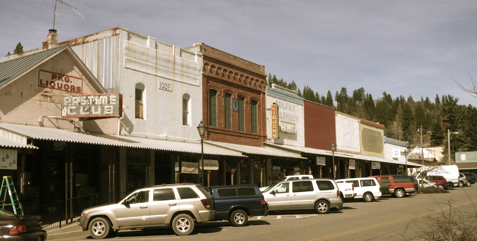
Storefronts in downtown Colfax on old US 40
Several times I crossed the old CeePee’s route over the mountain. Now double tracked, sometimes I’m crossing the footsteps of the Chinese laborers who blew themselves to smithereens as Charlie Crocker pursued his goal; sometimes, I’m crossing the newer route, the one with the more gradual grade, the one that allows the Union Pacific (nee: Southern Pacific; nee: Central Pacific) uninterrupted, year-round access to points east.


DUTCH FLAT is a colony of cottages. Some are summer homes. Some are full time residences. The town’s exposure is a bit northerly so when the snow level drops to 3500 feet, it nestles around the little village for a bit longer than over on the freeway. Spring comes later than in the valley. Tiny streams lace the town site and a cool morning is perfumed with pinewood smoke from working fireplaces. The vintage homes are in various states of spruced-up-ed-ness. Several capture my imagination and I consider the creative aspects of owning the small white cottage with the deck that reaches over the creek as a studio. I add it to my list of never-to-be and find myself humming something from Man of LaMancha.

Double-tracked
Once, walking outside of Dutch Flat, I heard the cry of a General Electric dash-8 as it struggled to pull a string of freight cars up the hill. Its air horn echoed against the mountain a mile and a half away. The echo, it turned out, was another freight, heading down the hill. The distant, rhythmic clatter of their trucks on the rail joints whispered as sweetly as a mountain brook. Far, far superior to the incessant roar of I-80.


MY MISSION TODAY was to check out the Dutch Flat Hotel. A family celebration is being planned for a few months off and, in combination with dinner at the acclaimed Monte Vista Inn; an evening taking over the hotel would be perfect. We’d phoned the hostelry, using both their listed numbers, but had received no call back. This necessitated my early spring drive into the mountains.

I followed Sacramento Street into town. Just past Secord Alley, I turned right onto Main. The restored three story building, resplendent in red, towered over Dutch Flat’s business district: the general store, a real estate office and the post office. The hotel was not open, but it was not closed down. It appeared as if there had been no visitors for quite some time; but peering through the lace curtains the restored wallpaper, antique furnishings and period art still adorned the inside.

I suspected that the ambitious couple dreamt of one day owning a classic B&B, put their heart, soul and sweat into making it a reality, sunk an incredible amount of money into a ground up restoration, and the recession hit. A local, willing to share, shared as much. He informed me that the owners were still around and that, under the right circumstances, they open for parties and events. Then he gave me the secret number.

Still, I couldn’t help believing that Dutch Flat, the little Sierra community that boomed during the gold rush, again with the railroad, yet again as Bay Area folks bought second properties was experiencing one of those busts that naturally falls in between. I felt melacholy for the couple and couldn’t help seeing the wisdom in Yogi Berra’s words about “predictions.”

o0o

TODAY’S ROUTE: Taylor Road from Loomis follows the old Route 40. Take it east to Newcastle; merge onto the freeway to jet through Auburn; exit at Bowman and cross under the Interstate. First right is Lake Arthur Road. Follow Historic Highway 40 signs, braid the freeway, and the Union Pacific right of way taking Applegate Road, and the Ponderosa Way to Colfax. Northeast on 174, right on Rollins Lake Road crisscrossing 80 to Gold Run. The route goes by several names through this stretch. Watch for the church to the right on the north side of the freeway; shortly, left cross track, then right onto Lincoln Road. Follow to Monte Vista. Left. Left again on Sacramento Street. Watch for sand on pavement! Wind down the slope and across the tracks into Dutch Flat. Return: Continue east to Alta and Baxter (source of your Arrowhead Springs water.) Join I-80. Head west but get creative figuring out a way to avoid the slab.


ADDITIONAL PICTURES (click on any to enlarge):

Schuyler Colfax and a plaque telling of his visit to the area:

The California Zephyr pulls out of Colfax after a quick stop:

Along Lincoln Road: hydraulic mining was not the exclusive purview of the folks up north along the South Yuba:

Dutch Flat historic marker:

Some vintage Dutch Flat buildings:

Roscoe. When his parents leave for work each day, Roscoe hops the fence and ambles over to the post office. There he welcomes friends and strangers alike. He was kind enough to accompany me as I wandered through town, talked with the locals and snapped a picture or two.


RESOURCES:

A little more history on Dutch Flat: http://www.ghosttowns.com/states/ca/dutchflat.html

The Dutch Flat Hotel’s (former?) website: http://dutchflathotelretreatcenter.typepad.com/

Information on old US Highway 40: http://www.route40.net/page.asp?n=1

© 2012
Church of the Open Road Press