Showing posts with label State Route 16. Show all posts

Tuesday, March 24, 2015

WALKING THE FULL BELLY FARM WITH DR. BENJAMIN BLOOM


I never was too impressed with the term “organic.”  Like “new and improved,” “lite,” “authentic,” “life-time,” “limited,” and now, “gluten free,” the term organic seemed tagged to a product simply as a marketing ploy.  At least that’s the way I saw it.  My spouse would buy organic vegetables and fruits and eggs, paying a little more, but when I went to the store, because of my built in cynicism and the fact at chemicals hadn’t killed me yet, I didn’t.

Recently, we ventured up California’s State Route 16 into the luscious Capay Valley.  It seems the first weekend in spring, or thereabouts, the Full Belly Farm has an open house. Berkeley friends are subscribers to a program called Community Supported Agriculture (CSA) wherein Full Belly offers neighborhood delivery of fresh organic produce to customers in the Bay Area and Sacramento.  We plan a rendezvous with our friends at the farm.

Springtime in the Capay Valley is what God must have had in mind when Eden was created.  Rolling green hills are dotted with blue oaks and mantled in poppies and lupine.  Row upon row of blossoming stone fruit trees - almonds, peaches, plums - provide spring's signature fragrance while, against an azure sky, the sun plays hide-n-seek through puffy, fair weather clouds.

The highway twists through farmlands and pastures and into and out of bergs with populations that can be enumerated with merely two digits.  


I’ve ridden the road many times in all seasons of the year, always wanting to linger longer and dig deeper.  This day, I’d get to.


The Full Belly Farm is roughly 400 acres backing up to Cache Creek.  Salvaged from an aging almond orchard in the ‘80s, its four partner/owners employ 60 people year round.  Almost unheard of in agriculture, this employment model is only one of the enlightened possibilities availed by the philosophy of the ownership group: sustainability.   The walking tour with co-owner Paul explains it all.

We stroll past an apple orchard where Fujis are in blossom. “Other apples do better in this heat,” we are told….

…and a strawberry field.  Paul lifts the deer fence to let the children crawl under.  “Grab yourself a strawberry, but please be careful not to step on the plants”…

…on the way to a seven-acre plot of garlic.

“Small, diversified croplands,” he says.  “We can produce so much more and care for the land so much better.”

A flock of hens is penned by a temporary fence.  Inside the enclosure is a rolling hen house.  The hens scratch at the land by day repairing to the henhouse at night.  At regular intervals the fence and henhouse is moved to a new plot leaving behind the natural fertilizer than chickens produce.

In another area, sheep graze down tall grasses using their natural digestive processes to return nitrogen and other nutrients to the soil.

Beyond the rows of garlic, a field of lettuce varieties grows uniformly.  Seeds are planted between furrows.  When weeds sprout, “we smother them with dirt keeping the non-favored plant from getting sunlight.”

Natural oils are used to discourage some pest insects, but swaths of land with lush growth are reserved as insect havens.  “If you stop and look, you’ll soon see a lot of movement, hear a lot of sound. 

“Too many in agriculture treat honey bees like farm workers – and we shouldn’t treat our farm workers this way.  Traditionally we’d use the bees in the almonds, then put ‘em in a box and ship ‘em to the next job."

Paul points to a section of tousled, knee-high weeds and grasses.  “Here, we don’t have honey bee hives, but honey bees and other pollinators live here because we’ve set up environments in which they thrive.”

Among the mixed tangle of weed-like plants grows a variety with blue flowers.  “Flax,” we are told.  “We are experimenting with growing the plant for its fiber.”

And about that year-round employment?  “Because of how we do things - planting, harvesting and planting again, spring summer and fall, we have to have people here all the time.”  Then he adds: "Bees, too."


As we walk along, I begin to think of Benjamin Bloom (1913-1999) a preeminent educational thinker of the mid-twentieth century.  His taxonomy of learning processes is something we all studied as teachers. 

But finding examples of his theory actually put into practice are elusive.  Alongside farmer Paul, I suddenly realize I am walking alongside a real, live Benjamin Bloom. 

The success of this organic endeavor rests squarely in the farmer knowing how to employ Bloom’s hierarchy of thought.  Here’s what I saw:

Recall (or knowledge): The farmer knows the soil.  He knows the seed, the water, the exposure to sun, the heat, the cold, the seasons.  And the market.

Grasp (or understanding): The farmer understands what crops will be successful in which corner of the property.  He understands the strengths and weaknesses of a plant or variety.

Application: The farmer makes decisions about what goes where in concert with that grasp.

Analysis: The farmer gathers data, which may be as simple as measuring the yield of a particular product on a particular plot.

Synthesis:  The farmer marries what he’s learned about yields with what he’s learned about the natural benefits of sheep grazing and chicken scratching or reserving space for insects or allowing weed cover to mature in order to conserve moisture to enhance the chances for greater results in subsequent efforts.

Judge or conclude:  Experimenting with new combinations of exposure, water retention, micro-climates and poop, the farmer allows less productive practices to slip away to be replaced by those practices he judges to be more successful.
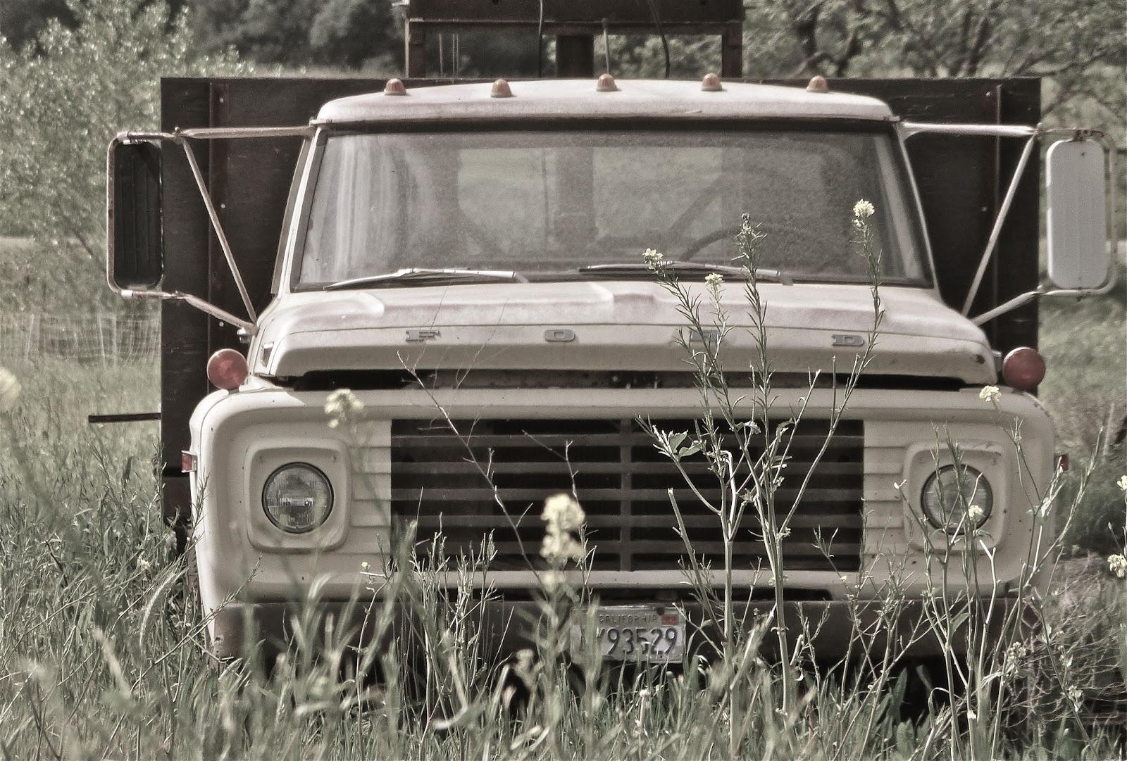

Perfunctory Old Truck Picture
Walking back to the farmhouse, I tell Paul he should be a teacher “…you know, if this farming thing doesn’t work out.”  Clearly there’s educational practice stuff he gets, I’m thinking. 

He chuckles, offering a very modest reply and then says something to this effect: It’s relatively simple to engage in all of those levels of thinking when you’re working with your hands in the soil day by day.  Our livelihood depends on it.  “Schools, I suppose, can’t do this too effectively because of cost, logistics…”

He’s right, of course.  Our students could receive a much more hands on – much better grounded – experience if schools could somehow be more like farms.  They would graduate with a less sterile but far more heightened sense of how things work and how those things work together.

It’d be organic.

o0o

Full Belly Farm is located just on County Road 43, off Highway 16 about a mile and a half north of Guinda.  They are open to the public on select days (see their website) and offer organic produce and fiber through farmer’s markets and their Community Supported Agriculture program.

Internships are available, school field trips are encouraged and there’s a summer camp for kids.

Check out their website for coming events and to learn more: http://fullbellyfarm.com/

© 2015
Church of the Open Road Press

Friday, February 1, 2013

OLD STUFF BY THE SIDE OF THE ROAD


A retired plough horse we all called Cricket used to stand behind a fence on a rise beside highway 108/120 monitoring traffic on the road to Yosemite.  One day she wasn’t standing there.  It didn’t take long for word to get out that she’d passed.   Within hours, a memorial of sorts sprung up on the fence.  The local paper ran a feature.  Even today – ten, maybe twenty years later – frequent passers-by wonder about the stories the old horse might have told.

Riding country roads one often spots old stuff looking back at you as you rocket by.  Sometimes, I suppose, the farmer may have retired an implement by the side of the road because its placement there would be out of the way of ranch operation.  Sometimes, I reckon, that’s just where the old thing died. 

A warm pre-spring day invited some saddle time.  I couldn’t remember the last time I’d visited the lowlands of Yolo County.  Not long into the little circuit I’d devised, I began to see a pattern of derelict equipment in the rural farmlands north and west of Sacramento.  With no agenda set for the day, I decided to photograph a few.


First was a land plane.  A primitive sample rested in a thicket of choking willows.  After the area shifted from wheat production to rice, these blades were dragged behind a team or an old tractor.  The objective was to level the land, encircle it with small levees, flood it with river water and set the acreage to seed in rice.  Today’s models are bigger and more refined, able to smooth larger swaths in less time.  Loyal though this implement was, today it sits like a jilted lover – in no way past his or her prime – waiting for the rust to spirit it away.

Further down the road a piece, a heavy implement like this might have been used to tackle weeds, but more than likely it set tiny furrows for planting some sort of seed crop.  Cloaked in winter grass, it too, rusts. 

Both of these prompt me to think of the days before we recycled things; when we employed iron and steel instead of plastic.  Certainly, these could be lifted to the salvage yard, melted down and sent overseas to be reincarnated as a Hyundai, but I was rather glad to see them parked along side the road.  I wondered what stories they might tell.

The old farm truck replaced the horse drawn buckboard.  North of State Route 20 in the Bear Creek drainage, this example awaits the inevitable, its board bed checked, cracking and becoming dust while its sheet steel cab puts up a better fight.

Just off State Route 16, these three amigos – an International, a Ford and, I think, a Diamond Reo – discuss the state of things as only wizened retirees can do.  I suspect each one has more than a few tales of the glory days, hauling silage in the winter or produce in the fall or fording a swollen Cache Creek in the spring.

Almost any side road is an interesting thing.  This one is behind a locked gate, but its gentle curve invites me to wonder what might be around the bend.  And how many times did one of those three trucks drive it?

Barns, too, have stories they won’t tell.  Across the field from Yolo’s Cottonwood Cemetery, this old barn has weathered decades of blazing sun and stud chilling fog.  But the real stories may have something to do with that glorious hayloft, and what, after a Saturday dance and a bit of purloined moonshine, some strapling young hand may have coaxed from the farmer’s maiden.  Better still would be the story about what the farmer did with the boy once he caught up with him.

The catch of the day has to be this classic old 40s era Ford Ferguson tractor.  Whatever color it used to be, it is now just rust.  The sun has worked its way on the huge tires melting them to where a finger swipe will return with a helping of black, oxidized dust.  No telling how long this has been sitting next to the I-80 frontage road east of Davis.  No telling how it feels about the circumstance.

Seeing these derelicts reminds me of when we built things to last and we expected them to do so.  If it busted you could fix it with a monkey wrench and a ball peen hammer.  Strong as an elephant and loyal as a bird dog, these were the implements that tamed the land creating California’s unparalleled agricultural heritage.  I enjoyed my look back.


I “learned” to drive on a late 40s vintage Ford Ferguson tractor.  Dad had purchased it cheap, responding to an ad in the local paper.  He needed the thing to tend four-and-a-half acres of almonds he’d bought after his escape from LA.  Dad taught me how to shift gears using a clutch, accelerate and slow down using the hand throttle and how to avoid obstacles with the steering wheel.  The thing had no brakes.  Countless times I plowed through a fence or ran over a tree or crashed into something.  Dad never knew.  The old Ford wasn’t talking. 

Once, after watching the Indy 500 on TV, I decided a red racing stripe across the old tractor’s gray hood would look good.  Dad did find out about that one.
           
The property sold about 40 years ago and along with it the tractor.  I drive by my growing-up home occasionally to see if the thing’s been retired to the fence line along the avenue.  As of yet, it hasn’t.  Once it is, however, I’ll stop by and ask what stories it might remember from my youth.

o0o

Today’s Route:  I-5 to Woodland; north on E8 (county designation) to Knight’s Ferry; north further on SR 45 to Colusa.  Stop for an omelet at Tommy’s Market Street Café.  West on SR 20 through Williams to SR 16; south on 16 through the fabulous Cache Creek drainage to Rumsey, Guinda – stop in at the country store if only to say hello - then on to Brooks, Esparto and Madison.  South on old 99W to Winters; east on 128 and Russell Road to Davis; I-80 west to the bay or east to home.

© 2013
Church of the Open Road Press

Sunday, March 11, 2012

A QUICK VISIT TO WILBUR HOT SPRINGS

WESTERN COLUSA (CALIFORNIA) COUNTY

I shall return.
General Douglas MacArthur
(although the General was not referencing this specific destination)

Third in a series, thankfully, of only three.


THERE IS A VORTEX we travel through – sometimes on a motorcycle, sometimes only in our dreams – a vortex that leads us to some curious and special other side. Maybe it’s time travel. Maybe it’s Eden. Maybe it’s just to a place where time doesn’t matter, the cell phone doesn’t connect and neither does talk radio. It may not be Iowa, but it just might be heaven.

A few hundred yards from where California State Route 16 tees into Route 20, a nicely compacted gravel road exits north and follows the course of Bear Creek through the eastern foothills of California’s Coast Range. These mountains are older than time. Their folded strata are formed by pressure some 4500 miles east as the mid-Atlantic trench pushes all of North America a few millimeters a year closer to China. You can look it up.

It isn’t just pressure and folding. The Coast Range sits on the North American edge of the Pacific Ring of Fire – a natural phenomena that June Carter Cash did not write about. Spotted throughout these grass and oak studded mountains are geo-thermal sites fueled by molten rock fairly close to our earth’s crust’s surface. The cracks formed in that on-going folding process allow the heat to escape – or at least play tricks on the surface water that seeps downward.


(c) Wilbur Hot Springs
BACK IN 1865, when the color had played out in the Sierra and the transcontinental railroad was still only a gleam in the eyes of four who profited from the gold rush, someone stumbled across a hot spring along the western edge of Colusa County. The pungent sulfur smell and warm temps of the naturally occurring creek clued that someone to something special here. The waters are natural. Their impact divine. And the one-percenters of 140 years back, folks from Sacramento, San Francisco and points undefined found their way to Wilbur Hot Springs.

An inveterate NPR listener, I’d heard of this place through a sponsorship promo placed by the current proprietor. I knew the Leesville, Lodoga, Stonyford intermountain area, but I hadn’t ventured up the road that leads to these living waters. Until last Sunday. With a family celebration due in mid-May, I was curious whether this venue might accommodate.


I TOOK THE LONG WAY HOME after my trip through the Capay Valley. Following Bear Creek, I zigged across State Route 20, finding myself on a Prius or Civic-able stretch of nicely grade gravel road. The late winter hills still wore cloaks of rust and gold; but tiny shoots of green pushed through. The occasional clump of lupine spoke to the unending rhythm of the seasons. And the purple redbud blossoms, somehow, didn’t cause me to think of Judas. I just rode.

Four miles on, substantial steel bridge crosses Bear Creek. The intersection is marked Wilbur Springs Road. Clever. I would not be lost this day!

A mile west stands a sign and a steel gate. I paused to ponder. An afore-mentioned Prius pulled up. An occupant stepped out, opened the gate, answered a question I posed and drove forward. I followed.


THE WILBUR SPRINGS resort consists of a turn-of-the-century hotel, a couple of newer buildings and a series of baths fed by a fluminarium sourced at the vent from which the naturally heated water emanates. All is tucked in to a voluptuous fold through which a creek flows from a valley just a few turns up the road.

A courteous sign asked that I remove my boots before entering the hotel. Ample “cubby” space is allowed on the veranda just out the door from the cozy and inviting lobby. A young lady worked a reservation computer just across the counter, but, in this neck of the woods, I have no idea what it could be plugged in to. Proprietress Meg graciously walked me through the various rooms of the century old hotel. She shared about the communal kitchen and the accoutrements found in each of the 20 rooms – each period appointed, harkening back to a simpler yesteryear.

She accompanied me across the road to the spa area, commenting knowledgeably about my BMW, parked where I knew I shouldn’t have parked it. She pointed westward toward the 1800-acre preserve that followed the upstream course of Sulfur Creek, which, later I would investigate on foot.

Across the way, several pools are spaced – each maintaining a different temperature of mineral-infused waters ranging from 107 degrees to 98 degrees. Attire is optional.


ENCHANTING THOUGH THIS SPOT IS, it would not be the right locale for the family get-together I was scouting. The bulk of the grandkids are under four and there are no jungle gyms or sand boxes for their amusement. Still, come some November, when the Sacramento Valley is cloaked in a bone-chilling fog and the sun will not appear for about a dozen weeks, Wilbur Springs is a place I will visit (with spouse) for some rejuvenation, relaxation and escape.

Meg had shared: “We have no internet up this way. No cell coverage either. Sometimes, we ask folks to simply leave their watches in their vehicles.” I drove away thinking about the vortex and how easy it would be to slip through to the other side.

o0o

TODAY’S ROUTE: North on SR 16 to 20; west on 20 about 675 yards, right on Bear Valley Road; four miles. Left on Wilbur Springs Road. One mile to gate. Unlocked. Resort is a few hundred yards beyond. Alternate return route: Left on Bear Creek Road to Leesville, east on Leesville-Lodoga Road to SR 20. East to Williams and I-5.


RESOURCES: Check out Wilbur Hot Springs informative website at www.wilburhotsprings.com. The link shares area history and available accommodations. See you there! (Just probably not “nekked.”)

© 2012
Church of the Open Road Press

Monday, March 5, 2012

RETURN TO THE CAPAY VALLEY – AGAIN AND AGAIN

California State Route 16

TWO THINGS: Great roads and near year-round riding weather. Finding a new place to ride isn’t easy after one’s been riding a while. Revisiting a great road, however, makes up for it. So many elements are at play while in the saddle: Time of year, time of day, direction of travel, weather. Each of these elements make tomorrow’s ride on yesterday’s road different from the passage before.

State Route 16 through Yolo and Colusa County’s Capay Valley is one of those roads one cannot get too much of. It had been quite a spell since my last trek up this way and the early March weather report called for highs in the mid 70s. Any questions?


As ever, clicking on any picture will expand electrons.
PICKING UP 16 off I-5 north of Woodland, this abandoned farmhouse has always captured my attention. It wasn’t until this trip that I pulled over to take its portrait. Rising out of the valley floor amid row crops, with boarded up windows, the luster of its elegance is long lost. It stands like a haunted monument to the stature of some century-ago landowner. Nearby, someone is living in a mobile.

Across 505 (Winters Cut-off between Interstates 80 and 5) the little town of Esparto provides some commerce at the mouth of the Capay Valley. The train station stands as vacant as that Victorian farmhouse a few miles back, but a new banner suggests restoration might be in its future.

SR 16 is more heavily used this past 15 years since, up in Brooks, the Cache Creek Casino has taken root and flourished. The hamlet of Capay lies along the way. Its Chamber of Commerce sign indicates that there are old time things to do in the area – things folks enjoyed before the gambling and nightclub scene sprouted.

The little valley is home to small farmers – some totally organic – who raise vegetables for local markets as well as almonds and stone fruits for wider distribution. Having traveled Umbria some five years ago, with the exception that oldest buildings here are about a thousand years younger than those in old Italy, the Capay region is quite reminiscent of that temperate Mediterranean area.

Tiny roads lead left and right off the main artery, but most dead end not too far up the eastern or western slope of the ridges that texture the horizon.

The old school stands empty – there is no banner promoting its restoration. Set at a little crossroad, I can only imagine that the community got together and constructed this edifice on a donated corner of farmland. I wondered if the product of this institution graduated prepared for that which they would confront throughout life. Then, peering at the verdant hills and rich farmland concluded that its students did right well here.

The Guinda Store is a must stop. Meat counter. Sundries. Snacks. Local wines. And a pleasant bench upon which to sit and watch the world slowly pass by.

I’d never stopped in Rumsey before although I’d always admired their community hall: neat as a pin, cared for, loved.

A plaque tells the story of the town that once was.

Unlike the Victorian farmhouse, the depot or the old school, this beautiful old building is still finding reason.

Across the way, a local has collected artifacts of the valley’s agricultural heritage and placed them just out of reach on his private corner. I suspect that by judiciously pouring a little low octane into this devil – maybe after changing the spark plugs – she’ll fire up ready to pick up where she left off seventy-five years ago.

Highway 16 rises out of the valley and courses along Cache Creek, then Bear Creek for the rest of its run. The redbud tells us spring is here.

Between the BLM and Colusa County, several primitive camp, picnic, pit toilets and access points dot the route. Good timing if one stopped for too-much-of-a Dr. Pepper back at the Guinda store. Across the way, it looks as if an old cowman’s house has seen far better days.

And the fence board here looks like a huge piece of petrified linguine.

Bear Creek settles into what, for this area, is considered a high mountain meadow. The deep blue water is a mere reflection of a deep blue late-winter sky.


THE COAST RANGES in California are oft overlooked – particularly their eastern flanks. They are overshadowed by the ocean and the redwoods to the west and the snow corniced Sierra far to the east. Highways and lesser roads in this region are delightful to explore and, outside of that stretch up to the Casino, very under-trafficked. It is difficult to imagine a better place for a relaxing traipse into yesteryear.

o0o

Local Capay Valley booty
TODAY’S ROUTE: I-80, north on I-5; west on SR 16 past Woodland. SR 16 through Esparto (right turn into town, left out of town at depot), Capay, Brooks, Rumsey; follow Bear Creek to “T” at SR 20. Watch for sand and slide detritus on the pavement as you carefully enjoy sweeping turns along Bear Creek! Return: Either east on 20 to Williams; south on 5; or West on 20 – 675 yards, right on Bear Valley (gravel) Road. Head north. Explore. But carry a good map.

© 2012
Church of the Open Road Press