Showing posts with label State Route 36. Show all posts

Wednesday, January 27, 2016

SCENIC ROUTE FROM REDDING


Words to live by:
Having been warned in a dream…
…they left for their own country by a different road.
Matthew 2:12 (ISV)

Necessity put me behind the wheel of the Nissan Frontier rather than a preferred two-wheeled conveyance, but that didn’t preclude me from enjoying an alternative drive home.  Just a month north of winter’s solstice and in a gap between storms, a low sun and a nice collection of clouds made this scenic journey very enchanting.

CA 273 amounts to the old divided highway linking Redding to Cottonwood.  Placer Road heads west through the Clear Creek drainage where the BLM has established numerous trailheads. 

Past Igo, a quick jaunt south on Gas Point Road affords a visit to the Northern California Veteran’s Cemetery – a tranquil spot to rest.

Also known as A-16, this stretch of pavement isn’t always smooth but there’s always something of interest around the next bend.

CA 36 from Red Bluff to Fortuna is a world-class two lane that attracts riders from just about everywhere.  The last time I rode it I was choking on smoke from a wildfire in the Trinities.  This day, they rose crystalline and pure, their snowy caps soothing way must lay beneath.

Along 36, vestiges of the last storm settled between ridges and, in some places cloaked out the view on the highway.  Headlights on.

But just as quickly as you drive into the fog, you descend out of it.  A barn across from the store in Dinsmore poses in the morning sunlight.

From Bridgeville, one can continue east through the redwoods along the beautiful Van Duzen River, or as Rider Magazine Clem Salvadori recently reported, you can travel south on a little-used Alder Creek Road.

Stopping for a perfunctory picture of a derelict truck, an area resident slowed waaaayyyy down and then stopped in the middle of the road as if to say: you ain’t from around hyere, are ye?

Down the road, another barn caught my eye.  I always think about the community effort that goes into one’s construction of a barn and wonder how long ago that effort happened for this one.

Around a bend, a sign warns me to slow down and immediately I find myself in the heart of Blocksberg – a town with few residents and a Zip Code.

A church, too.

South, I drop into the Eel River’s valley to check out the town of Fort Seward, but unless that little convenience store I passed is it, I missed it.

Back on Alder Point Road a curious concrete structure once did something to the course of a stream now running off copious amounts of water from yesterday’s storm.  Not sure what it was but the circular shape must have been an outlet for something.

Ten miles on, I passed through the community of Alder Point without stopping.  Usually, there’s pavement in town possibly turning to dirt on either end.  In Alder Point it’s just the opposite.  I drop one front wheel into a water-filled chuckhole that may have been eight feet deep, given how my teeth reacted.

Closer to Garberville, the road is more civilized making me, again, wish I’d been on a motorcycle.

A view from the crest of a ridge offered a final shot of the light playing with the clouds on what turned out to be a glorious alternative route home.

o0o

Today’s Route:  Fill up before you depart! Redding to Platina: South on CA 273, west on A16 (Placer Road) to CA 36.  Platina to Bridgeville: west on CA 36.  Bridgeville to Garberville: South on Alder Point Road* through Blocksberg and Alder Point (in between those two bergs, consider dropping into the Eel River Valley to check out the farm land around Fort Seward) then west to Garberville and US 101.  *Note: Employ extreme caution if choosing Alder Point Road on a street oriented bike.

© 2016
Church of the Open Road Press

Thursday, October 16, 2014

CALIFORNIA’S NORTHERN CASCADE: MOUNT LASSEN AND MOUNT SHASTA


Day 1 of the Volcanic Legacy Tour of California and Oregon


In about 1959, my folks prodded my seven-year-old butt up to the top of a snowy Lassen Peak.  At the time it seemed like torture.  My toes frozen inside some raggedy Keds, I don’t remember enjoying anything on the way up.  Going down, however, without an inkling of how dangerous it might be, sliding down a three hundred yard snowfield made the day quite worthwhile.  There would be no snow this day.

I try to make it back every year, but it had been a while since my previous visit.  It had also been years since I’d done a road trip with my brother: he on his classic 90s era BMW 1000 GS.

Eschewing the glorious Deer Creek Highway from Chico, we bolted up CA 99 to Red Bluff.  California’s State Route 36 east of Red Bluff tilts from the valley floor and in about 36 miles rises into the volcanic ridges and floes of the Cascades.  Passing through the climatic zones on the October ascent is exhilarating.  I can’t remember the last time I’d ridden this route from farmland to forest.

Turning north on CA 89, we enter Lassen Volcanic National Park, one of the state’s best-kept secrets.  There are plenty of hikes, plenty of smells and lots of interesting flora, fauna and geology.  One could spend weeks.


Once in the park, we paused for a bike portrait with Broke Off Mountain in the background.  Broke Off is a better hike that Lassen Peak.  Longer, but a more gradual climb.  And when you get to the summit, you have a nice view of the park’s namesake mountain.  Mom and Dad pushed my butt up that one, too.


Inside the park, CA 89 winds past fumaroles, alpine lakes and ridges made of volcanic mud and ash.  Sparse vegetation, if it gains a foothold, grows slowly in these 8,000-foot climes.  Tremendous views are offered south to Lake Almanor, west to the Sacramento Valley and always of the mountain.

We pause at the Bumpass Hell trailhead and then at Summit Lake, recalling family adventures from decades ago.

But, as on too many of my trips, our goal was further up the road therefore our pauses were too brief and our cameras used too little.


CA 89 may be one of the prettiest roads anywhere in America.  It breaks off from US 395 in Mono County, crosses the spine of the Sierra Cascade and ends up uniting with I-5 in Mount Shasta, CA.

We travel through Hat Creek Valley, past McArthur/Burney Falls State Park and stop for a roadside photo-op once the Queen frames herself at the end of a straight stretch.

McCloud, CA is a moment off the highway.  The old lumbering town still has remnants of the rail line that brought timber to the mill and products to the mainline.  Brother Bill’s wife was born at the hospital there.  We find the old building is being restored.


The McCloud Hotel is a fine place for a romantic evening, but since I’m with my brother, we choose to stay at a Best Western in Mount Shasta.  An evening walk around town affords a peek at the Queen as dusk settles.


We retire wishing we’d covered a little less ground and smelled just a few more of the roses along the way.

o0o

Note to Self:  When riding with someone else I often wish I’d stop to take a picture as I whiz past something historic or beautiful, but don’t because I don’t want to hold the other guy up.  I need to quit worrying about that.

© 2014
Church of the Open Road Press

Thursday, September 22, 2011

THE NORTH COAST – VOLCANIC LEGACY LOOP

No place on earth is home to such scenic wonder
and is visited by roads engineered with such grace.

More evidence that God must,
in her leisure time,
ride a motorcycle.


The Vaca Hills west of Winters, CA

STATE ROUTE 128 climbs across California’s Coast Range beginning in the Sacramento Valley at Winters and ending on the rugged California Coast below Fort Bragg.

Monticello Dam
Along its route one passes through the arid rain shadow of the Vaca Hills, past what used to be the Monticello Valley (now inundated by Lake Berryessa)...


Dry Creek area vineyard
 ...among vineyards of the Napa, Alexander and Anderson Valleys...


Where angels may be heard on occasion

...finally tunneling through redwoods before achieving the coast.


STEWARTS POINT SKAGGS SPRINGS ROAD offers an alternative route to the Pacific. Heading west from US 101 at Healdsburg, this secondary road explores the Dry Creek wine-growing region…


Escaping the Tule fog
…before rising to capture of view of Lake Sonoma.


Historic Haupt Creek Bridge
From there, it skips from ridge top to ridge top, plunging into and out of tiny stream courses that have worked for eons to sculpt the Coast Range. Within the last two hundred yards, the road emerges from the redwoods to afford the rider a heart-stopping glimpse of the ocean.


Near Caspar (Google Img.)
STATE ROUTE 1 is legendary. So much so that people fly in from all over the world just to ride or drive its winding course, absorb lungfuls of fresh maritime air…


Coastal California
…view the sea chewing away the ancient cliffs and stop for rest or refreshment in any of a number of quaint, rustic shoreline villages.


Farming the north coast
The route seethes with history from the ancient Pomo, the failed attempts of Russian settlement, the glory days of redwood lumbering and the boom and bust cycles of the salmon industry.


Light plays in the redwoods (Google Img.)
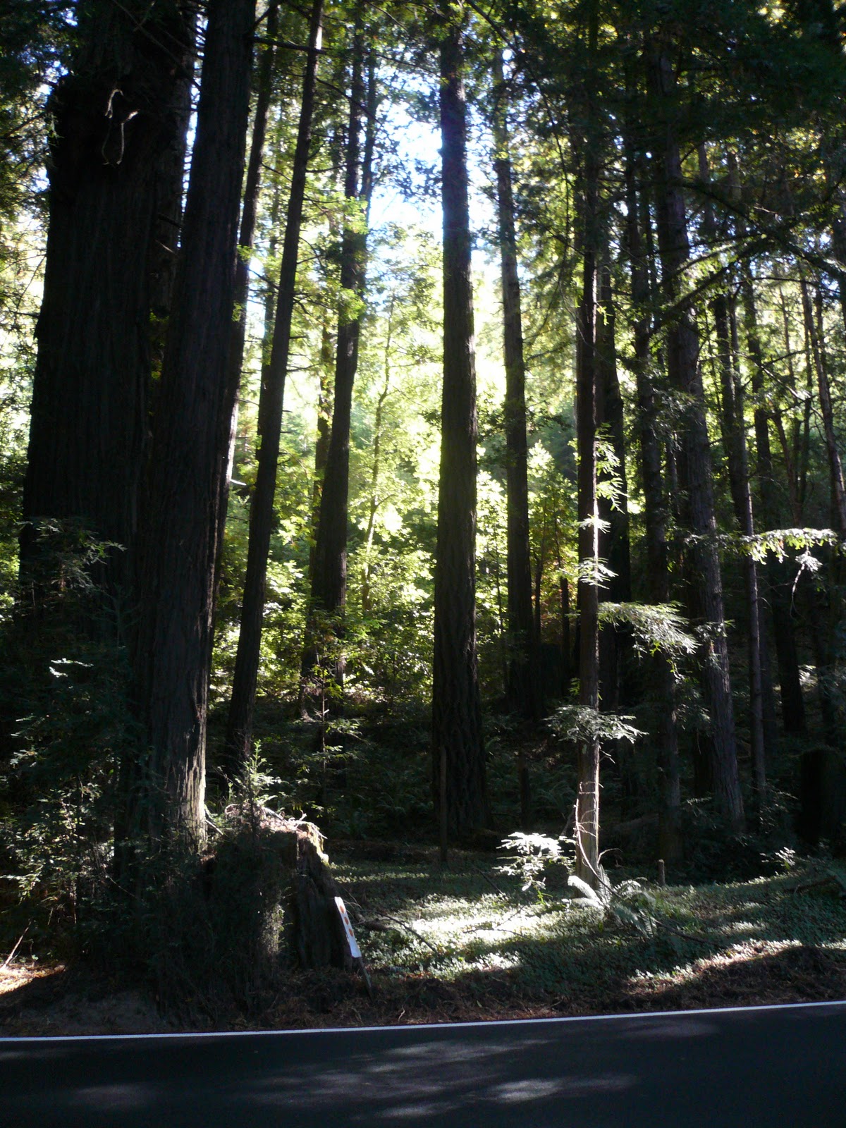
US 101, north of Leggett picks up the state route’s theme, coursing through parks of towering redwoods where echoes of siren songs can still be heard if one simply gets off and listens. The play of mid-day light through the ancients creates kaleidoscopic colors that change with each turn of the highway.


Coastal cooling
Further north, through the area’s capital, Eureka, the seashore’s moderate climate underpins the unique and delicate ecology where the Coastal Redwoods thrive...

Old PalCo mill at Scotia

...and air conditions the old mills where these giants had been harvested and transformed into fencing, decking and trim.


US 199 departs a fog-blanketed coast at Smith River and quickly climbs north of the Trinities…


Crossing into Oregon (Google Img.)
…passes through the Randy Collier tunnel under Hazel View Summit and enters Oregon. Tiny towns dot the route – somewhere the lunch spots don’t open until nearly noon and premium gas for the bike is unavailable. Out of the groves of sequoia, forests transition to yellow pine and the rocky pastures provide forage for deer and cattle.


Indian Creek Road
A SECONDARY ROAD leads south out of O’Brien, twisting and switch backing over the Siskiyous. The Rogue-River Siskiyou National Forest management has chip sealed the road ensuring its longevity for a season or two longer, but tempering the degree to which one enters the inviting turns. At the summit, views stretch southward over range after range of rugged territory.


Happy Camp (Google Img.)
Winding down into Happy Camp it is easy to see why these remote reaches of forestland burn so readily and often. Steep. Rugged. Difficult to access. And full of forest tinder.


Rt 96 in the Klamath Canyon
STATE ROUTE 96 traces the Klamath River in through the depths of its canyon. The late summer water is emerald green and the hillsides deep, dry golden. The cool temperatures of the coast and the high country are long gone as the thermometer reads mid-nineties.


Crossing the Shasta River
At I-5, an alternate highway, State Route 263 (perhaps the old 99) slips through a canyon, and just before Yreka crests to afford a breath taking view of Shasta.


Mount Shasta from McCloud
STATE ROUTE 89 begins in Mount Shasta City and may prove to be the best motorcycling road in the entire state. After departing McCloud, the struggling once-lumber town...


Burney Falls
…the highway rifles straight through tall forests of buckskin pine, the floors of which are neatly manicured to reduce fire damage potential. 30 miles on it swings south past Burney Falls, through the placid pasturelands of the Hat Creek Valley…


Mount Lassen over Hat Creek Meadow
…thence through Lassen Park and then off to explore the high country of the Sierra.


High meadows near Mineral, CA (Google Img)
STATE ROUTE 36 is joined east of Mineral. Traveling west we descend through the cinder-soils and fir forests into the land of Ishi, the last North American stone-age man.


Ancient Cinder Cone near Red Bluff (Google Img.)
The road is chiseled across ancient mud floes and through small lush valleys supporting small acreages of irrigated pasture. A fifteen-mile stretch of hardpan leads down to the northern Sacramento Valley where I-5 is accessed for a quick blast north to Redding.


Platina.  All of it.
36 IS AGAIN PICKED UP at Platina, former lumbering transshipment point and one-time platinum mining berg – hence the name, at least according to the young woman working the watering hole there.

The highway immediately climbs over several ranges finally descending into the course of the Mad and Van Duzen Rivers. No real food or gas until Fortuna out by the coast, but the turns are luscious and one never knows when the next curve over a ridge will afford a view that you’d stop for if you weren’t having such fun in the saddle.


Looking east on 128
 Approaching the coast, again we tour cathedrals of redwoods. Road noise slips away to be replaced by that soft choral siren song of the ancients.


Noyo Harbor
 THE LOOP IS COMPLETED by heading south on 101 to Leggett and following 1 back to Fort Bragg. This time we take 128 east and enjoy a final few miles along the Navarro River and its attendant redwood groves.


West end of Berryessa
A “shortcut” through the Seventh Day Adventist community of Angwin adds an additional 80 minutes to an already too-long, too-hot final day. The west shore of Lake Berryessa appears where my mental compass said it shouldn’t have been.


Winters Main Street
But a twenty-minute stop in Winters allows enough energy regeneration for a charge across the valley to home.

© 2011
Church of the Open Road Press