Showing posts with label Redwoods. Show all posts

Tuesday, October 7, 2025

A Visit to Hendy Woods

 Today’s Lesson?Visit those places you frequently pass by.


In countless times traveling State Route 128 to the Mendocino Coast, we’d passed signs for Hendy Woods State Park, but never pulled in. No more! Bordered on its north by the Navarro River, this gem serves as a respite from the normal cacophony of our so-called civilized lives. 


A mile past the entrance station ~ nine bucks for seniors ~ a trailhead invites visitors to pad into acres of pristine Coast Redwood forest millennia in the making. Level and soft, the path tunnels under towering samples of sequoia sempervirens that filter what sunlight makes it to the duff-covered forest floor. Dogwood and madrone dot those rare sunny spots. Sword ferns trace tiny whispering streams. 


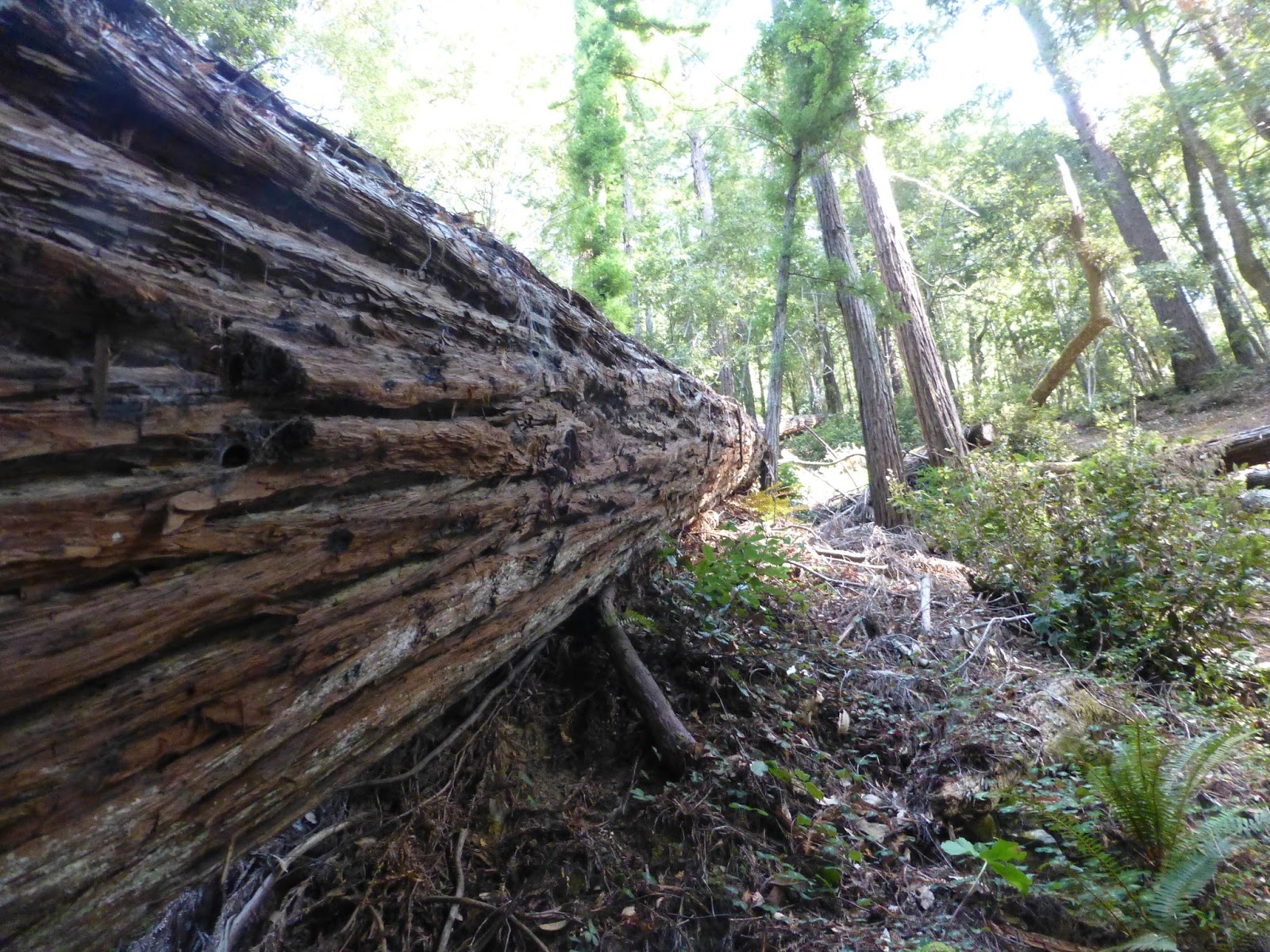
Towering redwoods ironically have quite shallow roots. Many topple over leaving impressive natural sculptures for passers-by. The fallen giants are anything but dead as sprouts squeeze out of their bark, a century or so to become behemoths themselves.


There is nary a sound in this cool forest cathedral ~ on our visit, only a breath of air soughing above. The wide trail accommodated a chair-bound visitor (with pup on leash) who offered a soft and pleasant “Isn’t this simply lovely?” as we passed. Indeed it was ~ and is ~ well worth an hour or a day’s respite from the above-mentioned normal. It serves as a reminder to check out those places we so frequently drive right past, lest we miss something beautiful.


Getting there: West on 128 from C’dale through Boonville and Philo. About 2-3 miles past Philo, look for a state park sign alerting you to turn left on Greenwood Road (toward Elk). Hendy Woods is just over the bridge a half mile from the 128 junction. Pack a picnic and bring a camera.

Tuesday, April 12, 2022

THE ARMSTRONG REDWOODS RETURN

…and We Return to Armstrong Redwoods


A year-and-a-half ago, the Walbridge Fire surged, burned and seemingly ravaged Armstrong Redwoods State Park just outside of Guerneville.  Many living throughout Sonoma County and beyond recall stinging eyes and choking air brought about by smoke that that hung in the atmosphere for weeks.


As the conflagration raged over vineyards and pastures, hillsides and dales, the fire swept through the Austin Creek Preserve and crept down the hill into the priceless redwood grove that has always been an area treasure.  Monitoring the fire’s progress on the radio was much like listening to a late-night baseball game where team Redwood was being routed by team Inferno.  What would remain when all was said and done?


Well, the good news is that the treasure survived.  On a recent weekday Candi, Edward (our dear old Aussie-lab mix) and I dropped by to check things out.  The lovely trail from the entrance station to the Colonel Armstrong tree has been refurbished. At 1400-years-old, the Colonel Armstrong appears fabulous: a sentinel tall, strong and steady (and looking not a day over 1200.)  


The trail to the picnic area has been cleared as well. While the Walbridge Fire impacted the hillsides and meadows further up and some the park’s forest floor, the resiliency of the Sequoia stand is evident.  Far from devastated, many of the trees in the lower reaches, though scorched, again provide a canopy of deep green. Redwood shoots ~ some already as tall as six feet ~ are springing out of ancient burls and stumps. Ferns and other forest flora are reestablishing themselves illuminated, in places, by those shafts of sunlight that make redwood forests so ethereal and cathedral-like. On our visit, the air was still and cool and sweet, the voices of other visitors hushed, because that’s what you do in a cathedral, right?  


Getting there:  North of Santa Rosa, exit US 101 at River Road; west to Guerneville; north on Armstrong Woods Road to entrance station. $10 day use fee, waived with a State Park Annual Pass ~ available at the gate. Lower trails are cleared and open, but Edward (the dog) was restricted to walking (on leash) only on paved roads.  Pack a picnic, bring water and grandkids. Neighboring Austin Creek Preserve (up the hill) is still closed.  


As an aside:  When on a motorcycle ride in our area, frequently, I’ll stop, dismount and wander a few yards into one of our many redwood groves, just to listen to the angels whisper.  It’s good to know those angels have returned to Armstrong Redwoods.  Perhaps they never left.


© 2022

Church of the Open Road Press

Monday, February 29, 2016

THE ENDURING AVENUE OF THE GIANTS

…make that “endearing…”

The Avenue of the Giants was once US 101, winding through Humboldt County’s majestic and humbling redwoods.  Now, it’s the old road.  About thirty miles in length, it had been the sole artery – outside the ever-present Eel River – serving the lumber and small farming communities of the area; bergs bypassed when progress gave us a new 101.  Today, it is easy to miss those little points of history as we efficiently travel north or south, rocketing through the stands and groves as if it were just any old forest.

Yet, finding that old road and spending a day exploring, hiking, listening to the whispers of the woods, proves to be a day well spent.

The “Avenue” offers many places to pull out …


… and many trails to explore.


We can be dwarfed by the massive trees …


… and easily miss the subtle beauty resting on the forest floor.


Heads up: Your pictures won’t do justice.


Due to our modern day need for speed, those quaint farming and logging communities are stuck with a lousy choice: either find happiness (and a living) in service to of those of us who’ve found the old road or simply die becoming a historic place name with no ‘there’ remaining.

I’d purchased gas here once, a while back.  No longer.


This rig used to haul produce between some point A and market, I suppose.


Perhaps this one, too?


Maybe from a farmstead like this one?


But the attraction – the profits – would always come from the standing timber.

Before the commercial logging boom of the 19th century, the coast was covered with redwoods from Big Sur to the Oregon border.  What once accounted for 2.4 billion acres of old growth forest had, by the end of the 20th century been reduced to a mere 120,000 acres.


More would be gone had the Texas financier who succeeded in a hostile takeover of Scotia’s once-sustainably managed Pacific Lumber Company been able to cash in on the old growth remaining on the company’s land holdings back in ’65 by cutting 'em all down.

Cal State Humboldt archive
 What, one must wonder, is the legacy of the man who plunders, pollutes and renders intractable harm simply so he can die with stacks of money in his account?

Thankfully, the forest is dotted and laced with groves and trails commemorating those with the wisdom and tenacity to protect the grandeur of it all.  Isn’t our collective heritage better served by folks like these?


These folks understood something.  Something about place.


Something about balance.


Something about beauty.


A day wandering through the forests and glades along the Avenue of the Giants will linger for quite some time.  As, one hopes, will the forests.

o0o

Notes and Resources:

Here is an on-line guide to the Avenue of the Giants: http://avenueofthegiants.net/

Regarding the Humboldt Redwoods State Park: http://www.parks.ca.gov/?page_id=425

The Save the Redwoods League has taken the forefront in preserving our north coast forests.  Here’s a little bit about their history: http://www.savetheredwoods.org/about-us/mission-history/

The “Profit Above All Else” mentality some may decry isn’t something particularly new.  Here’s a piece about the corporate raider who, in a hostile takeover, wrested the historic Pacific Lumber Company from a sustainable, responsible operation (I recall touring the mill back in the 60s) to a poster child for short term profits and bald faced greed: http://www.multinationalmonitor.org/hyper/issues/1994/09/mm0994_07.html

Need a place to stay while visiting the area?  Want to step back in history for an evening or two?  Check out: http://www.benbowinn.com/about-us/hotel-history.htm Be forewarned: You may never want to return to the present…

© 2016
Church of the Open Road Press

Sunday, February 28, 2016

ISHI PISHI WINE


…while up in Redwood country…

About 35 years ago when I left Chico to pursue my career in education elsewhere, my dad began writing a (really bad, sorry Dad) novel centered on a character not unlike his younger son.  The boy had left town to become a sheriff’s deputy in a far-flung northern California county.  At one point, the boy-deputy was investigating some crime or other occurring at a place called Ishi Pishi Falls, a name I was sure Dad had concocted on his own.

The other day, at a grocery store in Garberville, California, a bottle of red boasted fruit from a ranch of exactly that name.  How could Dad’s younger son resist?

o0o

Tasting Note:  Briceland Vineyards sourced fruit for this substantial Bordeaux Blend from a dry farmed hillside above the hamlet of Orleans off CA 96 along the Klamath River – a locale which could legitimately claim to be in a “far flung northern California county.”  We enjoyed this wine with some rustic French bread and a selection of Humboldt County cheeses, but we believe it will pair nicely with grilled lamb, roast duck or a hearty winter's stew.  Better find a second bottle…

© 2016
Church of the Open Road Press

Saturday, February 27, 2016

RECALLING THE GOLDEN ERA OF TRAVEL AT THE BENBOW INN

A journey back to the earliest days of road travel

With the advent of the automobile almost a century ago, the opportunity for folks to explore the nation grew exponentially.  No longer would a trip to Yellowstone or Yosemite involve securing camping tarps to buckboards and locking down the homestead for three or four months.  Crude emigrant trails became rustic roads that would evolve into concreted (and numbered) highways.  The spectacular red rock country of Utah would be but a few days’ drive from almost anywhere.  Likewise the Grand Canyon and the Tetons, the Great Lakes and the Great Smokies.  And California’s redwoods.

(c) Benbow Inn
In those early days, lodging may still have been strapped to the Hupmobile’s bonnet or pulled behind as an early travel trailer.  But soon, enterprising folks dotted the west with elegant hostelries offering sophisticated accommodations and fine dining in some of the most remote corners of our land. 

Over time, things would continue to evolve and routes like the old US 40 over Donner Pass would become Interstate 80 and those elegant inns would fall into disrepair as motel chains with numerals in their names offered much less for much less.

Still, some of the grand hotels of the early twentieth century still stand – a few refurbished to reassume their former glory.


How many times had I cruised north on US 101 passing the Benbow Exit just south of Garberville and said to myself, “I’ve gottta check that out?”  The answer?  Too many.

A period neon sign pokes through the trees where US 101 crosses the south fork of the Eel River.  The sign simply says “Benbow Inn” and is laced with an arrow pointing toward a 20s era hotel perched on a flat above the confluence of the south fork and its east branch tributary.  It’s easy to fly by the exit.  Try not to.

Designed by Albert Farr, a Julia Morgan contemporary, and completed in 1926, the Benbow Hotel became a popular wayside for those traveling the new Redwood Highway between San Francisco and Eureka.  (Ms. Morgan designed and built her little haven just down stream – tours are available.)

Entering the heavily timbered lobby, we are informed that tea and scones are offered: “Please relax and the bell will carry your bags to your room.”  Glancing through the shadows of the vast room, simple pleasures and ornate works combine to beckon the road weary to rest: soft chairs, a welcoming fire, and that tea.

A great and elegant dining room affords views of the river and a bridge.  A varied and inviting menu complements those views, as does an extensive, multinational wine list.  The service from staff recalls the earlier era as well.  With the first sip of a north coast Pinot, we downshifted into a relaxation mode that wouldn’t leave us even two days later as we departed.

Across the historic lobby is an even-on-a-February-Thursday hoppin’ saloon with a large selection of spirits and warm vibe.  Stepping out onto the patio with a little nip of really good hooch, it is easy to imagine yourself engaged in conversation with Spencer Tracy, Alan Ladd or even Herbert Hoover or Eleanor Roosevelt as a full moon dances across the waters only a few yards away.

Early on, energy for the enterprise was provided by a small hydroelectric facility built just below the confluence.  A concrete, steel and wooden structure tamed this small section of the Eel.  The pool backed up both the south fork and the tributary forming what became known as Benbow Lake.

Likewise in 1931, a modern rock and concrete bridge spanned the becalmed east branch, it’s lovely arch accenting the stream view from the terraced hillside upon which the old hotel sits.  Just add a canoe and, say, a Mountie. (Yes, Nelson Eddy once stayed here.)


The desk clerk shares directions to interesting walks in and near the grounds adding, “This is one of those places where you could do absolutely nothing for a few days and not feel at all guilty about it.”

Indeed: the comfortable, historic rooms, the crackling fire in the lobby, the manicured grounds edging a whispering Eel River – it takes little imagination to feel you’ve shucked your 1920s duster, taking a break from the old redwood highway, and if you never got back on that highway, it’d be more than okay to stay right here.


o0o

Notes: 

The historic hydro dam was breached about a decade ago owing to both fishery and seismic concerns.  It is scheduled to be imploded sometime during the summer of 2016.  Understandable, but too bad.  The relic, as it sits now, is a fitting testament to the ingenuity of those pioneers of tourism early last century.  The dam site is a short walk from the Inn.

A fine day may be spent enjoying the redwood groves and trails along the famed Avenue of the Giants, about a dozen miles north on US 101, using the Inn as a home base.  Sojourning so is highly recommended.

The Benbow Inn website contains details about the old gal’s colorful history and its impact on the region.  Accommodations. Prices and menus are listed.  It may be accessed at: http://www.benbowinn.com/


© 2106
Church of the Open Road Press

Saturday, October 17, 2015

REDWOOD ADVENTURE: CHAMBERLAIN CREEK WATERFALL TRAIL


In the Jackson State Demonstration Forest

It used to take forever to get from Willits to Fort Bragg on CA 20.  As a kid, that was the last leg of our twice-yearly trips from Chico to the coast, and the thirty-three miles indicated on the map seem to consume a half a day.  That’s because, as a kid, I was only interested in getting to the ocean – and shopping at the five and dime on Franklin Street.

Now, while I still enjoy the whisper of the surf and dinner at Noyo, the means to the end are becoming more intriguing and worthy of pause.

Looking for a place to walk Edward the lab-mix off leash, I stumbled across a web link to the Jackson State Demonstration Forest.  (See notes below.) At mile marker 17.3 on CA 20, a well-graded dirt road (number 200) follows Chamberlain Creek leading north into the redwoods.  I’ve probably passed this intersection a hundred times.  Road 200 winds along creek-canyon walls and through groves of redwoods.  Were it not gated about six miles in, one could follow it all the way to the California Western right-of-way near North Spur.  When dry, the road is easily passable on a road-oriented motorcycle, but logging operations are active from time to time, so use caution.


The trailhead to Chamberlain Falls is about four miles in on road 200.  There is ample room for parking.  A well-maintained trail descends steeply down the canyon wall, at some points using wooden steps to ensure the safety of the visitor. 

Crossing a downed forest behemoth, we quickly find the creek bottom and, looking over our shoulder worry about the stiff climb out.

But not for long.  There is something in the chorus of silence in a redwood grove that dissolves worry.  Soon we are marveling at the light filtering through the centuries-old trees and thinking about the lucky elves who must enjoy these environs around dusk when no one is present to hear their giggles.

We know they’re here, because we see their houses.


Chamberlain Falls, after four years of sub-normal rainfall, still soldiers on valiantly against the drought.  Looking only as a mere damp section on a solid rock face, one can only imagine the volume of its cascade and accompanying song in a more normal circumstance. 

Exploration is easy because the forest floor is a clear understory, with the exception of the many large trees that lay like God’s Pick-Up-Stix in and around still-established survivors. 

At over six feet tall myself, I estimate the circumference of one giant by standing next to it…

…while Edward explores its length.  He’s happy.

Fears about the steep climb out of this idyllic place are allayed as we encounter a nicely groomed trail that switchbacks up the canyon-side of a tributary, looping back to the road while affording generous views of the enchanting elf-encampment below. 

After forty minutes and about 3.3 total miles (.5 of which are on Road 200) we return to the parking area – refreshed, renewed and excited about what other subtle treasures might be hidden along side the once-interminable highway 20 between Willits and Fort Bragg.

We head home looking forward to more explorations along this route.

o0o

Notes: 

Today’s Route:  US 101 to Willits; west on CA 20 17.3 mile to (unmarked) Road 200; north on 200.  (Landmark: a rest area is on CA 20 is located about 50 yards west and just across the Chamberlain Creek Bridge from the necessary turn-off.)  Follow Road 200 four to four-and-a-half miles to well-marked trailhead on left.  Return:  For a dose of the coast, continue west on CA 20.  Fort Bragg and CA 1 is 18 miles away; south on 1 (along scenic bluffs and through quaint villages) to CA 128 at the mouth of the Navarro River.  East on 128 (through redwoods, wineries and once-funky Boonville) to US 101.

Information on the Jackson State Demonstration Forest from “Mendocino Walks:” http://mendowalks.org/JSDF/JSDF.php


About the Skunk Train (on the old California Western right-of-way): http://www.skunktrain.com/about.html


© 2015
Church of the Open Road Press

Friday, April 22, 2011

RAINY DAY PRACTICE RUN

PHILO-GREENWOOD ROAD, STATE ROUTES 128 , 1 LOOP

Skaggs Springs / Stewarts Point - from a former ride
YESTERDAY, we rode ninety miles from Healdsburg on US 101 to Elk on California 1 via Skaggs Springs Stewarts Point Road.  We detoured through a little berg called Annapolis sticking to roads that sport bike riders might refer to as "Meccas." Each blending riding challenge with stunning views.

Sam's wonderful Bonneville Black
The routes corkscrew in and out of countless canyons and hollows, across rusted steel bridges, atop ridges and through groves of redwood forest. Along the way, we enjoyed a mixed bouquet of silage, wood smoke, honeysuckle, diesel exhaust, must, and salt air.   The eighty degree temperature of the Dry Creek wine growing region dips to 53 on the coast at Gualala and maintains that through Point Arena and Manchester: all the way up to Elk (nee: Greenwood.) What a delightful ride!

Evening view from the cottage
 Today would be different.


FROM MY MORNING VANTAGE POINT on the couch situated in a tiny cottage across Highway 1 from the bluffs and beach, I can see the Pacific and the storms that are to come. The constant rhythm of the waves on the tiny beach provides a subtle symphony for relaxation, contemplation and calm. A second cup of coffee would be nice. The rain, light though it is, curtains the horizon line. The sky and sea are one. The universe seems but various shades of gray.

I venture out to see rainwater beaded up all over the GSA. I swipe the tank with my hand, scan the sky and ponder. Riding in the rain is not a favorite activity. Still, on this layover day at the cozy house in Elk, it is probably a good idea to practice those wet riding skills, especially if a hot shower awaits. I have a rubberized suit that goes over my riding pants and jacket, but a couple of years back, I purchased a BMW “Santiago” jacket from Santa Rosa BMW. It was last years model so I got a break on the price. It came without a waterproof liner – extra at additional cost – but I told the nice lady that I had a rain suit. “Try this,” she said. “If you have a Gore-Tex® shell, put it on under the Santiago. I bet you won’t need your rain suit jacket nor will you miss the liner.”


I DON THE SANTIAGO with my REI liner over a layer of recycled pop bottle (fleece), slip on the rain suit pants and head off. Immediately I realize that it is a misstatement to suggest that everything is gray. The clouds and the sea are muted tones of blue and purple, the coastal hills muted greens and golds; the red barns softened. Riding in this weather, the most brilliant color comes from the owl clover, aster, ice plant and poppy that ribbon the sides of the road.

Note the curving center line to the upper left
I use an anti-fog wax on the face shield of my Shoei helmet, but it doesn’t work worth a damn. The best option is to crack the windscreen a fraction and let the cool outside air vent inward and prevent condensation on the plastic. This chills my cheeks and causes my nose to drip, all of which is part of the multi-sensory nature of the riding experience. But the Touratech wind spoiler diverts most of the rainwater up and over my helmet.

My route takes me east over the Philo-Greenwood Road. The road rises to a ridge top where an apple orchard is completing its bloom, then dips into stream courses supporting stands of redwood. I suspect the origins of this road have something to do with the harvest of those giants. The rain picks up as I scale the west-facing slopes and turns to mist or fog as I descend into the hollows.

The road is wet but not particularly slick. Still, I use caution with the throttle and the brakes. Every action is gentle and gradual. I don’t want any firsthand knowledge about the coefficient of friction and the effects when one exceeds it.


AT A POINT, I am one with the weather, impressed with the subdued nature of a muted, misty world. The rain has pushed the wood smoke and diesel from the air. The honeysuckle is faint. Just as the colors have faded, so the air has become an aromatic meritage – each element indistinguishable, but the resultant blend delicious.

I battle the drippy nose, the cold hands, and the slippery pavement, deciding to ride a little further and explore a little more before turning homeward. My jacket and pants are keeping me dry and the long-gauntleted winter gloves are keeping my warm – critical for both comfort and safety.


California Highways 128 and 1 are Mecca routes. Places like Navarro, Comptche, Little River and Albion take form and then fade in a veil of mist in the rear view mirror. Running along the bluffs, the view to the west extends into the fog and thus, well past infinity. Where the road dips into the mouth of the Russian, Garcia, Navarro or some other river, engineers built switchbacks and twists that, when dry, require judicious jabbing into second gear. When wet? Just keep in mind that coefficient of friction.

With the right attitude and the right gear, the rainy ride is not something to fear. The day is good. But that hot shower back at the cottage in Elk makes it even better.

***

Note:  Thanks to Sam Bilbro for his constant efforts to introduce and reintroduce me to Sonoma County's coastal roads.

© 2011
Church of the Open Road Press