Showing posts with label Motorcycle day trip. Show all posts

Monday, November 10, 2025

ANOTHER SUNDAY RIDE

…two hours

and a half gallon of gas…


I decide it’s finally time to give up on riding motorcycles – safety wise, aging, etc. – and then a Sunday afternoon like yesterday happens. 

     Lazing around after coffee and a three mile walk, the current novel I’m reading lacked pull, the New York Times crossword proved too difficult – as it always does – and a nap seemed a waste of an 80-degree November afternoon. Do I really want to go through the hassle of pulling on riding gear and heading out. Actually, no, I didn’t. But I do so, anyway.

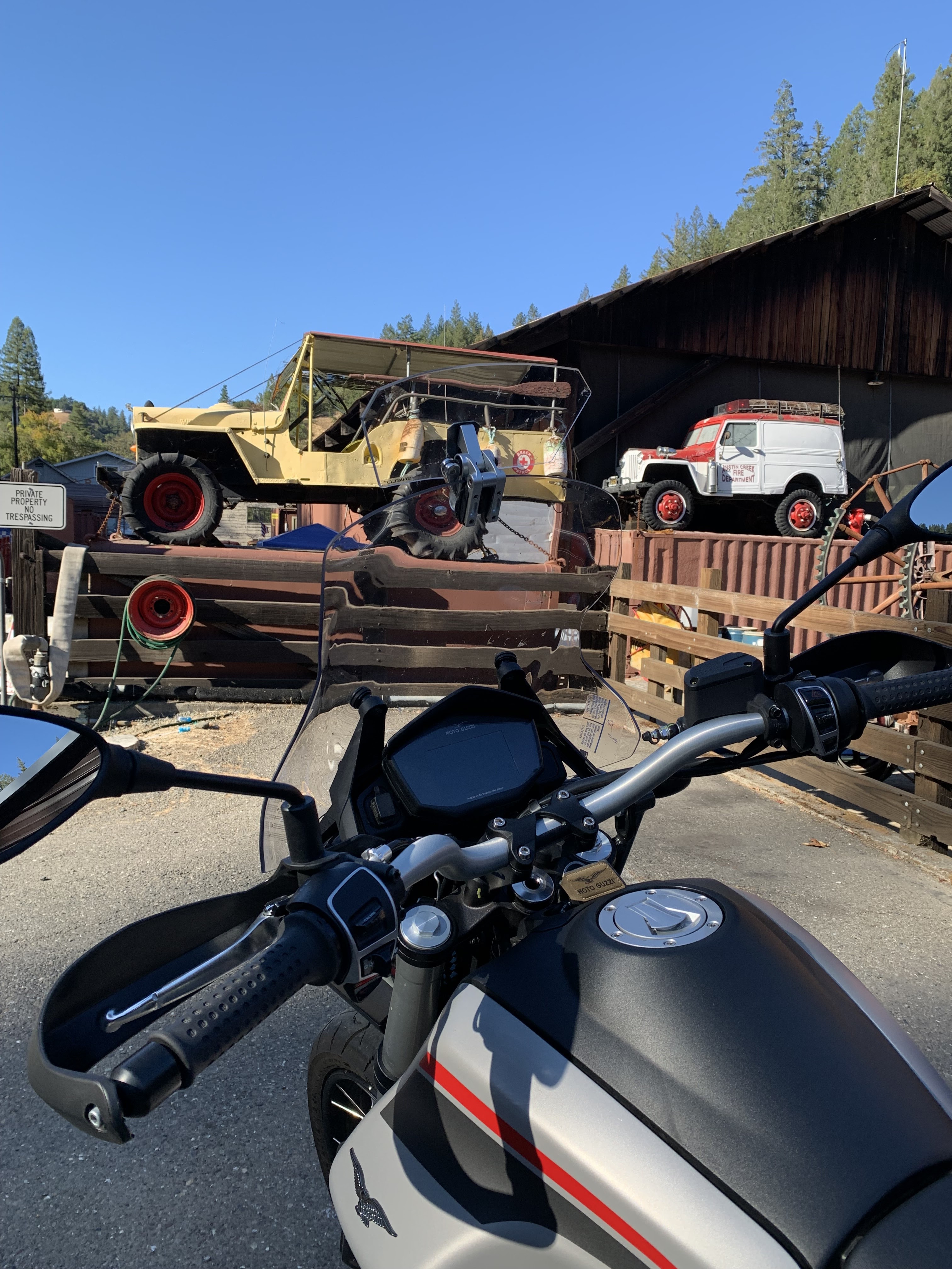
     The Royal Enfield at 411ccs is my other bike. It’s the one that requires little thought or maintenance. Lube the chain. Check the oil. Ride. The scant engine produces barely enough power for the thing to get out of its own way, but on hilly wine country by-ways, you don’t need power. Just wind on the helmet and associated fresh air.


Sunday’s ride would be both wind and fresh air and more. Eight miles from home I venture west on Dry Creek Road toward Lake Sonoma, thence to Stewarts Point Skaggs Springs Road. This mythical route is sought out by fellas on big displacement rice-rockets and euro-sports. The 35 mile-per-hour speed limit signs don’t even rate as a suggestion. A pair of road racers scream eastbound around a sweeping curve – rider’s knees inches above the pavement – as I tootle west. They drop their left hands for the perfunctory wave, as do I, when we pass. I’m enjoying the autumn hills dotted with golden oaks, digger pines and early vestiges of winter grass. I wonder about the tradeoff between the thrill of awesome speed and precise handling versus the sublime beauty of the rolling coast range in mid-fall. See ‘aging,’ above. Another pair race by, low-hand wave. 

     I’ve driven this route from the Russian River drainage all the way out to the Pacific Ocean several times on several different machines. BMW(s), a Triumph, a Yamaha, Guzzi(s) and I find myself calling myself fickle. Oh! The money I’ve wasted on motorcycle turnover. Yet, each one was unique. Each with its own character. Each filling a particular ‘need’ at a particular time. Today’s need would be to get out and enjoy some fresh air but not be gone so long that the left knee gets too stove up. 

     There’d be no particular destination, though I knew it wouldn’t be all the way out to the coast.


Stewart’s Point Skaggs Springs is a relatively new iteration. Forty-plus years ago, as Sonoma County burgeoned, the long-planned Warm Springs Dam was completed, impounding Dry Creek and its tributaries for much-needed water. Prior to that development, Skaggs Springs Road followed Dry Creek into the hills to a 1900s-era resort and continued west from there to the Pacific. That road was lost as Lake Sonoma filled and the new route was created: Twelve miles of lovely, wide pavement over gentle crests and sweeping curves through eastern-most redwood stands and oaks. Why wouldn’t I ride this every day of the year?

     A big BMW GS approaches – I used to have one of those – and a Harley and another Beemer. The riders are in no kind of hurry. They wave, as do I. Up ahead, I spot a silver trailer moving west along what will be my route. Within minutes, I catch up. It seems a Dodge Ram 3500 pulling a trailer full of about 15 head of cattle must be even more judicious on this road than I. So do his two associates. The bovine aroma isn’t at all offensive, rather, it is simply rural. I damper down to about fifteen miles per hour awaiting a section not curvy or hilly enough that I can safely pass the first cowboy. Don’t want to tangle with the next Ducati or Hayabusa, if any, screaming from the other direction. I’m noticing the fenceline, rotted posts suspended by barbwire strands; and skeletal evidence of a five-years-back wildfire – so many little details. Then I pass the second truck. 

     Perhaps two minutes after eclipsing number three, I come to a junction. Ahead, I know the lovely engineering will end, as the route returns to the original with broken, hummocky pavement, dips and cracks and conditions that will slow down those hotshots coming from the coast. The right turn, which I take, finds me on the western portion of the Old Skaggs Springs Road – a decrepit four-mile piece that didn’t get covered by the lake. Venturing along it’s clear that this section hasn’t seen repair other than the occasional sack of cold-patch asphalt in the forty-plus years since the dam was completed. 


     Folks live down this way. There are a couple of rustic residences and, somehow, a banjo starts to twang in my head. I’m following a creek’s mini canyon. Trees bending low. Occasional glimpses of sunlight reflecting off a tiny pool. Dodging some rockfall and attempting to avoid potholes that pock the surface, one’s that still await cold patch, likely in vain.

     An industrial strength gate closes the road before I can get to the water. Dismounting, although less than twenty-five miles from home, I feel like I’m in a different state; a different world: quiet save for the murmur of the leaves as the down canyon breeze tries to lose them from the sycamores and black oaks; tiny, upper-range piano-like music emanates from the little brook. 

     Getting off the saddle is good for that game left knee. I ambled a few yards down the rest of the road to the water's edge; there thinking about those rich folk who frequented that resort a few miles east and now about fifty feet deep. Good life, 1900s version.


The return would be just as delightful. Sun, curves, scenery and no cows. At one point I approach four bikes on side stands at the side of the road with their riders milling about. Good member of the motorcycle community that I am, I stop.

     “Everybody okay?” I ask.

     The rider of a BMW has a grin that would light up midnight. “Yeah, you?”

     His partner has a lovely Triumph Bonneville-based cafĂ© style bike. Stunning red. He eyeballs my Himalayan. “What is that?”

     “It’s my other bike.”

     “Other bike? What else you got?” asks Beemer man.

     “Guzzi. V-85.”

     “Really? I have a couple of Guzzis. An original V-7 from the 90s.”

     Seems as if everybody has owned a Moto Guzzi at one time or another – or wanted to. "I’m on my third Goose including a V-7 from the 2020s I had for a short time."

    The Triumph rider repeats: “What is that?”

     I explain that my Royal Enfield, though designed in England is built in India, “but every part that falls off represents the pinnacle of British engineering,” for which I receive a knowing nod.

     I point at the engine. “Twenty-two horses.”

     Triumph guy cautions: “Don’t wanna use ‘em all at once.”

     Chuckles abound.

     Before pulling away, someone says, “Well, have a pleasant day.”

     Wind on the helmet, autumn sun and colors and knowing pavement that awaits, I respond, “How could you not?”


I’m thinking I’ll put off giving up motorcycles for a bit longer.


© 2025

Church of the Open Road Press

Sunday, October 6, 2024

REPEAT PERFORMANCE

 Riding the Mendocino/Sonoma County Coast 

for the Umpteenth Time


I am writing this piece for myself so I can remember.  Remember what it’s like to have a day – an unplanned day – to do whatever the hell I want to do.  And a recent Saturday it involved ratty little roads to and from the coast split by a glorious run from Mendocino to Fort Ross on State Route 1. I’d jettisoned the voluntary time commitment associated with a vital community group – it was someone else’s turn – and rewarded myself with this.


Orr Springs Road connects Ukiah with Comptche and the coast at Mendocino.  In October the narrow route crosses ridges of grasses dry since April…


…and descends into seasonal creeks surprisingly not dry.


Remnants of the region’s past are evidenced by this little jack-stabbed teepee burner long ago used to incinerate slash from a small logging operation.  Constructed of corrugated metal, it is a rusty one-of-a-kind structure.


I wonder where the associated mill might have stood.


Also out Orr Springs is a clothing optional camp and/or resort indicated by a substantial and effective privacy fence built along the edge of the pavement. This is a good thing, I’m thinking, as I certainly wouldn’t want anyone hidden in the woods or down by the creek ogling or leering at my curvaceous and sweet sounding Italian motorcycle as we motor by.


Next, I roll past a lovely Montgomery Woods State Preserve – simply a grove of redwoods – with picnic tables, easy hiking along the creek and whispers of angels above when the breeze is just so.https://www.parks.ca.gov/?page_id=434 If you packed a sandwich, this is the place to pause.


A short distance beyond I come to a dilapidated homestead or a ranch of some sort with a roughly spray painted plywood sign stating, “You loot.  We shoot!” underneath this not-so-cryptic addendum: “Let’s Go Brandon.”  Desiring not to get shot, I didn’t stop for a photo, but looking at the state of things there, it appeared the place had already been pretty well looted.


The mid-morning air is cool and pleasant and the fall colors are beginning to turn. The road is both narrow and twisty enough that one can’t rush past this early-autumn display.


Comptche is out this way.  A small berg clustered with, perhaps, fewer residents than the number of consonants in the village name. (That’s not at all true, but it is a cute line I thought of from the saddle.)


Highway 1 is fifteen miles further. The two-lane I’m enjoying tees into it.  A quick jog north brings me to Mendocino, the picturesque coastal community of both legend and postcard.


The loop over to the headlands never disappoints and I found myself following a gent on a big BMW GS who was enjoying the same experience. 


Home-based near San Jose, this fella was completing a loop that had taken him to Alturas, then out CA 299 to near Eureka, then down the Coast.  “No hurry to get home,” I recall him saying.


Having taken this route or an iteration of it several times, I found myself not stopping for pictures I already knew I had.  But this one begs the caption, “The coast is clear.”


There’s a little devil in me that always suggests it’d be cool, less pressurized, to live in a small middle-of-nowhere hamlet or village.  No stoplights.  No superstores.  Fresh air.  Starry skies at night. All that stuff.  But, I argue, I’d at least like a bank where I could access my meager savings (Point Arena has a branch of my Credit Union) and a reliable place to keep my motorcycles tuned and running (I’ve engaged the independent whose shop is here to refurbish brother Beebo’s old BMW) and…


…the restaurant out at the pier has been closed the last several times I’ve gone out seeking chowder.  (Not anymore.)  Worry not, Church of the Open Road followers, I’m not feeding that little devil by entertaining relocation to Point Arena, (or Cedarville, CA or Tonopah, NV or Joseph, OR) but I will feed myself at Pier Place https://www.pierplacepointarena.com anytime I’m out that way.  The food was hearty and substantial, the list of on-tap micro brews copious and tempting.  But being on the bike, I opted for bubble water.  A cold bottle of Fort Bragg’s Scrimshaw pilsner is waiting in the fridge at home.


Lollygagging south through Sea Ranch, discouraged to take favored Stewarts Point/Skaggs Springs Road due to construction, I’m facing a longer day than I had (un)planned.  A left hand turn up Fort Ross Road found me leaving the temperate 72 degree coast and climbing into 90 plus degree territory on a road more pothole than pavement. 


The Guzzi’s “adventure” suspension absorbed the punishment as I crested the ridge and corkscrewed through redwoods and chamise into a half-century’s ago Cazadero.  This community has the requisite school, church and country store – but it also has an attraction unique and enticing.  A businessperson there has taken to restoring, trading, perhaps collecting pre-mid-60s Willys-era vehicles ranging from military flat fenders* to wagons and pickups. (* Quick! Name the two other manufacturers of WWII era jeeps.)


I suspect he may even have (or has had) those wonderful two-wheel-drive phaetons known as the Jeepster.  Dad had a ’50.  Brother Beebo later had a ’49.


Someday I’m going to muster up the courage to wander in there and ask if I can nose around a bit.


Eight hours and nearly 250 miles proved a bit too long for an old cuss like myself.  The hundred degree ending temp didn’t help.  But I gotta admit, a day on the bike traveling through remote sections of the Coast Range with a nice lunch thrown in for good measure, did wonders for my mental health.


Edging toward my mid-70s, I’m not sure how many more days like this I’ll confidently enjoy on two wheels.  Better grab ‘em while I can.


o0o


Today’s Route: North on US 101 to Ukiah, take last exit; north on State St (under the freeway); left (west) on Orr Springs Road to Comptche and CA 1.  South on CA 1 through Little River, Albion, Elk, Manchester, Pt Arena (lunch!); left (east) on Ft Ross Road; right on Seaview; left (almost immediately) on Ft Ross Road to Cazadero.  Continue to CA 116; head east (redwoods, Russian River, vineyards) to US 101.


© 2024

Church of the Open Road Press

Wednesday, December 23, 2020

FOREST ROADS AND FIRE TRAILS

 …the urge to explore continues…


After calisthenics we were told to jog from the old gym out to Warner Street, tag the fence and run back.  “That’d be about a half a mile,” Coach McDonald said.  I didn’t much care for jogging – still don’t – but did enjoy the run back.  Over the roof line of


Chico High’s gymnasium I could see the foothills and the mountains where the Sierra and the Cascade met.  Feather River country.  In the fall, those far away hills were streaked with the color of changing leaves.  In the winter, cloaked with snow.  Spring would bring a greenness that highlighted the roads scratched through the forests and meadows and into the high country.  Roads I so wanted to explore.


A seven horsepower Honda Trail 90 served as the Golden Hind I’d use to discover the world in my geographical back yard.  Endless summer days were spent putt-putting along forest highways and fire roads in the Plumas and Lassen National forests.  Each day I’d turn at a junction just to see where the dirt track led, and when darkness gathered, I’d make note of the routes I hadn’t opted for and promised to do them next time, perhaps as soon as tomorrow.


Fifty years have passed since those days jogging back to the old gym and mind-wandering about the adventure of an unexplored forest road.  But the fantasy still exists.  


No longer living in Chico – we’ve enjoyed several interim addresses – now I find myself in a small berg in California’s Alexander Valley toward the northern reach of the Russian River.  Looking across to the hills, I can easily see routes and trails carved into the chemise and woodlands of the Mayacamas east of town.  Standing in the driveway after having picked up the morning paper, my gaze toward the rising sun transports me back to those high school days when I wondered, “Where does that one go?”


A paved route called the Hopland Grade traverses the Mayacamas north of us.  We’ve driven it several times.  Like a carnival ride at Disneyland, several signs warn that

if your vehicle is longer than this length, you are prohibited from the route.  Hopland Grade is windy, steep and not quick.  Great fun on a Ducati Monster, not so much on or in anything else.  Near the base of the mountains we choose an intersection with the primitive The Old Toll Road.  Winding along the east side of the Sanal Valley, past industrial strength wine vineyards, the crumbly asphalt soon snakes into the hills, over and back over a seasonal creek, and through stands of black and live oak and madrone. 


Hog wire and rotted-post fences trace the road’s edge. There’s even a point where a metal gate appears – one that if one passed through it, one would soon be hurtling over a cliff.  Pavement gone, the surface is graded to a certain extent, washboarded some and dotted with puddles from a two-nights ago late-autumn storm.  The Subaru takes this road is stride.  As did the Yamaha Super Tenere the other time I was up here.  But something makes me long for my old Trail 90.


The map tells us that atop the spine of the Mayacamas we’ll find Adobe Creek Road, and we do.  The trouble is that at the intersection with Old Toll, Adobe Creek is gated allowing access only to the rancher with the appropriate key – and Cal Fire folks, too, I assume these days.  I suspect the secured road is one I might see from my driveway, several crow-fly miles to the southwest.  We had hoped to head south and join up with Pine Mountain Road which loops back to the Alexander Valley, but that won’t be the case today – if ever.  Ahead a bit, Adobe Creek Road will take us north affording a view of Clear Lake to the east.  At several minor junctions, each fire road is gated and locked. I’m beginning to get the picture that, unlike in our national forests, a lot of these roads-begging-for-exploration are closed to lookie-loos like me.  In these lands of steep hills and dry brush, I can’t fathom what a landowner might be securing behind these barriers – cattle surely wouldn’t do well amongst these thickets and I’m sure there are easier places to grow pot now that it’s legal. 


 The map tells us that Adobe Creek Road traces the line between Mendocino and Lake counties, and that six or seven miles north, we’ll intersect with the Hopland Grade – which we would have had not another damned gate barred our way about three-quarters of a mile on.  Here, we course east on Highland Springs Road, a Lake County thoroughfare that winds down the lee side of the Mayacamas.  The trees are more sparse on this side of the summit and those that dot the hillsides are primarily blue or valley oak.   The road is wider and far less steep owing to the fact that the rains that tear away at these mountains are more prevalent on the other side.  


Twenty minutes further we arrive at a lovely – but rather primitive Lake County public park.  Centered on Highland Springs Reservoir is a rod and gun club, an extensive Frisbee golf set up, tons of picnic spots and a four-mile trail that winds up the canyon then circles around the lake.  Edward the lab-mix was ready for a walk and so were we.  Up the draw, the woods are silent, dark and deep and frost (though not Robert Frost) still glazes the mid-day ground in the shaded areas.  


Gray squirrels leap from branch to branch, taunting the dog, and a lovely pink and brown salamander wriggles across the trail barely escaping my footfall.  Tracking back to the lake, great egrets wade the shore waters, redwing blackbirds flitter amongst the rushes and osprey and red tails circle overhead.  Mallards and coots discuss the problems of their world as they paddle across the surface.  We wish we’d packed a lunch. Edward wishes we’d packed a Frisbee.


Our exploration of the enchanting back roads and dirt tracks seen from the house wasn’t exactly a bust as we learned a lot about the lay of the land.  Clement Salvatore, until recently an entertaining and insightful staple at Rider Magazine, shares that there are at least ten times as many miles of dirt road as there are paved this side of the hundredth meridian.  I wouldn’t disagree.  But many of those miles of roads are unobtainable because they cross privately held stretches of heaven.


Still, there is much to explore.  Perhaps again tomorrow?


There are times when I haven’t been out much on the big Yamaha that I think about a different – smaller, lighter two-wheeler.  My range of interest goes frothe adorable Vespa 300 HPE to the spartan Royal Enfield Himalayan to the newly re-issued Honda CT 125, a descendent of my old Trail 90.  Likewise, I sometimes think the Subaru Forester is a bit stodgy and wouldn’t I prefer a Mini Cooper Convertible or maybe a rugged Jeep Wrangler forgetting what a nightmare my 1990 Wrangler turned out to be.


But, for exploring the high and lost fire roads of Sonoma, Mendocino, and Lake Counties, and for getting me safely (read: “at highway speed”) to and from those dirt roads, it’s tough to beat the two vehicles I have.  Dependable, economical, rugged and fairly comfortable, I recall that many times when I’ve answered the siren song of something more stylish, I’ve been disappointed with the result.  Reference here – along with that Jeep – my short-lived but gorgeous Triumph Thunderbird.


Then there’s this unavoidable positive: Both the Yamaha and the Subaru are paid for. 


© 2020

Church of the Open Road Press

Wednesday, July 29, 2020

COAST SIDE WEST SIDE STORY

...when national circumstance imitates art...

To escape the drumbeat of the both the news media and social media, I hopped on Enrico, the Yamaha and headed out to cruise the Pacific Coast Highway.  The rhythm of the road and the waves, I was sure, would carry me to a happy place.

Often, when I ride, a soundtrack will filter into my mind and accompany me on my journey.  Usually – whether it’s Sinatra or the Boss, Mozart or the Beatles – I don’t know why the playlist is what the playlist is.  I just enjoy the melding of melody and that road rhythm.

Today was different.  Today, the tunes came from “West Side Story.”  (Music by Leonard Bernstein.  Lyrics: Stephen Sondheim.  Ghostwritten by William Shakespeare.) We’d viewed the dazzling 1961 film the night before.  Lyrics were echoing as I descended Sonoma County’s Colman Valley Road from Occidental into the marine-layer refrigerator that always is California’s Highway 1 in July.

The story lingered.


I do a lot of thinking on the motorcycle.  Especially when fog or overcast mutes the scenery.  Sometimes I come up with a new idea like how 2 plus 2 can equal 7; sometimes, I simply try to figure out the hand that the world has been dealt.  

This day would be the latter.

Arthur Laurents’ “Westside Story,” like William Shakespeare’s “Romeo and Juliet,” is a tearful tale about forbidden love and ultimate loss.  (If you haven’t seen the film lately, take time to view it so I don’t have to provide an inadequate synopsis here.)

Ultimately, whether it is the Montagues and the Capulets or the Jets and the Sharks that allow their blindness and hatred to prevent them from sitting across the table and simply discussing, the result is the same.  An irreversible tragedy takes place, and only then do the opposing parties decide to seek some sort of common ground.


Somewhere between Point Arena and the eastward turn-off to CA 128 along the Navarro River – and while voicing Sondheim’s lyrics to “Somewhere” in my helmet – it dawned on me. (Granted, maybe this was simply another example of 2 and 2 equaling 7.)  But here goes: 

The differences and perceptions separating the families in Romeo and Juliet (1594-95) or gangs in Westside (1961) are not all that different from those dividing our nation’s left and our nation’s right (2020).  Sadly, the irreversible tragedy that is about to befall us is far more crucial – far more devastating – than the mere loss of a handsome, ill-fated lover.

No.  The loss will be that of what once was our grand Republic.

I believe that we can each play a hand in diverting the tragedy.

(c) 2020
Church of the Open Road Press

Wednesday, May 20, 2020

THE GEYSERS ROAD LOOP

...What has magma done for you lately? ... 

I like riding when the clouds give some texture to the sky.  A day or two after a storm when the white fair-weather cumulus float across a deep azure backdrop.  I like riding all the other times, too, but the clouds were terrific this day.


I hadn’t been out on Enrico, the Yamaha for a while.  Chores.  Priorities.  No destination diners open to eat during the pandemic.  All excuses.  There comes a time, however, when “I gotta keep my skills up” overrides all the other excuses.

That, and those clouds, conspired to get me suited up and in the saddle.


Geysers Road, looping from Cloverdale, tracing Big Sulphur Creek, skirting Geyser Peak and descending into the Alexander Valley near Healdsburg offers a trip through time, history, geology, fire science, crumbling infrastructure and viticulture all in about 35 glorious miles.  Along the way, we glimpse the largest geothermal power facility on the planet.

The route begins northeast of Cloverdale at the Geysers Road exit from US 101.  Winding along a rushing Russian River, we head east at the confluence of Big Sulphur Creek.  


Time and nature have not been kind to this section of off-again, on-again pavement.  Heavy winters, slippery clay soil, rising and falling water flows all wear away at a route that is so little used that maintenance seems always to be relegated to the bottom of the list.


In some stretches the pavement are two-lanes wide and double-lined striped. A hundred yards later, the pavement could be gone, and the route reduced to a narrow strip along an eye-popping canyon wall.

Then back to pastoral hillsides dotted with oaks frequented by crows and scrub jays.

We cross a century-old steel bridge, the likes of which can be found on many lost routes in the west.


Climbing out of a portion of stream valley, we see remnants of mining operations from back when quicksilver was needed in the process of refining gold from its ore.  


Gold, more prevalent in the Sierra; necessary mercury found in and about the Clear Lake region of the Coast Range.


Thirteen miles on, a fork offers the choice of heading to the geothermal facilities.  


Roads spiderweb across the opposite ridge leading to many plants positioned on the opposite ridge.  Pipes and powerlines complete the intricate and curious line drawing.  Access is locked away from us.

CalPine photo

A hundred and forty years back, steam was discovered rising from fractures in the earth. Water, seeping across otherwise impermeable layers of rock, slip into cracks and drizzle onto superheated magma, not far below the surface. A mystic and eerie phenomenon was created, sacred to native Americans and to be exploited by their European followers.

Sonoma County Historical Society Archive photo

A hotel was constructed – which later burned, twice – and water was bottled for its healing properties.

CalPine photo

Now administered by CalPine Corporation, their website (see below) tells the story of what appears to be a model of magma-incited, clean, renewable energy production. 

CalPine graphic


But not perfect energy production.  In October of ’19, during a spate of 100-mile-per-hour gales cresting the ridge, a hot high-tension transmission line arced spawning the devilish Kincaid Fire that, in a matter of hours, raced across the Mayacamas and into stream courses...


...searing all within its path, including Mercuryville (population 2)...

Purloined from somewhere else photo

...and taking with it the sign I remember from a previous ride up this way.

From the eastern flank of Geyser Peak, it is easy to spot the fire, ranch and mineral access roads that web the hillside. One wonders when that first stretch of Geysers Road will be left to crumble to the same state.


The fire blazed hotter and with more ferocity and abandon than a presidential campaign rally, threatening Geyserville – a quaint throw-back farming community in the Alexander Valley, and Healdsburg – the up-scale mecca of shops, tasting rooms and Teslas.  It was only through the heroic actions of legions of firefighters from near and far, that the sleepy bedroom community of Windsor was saved.  More than one fire captain admitted, later, that he didn’t think they could do it.  Living near-by, I’ll never forget the smoke.


Geysers Road on this side of the route provides preferred access to the geothermal plants.  Wider, guard-railed, better paved, it winds through higher pastures which give way to vineyards...


...and superlative views of the verdant Alexander Valley below.  Healdsburg is twenty-five miles from the junction, but it is difficult to not stop and take just one more photo of the developing scene.


Did I mention the clouds?

o0o

Resource:  Information, including facility tour info may be accessed at: https://geysers.com  Worth a look!

(c) 2020
Church of the Open Road Press