On the Cedarville, Burns, Winnemucca Tour
Fourth in a series…
The old Idaho Oregon Nevada route, known
as the ION Highway directed frustrated California 49ers to the greener (or more
golden) pastures (goldfields) of Idaho and Montana which opened up in the
mid-60s. I suspect California’s
Yuba-Sierra County Henness Pass Route was an extension of the ION.
A night-before’s glance at the map
informed us that the ION would be an interesting diversion from US 95 passing
through Rome to Arock to Danner – in search of the final resting place of Jean
Baptiste “Pomp” Charbonneau, son of Sacajawea.
But, as with many Church of the Open
Road adventures, we shoulda known something was up when John's 2012 4-Runner's
skid plates began cutting the tops off sage and bouncing over boulders amid the
"highway's" ruts.
US 95 heads east-northeast from
Burns Junction toward Jordan Valley.
It would be easy to fly by the unpaved Rome Road that connects to the
historic and remote ION route across the plateau.
Paralleling the Owyhee River, the Rome
Road turns and becomes the route we’re looking for, according the GPS in John’s
2012 4-Runner. It crosses the
Owyhee on a vintage 1906 steel structure.
A filigreed placard immortalizing
those visionaries who planned and built the bridge rusts atop the span.
Up stream, a small dam diverts water
into an irrigation flume, which courses along the base of the sandstone bluffs.
Nearby, the bulldozer perhaps once
used to maintain this “highway” rests in a state of perpetual unemployment.
The GPS unit is spot on. It directs us through a weary looking
farmstead and up a chiseled grade and across some high, gently rolling
terrain.
The road looks as if it hasn’t seen
a grading blade since the old boy down the hill retired, but the Toyota’s high
ground clearance and rugged body-on-frame engineering makes light work of the
tough climb.
Miles on, a primitive gate bars
further access toward Arock. Sans
any type of lock, we utilize the cleverly provided wooden lever to unbind the
stay from the wire loop and pass through.
Returning the gate to its closed
position takes more torque than I can muster, but close and secure it we
finally do.
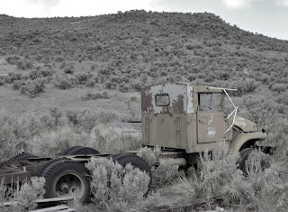
We know we are nearing an outpost as
we encounter more and more derelict equipment slowly melting into the sage.
Arock – the halfway point to Danner
– sports a Community Center, a church, a Post Office, and a crisp looking
little grammar school. A substantial
route leads south back to US 95.
But we scoff at this.
A home built from quarried lava cap stands
across from the Community Center.
The GPS leads us eastward out of
town. At a point not much further
on, the unit tells us the ION Highway courses northerly.
But, being smarter than any
electronic gizmo, we stick with the rutted route that appears more heavily frequented.
As things would turn out, we are
proven not to be smarter than the GPS nor are we particularly Frostian in our
choices about which road not to take.
A gorge carved by a tiny stream that
was dammed in 1903 blocks our route.
We would not make Danner this way.
We return to Arock, find the road
south to US 95 and hope that none of the locals – peeking through their
curtains – catch us backtracking.
After all, we’re geographers.
© 2013
Church of the Open Road Press


Thank you for the information; it is helpful for us adventurous folks who (like me) are still trying to drive this stretch. Going East to West, I turned back to Arock after encountering a blocked road (very likely, the gate which you referenced). Now I know that it may be able to be opened.
ReplyDeleteThanks for sharing. I explored the old ION highway from the east because coming from the west signs mark it as a private road. Not sure if this is legit, but I looked into it from the east - the ranchers on the east side were kind to me and gave me good beta. It continues on all the way through, but must be walked. It looks much like an old wagon trail trampled by cows.
ReplyDelete