Showing posts with label Utah. Show all posts

Sunday, October 27, 2024

ABOARD THE CALIFORNIA ZEPHYR (FINALLY!)

 A life-long dream come true ~ maybe

The California Zephyr has always been mythic to me. Winding like a silver ribbon up the Feather River Canyon, occasionally, we’d be lucky enough to see it as we drove California’s Route 70 in our ’54 Ford toward Quincy and Bucks Lake. Crisscrossing the canyon, if we were really lucky, we’d be crossing the river on a bridge as the train crossed above us, switching sides of the canyon. The silver beauty was always on the other side ~ always just a bit out of reach.  


The Zephyr ran from San Francisco to Chicago under the combined efforts of the Western Pacific, the Denver, Rio Grande Western and the Burlington Route. It had always been my dream thunder across our vast western expanse on this train. Alas, come the early 70s, service ended. As did my dream.  Or so I thought.


But along came Amtrak, the Federal government’s attempt to keep rail traffic alive. More successful along the eastern corridor of the United States, cross-country routes would enjoy less ridership. Yet, the Zephyr was revived. Now, however, using the historic Donner Pass Route initially carved by the Central Pacific, silver streamliners no longer grace the Feather.


 We board the Zephyr in Sacramento.


From the Sacramento Valley Station, the route winds and twists up the western slope of the Sierra with pauses in Roseville, Colfax, and, following the river courses of the American and the Yuba, cresting the Sierra on the highest trackage anywhere in the States. We enjoy a view of Donner Lake…


…before descending into Truckee for a twenty minute fresh air and, ironically, smoke break.


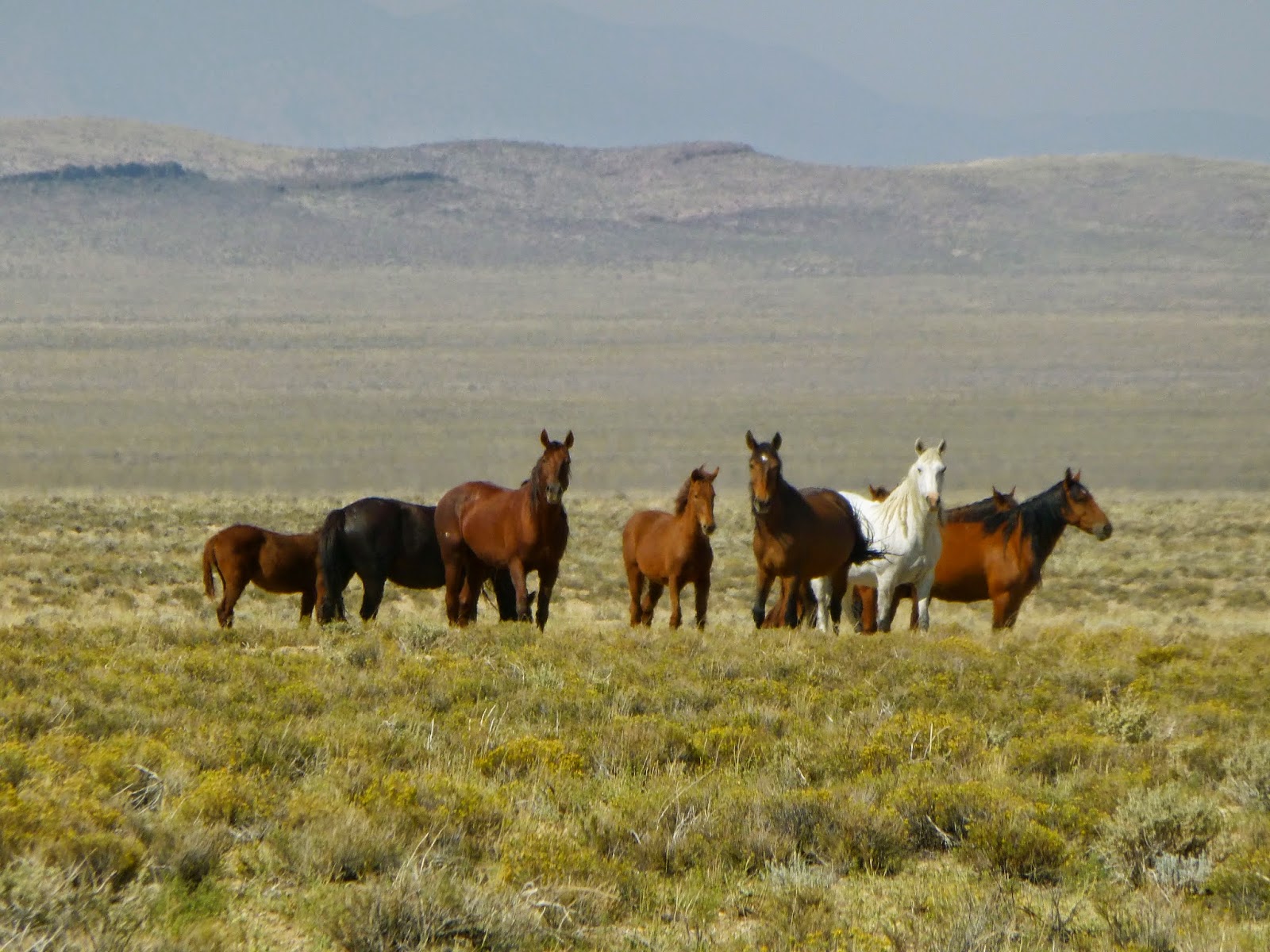
The route traces the Truckee River through the rain shadowed environs of the east slope of the Sierra. Conifer forests begin to give way to brittle sage and autumn’s golden grasses.  


East of Reno, we begin to get a feel for the vast and vacant high desert. Miles of that sage and mineral wealth (I suppose.)


Our rail journey will take 50 hours, several of those spent lightly sleeping in our rocking accommodation. But, as night falls, I snap this haunting image of a western sunset and wonder about the Shoshone and Paiute peoples who, for centuries, came to an understanding of that whole living in harmony with nature thing that we successors to this space don’t quite get.


Sunrise finds us coursing along the Gunnison River.


Rolling into Grand Junction, CO on the historic Denver and Rio Grande Route, we see one of many grand old stations left to decay.


A few miles of browning hills relentlessly shaped by river and wind…


…and we rumble into our first glimpse of the Great Plains.  I write ‘rumble’ because, to my untrained train butt, the Burlington Northern / Santa Fe right-of-way east of Denver seems a bit less well maintained than the UP to the west.


Lots of flat. Lots of grain ~ amber waves of it ~ mainly, it seems, corn. And lots of endless vistas. One can fly over this country, which we did on our return to California, and not grasp the distances, the vastness and the towns that look like nameless grids or checkerboards from 36,000 feet. We slept through all of Nebraska. 


Here’s Burlington, Iowa …


… and an aging Burlington Northern Pullman, Railway Express car and vintage loco. Glad these rolling stock examples are being preserved.


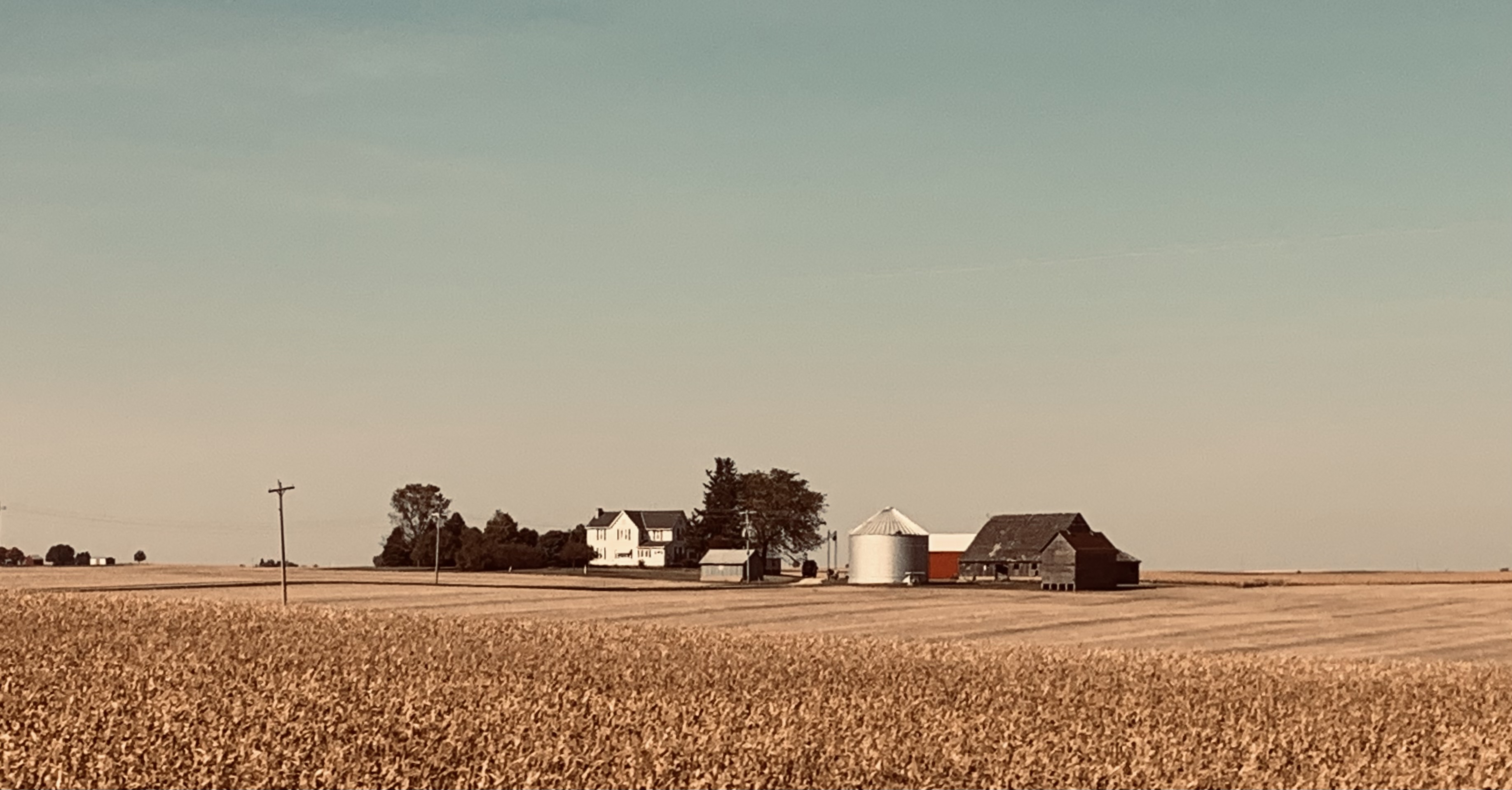
An hour or so further and an hour or so short of Chicago, this solitary farmstead captures a contemporary way of life we don’t experience on our western seaboard. And, while not wishing to wax political in this post, I believe I can understand why folks in these parts may see things differently than I do.


Chicago would be our literal end of the line. It’s where the Zephyr has always terminated. Chicago: with the ‘El’; the commuter lines to the suburbs; lines to the stock yards, steel and other industries; and the historic Union Pacific; Burlington Route; Chicago and Northwestern; and several other routes. We are informed that within the Windy City’s confines exist more miles of rail line than in the rest of the continental US combined. Rolling the final twenty minutes into Union Station, it’s a claim that’s hard to dispute.


After fifty hours on the train, I ask myself, “Did my long held dream of riding on the California Zephyr come true?”  


I recall myself in Dad’s ’54 Ford waving at passengers on the Zephyr as it wound through the Feather River Canyon. I question whether some little kid traveling up Highway 70 in the back seat of his dad’s current day SUV might be missing the opportunity to form his own romantic dreams about boarding this silver wonder and seeing where it takes him.


ResourceThe Story of the California Zephyr, by Karl Zimmerman. Quadrant Press. © 1972.  Nice historic photo and narrative about the early days of the original Zephyr. (Good luck finding a copy. You might want to check out your neighborhood model railroad shop as they often have these kinds of books.  Plus, model trains are kinda cool.  They bring back the little kid in many of us.)

© 2024

Church of the Open Road Press

Thursday, September 25, 2014

MORE STUFF BY THE SIDE OF THE ROAD

Central Nevada and Utah Edition

Countless narratives may pop up on a road trip: themes of history or commerce or antiquity or just foolishness.  Then there are the singular or small clusters of images that don’t fit a particular story until, when added together, they form the story itself.

Following is an album of those:

A sucker for old trucks and the stories they might tell, this one was spotted in Benton Hot Springs…

…as was this vehicle awaiting repair.

Venturing out into Nevada on US 6, we realize we are visiting the old west.  Cue a little Elmer Bernstein movie music.

East of Tonopah we visited the aging proving grounds where the “Right Stuff” boys cut their teeth…

…and viewed the aging hangars that once housed their rocket planes.


A day later, we are racing along a highway in Utah where the cut bank exposes seams of coal – coal the folks in Utah are eager to release…

Nearby, we witness what is referred to as “clean coal technology.”

It is wise to use caution when walking the streets of Price, Utah after dark.

Driving into Nine Mile Canyon, another old truck begs to be photographed…

…when what we’d really come to view was this:


Our visit to the Golden Spike National Historic Site was preceded by a stop at Ogden’s Utah State Railway Museum…

…where this narrow gauge locomotive was in the throes of restoration.

Its cab in a shop nearly finished after what the volunteer there claimed was about eleven years of 10 AM to 2 PM Saturday only work…  

…assuming the gang didn’t tank up on too much hot chocolate and coffee in the winter or beer in the summer.  The shop, we are told, is neither heated nor cooled.


Heading west along the old CP line, we come to an unexpected placard telling that the historic Wheeler Survey charted this area back in 1869.

A sandstone benchmark, nearly ground smooth by water and blowing sand bears George Wheelers mark.  Mysteriously, at this point, I am asked to make a mental note of the Wheeler Survey.  
Not a mile further, we arrive at the site of Kelton, Utah.  Little remains except for the railroad grade…

…and the cemetery.  (Not a bad place to spend eternity.  It certainly is quiet.)


Later, we seek the encampment at Palisade…

…where the Central Pacific crew forged line through a tricky canyon (40 years later, the Western Pacific chose the same route)…

…while living in hollowed out holes in the sandstone cliff buttressed by railroad timbers.


Elsewhere, some old signs – like some old trucks – beg to be photographed.


Transportation across the Basin and Range is a huge part of the country’s history.  First we walked it, then we spanned it with rails.  Later we flew, and in so doing dotted the landscape with navigational aides…

…and fuel carriers.  (This photograph is of the running board on a derelict and rusting fuel tanker trailer at a little used airport in Nevada.)


Wovoka was a man whose gentle power came from wisdom and faith.

We pay tribute to him at his resting place on the reservation near Smith, NV. 


Heading over Sonora Pass, west of the summit, we find a wide spot and it becomes clear why I was asked to remember the work of George Wheeler so many miles ago. 

Here, his team had carved a benchmark into a tree.  Its scar remains today.  Look carefully at what is inscribed in the tree's flesh.  (USGS - B M - 9205)

One comes to a number of realizations as the result of this little five-day sojourn into lost elements of America’s past.  Perhaps one of the most significant is this:  When flying along the interstate and seeing a tattered roadway or even just a pair of ruts heading through the sage and over a hill off toward a distant horizon, those tracks always lead somewhere. 

They lead to something, to some piece of history, to some gain or some loss.  Perhaps to a rancher’s feedlot, or a long played out mine, or a railroad construction gang’s camp, or a singular, lonely cabin dilapidated by wind and weather.  Or maybe just to a grand view of the west: a west that will be forgotten if we don’t, once in a while, explore some rustic route heading through the sage and over a distant hill.

o0o

Note:  Thanks here to fellow former educator and life-long geographer John who, with his trusty Toyota 4-Runner, guided this adventure across Central Nevada and Utah and back.


© 2014
Church of the Open Road Press

Sunday, September 21, 2014

ALONG THE ORIGINAL CENTRAL PACIFIC ROUTE


…from the Pre- to Recent History tour 
of Central Nevada and Utah

I like trains.  Always have.  Perhaps it’s the boy in me.  There’s something graceful and honest about a “Big Boy” pulling a mile of boxcars across a summit, steam chuffing out of pistons, air horn blast kicking off the canyon walls.  From about nine years of age on, the wanderlust on my shoulder whispered that I should hop on one of those box cars and see where I might end up after a week or so.  Never did it.  But perhaps this thought was the earliest vestige of the Church of the Open Road.

My favorite pastime on my first motorbike – a 1970 Honda CT 90 – was to ride the frontage roads that paralleled the Southern Pacific tracks running north out of Chico.  The road was slick and muddy.  The great fun was enhanced by the chance to wave at the engineer or fireman in the cab of a rumbling GP-40 and have the fellow wave back.  After two hours and about six miles, I’d return home completely satisfied, but eager to find another section.


I learned about the Central Pacific’s herculean effort to cross the Sierra Nevada and rocket over the basin and range while reading Oscar Lewis’s The Big Four, the first hardcover grown-up book I ever purchased.  I was ten.  Since before the popularization of the term “bucket list,” traveling that route has been something I’ve wanted to do. 

We arrived at Promontory Point and the Golden Spike National Historic Site where the National Park Service had rolled out replicas of the Central Pacific’s “Jupiter” – the original housed in Sacramento…
…and the Union Pacific’s 119.  This is where they met 145 years ago.


Stories are told of the frenetic race to grade rights-of-way sometimes parallel to one another…

…in an effort to garner rich government paydays and of Irish and Chinese gangs sabotaging the work of the others at the behest of their crew bosses.

The government stepped in declaring that the two lines should meet at Promontory Point.


Our task this day was to follow the old, abandoned CP route across the northern reach of the Great Salt Lake.  Rails mostly removed except for the immediate area of the historic site, the National Park Service and the BLM have preserved a portion of this as a Scenic Byway so that 60-year-old kids such as myself could live out long-held fantasies.

“The recent monsoon may have caused some old spikes to surface,” we’d been warned.  “Take two spares and a can of air.”

We figured one spare would have to do.


150 years ago, the most prevalent technology was simply muscle.  Lots of it.  With that muscle, the roadbed west of Promontory is, in parts, raised above the Salt Lake’s playa…


…and, in parts, cut through the ancient, melting ridges that form the lake’s boundary.

Timbered bridges still span arroyos that, seasonally, would threaten to wash out the rails.

The road slips down slope from the right-of-way. Around a gentle bend and through the sage and mustard the sign appears.  “Stop the car,” I nearly shout involuntarily.

This is the place where, on a bet, the Central Pacific crew eclipsed the 8.7-mile track laying record of the rival Union Pacific set only weeks before.  (The original sign is in the museum back at Ogden.)

I get out, wade through the brush and walk a section. On this still morning in mid-September, one can hear the echoes of dynamite blasts, pinging sledges and grunting laborers. 


It would be two hours before we would again find paved road.  Each minute, each mile rang with the epic effort expended to complete the transcontinental railroad across these vast and desolate ranges and the equally monumental result for the country.

Check one off the Bucket List.

o0o

Notes and Resources:

Information about the Golden Spike National Historic Site (and better directions than I could offer as to how to get there): http://www.nps.gov/gosp/index.htm
Since you’re out that way, be sure to stop at the Utah State Railroad Museum in Ogden.  Check out the renovated Union Station: http://theunionstation.org/museums-2/utah-state-railroad-museum/

© 2014
Church of the Open Road Press