Showing posts with label Eel River. Show all posts

Wednesday, April 27, 2022

A DAY TOUR OF THE EEL RIVER RIM

…Ahh! The simple remoteness of it all…


A long-time riding pal looks at a map of Northern California and comments, “You’ve been on pretty much all of these roads!”  While that’s more than a bit of an overstatement, it’s true that I have been on a lot of ‘em.  And yesterday, I bagged two more.


         My recent fascination with the Eel River environs has found me looking at remote sections of our Coast Range in Mendocino, Trinity, and Humboldt Counties.  The geography of this area is a jumble of volcanic spasms, tectonic folds deep river canyons all animated by the occasional earthquake or storm induced landslide.  The fascinating history is far less impacted by white presence than the gold-infused Sierra-Cascade to the east.  It’s easy to disappear into these hills and imagine tens of thousands of years of untrammeled life by the area’s first peoples, and clear to see the brunt of 19th century loggers and ranchers and the railroaders who tried to link everyone together.  Which doesn’t mean our conquering culture didn’t do immeasurable harm to those who came before.  See https://thechurchoftheopenroad.blogspot.com/2018/06/killing-for-land-in-early-california.html

         A good map or atlas (I carry DeLorme’s California Atlas and Gazetteer) indicates place names you can drive right through and never see, because whatever was there, no longer is, or isn’t much. Owing to the fact that I’ll be traveling dirt roads, I’m in our Subaru Forester this trip.  Given a suspect right knee, my days of confidently riding a big dual sport like my late Yamaha Super Tenere are over.  Plus, in the 100,000 miles I’ve put on the Sube, I’ve never once worried about tipping over on the thing.


I left US 101 at Laytonville following a well-graded Dos Rios Road into the Eel River Canyon.  Dos Rios is a small enclave of a dozen or so houses perched above the confluence of Berger Creek (I’m thinkin’) and the Eel. I think I spotted a school, but I’m not sure I saw a store.  


         Picking up State Route 162, I head north and east and over a ridge into Round Valley and Covelo.  The valley floor is lush, perfect for raising cattle, the cash crop that spelled the demise of the native peoples to whom that slice of heaven had been promised.  The town offers a number of services, but a number of services seem to have left as well.  There’s a Tri-Counties Bank in a newer building, but the old bank building stands as a burnt-out hulk.  The US Forest Service anchors a Mendocino National Forest ranger district there, but Georgia Pacific (or was it Louisiana Pacific?) mill, a long-time big employer, is long gone.

         Route 162 angles east, but north through Mina toward Zenia is the road I’ve long wanted to traverse.  Mina Road pavement ends just outside of Covelo, but the road is well graded, and signs ask folks to “use four-wheel-drive to protect the road from washboarding.”  I’d never thought of the connection, nor do I understand the physics of the deal, but my Forester is all-wheel drive, so I hoped I was doing my part.  The road twists and rises through oak woodlands into mixed deciduous forests, one side posted as reservation land for the consolidated tribes.  Kindly do not enter.  Okay.


The top of the ridge finds yellow pines and broad, high meadows suitable for grazing.  Mina, the berg, is little more than a framed gatepost entry to a ranch.  Without glancing at the GPS, one wouldn’t know that now they are traveling on Zenia Lake Mountain Road.  I check the map to see a Lake Mountain Ranch but see not a Lake Mountain.  Will there be a Zenia?
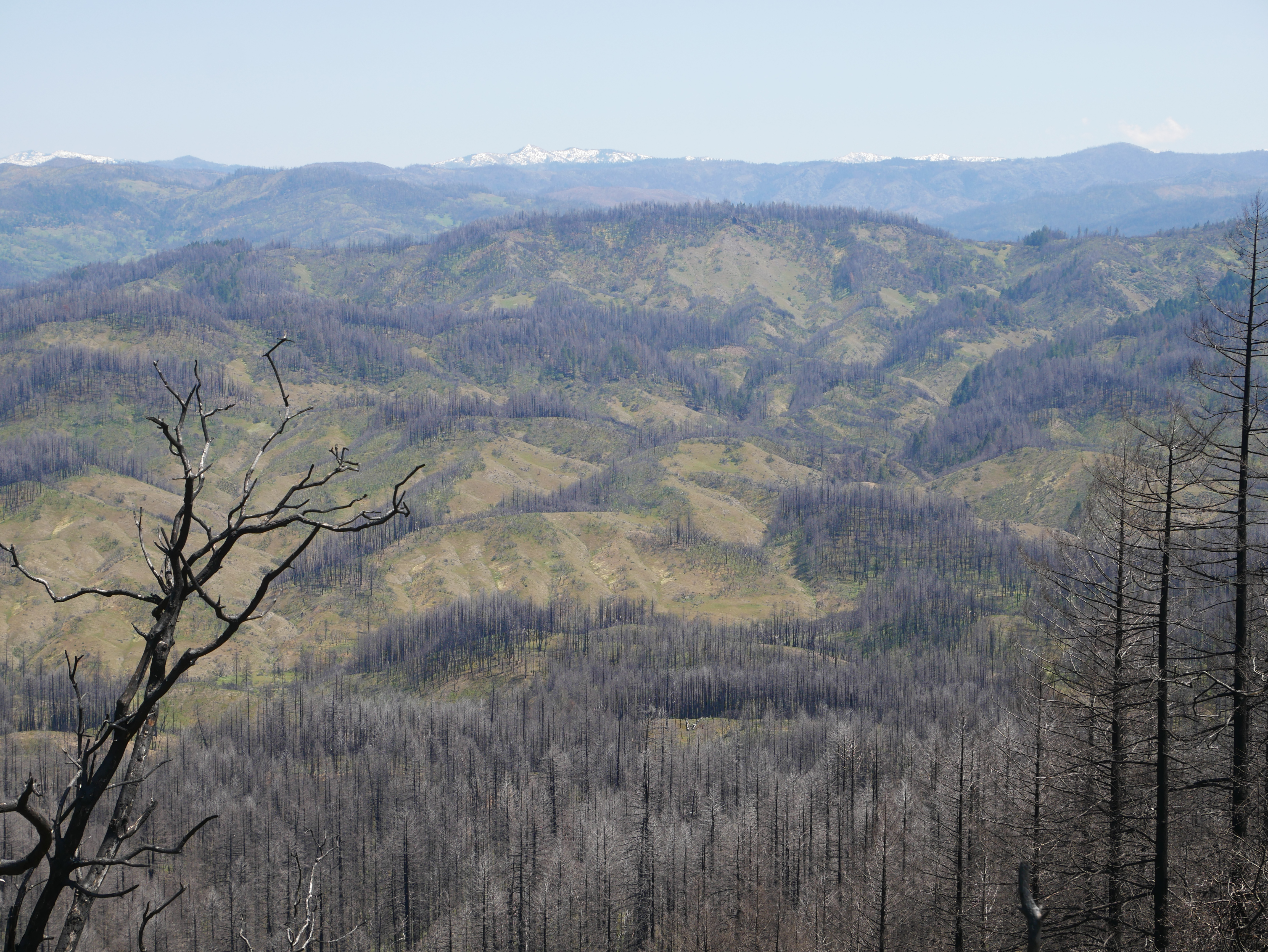


         Just when I’m noting the freshness of the high-country air, I encounter mile after mile of the Mendocino Complex burn scar of 2020. This fire, geographically, the largest in state history, took out Simpson Camp, a childhood Shangri-La, maybe fifteen to twenty miles east southeast of where I found myself this noon.  

        The big fire raged south of Kettenpom, a placename on this road, one that supports a small general store, what looks like an ag supply with bundles of PVC irrigation pipe ~ I wonder what for? ~ and even has a bright orange “76” gas sign.  Not sure it there’s gas.  A good-looking albeit laconic dog lazed in the road directly in front of the store as I wheeled around and on to Zenia.  Perhaps there, I’d pull in for a Snickers bar.


         Zenia, a bigger dot on the map than Kettenpom, has a post office.  And it once had a store.  There would be no Snickers bar this day ~ at least not one from the Zenia General Store. 

         From this point, there’s an inviting road that leads north into Van Duzen River Country, but that’ll be for some other time.  I turn west to wind beneath the Zenia Bluffs and into Alderpoint.  Alderpoint was a workstation on the now-defunct Northwestern Pacific Rail line. For 75 years, the NWP fought a losing battle with the forces of nature in the Eel River canyon.  Remnants of the rail grade can be seen paralleling the river from a fine bridge upon which I crossed.  Town, itself, is a relative city.  Big(ger) store.  School.  Businesses that support logging, ranching and, perhaps, extraction industries.  Lots of little homes.  Maybe not a lot of wealth, unless one considers that value of living in a scenic jumble of hills and ridges, oaks, pines, and meadows, with background music provided by the Eel River.  Not bad!


         The nearest closer-to-full-service town in Garberville, twenty winding miles west at US 101.  The pavement is nice and I’m sure that Alderpoint residents know the route well as they seek a little more selection on the grocery or hardware shelves.  But I don’t want to go to Garberville.  I want to bag Bell Springs Road.


All morning, I’d driven the eastern edge of the Eel River watershed.  This afternoon, I’d head south on the west side.  After heading southwest on Alderpoint Road, I exit south on primitive Harris Road.  I’m going to Harris!  Another labelled dot on the map.  Roughest route of the entire circuit, the Subaru handles it with aplomb.  I’m happy to not be on the bike, rolling over rolling gravel and small boulders.  I’m too old to pick the thing up off its side, and nobody’s coming along on Harris Road to help me out.  
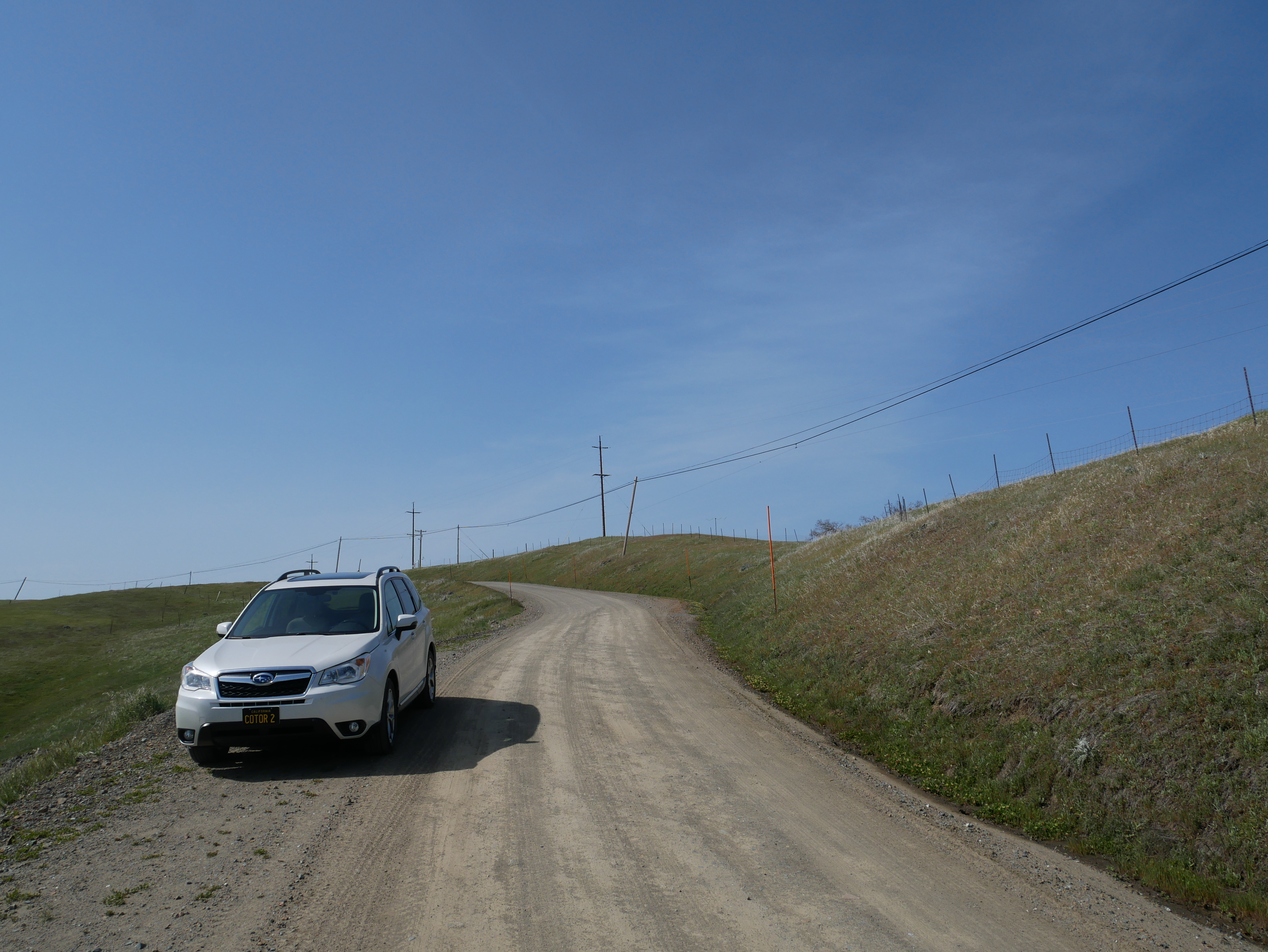


         I’m not surprised to find that Harris once had a country store, but no more.  The skeleton of the place still stands with a long, low overhung porch, whitewashed walls the whitewash of each dates back about 70 years, and nothing but ranchlands nearby.  I am shocked, however, to turn south on Bell Springs Road when I come to an unmarked placename: New Harris.  Outside of a road junction not even a derelict store.


         But I am enjoying Bell Springs Road, another one of those routes I’ve coveted.  Rising and falling over pasture lands and across high meadow grazing lands, there’s a remote on-top-of-the-world feeling with 360-degree views.  To the east, the Yolla Bolly wilderness peak still have snow, between here and there rises Cain Rock where the NWPs golden spike was driven in about 1916.  Cattle dot some areas, trees forest others.  Random roads track over the ridge and down into the Eels River’s deep canyon.  At some point down there is Island Mountain, site of a 0.8-mile tunnel, longest on the NWP route.  But, in reaching the site of Bell Springs, I realize I’ve missed the necessary road had I wanted to use to trundle down and see that engineering marvel.

         Bell Springs is home to a fire department with a red pickup and a third- or fourth-hand fire truck.  The company’s sign may have been hand painted by a fourth grader with an affinity for balloon letters.  Yet, a lovely slice of ruralness.

         It’s about twelve miles down to the junction of US 101.  Closer to the highway, population seems more dense and less rancher-like.  Once on the Federal Route, I have to remind myself to wick things up a bit in the Subaru as folks like to travel 65 miles per hour, not the 27 I’ve been enjoying for the bulk of the day.  It’s two hours to home.


I’m enamored by the remoteness of our nearby Coast Range.  I’m easily mesmerized into fantasies about life there when the nearest neighbors were mule deer, bald eagles, and the occasional mountain lion.  


         After seven hours of bumping around, it seems to me that, other than timber and some grazing, there has never been much that could be monetized or Europeanized or exploited in these parts. Which is good.  The true value of this region may be where this region takes you when you visit.

         Let’s not tell anyone about it.


© 2022

Church of the Open Road Press

Monday, February 14, 2022

THE GREAT REDWOOD TRAIL: DREAMS AND CHALLENGES

 Part 3 (of 3):  Rails to Trails in Our Backyard


In my garage rests a beautiful Peugeot ten-speed that I purchased new in 1972.  Back then I used it to commute to class at Chico State and later, occasionally, to my teaching assignment eight miles south in Durham on a bike path that once was the route of the Sacramento Northern Railway. 


         So, the idea of a hiking/biking path from Cloverdale to Humboldt Bay sets my mind to dreaming of hopping on the Peugeot and pedaling the entire distance.  Imagine! Following the route of the old Northwestern Pacific through vineyards and foothills to Ukiah and Willits then though the rugged and remote Eel River canyon, tunneling beneath stands of redwoods and madrone, ultimately arriving at the coast with its sea gull calls and wisps of salt air.  [Understand that I get a bit tuckered out just cycling back from the coffee joint just a few blocks downtown, but that’s beside the point.]


In the early 1900s, the NWP appeared to be a good transportation idea, one that would link the Eureka area with the outside world, sending redwood south and agricultural goods, manufactured products, and tourists north.  But geology, geomorphology, and weather ~ essentially Mother Nature, herself ~ had other ideas.  So, railbanking the route (preserving the grade but no longer enabling rail traffic) and repurposing it as a recreational trail seems a good use of her remains.  

         A roadblock may be around the bend, however.  A group interested in transporting coal from Wyoming’s Powder River Basin (Hey!  That’s Walt Longmire’s neck of the woods!) to export markets in Asia has proposed revitalizing the old NWP as a critical link from the Union Pacific right-of-way near Suisun to a yet-to-be-built transshipment facility at Humboldt Bay.  Called the North Coast Railroad Company, the group has filed formal opposition to the proposal to railbank the old NWP route and convert it to trail.  The Company intends to acquire the line “and restore it to operating condition to support future, high-volume traffic flows.” The company claims that it has $1.2 billion in their pocket(s), but those in the know suggest it would cost twice that to restore the line.  


        Political leaders ranging from local city council members to area Congress-folk are lining up against the efforts to return freight traffic for a couple of reasons.  1) Globally, the growing belief that burning fossil fuel such as coal is harmful to the planet; and 2) locally, the persnickety nature of Mother Nature and her inclination to toss a trainload of subbituminous coal into the Eel in the event of a track failure or landslide.  

         It will be interesting to see if the coal train somehow derails the Great Redwood Trail.


Absent the above, it may be ten or more years before the Great Redwood Trail comes fully to fruition.  In those years, issues like the protection of neighboring property, accommodation of overnight campers, infrastructure maintenance and trail security will be addressed and resolved.  However, given that time frame, my dream of pedaling from here to Eureka on a then-60-year-old bicycle ~ at age 80-plus myself ~ may always be just a dream.  

         But that old Peugeot is a darned good bike and I have a strapping grandkid or two who’ll be about 25 at the time. 


Hmmmm…  Guess who might be getting an antique ten speed and, along with that, a mission…


Resources:

For more information on the history of the Northwestern Pacific Railroad, check out: http://www.nwprrhs.org/history.html

For progress and details on the Great Redwood Trail, see:  http://www.thegreatredwoodtrail.org


© 2022

Church of the Open Road Press

Saturday, February 27, 2016

RECALLING THE GOLDEN ERA OF TRAVEL AT THE BENBOW INN

A journey back to the earliest days of road travel

With the advent of the automobile almost a century ago, the opportunity for folks to explore the nation grew exponentially.  No longer would a trip to Yellowstone or Yosemite involve securing camping tarps to buckboards and locking down the homestead for three or four months.  Crude emigrant trails became rustic roads that would evolve into concreted (and numbered) highways.  The spectacular red rock country of Utah would be but a few days’ drive from almost anywhere.  Likewise the Grand Canyon and the Tetons, the Great Lakes and the Great Smokies.  And California’s redwoods.

(c) Benbow Inn
In those early days, lodging may still have been strapped to the Hupmobile’s bonnet or pulled behind as an early travel trailer.  But soon, enterprising folks dotted the west with elegant hostelries offering sophisticated accommodations and fine dining in some of the most remote corners of our land. 

Over time, things would continue to evolve and routes like the old US 40 over Donner Pass would become Interstate 80 and those elegant inns would fall into disrepair as motel chains with numerals in their names offered much less for much less.

Still, some of the grand hotels of the early twentieth century still stand – a few refurbished to reassume their former glory.


How many times had I cruised north on US 101 passing the Benbow Exit just south of Garberville and said to myself, “I’ve gottta check that out?”  The answer?  Too many.

A period neon sign pokes through the trees where US 101 crosses the south fork of the Eel River.  The sign simply says “Benbow Inn” and is laced with an arrow pointing toward a 20s era hotel perched on a flat above the confluence of the south fork and its east branch tributary.  It’s easy to fly by the exit.  Try not to.

Designed by Albert Farr, a Julia Morgan contemporary, and completed in 1926, the Benbow Hotel became a popular wayside for those traveling the new Redwood Highway between San Francisco and Eureka.  (Ms. Morgan designed and built her little haven just down stream – tours are available.)

Entering the heavily timbered lobby, we are informed that tea and scones are offered: “Please relax and the bell will carry your bags to your room.”  Glancing through the shadows of the vast room, simple pleasures and ornate works combine to beckon the road weary to rest: soft chairs, a welcoming fire, and that tea.

A great and elegant dining room affords views of the river and a bridge.  A varied and inviting menu complements those views, as does an extensive, multinational wine list.  The service from staff recalls the earlier era as well.  With the first sip of a north coast Pinot, we downshifted into a relaxation mode that wouldn’t leave us even two days later as we departed.

Across the historic lobby is an even-on-a-February-Thursday hoppin’ saloon with a large selection of spirits and warm vibe.  Stepping out onto the patio with a little nip of really good hooch, it is easy to imagine yourself engaged in conversation with Spencer Tracy, Alan Ladd or even Herbert Hoover or Eleanor Roosevelt as a full moon dances across the waters only a few yards away.

Early on, energy for the enterprise was provided by a small hydroelectric facility built just below the confluence.  A concrete, steel and wooden structure tamed this small section of the Eel.  The pool backed up both the south fork and the tributary forming what became known as Benbow Lake.

Likewise in 1931, a modern rock and concrete bridge spanned the becalmed east branch, it’s lovely arch accenting the stream view from the terraced hillside upon which the old hotel sits.  Just add a canoe and, say, a Mountie. (Yes, Nelson Eddy once stayed here.)


The desk clerk shares directions to interesting walks in and near the grounds adding, “This is one of those places where you could do absolutely nothing for a few days and not feel at all guilty about it.”

Indeed: the comfortable, historic rooms, the crackling fire in the lobby, the manicured grounds edging a whispering Eel River – it takes little imagination to feel you’ve shucked your 1920s duster, taking a break from the old redwood highway, and if you never got back on that highway, it’d be more than okay to stay right here.


o0o

Notes: 

The historic hydro dam was breached about a decade ago owing to both fishery and seismic concerns.  It is scheduled to be imploded sometime during the summer of 2016.  Understandable, but too bad.  The relic, as it sits now, is a fitting testament to the ingenuity of those pioneers of tourism early last century.  The dam site is a short walk from the Inn.

A fine day may be spent enjoying the redwood groves and trails along the famed Avenue of the Giants, about a dozen miles north on US 101, using the Inn as a home base.  Sojourning so is highly recommended.

The Benbow Inn website contains details about the old gal’s colorful history and its impact on the region.  Accommodations. Prices and menus are listed.  It may be accessed at: http://www.benbowinn.com/


© 2106
Church of the Open Road Press