Showing posts with label Robinson Flat. Show all posts

Saturday, September 28, 2013

AFTERMATH: AMERICAN RIVER WILD FIRE

A mid-September inch-and-a-half of rain to the high country was considered early this year, but not early enough.  Back in mid-July a wild land fire roared up from the depths of the Middle Fork of the American River.  For a time, the community of Foresthill was threatened.  But as the winds shifted, most of the fire’s activity worked its way east.

Earlier this month, before that storm, I decided to ride up Foresthill Divide and check out the changes in the environment up there.  At a junction in a still-green section of cedar and fir, a Forest Service Security Officer – all the way from Minnesota – stopped me.  “Fire’s still active.”  (It had been at least six weeks.) “They’re still doing water drops on hot spots with helicopters.” 

I’d seen a distant plume from a clearing back down the road and was a bit surprised by its robust nature this late in the game.  “Did it get as far as Robinson Flat?” I asked.  “Is the old guard station okay?”

“You know, I don’t know.  Ever’body who comes up this way seems to want to know about Robinson’s Flat.  I’ve never been there.  This is as far as I’m supposed to go.”

I counseled him to get up that way if he got the chance.

“Not the first time I’ve heard that,” he said with a casual grin.


Curiosity and time arc on separate trajectories.  Yesterday, mine crossed.  I straddled the Breva and headed up the Divide to tour the aftermath.

That first good soaking quelled the fire.  The security stop was gone but the area immediately around it was still a verdant green.  A map of road closures was posted there.  It indicated that Foresthill Road was open all the way to Robinson Flat and beyond, but every offshoot from Foresthill Road was closed.
A half-mile up the road, the fire’s effects were fully realized.

Blackened trees, devoid of leaves or needles stood naked against an innocent, blue sky. 

Manzanita ground cover was stripped of leaves in some areas; reduced to ash in others.
The pavement of Foresthill Road provided enough fuellessness to break the torrent from crossing and descending into the North Fork drainage.

Huge sugar pines had been expertly felled by the side of the road in an effort to push fuel back into the fire’s path.  I could imagine the heroic efforts of the firefighters wielding chainsaws in choking, hot conditions.
Foresthill Road, six weeks hence, was open, clear and free of debris, although the air was tinted with a stale ashtray aroma emanating from the moist and musty remnants of charred duff.
Three or four miles in, I came to a sign recounting the story of the last major fire in the area, one from 2008.  Conflagrations are not unknown in these parts.  Not even rare.


The drama of the American Fire was eclipsed by an explosion called “the Rim Fire” down on the Stanislaus, about 80 miles south.  In that episode, tens of thousands of acres were scorched and thousands of folks battled to save forested lands and properties.  Beyond the monetary costs and human-view losses, an unfortunate aftermath of both of these fires has been finger pointing and blamesmanship.

Some say if we’d allowed timber harvest to continue as it had in the 60s, there would not have been the fuels available for such a broad swath.  Others suggest that the government mishandled clearing of the understory.  Still others say the urban-forest interface locates people in places where protection of private property is too expensive and is accomplished at the expense of the rest of the forest.  Many, in each of these camps, are absolute in their assurance that it is the other guy’s fault, whether the other guy is the environmentalist, the government or the developer.


Some things seem fairly simple, however. 

The devastation of a forestland fire is awful to look at, but simply part of a regenerative process.  Prior to our meddling in the natural situation, fire rolled through forests cleaning underbrush, reducing fuels and enriching soils for seeds to sprout and the cycle to continue.  Then we came along with plans to improve on the circumstance.

We are all responsible for maintaining healthy forests.  We can do this through moderation in our efforts to harvest, develop and groom our wild lands.  Too much of any one puts things out of balance.  And we see the results.

Individual visitors to the forest must be careful with fire.  It has always been the case that our southwestern forests live in an arid climate.  Folks leaving campfires unattended, carelessly discarding smoking refuse, using fireworks, or especially deliberately setting fires deserve jail time salted with some time on a crew cutting line.

And this I learned from a whiskered Forest Service fire boss while hauling groceries to the huge Skinner’s Mill fire camp on the Mendocino outside of Corning, CA back in the 70s:  "We don’t put wild fires out," he said.  "They go out."

With that inch-and-a-half of rain recently, that’s what happened on the Foresthill Divide.

© 2013
Church of the Open Road Press

Tuesday, May 29, 2012

“TODAY’S PERFECT...”


Robinson Flat Road – Placer County, CA

...Or so said the man piloting a county dump truck laden with gravel up the hill.  Just above Robinson Flat, I’d pulled over to the side of the road giving him ample berth to pass. 

“You okay?” he’d asked.

“How could anyone not be okay up here?” I responded.  Then I added, “Unless you gotta work.”

“Yeah,” he said looking down from the cab of his International 2½ ton, checking out my abnormally clean GSA, “but I getta work up here.”

“Today is perfect,” I said as he waved and shoved the rig into gear.


Robinson Flat is a favored destination.  About 70 minutes from home we frequently find ourselves with a better bottle of Tokay, a couple of chicken sandwiches, folding chairs and a free, languid afternoon. Whatever book has been resting unfinished on the bedside table will be finished while the dogs freely gambol in the meadow.

Today’s mission was simple reconnaissance: take the bike up there to assess the condition of the road and the meadow and parse out how soon one of those lazy afternoons might safely be added to the summer schedule. 

Although a storm had blown through on Saturday prompting the local TV station to be agog about snowfall in the mountains, the intervening 80+ degree-days wiped out any accumulation.  The 29 miles of paved route from Foresthill were clear and dry, and the tiny bit of gravel I traveled was being filled and graded by a county crew that included the young man. 

The guardhouse near the meadow looked as if it has struggled through a winter that was not yet fully finished.  Refurbished about three years back, its brown painted sides looked in need of another coat and the green painted shingles on the roof made it appear that painting roof shingles green was not such a practical plan.  A mitten of snowfield wrapped about half the base of the cabin.

Likewise, the meadow had yet to see spring.  Water stood atop the saturated glade with no place to run off and nowhere to sink.  I was reminded that this spot, long before man, was a tiny subalpine lake – probably home to the ancestors of today’s black bear and whitetail deer.  Whatever wildflowers I might expect to see in a month or so were probably still encased waiting for a longer spell of warm weather to break out of their shells and splash their color on the landscape.

Hiking around the grounds, the litter of the prior season had been either picked up or scrubbed away by an icy, departing winter.  I did find a derelict poster warning of bear encounters tattered and tossed on the moist duff.  I wondered whether the vandals responsible for the defacement of this government notice were named Bubba and Jim-Bob or Yogi and Boo-Boo.  I hoped it was the latter.


Opting not to traipse through the county’s construction zone this day, I retraced my steps back toward Foresthill.  While riding on gravel and dirt is pleasurable on the big GSA, having time to simply ride and enjoy the nectar of the first breaths of spring is as well.  I could take the long way home next time.  I figured I’d be back up this way in about three weeks with a good book.


Today’s Route:  I-80 west to Auburn; exit Foresthill Road.  East on Foresthill Road 17 miles to the community; continue 29 miles further to Robinson Flat.  Alternate return:  South, over the ridge on graded gravel Robinson Flat Road, passing the road/trail to Duncan Peak LO (Hike this!); right on Mosquito Ridge Road (paved) back to Foresthill.


Related Posts:  Having been to Robinson Flat numerous times, here find a couple of Church of the Open Road posts about rides and hikes hubbed from that point.


Also, click on the “Foresthill Road” label and see if something else shows up.

© 2012
Church of the Open Road Press

Saturday, September 3, 2011

ANOTHER NICE RIDE ‘N’ HIKE COMBINATION

Robinson’s Flat to Duncan Peak LO (Placer County, CA)


THE OTHER DAY I took a copy of Timothy Egan’s The Big Burn up to the fellow manning the lookout on Duncan’s Peak. Two reasons: 1) Egan’s book presents a compact history of the early days of the US Forest Service along with its earliest great challenge, and B) any day one gets to ride a Beemer or Guzzi (or a KLR) up Foresthill Road from Auburn to Robinson’s Flat is going to be a really good day.

I tossed some hiking shoes into the Jesse’s on the GSA, leaving the Breva home in case I was tempted to ride the gravelly mile and a half from Robinson’s Flat up to the lookout. I wasn’t. The walk would be a good one and watching the scenery unfold at my feet never ceases to steal my breath.


FORESTHILL ROAD departs I-80 just east of Auburn; just a short jaunt up the hill from Sacramento. It crosses the North Fork of the American and traces the high ridge into Foresthill. These 17 miles are gorgeously engineered and heavily patrolled.

Climbing above Foresthill, the road creases through mixed forest as it gains elevation. Eight or ten miles further on, a side road leads to Sugar Pine Reservoir, thence off to Iowa Hill and Colfax back on 80. Continuing east, one rides through the yellow pine belt past little dirt tracks that lead to gold rush era locales lost to history.

The last ten miles of pavement lack a centerline. Through stands of forest and clearings, the shoulder drops off inviting the rider to pay close attention in and through the wondrous twisting curves. [Click on Foresthill Hill Divide in the “tag” section to learn more about this magnificent route.]


File photo from my KLR days
AT ROBINSON’S FLAT, I rest the bike on its sides stand and change footwear. A nineteen-teens era guard station has been resurrected and sits as a monument to the early foresters who watched over the resource.

A stroll to the nearby high forest meadow and a few cranks on the hand pump there, rewards me with some of the world’s purest waters. Good to remember on a day when, hiking at 7500 feet, the temperature may touch ninety.


THE WALK TO DUNCAN PEAK can be accomplished via trail or via road. I choose the gravel and dirt extension of Robinson Flat Road for the climb, opting for Little Bald Mountain Trail for the return. Either way, the final two hundred yards to Duncan Peak is a delight, as the entire world seems to unfold at my feet.

Once there, a nice conversation with John, the ranger on duty, ensues. He points out area promontories and talks about the various hikes he’s taken on his off days.

“See that outcrop?” About a mile north, a small white dome rises above the forest. “That’s the site of the original lookout.”

I’d been up this way easily two dozen times and didn’t know there had been a former lookout anywhere in the area.

“Seems they built the thing, had a great view of everything except what lies beyond this ridge right here.” He pointed at the ground below the current tower.

“Wouldn’t they have figured that out before they built the thing?” I asked.

We shook our heads in concert and both said, “Government work.”


I WALKED A BIT of the Little Bald Mountain Trail, because that’s what I planned to do. Along this ridge east of the peak, views stretch to the south and southeast. French Meadows Reservoir lay at my feet and the ski runs at Mount Rose are visible about 25 miles off.

Fire had devastated this area around thirty years ago. The short high country-growing season makes reforestation a long process.


HAVING RECEIVED DIRECTION from Ranger John, the hike over to the old site was an easy one. “Just turn right when you get to the cattle guard and park there.”

I had nothing to park.

The trail John indicated was actually a passable but unimproved dirt road. Keeping my bearings about me, I followed my nose and came upon the base of the dome.

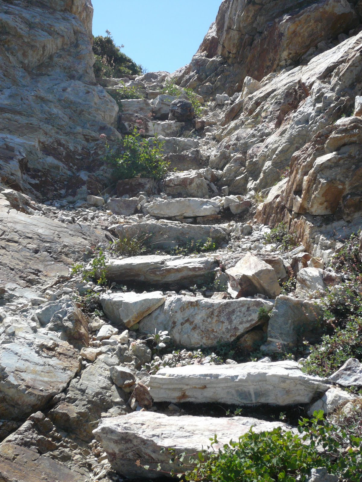
A trail coursed between the pine-mat Manzanita and climbed the slope. Long ago workers had hewn steps through a fissure in the granite.

A few out-of-breath minutes lead me to the remains of the fire lookout: A sixteen by sixteen foot splintery wooden platform perched atop solid rock.

One has to wonder how they got materials up here for this structure, and how they got them to stay grounded over the years of its use.

The view to the north included the abandoned tower at Grouse Lakes – some thirty miles away; and beyond that, another score or more, the tower on the Sierra Buttes appeared as a mere speck.

To the south, the current lookout gleamed in the mid-day sun. I stood next to the platform and waved for a moment or so, thinking Ranger John might like to know I’d arrived.

Lunch involved some dried beef and bottled water on a sun-silvered, splintery perch with a 360 degree view that most will never see. I took some notes and started back down.


BACK AT THE PUMP at Robinson Flat, I drenched my head before donning my helmet. As the vents carried the cool air through, I considered this a good ride, a good walk and a good new discovery. Therefore a really good day.


NOTE:

Photographer Keith Sutter offers some great shots of the Duncan Peak Lookout.  Find his work on line by Googling Duncan Peak Photos.

© 2011
Church of the Open Road Press

Monday, October 4, 2010

WHERE THE PAVEMENT ENDS: FORESTHILL ROAD - ROBINSON FLAT TO SODA SPRINGS

FROM A TINY GUARD STATION measuring about 16 by 16 feet, rangers stood watch over the wild and remote Tahoe Forest while assigned to Robinson Flat. I found this place fifteen years ago. It is where the pavement ends.

Since then, I’ve spent many pleasant afternoons “patrolling” the area with friends: hiking to Duncan Peak for the magnificent panoramic view from the active lookout; traipsing along the edge of a big burn that ran through not long ago; relaxing with a book and a bottle of wine at the edge of the meadow; pumping water from the ancient well and slaking a dusty trail thirst.

The pavement stretches back through Foresthill to Interstate 80. Beyond, the road is a question mark. An inviting sign says: “The Cedars – 17” and “Soda Springs – 25” and the invitation had gone unanswered for a decade and a half. No longer. Today, I would pretend I was stationed at the Flat and patrol the regions to the east, thinking: 25 miles? Piece of cake.


THE BMW GS ADVENTURE is built for anything any road can throw at it. My version has a button that when pushed, elevates and adjusts the suspension so that the bike more smoothly absorbs the bumps and shocks of primitive roads. I once paid less for a house than I did for this bike, so I do not wish to test the limits of the machine – especially in an area where the forest is so thick and the mountains so steep as to restrict helicopter rescue of my broken body. I am glad the road appears smooth.

It appears smooth because it has recently been watered down to limit dust from timber transport operations. It is smooth. Like cake frosting. A guy in a Peterbilt with a load of logs will have no problem. The rear wheel of the Beemer, however, begins a scary imitation of Peggy Fleming, the 1968 gold medalist in figure skating. I determine that I’ll go gingerly for a stint and not be afraid to turn back. In time, the road crosses into a less active logging area. The frosting is replaced by dust. Dust the consistency of cake flour. Smooth. Yes. The road is still smooth, but now it is surfaced in loess – windblown dust – that masks the hard ruts of a summer’s worth of heavy travel. The front wheel seeks a groove I cannot see and cannot steer out of. I drop my feet from the pegs and engage in very dangerous out-rigging.

At one point I stop to find both boots four inches deep in dust and the wheel rims of the great machine buried in the powder. I can’t muscle a turn around, so I plow forward. At an opportune wide spot and I pull over for a rest and a photo. It’s been four and a half miles and 35 minutes, but some on-foot reconnoitering shows the road ahead to be better.

And it is. Soon I find myself in second gear traveling between fifteen and twenty miles an hours. For maybe three hundred yards. Corkscrewing down into a creek drainage, the switchbacks turn wide, steep and gravelly. Counter-intuitively, I must remember to rely more heavily on the rear brake as I tiptoe down the hill. Moving from thick forest, toward the bottom, things level out as the woods have yielded to willows and dried meadow grasses. I crank up but just as quickly I throttle down. Ahead, the road drops twenty-five feet to ford a stream that has recently been crossed. The water is murky. I can’t see the bottom. I edge into it uncertainly, use my feet for outriggers once more and power up and out. The route on the other side looks as if someone bladed it with a bulldozer and called that simple action engineering. The road goes up the side of the stream bank but angles across the slope. Loose rock litters the course. Standing on the pegs, I power up knowing that if I let this thing die, there’ll be no good place to put a foot down and I’ll tumble. It’s about a two hundred yard dash. The suspension absorbs the primitive surface and I can feel rocks being spit from the back wheel. Achieving the top, I stop. Point of no return, I think and then I say aloud: “No way in hell I can go down that slope.”


THE FORMATION OF THE SIERRA is the result of a complex series of events starting as far east as the mid-Atlantic rift zone. As the North American continent is pushed westward, it collides with a static Pacific Plate. Faults and cracks form and through these, volcanic mud is squeezed up covering the surface and filling ancient riverbeds. As the pressure builds, the granitic core of the Sierra tilts as a huge block. Rising to fourteen thousand feet, with the coming of an ice age, glaciers form, chiseling and scrubbing the highest reaches.


For the past eon and a half or so, the relentless uplifting has been battled by relentless wind, rain and ice. Forming in the crevasses, meadows of silt washed down from on high. Ringing those meadows, peaks whose height yield no growing season. In between, forests of fir and pine top lodes of gold bearing quartz. Crossing it all, roads ranging from Interstate 80 to this one.


BEYOND THE CREEK, Foresthill Road scales a minor ridge. Still rough, it is frequented by this season’s deer hunters, thus better traveled and more passable. At the crest, a fine view of the Royal Gorge of the American to the east and Snow Mountain to the north. A quick descent takes me to “the Cedars,” a privately held section of rustic summer homes set about the edge of one of those mountain meadows. A large common building – perhaps a lodge held communally by summer residents invites a visit. But a “No Trespassing – Area Patrolled” sign voids the urge. Wonder whether such trespass was the purview of the ranger back at the Flat?

White cumulus clouds have gathered atop the ridge dividing the enclave of cabins from Soda Springs and I-80. Later in the day it will rain. I really want to miss the storm. I figure I’ll chug forward, but thankfully, the remaining eight miles are graded and the path fast.


THERE ARE TWO THINGS I have experienced in life that I hope never to experience again: knee surgery and divorce. Add to that: Foresthill Road from Robinson Flat to Soda Springs. Nasty, steep, dusty, rutty. But then again, spectacular and subtle. I may have to think this over.

© 2010
Church of the Open Road Press