Showing posts with label Mono County. Show all posts

Saturday, April 21, 2018

EAST SIDE OF THE SIERRA SCENES

… not so Californee-ized as California …

From Inyo to Modoc, something about the east side of the Sierra Cascade is different.  Perhaps those great mountains that keep out the rain keep out something else as well.  Slower in pace than the rest of California – a bit lower in price, too – travelling along US 395 from Ridgecrest to Alturas provides a peek back at times past.  


In early April, we travelled the southern portion from Kramer Junction (with CA 58) to Minden in Nevada’s Carson Valley.


I – Alabama Hills

Outside of Lone Pine, on the way to the trailhead at Whitney Portal – closed in April due to snow – one passes the Alabama Hills.  


A great display of wind-rounded granite or sandstone, one could be excused for thinking Hop-a-long Cassidy might be about to round a bend in the trail, because this is where they filmed him doing so.


John Wayne, Duncan Reynaldo, Gary Cooper and countless others as well.

A museum nearby recounts the Hollywood history of the area and roads and trails allow visitors to believe, for a time, that they are extras if not in a western, then an ad for a Chevy or a Ford truck or a Mazda automobile rooster-tailing dust across the desert.


Watch out!  Perhaps there’s a sidewinder hiding out behind this. (Probably not.  Outside of Sacramenta, they ain't no sidewinders in Californi-ee. - Walter Brennan as a renegade sourdough in a John Ford Western, shot in these parts.)


The April weather turns quickly and the clouds present a real-life drama without the help of lighting or sound technicians.  


A half-day spent here is a half-day well spent.


II – Manzanar “Relocation Center”

I’d been to Manzanar before. (A link to that visit follows this post.)  In August of 2010, the heat seemed unbearable and it was easy to feel how miserable life was for fellow citizens whose only crime was being born with a different color of skin or a different shape of eye.


In April of this year, a nasty north wind blew rain drops horizontally across the landscape peppering us like birdshot and chilling us to the bone.  


The gale beat at the tar paper roofing and siding. Residents were never far from the fierce elements of springtime.  I don’t want to imagine winter.

The National Park Service has reconstructed a few of the crude dormitories, cookhouses and latrines.


And in the substantial gymnasium, built by the hands of those interred, displays speak to life in this high desert and of the misguided thinking that prompted the creation of this and ten other remote and inhospitable places.


As a tiny girl, a one-time colleague of mine spent time at Poston in Arizona.  At age three, it is hard for me to believe that she was ever a threat to the Republic.


III – Bristlecone Pine Forest

When my computer malfunctions, when the tool becomes and obstacle to getting work done, I often slip into use of my second language – profanity – until the problem is resolved or I’ve tossed the thing out the window.  My traveling partner, I came to find out, has a similar reaction to steep, narrow, windy roads without guardrails.

Such is the road to the Ancient Bristlecone Pine Forest.


I stopped for few pictures.


The Visitor’s Center, some 28 miles east of US 395, offers interpretive exhibits when open (it wasn’t, yet) and a couple of easily accessed trials (if you discount the drive up there) to the oldest living things on earth.


Humbling indeed.  Our visit was truncated by the anticipation of the road back down the mountain.  


On my list is a revisit on Enrico, the Yamaha, affording me more time to embrace the truly timeless nature of… …nature.


IV – June Lake Loop

A side trip on the June Lake Loop might be preferable to rocketing up 395.  The loop swings west to the foot of the precipitous tilted fault-block uplift that forms the east side of the Sierra.  Summer homes and ski cabins cluster in the tamarack pines along the edges of high mountain lakes.

Snow melt pours over rocky ledges…


…filling those lakes with pristine water and perfect reflections.


You can’t help but come away with a crick in your neck after looking skyward at the jagged aretes and peaks of the High Sierra: So near and yet so far.


V – Parting Shot

We chose not to visit Mammoth this trip having been advised that is may be a bit too corporatized for its own good.  Fine winter skiing is offered but in the transition from being an out-of-the-way secret to a destination resort, some have suggested Mammoth may have lost a bit of its charm.  The same might be said of much of Tahoe, further north.

I suspect I may have inherited some sort of a latent desert rat gene from Dad.


Thoughts of mountains and valleys and sage and clouds and a little thunder – rather than speedboats and casinos – are all I need to urge me to return to the East Side.


o0o

Notes and Resources:

Along with your DeLorme’s California Atlas and Gazetteeryou should

Read:  The Land of Little Rain by Mary Austin. 1903. Widely available, Mary Austin writes of the area in a beautifully lyrical fashion, providing the reader with a deep view of the geography, natural history and culture that have shaped and are still shaping this Land of Little Rain.  (My copy, Penguin 1988, has an introduction penned by Edward Abbey making the volume a special treat.)

Purchase: At the bookstore in Bishop or, better yet, prior to departure get: Guide to Highway 395: Los Angeles to Reno by Ginny Clark.  Western Trails Publications, P O Box 2485, Lake Havasu, AZ, 86405. Revised 2013. $20.  A few typos but a lot of tidbits of history that’ll make you want to take – rather than pass by – that non-descript turn off.

Pick up: Available at many businesses along 395 are county-specific guides to backcountry roads with travel tips and advice you’d be wise to follow.  Grab these at any visitors center or small business along the route.  They’re free.

And you may want to visit these web links:

Church of the Open Road notes from a previous visit to Manzanar:  http://thechurchoftheopenroad.blogspot.com/2010/08/photo-essay-of-manzanar-relocation-camp.html


This Inyo County website is quite comprehensive with additional inks to click through: Owens Valley / Eastern Sierra Visitors Planning Guide: https://www.theothersideofcalifornia.com/trip-planning/

As is this Mono County website: https://www.monocounty.org

Though we were just passing through, we opted to spend a lay-over day in Bishop.  We should have planned for more.  Central to many alluring attractions both historic and natural, the town is the type of place where you’ll meet a stranger and leave with a new friend.  Nice, affordable and close to some good eating, we stayed at Bishop’s Creekside Inn: http://www.bishopcreeksideinn.com/

© 2018
Church of the Open Road Press

Thursday, October 12, 2017

AUTUMN ON 89 – PART 3


Into the Rain Shadow


Here is the precept this series of three posts will set out to prove: California’s state route 89 is among the most beautiful highway routes in the entire country. 


On a chilly October morning, it’s tough to get out of bed, especially when being nuzzled by a canine heater.  The cozy cabin at Sorensen’s with its knotty pine interior seems an inviting place to hibernate until April.  I asked about this at the front desk but was informed that the resort is pretty much fully booked year round.

Given a distance yet to travel if we were to complete our exploration of California’s State Route 89, an early morning constitutional seemed in order.

The early rays of sunlight illuminate this juniper…

… but in the sheltered mini-canyon of this brook, rocks were layered in ice.


At Woodfords, Highway 89 heads south to Markleeville, seat of Alpine, https://alpinecounty.com/ California’s least populous county and perhaps the only county seat lacking full service banking.  Through town, the road rises to another of those 1800s scenes…


… then follows the East Carson River, another grand playground for the fisherpersons among us…


… where the autumn blossoms from roadside sage (?) contrast with the standing deadwood of a two-years-ago wild fire.  Still, a river runs through it.


Monitor Pass feels like little more than a rise, then fall, of the roadway.  It is marked by a weathering stone marker…


… set among aspens growing on either side of the route.


Clearing that copse of trees, it is clear we’ve moved to the rain shadow of the Sierra.  The lush forests of ten miles back are gone, replaced by largely barren hills dotted with stunted pines and juniper and scruffy brush.  Cattle country, if you don’t run to many of ‘em.


Off to the north, a fire lookout perches atop a wind-worn Leviathan Peak.  A rugged dirt road winds up the hillside.  The Subaru begs us to take it.


About two hundred yards short of the top, a substantial steel pipe gate blocks the road.  We disembark for a little hike.


The view from fire lookouts is always outstanding.  Go figure.


I figure out how to do a panorama shot on my Sony pocket camera only to return home to discover that the computer screen wide enough to do justice to the vista has yet to be invented.


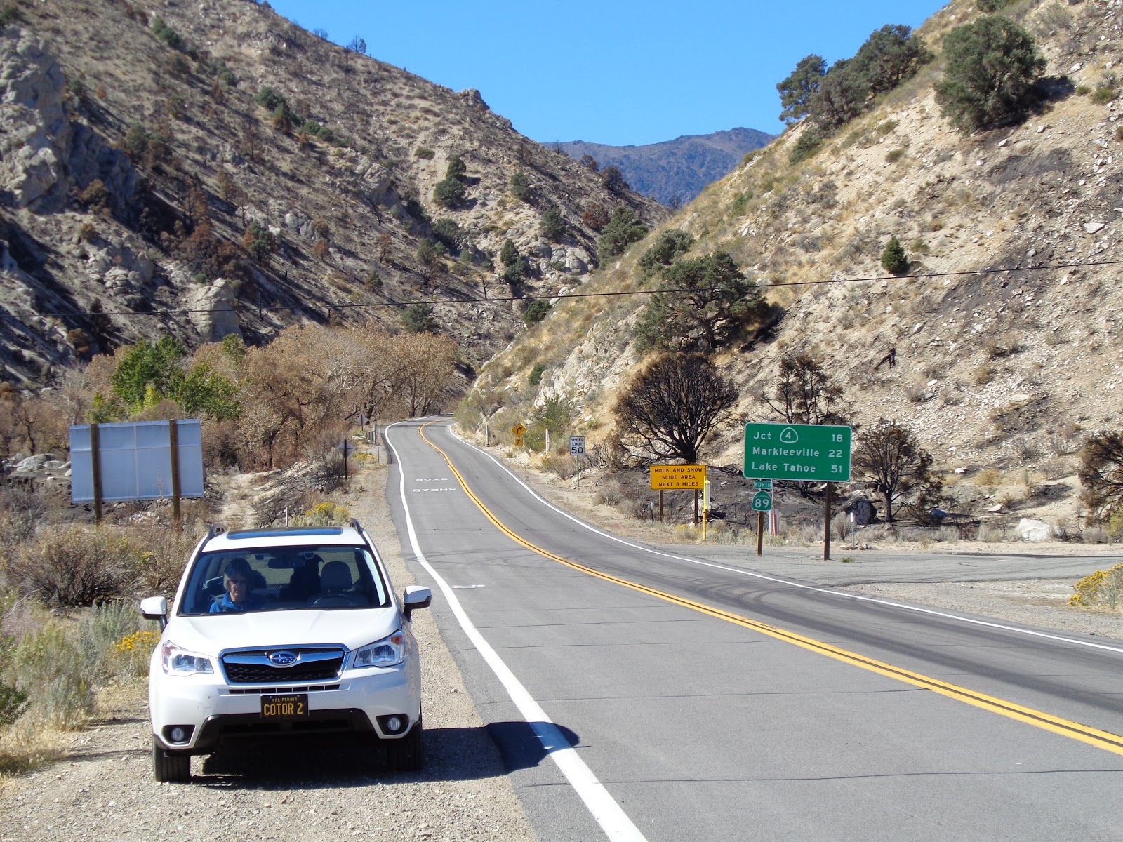
Creeping back down the dirt track and resuming our tour, Highway 89 winds over and around dry, desert ridges, and, in its final few hundred yards, traces a stream course down to the floor of Mono County’s Antelope Valley.

Many times, I’ve seen motorcycle riders throttle through this canyon, ending up on US 395 bearing a grin bright enough that it could be seen through their full-face helmets.  I recall feeling that grin myself after running the route on one motorcycle or another.


But 395 is where this glorious state route ends. 


After more than 300 miles and having visited lumber towns, volcanoes, pristine meadows, snowfields, granite arêtes and countless turns and summits and tastes of history, the premise of the little tour I’d planned held true: State route 89 is among the most beautiful highways in the entire country.

The only question that remains is: How long until I can do this again, heading the other direction?  (…on the bike?)

© 2017
Church of the Open Road Press

Tuesday, October 10, 2017

AUTUMN ON 89 – PART 2


Ishi Country to Hope Valley


Here is the precept this series of three posts will set out to prove: California’s state route 89 is among the most beautiful highway routes in the entire country. 


Fifty-five years ago, Dad was hot on the trail of Ishi, considered the last of the unsullied native North Americans.  Ishi lived in the wilds of both Deer Creek and Mill Creek avoiding contact with the white settlers whose presence caused the demise not only of his Yahi (or Southern Yana) clan, but of all of the continent’s Indian population.  Just a hop, ski and a jump from our home in Chico, Dad would pore over maps and Al and Theodora Kroeber’s work and the journals of emigrants from a hundred years before, trying to discern where and how Ishi and his brethren lived; then with his kids, Dad would strike out into the wilderness to show us where it all happened. 

The one thing I remember is that one summer day, we stopped in at the Mill Creek Lodge where he bought me a root beer popsicle from the freezer on their porch.  Since that day, I’ve always wanted to spend the night in one of their rustic cabins.    This trip, we did.  Recently purchased by a couple of young partners, this off-the-beaten-path hide-away is worthy of a night or two. http://millcreekresort.net/


Highway 89 aligns with State Route 36 in these environs, and our day’s tour would find us motoring east to Lake Almanor, a lovely reservoir that now fills the Almanor Basin. http://www.lakealmanorarea.com/ I’d served at the principal for the little elementary school in Chester some twenty-five years ago, and my own pig-headedness prompted my unceremonious departure from that lovely place. Had I possessed the necessary maturity and professionalism, I’da likely stayed for a career.


Still, Almanor holds a favored spot in my heart for it’s high country surroundings, it’s history of both lumbering and mining, it’s limitless recreational opportunities, it’s clean air and the cleansing nature of it’s night skies.


After breakfast at Anna’s, my favored spot for a slice of Greenville life, and whizzing through Crescent Mills, we veered into the gravel parking area marked by a brown Forest Service sign. 

Countless times I passed a trailhead that I wouldn’t visit until this trip down 89.  Edward, the lab-mix was more than ready to stretch for a bit, and, perhaps lift a leg, were a black oak or digger pine available for the purpose.

The waterfall on Indian Creek dumps into a delightful pool that, I’m sure, come summertime, is thick with folks enjoying the cool waters.

This day, we receive a glimpse of the fall colors to come.

Above the opposite bank, an historic rail line shooting up toward Fall River Mills now supports both the BNSF and the UP.  I can hear the baleful whistle and the low rumble of truck on track echoing through the canyon.

Not far below is the picturesque Keddie Wye, an engineering marvel on the old Feather River Route from early in the 20th century. http://www.american-rails.com/keddie-wye.html


CA 70 follows the Feather River Canyon between Oroville and Quincy.  In itself, Highway 70 is a classic route.  Dad thought he’d teach me how to drive on, until he realized I couldn’t keep his beloved Toyota FJ-40 centered in 70’s winding lanes.

State Route 89 joins this road at the Greenville Wye, heading east through the Plumas County Seat and past several tiny one-time bergs.  Along the way, we pass a unique 360-degree loop engineered by the Western Pacific to raise the rail line on a two percent gradient necessary to make the line from Reno out to Quincy, thence down to Oroville, a reality.  Another engineering marvel.  Can’t really see it from the road, although it does show up on the Subie’s GPS map in the dash.


At Blairsden, 89 breaks south through the historic lumber town of Graeagle – now given over to second homes and golf courses – with a cool general store and fine little café and a string of galleries and shops occupying repurposed 100-year-old company town houses.

South of Graeagle we depart 89, foregoing a trip through Calpine, to enjoy the pristine pools of the Lakes Basin, ringed in lofty granite. http://www.lakesbasin.com/ Gold Lake, itself, is a treasure and the Sierra Buttes are as stunning as any peaks in the range, except few people visit.  That said, the rustic lodges that dot the region are often booked a year in advance.

A previous hike to the lookout atop the Sierra Buttes is recounted here: http://thechurchoftheopenroad.blogspot.com/2011/08/nice-ride-nice-hike-sierra-buttes.html The hike is a dandy and the view a great reward.


In order to rejoin CA 89, we bear east at Bassett’s junction on CA 49 and cross Yuba Pass.

Just over the summit is a view spot filled this day with road repair equipment. 


Normally one gets a stunning view of the Sierra Valley with its pasture lands rimmed in worn, rolling ridges.

Reconnecting with our route, we pass this classic road sign…


…and get a taste of an old west that may still be alive.


Perhaps the most taxing length of State Route 89 is the section that runs through Truckee, down past Squaw Valley and along the west side of Lake Tahoe.  Even on a mid-week day in October, the traffic is heavy and, in some place stop-n-go. 

Truckee’s historic downtown has not been so touristified that it isn’t still a delight – just ask Paul McCartney who has been known to stand in with the band at the corner tavern.  Sadly, we’ve always missed these occasions. 

The UP’s California Zephyr runs on these tracks – although it used to run up the Feather River – and taking this train from Roseville over Donner for an overnight in Truckee is a delight.

Squaw, too, with its history of hosting the 1960 winter games is worth a gander.

We didn’t stop until we arrived at Tahoe’s classic view of Valhalla, the tiny island in the middle of Emerald Bay. 


Cut the population and traffic by 90 percent, and the property costs by about five times that, and I’d consider moving here.


The evening of the second day found us at the incomparable Sorensen’s Resort http://www.sorensensresort.com/ in Hope Valley.  A low October setting sun set the aspen leaves aflame…


… the cozy accommodations…


… and a chill we’d anticipate in the morning.  Glad I packed wool.


More on that in our final installment.

o0o

Next:  Autumn on 89, Part 3: Into the Rain Shadow

© 2017
Church of the Open Road Press