Showing posts with label Lake County. Show all posts

Wednesday, December 23, 2020

FOREST ROADS AND FIRE TRAILS

 …the urge to explore continues…


After calisthenics we were told to jog from the old gym out to Warner Street, tag the fence and run back.  “That’d be about a half a mile,” Coach McDonald said.  I didn’t much care for jogging – still don’t – but did enjoy the run back.  Over the roof line of


Chico High’s gymnasium I could see the foothills and the mountains where the Sierra and the Cascade met.  Feather River country.  In the fall, those far away hills were streaked with the color of changing leaves.  In the winter, cloaked with snow.  Spring would bring a greenness that highlighted the roads scratched through the forests and meadows and into the high country.  Roads I so wanted to explore.


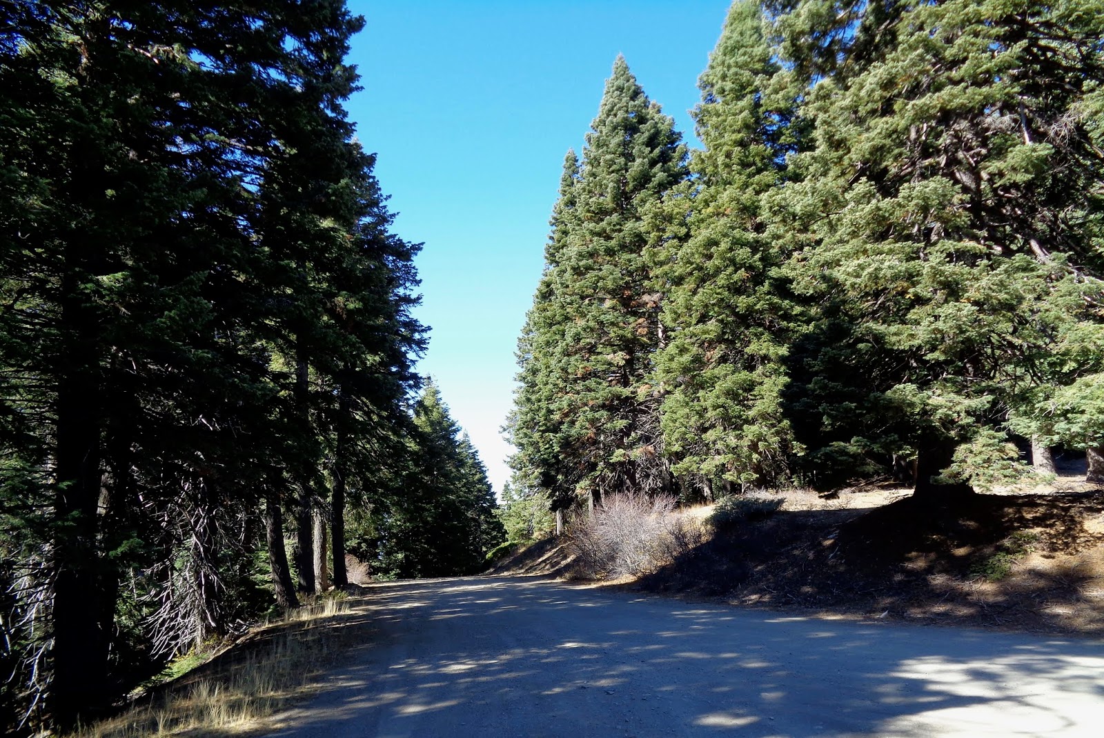
A seven horsepower Honda Trail 90 served as the Golden Hind I’d use to discover the world in my geographical back yard.  Endless summer days were spent putt-putting along forest highways and fire roads in the Plumas and Lassen National forests.  Each day I’d turn at a junction just to see where the dirt track led, and when darkness gathered, I’d make note of the routes I hadn’t opted for and promised to do them next time, perhaps as soon as tomorrow.


Fifty years have passed since those days jogging back to the old gym and mind-wandering about the adventure of an unexplored forest road.  But the fantasy still exists.  


No longer living in Chico – we’ve enjoyed several interim addresses – now I find myself in a small berg in California’s Alexander Valley toward the northern reach of the Russian River.  Looking across to the hills, I can easily see routes and trails carved into the chemise and woodlands of the Mayacamas east of town.  Standing in the driveway after having picked up the morning paper, my gaze toward the rising sun transports me back to those high school days when I wondered, “Where does that one go?”


A paved route called the Hopland Grade traverses the Mayacamas north of us.  We’ve driven it several times.  Like a carnival ride at Disneyland, several signs warn that

if your vehicle is longer than this length, you are prohibited from the route.  Hopland Grade is windy, steep and not quick.  Great fun on a Ducati Monster, not so much on or in anything else.  Near the base of the mountains we choose an intersection with the primitive The Old Toll Road.  Winding along the east side of the Sanal Valley, past industrial strength wine vineyards, the crumbly asphalt soon snakes into the hills, over and back over a seasonal creek, and through stands of black and live oak and madrone. 


Hog wire and rotted-post fences trace the road’s edge. There’s even a point where a metal gate appears – one that if one passed through it, one would soon be hurtling over a cliff.  Pavement gone, the surface is graded to a certain extent, washboarded some and dotted with puddles from a two-nights ago late-autumn storm.  The Subaru takes this road is stride.  As did the Yamaha Super Tenere the other time I was up here.  But something makes me long for my old Trail 90.


The map tells us that atop the spine of the Mayacamas we’ll find Adobe Creek Road, and we do.  The trouble is that at the intersection with Old Toll, Adobe Creek is gated allowing access only to the rancher with the appropriate key – and Cal Fire folks, too, I assume these days.  I suspect the secured road is one I might see from my driveway, several crow-fly miles to the southwest.  We had hoped to head south and join up with Pine Mountain Road which loops back to the Alexander Valley, but that won’t be the case today – if ever.  Ahead a bit, Adobe Creek Road will take us north affording a view of Clear Lake to the east.  At several minor junctions, each fire road is gated and locked. I’m beginning to get the picture that, unlike in our national forests, a lot of these roads-begging-for-exploration are closed to lookie-loos like me.  In these lands of steep hills and dry brush, I can’t fathom what a landowner might be securing behind these barriers – cattle surely wouldn’t do well amongst these thickets and I’m sure there are easier places to grow pot now that it’s legal. 


 The map tells us that Adobe Creek Road traces the line between Mendocino and Lake counties, and that six or seven miles north, we’ll intersect with the Hopland Grade – which we would have had not another damned gate barred our way about three-quarters of a mile on.  Here, we course east on Highland Springs Road, a Lake County thoroughfare that winds down the lee side of the Mayacamas.  The trees are more sparse on this side of the summit and those that dot the hillsides are primarily blue or valley oak.   The road is wider and far less steep owing to the fact that the rains that tear away at these mountains are more prevalent on the other side.  


Twenty minutes further we arrive at a lovely – but rather primitive Lake County public park.  Centered on Highland Springs Reservoir is a rod and gun club, an extensive Frisbee golf set up, tons of picnic spots and a four-mile trail that winds up the canyon then circles around the lake.  Edward the lab-mix was ready for a walk and so were we.  Up the draw, the woods are silent, dark and deep and frost (though not Robert Frost) still glazes the mid-day ground in the shaded areas.  


Gray squirrels leap from branch to branch, taunting the dog, and a lovely pink and brown salamander wriggles across the trail barely escaping my footfall.  Tracking back to the lake, great egrets wade the shore waters, redwing blackbirds flitter amongst the rushes and osprey and red tails circle overhead.  Mallards and coots discuss the problems of their world as they paddle across the surface.  We wish we’d packed a lunch. Edward wishes we’d packed a Frisbee.


Our exploration of the enchanting back roads and dirt tracks seen from the house wasn’t exactly a bust as we learned a lot about the lay of the land.  Clement Salvatore, until recently an entertaining and insightful staple at Rider Magazine, shares that there are at least ten times as many miles of dirt road as there are paved this side of the hundredth meridian.  I wouldn’t disagree.  But many of those miles of roads are unobtainable because they cross privately held stretches of heaven.


Still, there is much to explore.  Perhaps again tomorrow?


There are times when I haven’t been out much on the big Yamaha that I think about a different – smaller, lighter two-wheeler.  My range of interest goes frothe adorable Vespa 300 HPE to the spartan Royal Enfield Himalayan to the newly re-issued Honda CT 125, a descendent of my old Trail 90.  Likewise, I sometimes think the Subaru Forester is a bit stodgy and wouldn’t I prefer a Mini Cooper Convertible or maybe a rugged Jeep Wrangler forgetting what a nightmare my 1990 Wrangler turned out to be.


But, for exploring the high and lost fire roads of Sonoma, Mendocino, and Lake Counties, and for getting me safely (read: “at highway speed”) to and from those dirt roads, it’s tough to beat the two vehicles I have.  Dependable, economical, rugged and fairly comfortable, I recall that many times when I’ve answered the siren song of something more stylish, I’ve been disappointed with the result.  Reference here – along with that Jeep – my short-lived but gorgeous Triumph Thunderbird.


Then there’s this unavoidable positive: Both the Yamaha and the Subaru are paid for. 


© 2020

Church of the Open Road Press

Tuesday, October 22, 2019

YUKI TERRITORY

…exploring a road not-yet-taken…

A blue sky domed the late October day and exploration of a road not-yet-taken called.  Plus, the Subaru was still relatively clean from having been to the car wash three weeks ago: and that simply wasn’t right.  The road in question – one I’d examined on multiple maps – would take me through the heart of Yuki Territory.


When communities of people lived naturally, their universe was, in general, centered on a water course and bounded by the hills and mountains drained by that stream.  Trade, if it occurred, happened because folks crossed the ridge or paddled a distance down river.  Sometimes that resulted in conflict; sometimes simply trade.

I’d first read about the Yuki in a couple of books that exposed the genocide of northern California Native Americans who’d been forced-marched to the Round Valley Reservation near now-a-day’s Covelo.  Geographically, among the closet groups herded to that spot were the Yuki whose ancestral territory centered on a length of the Eel River.  Before European incursion, I read, game was plentiful enough, bulbs and berries and acorns abundant and salmon teemed in the river.  Seemed Eden-esque to me.  I’ve never been sure whether the narrative about Native Americans living in harmony with nature was more truth or myth, but I figured a visit to this remote area of California’s Coast Range might help sway me one way or the other.


I picked up Mendocino Forest Road M1 at Lake Pillsbury.  Unpaved, M1 – also called 1N02 – runs the entire north-south length of the Mendocino National Forest. 


(Fun Fact: No paved road crosses the Mendocino National Forest either north south or east west.  Plan on visiting on your dual-sport or in your 4-by.)

At Cabbage Patch, about four miles northeast of the lake, M1 breaks to the north with signage indicating this is the route to Hull Mountain; but also indicating that Eel River Station is reached by not making this choice.  My Forest Service map says otherwise.


The climb to Hull Mountain is steep and not well graded.  I worry that the Subaru, trusty though it is, with its lower profile “touring tires” on fancy wheels, might be a bit too delicate for this purpose.  I grind over ruts and rocky bumps thankful that I’d left the big Yamaha at home.

A view to the south unfolds in the mirror, but I wait until I reach the spur to Hull Mountain to stop.  A short hike up the service road leads me to a derelict set of stairs…


…the remains of the old fire lookout…


…and a remarkable view of Lake Pillsbury with a sliver of Clear Lake in the distance.


200 yards up the road comes the first marker for the Yuki Wilderness, a roadless area that stretches west from M1 into the depths of the Eel River Valley.  


Glancing back toward Hull Mountain – elevation 6800+, I note that the frost has already tinged the leaves of the deciduous scrub in the area. 


In the view northward, the hills look almost afire…


…perhaps not a good metaphor as just up the road remnants of something not-so-long-ago stand waiting to fall as their anchoring roots rot below the surface.


The scene prompts me to rethink that question of living in harmony with nature.  If a huge fire roared through a couple of centuries back, what could the native Yuki done about it?  On the other hand, given that they didn’t thwart the small lightning caused blazes of eons ago, the forests likely never grew so thick and tall that a big conflagration had the fuel to blow up into a fire storm.  Perhaps our native cousins lived in harmony because there was no other choice.


While the road from Pillsbury to Hull Mountain is primitive, beyond that promontory, it is graded and even engineered with drainage culverts.  Ruts are gone. No bedrock protrudes and I wish I’d been riding the big Yamaha.


I stop for a view to the west where the hills gently slip to the river.  The grasses seem to invite deer and other grazers and I believe the Yuki’s piece of Eden was something worth preserving.  Thus, the Wilderness designation.


Continuing north, I climb through the yellow pine belt and come across the newly established Berryessa – Snow Mountain National Monument.  


The fir and pine sough in the soft breeze offering a sound reminiscent of the old sheep camp, a few miles from here, where family would spend early summer holidays back in the 1960s – across Mendocino Pass from Yuki Territory.

But white folks grazed something here.  


The steel gates are modern, but the tell-tale remnants of nearby timbers rotting into dust suggest cattle had been run up this way since the days of George E White, the would-be baron who orchestrated the demise of the Round Valley Reservation back in the 1860s and 70s.

Breaking out of the forest, M1 gently descends the west-facing shoulder of Etsel Ridge.  Round Valley and Covelo are nestled at the bottom.  I imagine that the distant valley is where the Yuki may have taken shelter – along with deer, bear and the occasional puma concolor – when the snow flew in the high country.


Over the course of the next six or eight miles I wind around the end of the ridge and down through mixed oaks, finally following a creek that will empty into the Eel River at Eel River Station.  I pause for a shot of the one-lane bridge; one I’d walked across a few years back and wondered where the road I’d just traveled came from.


Now I knew.  Yuki Territory.

© 2019
Church of  the Open Road Press

Monday, July 15, 2019

VENTURING OUT TO BLOODY ROCK


A tale of either or

My transgression this day would be nothing compared to those visited upon this place a century and a half ago. The Bloody Rock trail is closed: I hiked on it anyway.

The Eel River commands the third largest river drainage in all of California.  Several Native American groups called specific tracts of this remote, beautiful and largely overlooked region of the Coast Range home.  Skirmishes and scuffles broke out from time to time, but rarely, historians report, were casualties massive.  Issues related to territory developed only after European settlers found value in grasses for grazing cattle and sheep; and that damned gold a bit further north.

A trail guide informs me that the Bloody Rock trail is a 2.4-mile path linking the parking spot on 20N01 to a wide and cool Eel River.  

Initially, the trail is a poorly used slit in a huge field of knee-high wild oat – it’s officially closed, after all.  The seeds and stickers of these grasses lodge in my long pants.  

Into and out of a stream course, I venture into the northern-most scar of last year’s Ranch Fire – the largest, acreage-wise, in California history.  While I’m seeing the footprints of other transgressors who ignored the trail closure, I’m not seeing the outcrop.  I’d read that the rock itself is a mere .5 mile from the trail head. Some 45 minutes on and descending to where I could hear the rapids of the Eel, I realized I’d missed a stitch along the way.  

Mounting a hill, off-trail, I gain a view of the river canyon and see a rock outcropping, but at only about 20 of 30 feet in height – a jumper might end up with some bruises or broken a leg – it doesn’t look like my quarry.  

Backtracking, I figure I’ll need to engage in further book-learning and come back another time.  Cresting a rise and looking through the scorched brush and naked oaks, a basaltic monolith appears to jut out from the edge of the ridge a few hundred yards west.  I clamber off-trail to get a better view: Aha! Bloody Rock, just as it appeared in some old-time photos.


There’s a rugged little stream course between me and the rock; along with a field choked with wild oat and dense with spiny thickets eager to rip at my clothing and flesh.  The fire-scarred ground beneath my feet is pocked with holes in which once grew oaks and digger pines; their stumps reduced to ash even well below the surface.  Each hole is an ankle waiting to be twisted and I’ve only got two ankles.  I’m hiking alone and it’s a mile back to the Subaru. This is why the Forest Service wisely closed the area.

Enough people died in these parts, I reckon, and after a couple of snapshots, I resume the trail and find my way back to the road. Any spur leading to the top of Bloody Rock must have been obscured with weeds, thus invisible to passers-by such as myself.  My exploration was not a failure, this day, but it wasn’t a great success, either. I’ll return some spring when the trail is open, the grass green and the temps more moderate.


The story of Bloody Rock is this: In the fall or winter of 1859, deep in Eel River territory, a group of Yuki – self-exiled from the Round Valley Reservation – tried to befriend and enlist their ancestral foes, the Pomo, in common cause against what was perceived to be a bigger threat: the influx of whites.  The Pomo rebuffed the offer and, in turn, shared their chumaia (enemies’) plans with the European settlers.  The Americans sought to quell this insurrection and, according to Stephen Powers (1873?), chased the band the over the hills and through the Eel’s canyon, killing many.  A group of 30 or 40 (some say about 65) took refuge atop a basaltic promontory overlooking the river.  A dozen or so settlers cut off the Yuki’s retreat and… 

“…Hemmed in on one side, headed off on another, half-crazed by sleepless nights and days of terror, the fleeing ‘savages’ did a thing that was little short of madness…”. They were offered three alternatives: “Either continue to fight and be picked off one by one, continue to truce, return to Round Valley and perish from hunger, or lock hands and leap down off the bowlder [sic]”

“They advanced to the brow of the mighty bowlder, joined hands together, then commenced their death song…” ultimately, “with one sharp cry of strong and grim human suffering,” leapt down to their death.

Source: Stephen A Powers, The Tribes of California, 
originally published 1876 (?), page 138.
Quoted in: Frank Baumgardner Killing for Land in Early California, 
Algora Publishing, 2006, page 259-60;
 (out of print, but available to the persistent)


While websites such as Find a Grave suggest that “many years later the bones of the Indians were still in evidence at the bottom of Bloody Rock,” some others – archeologists and paleontologists – report that no such remains were ever found.  It is known that none of these Yuki ever returned to the reservation at Round Valley leading to one of two conclusions. Either:

a)   The Natives chose the course of the “noble savage” [that term from Powers] and engaged in mass suicide, or
b)  The people were coaxed down from the rock and executed at various, undisclosed locations throughout the wilds of the Eel.

The former offers good theater; the latter, an example of how a culture of superior weaponry and technology can overwhelm and eradicate a culture with lesser tools. *  

Notes: 

The Church of the Open Road discourages folks from hiking on closed trails.  I shouldn’t have engaged in this activity.

Although I chose to take the Subaru, the Mendocino National Forest maintains miles of delightful dual-sport and/or adventure touring roads: nicely graded, wide, gorgeous views and little traveled.  Next time I’m bringing Enrico, the Yamaha.

Here is a link to a Bloody Rock Trail guide:    https://www.alltrails.com/trail/us/california/bloody-rock-trail  Their “getting there” tab serves as my “Today’s Route.”

Here is a link to the “Find a Grave” listing of Bloody Rock:    https://www.findagrave.com/memorial/104167874/65_yuki_indians-killed_at_bloody_rock

*  This little journey prompted me to ask myself: As human history repeats and repeats itself, is it any wonder that countries like Iran and North Korea seek membership in the club of nations armed with nuclear weaponry?

© 2019
Church of the Open Road Press

Monday, April 29, 2019

DINING DESTINATION IN LAKE COUNTY, CA

Upper Lake’s Blue Wing Saloon

file photo from an earlier lunch visit
Two-thirds of the way between Chico, where we spend the occasional Sunday with grandkids, and home in Cloverdale we find the Blue Wing Saloon. Located on Upper Lake, CA’s short and historic Main Street, it has proven to be our dinner-stop location of choice on this drive.  Locally sourced meats and greens, the bison burger is a lunch-time favorite, but last night’s (a Sunday) grilled pork chop was perfect with a glass of Lake County Pinot.

But wait!  There’s more! We happened in around 7:00 PM to unexpectedly find a trio – piano, bass and voice – soothingly performing standards from the great American songbook.  Local musicians, each, they added an already scrumptious dinner in the historic bar/dining room.  The pianist who claims to farm weeds (not weed) just north of town played Hogey Carmichael’s “Stardust,” the only song my dad ever tried to play on the piano [insert flood of memories here] while the classically-trained emigre from Japan “back in the 70s,” she told us, provided the lyrics. Thus, once home I found I’d been offered the soundtrack for a night’s dreams.

Next door – across a cool and lovely outdoor dining venue – is the historic and rebuilt Tallman Hotel. A grand option given the wide selection of whiskeys behind the bar at the Blue Wing that I couldn’t sample knowing I had a seventy-minute drive yet to come.

Rather than being just a place to break up a long drive,  the combination of these two establishments will make an oft-overlooked and oft-passed-right-through Upper Lake a destination for us in the very near future.

o0o

The Blue Wing has a comprehensive wine list, micro-brews on tap, a continually changing seasonal menu and great service – all in an historic setting that makes you feel as if you’ve been transported back in time a good hundred years or so.  Check it out…  https://tallmanhotel.com/blue-wing-saloon/  


© 2019
Church of the Open Road Press