Showing posts with label Local History. Show all posts

Wednesday, May 28, 2025

ANOTHER RETURN TO SIMPSON CAMP

 …a Memorial Day Tradition…


On or about Memorial Day in good years, I’ll make the trek up to Simpson Camp (western edge Glenn County near Mendocino Pass) with a loved one or a few to reminisce about 1960s-era visits to that old sheep camp with the sheepherder who worked the area forty years before. [Details are recounted in “Eden Indeed: Tales Truths and Fabrications of a Small Town Boy” pages 186-203] Our family reveled and relaxed in the beauty and solitude of the cool evergreen forests, velvet soft glades and clear starry nights. 

     In 2020, we fulfilled one of Mom’s final wishes and held a memorial for her at Simpson Camp, leaving her beloved shillelagh tucked beneath a fallen timber. Within months, the devastating August Complex fire roared through searing the trees, wiping out any sign of the camp, and leaving only a trace of white ash where Mom’s stick had lain.  


Back in the sixties, a small cluster of oak trees grew at the top of the ridge, visible from camp. Dad said it looked like a Greek Chorus, whatever that was. On a clear day, standing near to those oaks, looking west, one could see the fogbank of the Pacific shore; looking east, Lassen Peak: the whole of my northern California growings-up. As we lunched after Mom’s memorial, I called a granddaughter and a nephew to visit that stand where they watched as I drove a wooden stake in the ground, observing the knowing nods of those from the next generation.


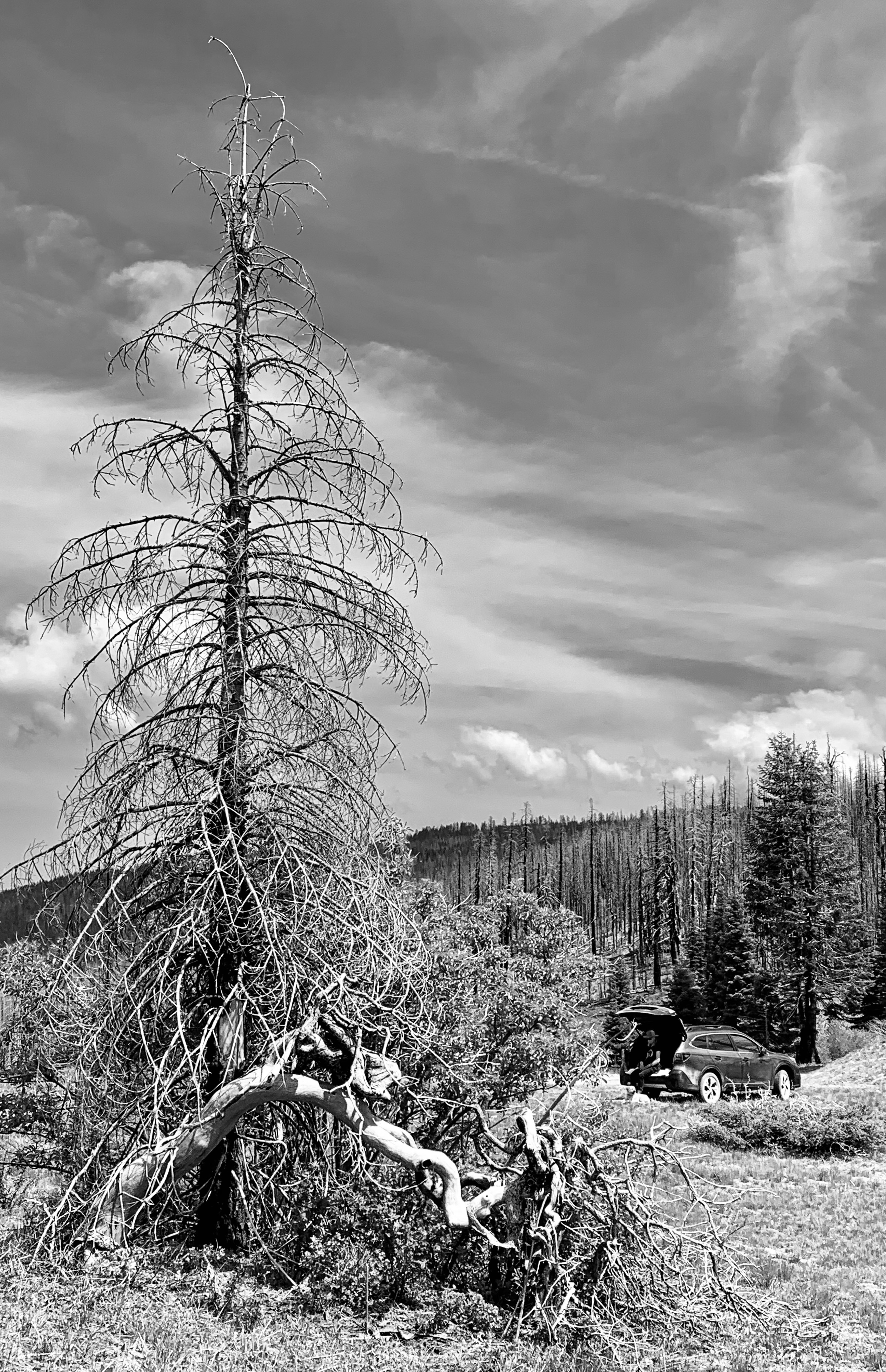
This recent visit found the old camp regenerating. Amid the blackened spires of standing deadwood, thickets of gooseberry and chemise were taking hold. The meadow was back and foresters were awork downing some of the standing deadwood and yarding it into piles for later care; all under the ever watchful gazes of a couple of circling red tails.

     Curiously, that copse of tiny oaks had somehow survived the great fire. My stake in the ground was still my stake in the ground, confirming that, at some time-point in the future, I’ll witness ~ and be one with ~ the rebirth of Simpson Camp.


Photo Album 2025


Stepping out of the car at the top of the ridge.


Life returns to the meadow.


Someone has replaced the Zibe’s sign lost in the fire. (I had hoped to do this.)


 Nail of particular importance (see page 201-02)


Jethro waits for Dad (me) who needed an 'alone-time' moment back at camp.


Final view of the road winding down the hill.


My stake in the ground.

© 2025

Church of the Open Road Press

Sunday, June 2, 2024

OLD HAUNT

 …first in a series of stories from a recent road trip


My pal and I powered up the roughly paved road to the Paxton Hotel about mid-afternoon.  It would be my first real visit in about 65 years.  Or would it be a visit at all?


         As we set our Moto Guzzis on their side stands, a furious looking someone steamed in our direction from a nearby cabin.  

         “Just the man I was lookin’ for,” I said before he could utter a word.

         “Huh?”

         “Yeah.  You run this place?” I asked.

         “Security and stuff,” he said.  “Who wants to know?”

         I’d unzipped my bike’s tail pack and slipped out a copy Eden, Indeed: Tales, Truths and Fabrications of a Small Town Boy.  [Available by special order through your neighborhood independent bookseller – or through that online company that starts with an A.]  “Here,” I said.


         Whatever steam he had boiled up began to dissipate.  “What’s this?

         “A book I wrote about growing up in Chico. There’s a story in there [starting on page 48] about the time Dad stopped in here for a beer ‘cause he was tired of hearin’ me and my brother squabble in the back seat of the car.”  

         Security and Stuff crimped an eye and began thumbing through pages.

         “The barkeep served up Dad’s beer and then scared the crap out of me with a story about a ghost woman who sat in a rocking chair all night.”

         The man grinned.  “That rocker’s right there on the porch.” He pointed.  “Go take a look.”  

         I climbed up the stairs and snapped a picture or two.  Frankly, the chair didn’t look exactly like or old enough to be the one in question, but I’d been seven at the time of my other visit and memories can be fuzzy.  


         “Would you like to see what they’ve done to the place?”  I wondered who ‘they’ was and how many ‘theys’ there’d been in the past six decades.

         The entrance was not as I remembered.  No shaft of light illuminated a tired wooden floor or tattered rug when he opened the door.  I didn’t see the upright piano or the moth-eaten American flag.  The filmy curtains were gone and the windows seemed to close, which they didn’t do before.  It seems a lot of work had been done and redone to freshen things up.  The bar was polished and clean – no cigarette butts filled ashtrays – and the kitchen looked commercial and modern.  

         “If you’ve got a minute, I’ll show you the widow’s watch.  You wanna see it?”

         “Sure!”  

         I was expecting to head upstairs, but instead squeezed through a narrow portal and clumped down a darkened set of stairs.  The walls had no interior plaster or sheathing, just rough two-by-fours with light slipping through cracks in the exterior planking.  The air smelled of dust and mildew aged a century or more.  

         As we clambered down, he explained: “Sorry to be so gruff up there.  This is private property and I just ran off five guys and a gal who seemed pretty high on something.  Didn’t understand the term private.  Got into quite an argument.  Made me kinda edgy.  Sheriff can’t respond too quickly in this neck of the canyon.  Distance and all.”

         We pushed through a narrow passage with a grubby, littered floor with poor footing.  Opening a door that he must have located by feel alone he said, “Here’s where they found that rocking chair.”  Then he pointed at a pair of windows that didn’t quite close.  “That’s where she was lookin’ out.”


         I stepped around a weary settee that might have survived a trip around the horn and peered through the dusty, wrinkled glass.  “You can’t see the tracks from here.  Aren’t they up the hill?”


         “Yeah. It doesn’t make sense, does it?  But this is where they say they found what they think was the old gal’s chair.”  I again wondered about ‘they.’  

         He opened a door and now sunlight flooded in.  We stepped outside finding ourselves at the basement of the grand old building.  The Feather River rushed by in the ravine a hundred or so feet below us, its current offering an age-old whisper.  Although we could see Highway 70, the old Western Pacific Line was nowhere in sight.


         He thumbed through the book.  “So you grew up in Chico?”

         “Yep.”

         “So did I.  Chico High.  Class of ’79.”  He offered a bit more bio.  Father was a lawyer.  He, himself, flew fixed wing transport until he retired a few years back and moved home.  Came to do this for lack of anything better.  Enjoyed the place and the job; not so much having to run folks off.


The Paxton Hotel is now used for special occasions like weddings and such.  Rooms aren’t available to passers-through, but we were told we could stop by any time.

         As my pal and I puttered down the road back to the highway, I wasn’t sure I’d seen the actual chair – at least it wasn’t the one I remembered – or visited the actual window where the ghost lady would rock at midnight “Waitin’, just waitin’ for her true love to return.”  

         But I was sure I’d visited an old haunt.


© 2024

Church of the Open Road Press

Tuesday, April 12, 2022

THE ARMSTRONG REDWOODS RETURN

…and We Return to Armstrong Redwoods


A year-and-a-half ago, the Walbridge Fire surged, burned and seemingly ravaged Armstrong Redwoods State Park just outside of Guerneville.  Many living throughout Sonoma County and beyond recall stinging eyes and choking air brought about by smoke that that hung in the atmosphere for weeks.


As the conflagration raged over vineyards and pastures, hillsides and dales, the fire swept through the Austin Creek Preserve and crept down the hill into the priceless redwood grove that has always been an area treasure.  Monitoring the fire’s progress on the radio was much like listening to a late-night baseball game where team Redwood was being routed by team Inferno.  What would remain when all was said and done?


Well, the good news is that the treasure survived.  On a recent weekday Candi, Edward (our dear old Aussie-lab mix) and I dropped by to check things out.  The lovely trail from the entrance station to the Colonel Armstrong tree has been refurbished. At 1400-years-old, the Colonel Armstrong appears fabulous: a sentinel tall, strong and steady (and looking not a day over 1200.)  


The trail to the picnic area has been cleared as well. While the Walbridge Fire impacted the hillsides and meadows further up and some the park’s forest floor, the resiliency of the Sequoia stand is evident.  Far from devastated, many of the trees in the lower reaches, though scorched, again provide a canopy of deep green. Redwood shoots ~ some already as tall as six feet ~ are springing out of ancient burls and stumps. Ferns and other forest flora are reestablishing themselves illuminated, in places, by those shafts of sunlight that make redwood forests so ethereal and cathedral-like. On our visit, the air was still and cool and sweet, the voices of other visitors hushed, because that’s what you do in a cathedral, right?  


Getting there:  North of Santa Rosa, exit US 101 at River Road; west to Guerneville; north on Armstrong Woods Road to entrance station. $10 day use fee, waived with a State Park Annual Pass ~ available at the gate. Lower trails are cleared and open, but Edward (the dog) was restricted to walking (on leash) only on paved roads.  Pack a picnic, bring water and grandkids. Neighboring Austin Creek Preserve (up the hill) is still closed.  


As an aside:  When on a motorcycle ride in our area, frequently, I’ll stop, dismount and wander a few yards into one of our many redwood groves, just to listen to the angels whisper.  It’s good to know those angels have returned to Armstrong Redwoods.  Perhaps they never left.


© 2022

Church of the Open Road Press

Monday, February 14, 2022

THE GREAT REDWOOD TRAIL: DREAMS AND CHALLENGES

 Part 3 (of 3):  Rails to Trails in Our Backyard


In my garage rests a beautiful Peugeot ten-speed that I purchased new in 1972.  Back then I used it to commute to class at Chico State and later, occasionally, to my teaching assignment eight miles south in Durham on a bike path that once was the route of the Sacramento Northern Railway. 


         So, the idea of a hiking/biking path from Cloverdale to Humboldt Bay sets my mind to dreaming of hopping on the Peugeot and pedaling the entire distance.  Imagine! Following the route of the old Northwestern Pacific through vineyards and foothills to Ukiah and Willits then though the rugged and remote Eel River canyon, tunneling beneath stands of redwoods and madrone, ultimately arriving at the coast with its sea gull calls and wisps of salt air.  [Understand that I get a bit tuckered out just cycling back from the coffee joint just a few blocks downtown, but that’s beside the point.]


In the early 1900s, the NWP appeared to be a good transportation idea, one that would link the Eureka area with the outside world, sending redwood south and agricultural goods, manufactured products, and tourists north.  But geology, geomorphology, and weather ~ essentially Mother Nature, herself ~ had other ideas.  So, railbanking the route (preserving the grade but no longer enabling rail traffic) and repurposing it as a recreational trail seems a good use of her remains.  

         A roadblock may be around the bend, however.  A group interested in transporting coal from Wyoming’s Powder River Basin (Hey!  That’s Walt Longmire’s neck of the woods!) to export markets in Asia has proposed revitalizing the old NWP as a critical link from the Union Pacific right-of-way near Suisun to a yet-to-be-built transshipment facility at Humboldt Bay.  Called the North Coast Railroad Company, the group has filed formal opposition to the proposal to railbank the old NWP route and convert it to trail.  The Company intends to acquire the line “and restore it to operating condition to support future, high-volume traffic flows.” The company claims that it has $1.2 billion in their pocket(s), but those in the know suggest it would cost twice that to restore the line.  


        Political leaders ranging from local city council members to area Congress-folk are lining up against the efforts to return freight traffic for a couple of reasons.  1) Globally, the growing belief that burning fossil fuel such as coal is harmful to the planet; and 2) locally, the persnickety nature of Mother Nature and her inclination to toss a trainload of subbituminous coal into the Eel in the event of a track failure or landslide.  

         It will be interesting to see if the coal train somehow derails the Great Redwood Trail.


Absent the above, it may be ten or more years before the Great Redwood Trail comes fully to fruition.  In those years, issues like the protection of neighboring property, accommodation of overnight campers, infrastructure maintenance and trail security will be addressed and resolved.  However, given that time frame, my dream of pedaling from here to Eureka on a then-60-year-old bicycle ~ at age 80-plus myself ~ may always be just a dream.  

         But that old Peugeot is a darned good bike and I have a strapping grandkid or two who’ll be about 25 at the time. 


Hmmmm…  Guess who might be getting an antique ten speed and, along with that, a mission…


Resources:

For more information on the history of the Northwestern Pacific Railroad, check out: http://www.nwprrhs.org/history.html

For progress and details on the Great Redwood Trail, see:  http://www.thegreatredwoodtrail.org


© 2022

Church of the Open Road Press

Thursday, January 27, 2022

THE GREAT REDWOOD TRAIL: A BRIEF HISTORY OF THE NORTHWESTERN PACIFIC RAILROAD

 Part 1 (of 3):  Rails to Trails in our Backyard


In Northwest California lie Humboldt and Mendocino Counties.  The region, with its steep terrain and large redwood forests, remained isolated from the rest of California until the completion of the Northwestern Pacific Railroad (NWP) in 1914.  After being settled by immigrants in the 1850s, the coastal regions of both counties were easily accessed by sea, but an overland route was slow and difficult to traverse.  Particularly vexing was the transport of redwood lumber ~ often referred to as “red gold” ~ from area mills to San Francisco markets.  In the 1850s, doghole schooners were the main vehicle for shipment, but mill owners were only paid once their timber arrived in port.  When a ship went down ~ as happened frequently ~ so went the profit.


         In 1884, two Humboldt mill owners, John Vance and William Carson (…recall Eureka’s elegant and gingerbready Carson mansion?  Same guy…) joined forces to begin a railroad that would connect Eureka with the outside world.  A rail line was constructed to link Eureka with Fortuna and Rohnerville.  Fifteen years later, the Pacific Lumber Company in Scotia began building lines south into the Eel River. Soon the area was webbed with tracks servicing mills and towns, but shortly after the turn of the century, none were yet connected to the economic hub of the San Francisco Bay Area. 

         Enter the owners of the Santa Fe and the Southern Pacific.  In 1906, they joined into an agreement that would link the north country lines with those owned by the S.P. which already extended from the Bay to Willits.  The trick would be to construct something through the rugged and remote Eel River Canyon.


         Over the next seven years, crews prepared grade, built bridges, bored tunnels and laid track along the river course finally driving a “golden spike” at Cain Rock in 1914.  At a cost of $14 million dollars the rail line was finished.


But the fun was just beginning.  California’s Coast Range is a complex mixture of geologic features.  Mother Nature’s favorite toys, tectonics, volcanism, and the weather, play havoc with the plans of mere humans.  Movement along faults and fissures like to nudge and sometimes shatter stuff we build in the coastal mountains.  Huge plugs of basalt speak to her volcanic past.  And, at cut banks we can see today, bent and tilted layers of unstable clay indicate that the NWP traverses an ancient, ever-uplifting ocean floor.  (So does US 101.)

         Heavy winter rains, working in concert with these elements caused bridges to wash out, tunnels to collapse and rails to give way under the weight of passing freights. Like dots on a timeline of misfortune, one washout or collapse was soon followed by another.  Among the more notable?  In a 1964 flood ~ one that some of us may remember ~ the entire rail route through the canyon was washed away. Remnants of fallen rail cars can still be found in the riverbed.  Tenaciously, the tracks were rebuilt.  Then in 1978, the tunnel at Island Mountain caught fire ~ arson is still suspected ~ and the redwood ties and tunnel support structure burned, collapsing the thing. That, too, was repaired.

         But the die was cast.  While shipping lumber by rail was cheaper and more efficient than by schooner, it wasn’t much more reliable.  Construction cost for the route proved to be a fraction of the cost of keeping things up and running.  Plus, with the advent of the state and federal highway systems, diesel trucks proved more reliable and more flexible in getting product to market.


         70 years battling the greater forces of Mother Nature proved to be enough ~ she always wins, doesn’t she?  The last NWP train ran on the northern line in 1984.  


What might become of an abandoned rail line through such a scenic ~ yet unstable ~ corridor?


Reference:   Northwestern Pacific Railroad: Eureka to Willits.  Susan O’Hara and Alex Service.  Arcadia Publishing.  2013. $22.  (Locally available, this is a delightful book with tons of information and lots of old photos.)


Next:             The Great Redwood Trail: Concept and Proposal

© 2022 

Church of the Open Road Press

Monday, May 25, 2020

A STOP ALONG CALIFORNIA’S “TRAIL OF TEARS”

... remembering (and sharing) forgotten histories ...

California’s own “Trail of Tears” crosses Mendocino Pass where Glenn, Tehema and Mendocino Counties come together.  Stretching from embarkation points (like Camp Far West – now inundated – in Yuba County), native peoples from the valley and Sierran foothills – Maidu, Yana, Konkow, Wintu, Nomlaki, among others – were forcibly marched along this route to a reservation in what is now known as Round Valley.  Their story is devastatingly tragic.

Fifty years ago, with an old sheepherder from our neighborhood, Mom and Dad took the family to camp annually at the base of a high-county glade perhaps three miles distant from the pass. Sleeping under billions of stars, for several Memorial Day weekends, we heard the tales from the old sheep man who, as a kid, summered livestock up that way: tales of hustling sheep up the Grindstone Trail using old Model Ts, of mountain lions taking one or two head a week, of Saturday night “hooplas over ta Smith Camp...”

I only found out about the “Trail of Tears” while working on the Maidu Interpretive Center, a first-peoples museum built next to an elementary school where I once served in Roseville.  That discovery prompted me to try to find our old camp spot, which after several attempts, I did.  It turns out: the road to our old stompin’ ground IS the old “California Trail of Tears.”

I have long wanted to take a couple of next generations to that pristine and sacred spot and share some of the old man’s stories (and, now, a few more) with my children and grandchildren.  


Mom died in October of ’17.  On Memorial Day weekend, those newer generations met at the sheep camp to set Mom free and to hear a story or two.  

Returning home, a mark was checked next to an entry on this old man’s bucket list.  A dream had come true.  I hope they’ll visit again...

(c) 2020
Church of the Open Road Press

Wednesday, May 20, 2020

THE GEYSERS ROAD LOOP

...What has magma done for you lately? ... 

I like riding when the clouds give some texture to the sky.  A day or two after a storm when the white fair-weather cumulus float across a deep azure backdrop.  I like riding all the other times, too, but the clouds were terrific this day.


I hadn’t been out on Enrico, the Yamaha for a while.  Chores.  Priorities.  No destination diners open to eat during the pandemic.  All excuses.  There comes a time, however, when “I gotta keep my skills up” overrides all the other excuses.

That, and those clouds, conspired to get me suited up and in the saddle.


Geysers Road, looping from Cloverdale, tracing Big Sulphur Creek, skirting Geyser Peak and descending into the Alexander Valley near Healdsburg offers a trip through time, history, geology, fire science, crumbling infrastructure and viticulture all in about 35 glorious miles.  Along the way, we glimpse the largest geothermal power facility on the planet.

The route begins northeast of Cloverdale at the Geysers Road exit from US 101.  Winding along a rushing Russian River, we head east at the confluence of Big Sulphur Creek.  


Time and nature have not been kind to this section of off-again, on-again pavement.  Heavy winters, slippery clay soil, rising and falling water flows all wear away at a route that is so little used that maintenance seems always to be relegated to the bottom of the list.


In some stretches the pavement are two-lanes wide and double-lined striped. A hundred yards later, the pavement could be gone, and the route reduced to a narrow strip along an eye-popping canyon wall.

Then back to pastoral hillsides dotted with oaks frequented by crows and scrub jays.

We cross a century-old steel bridge, the likes of which can be found on many lost routes in the west.


Climbing out of a portion of stream valley, we see remnants of mining operations from back when quicksilver was needed in the process of refining gold from its ore.  


Gold, more prevalent in the Sierra; necessary mercury found in and about the Clear Lake region of the Coast Range.


Thirteen miles on, a fork offers the choice of heading to the geothermal facilities.  


Roads spiderweb across the opposite ridge leading to many plants positioned on the opposite ridge.  Pipes and powerlines complete the intricate and curious line drawing.  Access is locked away from us.

CalPine photo

A hundred and forty years back, steam was discovered rising from fractures in the earth. Water, seeping across otherwise impermeable layers of rock, slip into cracks and drizzle onto superheated magma, not far below the surface. A mystic and eerie phenomenon was created, sacred to native Americans and to be exploited by their European followers.

Sonoma County Historical Society Archive photo

A hotel was constructed – which later burned, twice – and water was bottled for its healing properties.

CalPine photo

Now administered by CalPine Corporation, their website (see below) tells the story of what appears to be a model of magma-incited, clean, renewable energy production. 

CalPine graphic


But not perfect energy production.  In October of ’19, during a spate of 100-mile-per-hour gales cresting the ridge, a hot high-tension transmission line arced spawning the devilish Kincaid Fire that, in a matter of hours, raced across the Mayacamas and into stream courses...


...searing all within its path, including Mercuryville (population 2)...

Purloined from somewhere else photo

...and taking with it the sign I remember from a previous ride up this way.

From the eastern flank of Geyser Peak, it is easy to spot the fire, ranch and mineral access roads that web the hillside. One wonders when that first stretch of Geysers Road will be left to crumble to the same state.


The fire blazed hotter and with more ferocity and abandon than a presidential campaign rally, threatening Geyserville – a quaint throw-back farming community in the Alexander Valley, and Healdsburg – the up-scale mecca of shops, tasting rooms and Teslas.  It was only through the heroic actions of legions of firefighters from near and far, that the sleepy bedroom community of Windsor was saved.  More than one fire captain admitted, later, that he didn’t think they could do it.  Living near-by, I’ll never forget the smoke.


Geysers Road on this side of the route provides preferred access to the geothermal plants.  Wider, guard-railed, better paved, it winds through higher pastures which give way to vineyards...


...and superlative views of the verdant Alexander Valley below.  Healdsburg is twenty-five miles from the junction, but it is difficult to not stop and take just one more photo of the developing scene.


Did I mention the clouds?

o0o

Resource:  Information, including facility tour info may be accessed at: https://geysers.com  Worth a look!

(c) 2020
Church of the Open Road Press