Showing posts with label Lassen Trail. Show all posts

Wednesday, November 12, 2014

YET MORE STUFF BY THE SIDE OF THE ROAD


Exploring NE California’s High Lonesome
Part 3 of 3

Every road trip contains a narrative or two: a story about the history of an area or sweep of the pavement or the emotions associated with traveling through space and time on two (or more) wheels.  Some photographs may enhance the narrative.  Some don’t fit into the storyline, but you find yourself with them anyway.

Here are photos captured in the latest trip to Northeastern California, as well as a few shots of the area from earlier trips.

This old barn is Chester, California.  It has graced the margin of Lake Almanor since before there was a Lake Almanor.  

I never took a picture of the ol’ gal when I lived in that neck of the woods twenty years back.

In Adin, California, an old saddle deteriorates on a fence rail behind the General Store.  Here it rested four years ago.

Here it is in early November of 2014.

From across CA 139, Adin’s Main Street, a buck watches intently hoping that thing I have in my hand only shoots pictures.
No this is NOT yard statuary.

Niles is a big name in Alturas.  I’ll have to do some research as to why.  They’ve named a hotel, a cafĂ© and the picture show after Mr. Niles.  The art deco style neon sign that lit the street in 2009…

Still does in 2014.

I’m a sucker for old doors that may no longer be in use, frequently wondering where they once led…


I’m a sucker for old trucks, too.  I think this WWII era Dodge Power Wagon could tell a few tales to one of those new-fangled Dodge Rams the boys up this way seem to be so enamored with.

"Yeah, well, back in MY day..."

The family’s been visiting Mount Lassen and environs for over 50 years…

"Dad."  Photo by Dr. Wes Dempsey, circa 1966
After the first snowfall in November she looked particularly pristine.

Viewed from the Antelope Mtn. Lookout northwest of Susanville.

Years ago, I was exploring the Lassen Cut-Off from the old Applegate Trail.  Lassen guided immigrants who’d started on the Oregon Trail but who were bound for California.  About 10:00 AM one June morning, west of Fandango Pass, this barn caught my eye.

Last week, here’s how the old girl looked at dusk.


One never knows what one might find that will set the mind to imagining…

What detail might be overlooked by the hurried…

Carving in west-facing facet of Von Schmidt marker post.
That’s why we need to heed the road sign that points to the road less traveled…

Delighting in what we might discover over the next rise…

Or around the next bend.

© 2104
Church of the Open Road Press

Saturday, November 8, 2014

ON THE BARREL SPRINGS BACK COUNTRY BYWAY


Exploring NE California’s High Lonesome
Part 1 of 3

There’s a place in the Golden State that is not of the Golden State.  It is a region where the summer’s air is clear and sweet and the winters come with teeth in them.  Traffic might consist of an F-350 towing a gooseneck stock trailer.  Heavy traffic would be two of ‘em.

The people who live in these parts must be rugged.  They must be self-reliant.  They must care for the land – for that’s their wellspring – and for one another. 


The Barrel Springs Back Country Byway offers a glorious tour with windows into both our recent and prehistoric pasts.  It begins up in Modoc County at Cedarville, California.  The Bureau of Land Management in offers a self-guiding booklet highlighting details one would surely drive right past.

Heading east on CA 299 we are well warned of those circumstances the locals must take for granted.  They carry fuel.  And, quite probably, blankets.

This being November, at 4650 feet, Cedarville and the Surprise Valley have been kissed by frost.  Yellow leaves on the town’s windbreak trees contrast with the deep browns of the basaltic cliffs.

The area’s geologic history is a story of volcanism whose chapters will continue to be written long after time ends.  To the south of the state route in the middle of a dry alkali lake, a thermal creates steam accented by the low mid-autumn sun.

Over a crest, the pavement ends, as does the State of California.

Although the rough topography does not.  The great basin and range of the United States’ west begins in this region, hummocking the landscape from here to Colorado.  Nevada route 8A proves quite serviceable.

The 49ers hopscotched over these parts in their press westward.  Volcanic mud cones may have sparked curiosity, but the sourdoughs had more important things on their mind.


The map provided in the guide is sketchy and doesn’t correspond too well with either those provided by AAA or the USGS.  Signs along the way confirm that we’re not lost.  Knowing that we were on the road to Vya – listed as a ghost town – and that it was only two miles further – was exciting.  We looked forward to getting out and exploring the ruins.

Within that short stretch a billboard – a billboard out here?!? – advertises vacationing in what didn’t exactly look like the garden spot of the entire west.

Turns out the “ghost town” consists of a few buildings paired on either side of the road and all on private property – that of the B&B folks.  But decay has been arrested.   

The Far Western Anthropological Reach Group offer s a very nice booklet about the site, noting that it was located in what would become the dry farming area known as Long Valley.  Fremont (1843-44) had been through here on his way to wrest Monterey from the Californios; Later, Lassen used the area for his cut-off.

This day, the only resident that wasn’t bovine in nature patiently watched as we passed by beneath him.

Not listed in the ghost town category, however, are many, many homesteads, cabins and barns – some long abandoned – but each standing for more than a century against the area’s elements.

A rustic post hewn of juniper holds the barbed wire that keeps us from getting too close.


The route, now Nevada 34, rises out of Long Valley then into and out of Mosquito Valley.  We pass Barrel Springs without knowing it and find ourselves on Barrel Springs Road.

The guidebook suggests we should get our and explore at Rock Creek: two hundred yards upstream and check out the low lava cliff.

Pointilated into the rock is an image.  The technique is the same as had been seen in the Nine-Mile Canyon area of eastern Utah.

Over the course of several hundred feet, more than a handful of petroglyphs have been etched into the basalt.

Curiously, none are more than about four feet above the grade.  In the eight to ten thousand years since these were rendered, perhaps a bit of the soluble surface has eroded and deposited itself at the base of the little cliffs.  Or perhaps, when Rock Creek rages, the immediate landscape changes.

Signs of leaching are present where water has filtered into and out of a crack in the rock.  Mineral residue covers some of the art.


Beyond Rock Creek, Barrel Springs Road reenters California remaining graded gravel almost all the way in to Fort Bidwell.  Heading south on Modoc County Road 1, we pass through Lake City and return to Cedarville.  


Over the course of about six hours we have toured from Cedarville’s present day (about 1950) all the way back to well before man ever kept track of something as superfluous as time.   

The experience prompts a great deal of respect for those who braved the harshness of this place opening the west to our tender feet, and to those who reside in this subtle place, possessing the mettle to make a go of it and the heart to embrace its beauty.

o0o

Resources:  Here further information about this scenic tour from the BLM: http://www.blm.gov/ca/st/en/fo/surprise/valley.html  and their guidebook: https://archive.org/details/surprisevalleyba00unit

For a little bit about the Surprise Valley, from the local Chamber of Commerce: http://www.surprisevalleychamber.com/

For more information about the Far Western Anthropological Research Group, check out: http://www.farwestern.com/ 

© 2014
Church of the Open Road Press

Tuesday, July 19, 2011

UNCLE PETE’S TRAIL - FANDANGO PASS ROAD

HISTORIC PATHS crisscross the west. The same can be said of historic lives. Confluence of these paths and lives can be found in the charted but rarely visited reaches of northeastern California.

On a trip to Oregon three years back, I stumbled into the Surprise Valley and spent the night at a $48 a night hotel in Cedarville. Doffing luggage from the tourer, I used the available daylight and drove north to check out Fort Bidwell. This was the place I knew Captain Jack had been executed in payment for his hand in the death of General Canby at the conclusion of the Modoc War.

Halfway between Cedarville and Fort Bidwell, Fandango Pass Road heads westward over the mountains. If ever I get a motorcycle more capable of handling gravel roads, I said to myself, Fandango Pass will be on my short list of to-dos.

Today, I would check that one off the list.


RISING EARLY IN ALTURAS, I assumed my usual practice of riding for a distance before stopping for breakfast. State Route 299 heads east, gently gaining elevation before cresting the Warner Mountains at Cedar Pass. Early morning mists cling to the higher reaches and the smell of the late night-early morning rain sweetens the air. Delightful smooth pavement sweeps through turns that descend past clusters of aspen and pine.


In forty minutes, I’ve achieved Cedarville, a town where former Sacramento resident Jamie Day reports: “strangers wave to you and say hello.” [Northern California Traveler, July 2011] This proved to be true as two gents; stopping for breakfast exited their well-worn pickups, inquired about my GSA and where I was going, and offered the latest report on road conditions up that way.


FANDANGO PASS ROAD is nicely graded and maintained. A push button adjustment dampers the shocks on the BMW to better handle the occasionally washboarded surface. The ascent is so smooth and captivating that I neglect to stop for pictures of the broadening panorama as frequently as I should.

The map lists the lakes in Surprise Valley as dry playas, but after this unusually damp-late season, both Upper and Middle Alkali Lakes shimmer in the mid-morning sun.


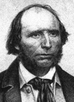
PETER LASSEN was a Danish emigrant who landed in Boston for a while but, like many of his day, moved west with fortune. His name is affixed to mountains, creeks, high schools, counties and national forest lands. He rubbed elbows with Spanish governors, US military leaders and California politicians. At one point, he settled at the confluence of Deer Creek and the Sacramento River, establishing a settlement he called “Benton City.” To populate the locale, “Uncle Pete” charted the Lassen Cut-off, a route that split from the Applegate spur of the old Oregon Trail and brought settlers to the northern Sacramento Valley. I knew the near-Chico portion of this route as Dad and I explored the Ishi Wilderness and Bruff’s Camp many times in the 60s.

The Fandango Pass portion was the eastern end of this cut-off, named, some say, because men, in crossing this pass late one season found themselves having to dance a fandango at night in order to warm bodies against the freezing October nights. It makes a nice story. Approaching the summit, that morning mist becomes a little more threatening. At the top I survey the rugged terrain and think about those old boys dancing around the fire to keep warm.


THE ROUTE PAST THE SUMMIT is a gradual descent over nicely groomed cinders. Approaching Goose Lake, where the Lassen Cut-off markedly departs from the Applegate Trail, a well-worn hay barn tells me that rugged folks still populate these reaches – and somehow make a living off the land.

Riding a bike, exposed to the elements and free of radio yammer, one is easily transported back in time. The imagination may turn the motorcycle into a mule or an ox and the route may turn from something graded to something needing to be picked through with a long knife and very careful steps. I can’t help but marvel at those who had the will and tenacity to do this.

Looking back at the Warners this morning, I note the threatening clouds and realize I was only moments ahead of getting drenched under a cloudburst. I wonder if I would have bitched about the conditions or danced a Fandango.


NOTES:

In all of our conflict with Native Americans, only one U S Cavalry general was killed in action. His name was not George Armstrong Custer. You can look it up.


The story of Peter Lassen's death is also quite interesting and still shrouded in darkness.  Yo!  NBC folks:  His story is great fodder for one of those "Unsolved Mysteries" episodes.

REFERENCES:

A detailed account of Peter Lassen’s life, exploits and ultimate death may be found on-line at The Nevada Observer. Lassen’s contemporaries read like a who’s who of pre-and post- gold rush luminaries including Fremont, Sutter, and Bidwell. How their paths intertwine is nicely recounted here through the use of both primary and secondary sources:

http://www.nevadaobserver.com/Reading%20Room%20Documents/life_and_death_of_peter_lassen.htm

The Northern California Traveler is published 10 times per year. Mainly a vehicle to promote real estate sales in northeastern California, editor Dennis Smith ensures that the content matches the good nature and good will of the people and the ruggedness of the area. Plus, the real estate listed is an enchanting look back to when we worked on, recreated on – and maybe appreciated a bit more – the land. www.northerncaltraveler.com

© 2011
Church of the Open Road Press