Monday, April 29, 2019

DINING DESTINATION IN LAKE COUNTY, CA

Upper Lake’s Blue Wing Saloon

file photo from an earlier lunch visit
Two-thirds of the way between Chico, where we spend the occasional Sunday with grandkids, and home in Cloverdale we find the Blue Wing Saloon. Located on Upper Lake, CA’s short and historic Main Street, it has proven to be our dinner-stop location of choice on this drive.  Locally sourced meats and greens, the bison burger is a lunch-time favorite, but last night’s (a Sunday) grilled pork chop was perfect with a glass of Lake County Pinot.

But wait!  There’s more! We happened in around 7:00 PM to unexpectedly find a trio – piano, bass and voice – soothingly performing standards from the great American songbook.  Local musicians, each, they added an already scrumptious dinner in the historic bar/dining room.  The pianist who claims to farm weeds (not weed) just north of town played Hogey Carmichael’s “Stardust,” the only song my dad ever tried to play on the piano [insert flood of memories here] while the classically-trained emigre from Japan “back in the 70s,” she told us, provided the lyrics. Thus, once home I found I’d been offered the soundtrack for a night’s dreams.

Next door – across a cool and lovely outdoor dining venue – is the historic and rebuilt Tallman Hotel. A grand option given the wide selection of whiskeys behind the bar at the Blue Wing that I couldn’t sample knowing I had a seventy-minute drive yet to come.

Rather than being just a place to break up a long drive,  the combination of these two establishments will make an oft-overlooked and oft-passed-right-through Upper Lake a destination for us in the very near future.

o0o

The Blue Wing has a comprehensive wine list, micro-brews on tap, a continually changing seasonal menu and great service – all in an historic setting that makes you feel as if you’ve been transported back in time a good hundred years or so.  Check it out…  https://tallmanhotel.com/blue-wing-saloon/  


© 2019
Church of the Open Road Press

Saturday, April 20, 2019

JENNER HEADLANDS PRESERVE

a tale of two visits

I like discovering a new road and I like discovering a new trail.  This is about the latter.


We hadn’t enjoyed too many sunny seventy-degree days this wet spring, so at the crack of 9:15 one recent Wednesday, I hopped on Enrico, the Yamaha, for a return trip to the Sonoma Coast.  

A late start, it may seem, but a favored breakfast spot in Duncan’s Mills doesn’t open ‘til 9:00 and job one would be to enjoy some Bella Rosa coffee (local to Sonoma County) and a perfectly-turned omelet.  


[Note to self:  Must return for the Cape Fear CafĂ©’s Sunday Brunch.]

West on CA 116 and north on CA 1, a cluster of automobiles are pulled off to the coast side of the highway.  A new sign indicates that at the base of the cliff and at the mouth of the Russian River, harbor seals calve.  This was their nursery.  Nice to know. Lots of pups this morning but too far away for a picture.  I’d left my long lens home.


So I took a picture of the bike.

A couple of clicks further north, the gates to the Jenner Headlands Preserve were open.  These coastal hillsides were dedicated by the Sonoma Land Trust and the Sonoma County Agricultural Preservation and Open Space District as a space for exploration and enjoyment.  Now administered by the Wildlands Conservancy, I motored in for a look.


A lovely green promontory north and slightly east of the parking area beckoned. 


And the wild flowers were profuse.


But this was to be a day on the motorcycle, not on shank’s mare.  I cataloged the spot as a place to return with my spouse and Edward, the lab mix.  [Leashed dogs are welcome on the park’s trails.]


The return visit would be only two days later…


… and the morning coastal fog which had crept in on little cat’s feet the night before, chose not to creep away this afternoon.

But the profusion of wildflowers would not disappoint.  Here are a few clusters and portraits.


The Sea to Sky Trail winds 7.5 miles over coast prairie and through mixed woodlands ending at Pole Mountain.  


With lots of up and down, the hike is a bit strenuous but with afternoon mist, never too heated.


The route is a combination of rutted ranch roads and glorified - but glorious, given the view and environs - cattle trails.


Ranching is still active in the area and as we departed the Sea to Sky Trail onto the Raptor Ridge Trail – thus offering us a nice five-mile loop – we passed between the ranch house and barn…


…weaving our way through a herd of cattle enjoying a marvelous existence that includes acres of fresh green grass and magnificent Pacific views…


…each head blissfully unaware of one upcoming really bad day for them.

The Raptor Ridge Trail winds down a steep and sometimes muddy track into a ravine.

Along the way we are afforded a mysteriously blanketed view of Goat Rock, a popular coastal destination just below the mouth of the Russian River.


We enjoyed just five of the 14 miles of trails in this new reservation, which only means we’ll have to return again to enjoy the rest.

o0o

Notes:  Wildlands Conservancy website:  https://www.wildlandsconservancy.org/preserve.html

Their efforts specific to Jenner Headlands:  https://www.wildlandsconservancy.org/preserve_jenner.html

Today’s Route:  River Road exit from US 101 north of Santa Rosa; west toward Guerneville (where River Road becomes State Route 116), Monte Rio and Duncan’s Mills.  North on State Route 1 through Jenner.  Look for the gate on the east side of the highway about two miles north of town.  Access is free but do consider leaving a donation with the iron ranger.

© 2019
Church of the Open Road Press

Saturday, April 13, 2019

BUSTIN’ TRAIL IN CLOVERDALE

The Church of the Open Road’s
Good Deed for the Day…

Adjacent to our little community rests an open space that sweeps from the edge of the Russian River’s Alexander Valley to the rim of some nearby hills.  Porterfield Creek drains this area – a habitat for oak, madrone, and manzanita as well as deer, gray fox and the occasional mountain lion.  The area is laced with trails – both developed and not. Background music for a hike during anytime of the year will include the melodies of whatever bird frequents the area that month along with the percussion of Porterfield Creek as it tumbles toward the Russian.

The place is a delight and, best of all, walking distance from our front door.

On hikes with Edward over the past sixteen months, a gradual transformation has occurred.  Volunteers from the Sonoma County Trails Council have been pressing back to shovel in an effort to grade and gravel sections the trails in the little park. Frequently we’ve seen ‘em out there and thanked ‘em, but the thanks never seemed like enough.

Today that changed.


Responding to an article in Cloverdale’s weekly paper, we joined the volunteers for a morning of paying-things-back labor. The network of trails was to be dedicated in an upcoming weekend, and after a particularly wet few weeks, there was work to do to spruce ‘em up.

The main task was to arrange drainage for water that would sheet down off the hillside and gather on the paths.  Soil in the area is a rather unforgiving brand of clay.  In the summer you couldn’t dig through it with a nuclear device, and in rainy season, the stuff forms a gooey glue that sticks to the Vibram of your boot soles adding about fifteen pounds each to each footstep.


Today’s job would be to channel that water along the uphill side of the trail points where a gentle swale would be cut across the path.  The gentlemen working the small crew skillfully engineered laterals and crosses knowing exactly where to dig – and how deep – checking their success by monitoring the seep water that flowed from the hillside, into the channel and then across the path.  Once certain gravity was doing her part, a number of loads of ¾ inch road base were spread and compacted across the previously muddy and slippery sections.

I learned that forming the ditches and swales was a gentle task.  Gradual would suffice as long as the water would flow away.  Also noted was how the mineral surface scraped from the trail course wasn’t just tossed down the hill side; rather organic matter (duff) was swept to the side, clay and rock deposited on other clay and rock, and then the organic matter returned to its spot.

A fifty to one-hundred-yard section of what will be known as the Three Bridges Trail (we’ll always call it “Edward’s Crossing”) has been a slippery and muddy mess. Footing has been a bit like ice skating on an oil slick.  On the wettest of days, this was a trail to be avoided.


Today, after three hours of our volunteering – and five from the regular crew – the trail is dang-near all-weather.  Water drains off the low sections and gravel rests atop the gooey clay mud.  The trail looks great and will be presentable for that grand opening event coming in May. 

o0o

Our public lands and open spaces require our support and stewardship.  Certainly, some of our tax dollars fund national, state and regional parks.  But, as our recent visit to Yosemite showed us, our parks need more than tax dollars to remain viable and healthy.  They need us.

Today, we contributed with a bit of our time.  Others are better at this than we’ve been.  Sister Sue has done this in Chico’s Bidwell Park and friend Patti has done this as a Canyon Keeper along the American River near Auburn.  

Today, we also became members of the Sonoma County Trails Council with a small financial contribution.

Now, as we walk the trails of the Porterfield Creek Open Space, along with the hardwoods and wildflowers, creeks and wildlife, there’s going to be a little feeling of contribution that will make our strolls there even more satisfying.

The Church of the Open Road is sure that there is an open space in your area that could benefit from your time or a few shekels and asks that you look into how you can help. 

Notes:


The Sonoma County Trails Council Website: https://www.sonomacountytrailscouncil.org

On why we’ll always call it Edward’s Crossing (previous pst):    https://thechurchoftheopenroad.blogspot.com/2019/02/the-search-for-edwards-crossing.html


© 2019
Church of the Open Road Press

Monday, April 8, 2019

YOSEMITE: 1954

My first visit to the Sierra…

The ’54 Ford Ranchwagon was brand new.  Not that I remember.  Dad had banged up a ’46 Chevy in a collision at an intersection – a collision that, to his dying day, Mom would not let him forget – so we needed a new car.  All this I was told.  I was also told that in celebration of this new family car our first road trip would be to Yosemite.  In later years, Mom always prided herself in packing our succession of station wagons such that no cargo rested above the lowest portion of the windows.  “Safest to drive if you can see out the back,” she’d said.  Also safest to have a two-door car rather than a four-door car because, so she explained, when she was growing up in Houston in the 30s, some poor kid fell out the back door of a four-door Hudson or a Plymouth or something, landed on his head on the pavement and “…was probably addled for the rest of his life.”
         
I’d just turned two so I don’t remember anything about this first-trip-for-me to Yosemite or how the car might have been packed. I know only what I was told.  And only what I was told after once, when as a teenager, I happened across a yellowing Kodachrome slide – shot by Dad with his trusty Signet 35 – of me standing in a wet didee on a picnic table, shoulders just unclutched by a red-sneakered Mom whose skirt was soaked nearly up to her waist.  The Merced River slipped by in the background of the frame.  Brother Bill looked on.
  
       
The ride from LA’s Altadena suburb to the valley floor had been hours long.  And, in the days long before car seats or seat belts – how ever did we survive?– I had a lot of time to rumble around in the back seat with brother Bill.  At twenty-seven months, I wasn’t much interested in the scenery, I suppose.  And even if we did have that travel bingo game – the tagboard gameboard with the little plastic windows – I would more than likely have occupied myself chewing on the gameboard’s corner than matching what was outside with what was illustrated on the card.
         
Anyway, upon our arrival in Yosemite Valley, apparently Dad pulled into a lovely spot in a valley floor campground backed by the river.  Apparently, also, was that once the seat in front of me was unoccupied, I could easily push the seatback forward and tumble out through the open passenger door.  And speaking of apparent, the rushing water of a snow-melt-flush Merced River must have been quite inviting because within moments, I was “bobbing up and down like a little red-headed cork,” according to Dad, who always chuckled when he told this, “as the river sorta carried you away.”

I didn’t hear Mom shriek or Dad swear.  All I have to recollect with is a once-obscure bit of family history linked to my discovery of an old Kodachrome slide depicting a two-year-old me atop a park service picnic table and a terrified, half-soaked – and likely infuriated – mother, undoubtedly at a loss for what to say or do next.  
         
We camped elsewhere that night.
         
And for the rest of Dad’s life, once the story was… well… public, Mom’s telling always concluded with, “I told Clayton not to pick a campsite so close to the river!” followed by: “I had to go in there and rescue you because he was fumbling with that damned camera of his.”


© 2019
Church of the Open Road Press

Friday, April 5, 2019

YOSEMITE: WINTER INTO SPRING

Visiting America’s BEST idea


Only the calendar suggested that spring had come to Yosemite. Winter was not quite finished. Vigorous intermittent cloud bursts were rolling through, shrouding the panorama across from our Yosemite West rental creating a cat-and-mouse display of tumbling cataracts on the canyon wall opposite.  The term shower curtain suddenly had a new meaning.        
         

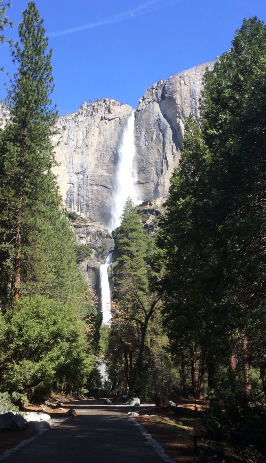
Descending some 2800 feet to the valley floor, the waterfalls run gloriously full.  El Cap stands like a granite gate keeper, only one with its head in the clouds. 


Mirror Lake, a two-mile walk from parking, both mirrors and mutes Half Dome.


I find myself thinking of Theodore Roosevelt and John Muir and their embrace of the subtle beauties of a magnificent place during inclement weather.  The softness under foot.  The aroma of dampened pine and fir.  The symphony of falling water.  


The near perfect blackness of a cloud-blanketed night.  Annoyances to the contemporary traveler were simply elements of an environmental tapestry these early twentieth century futurists felt worth preserving.

The following dawn: Overnight, spring had bullied that late-winter storm over the Sierra and out across Nevada.  


The air is crisp, the mountains and domes glazed in fresh snow and the forest floor washed clean.
   
      
A hooded Junco pecks at the duff until a Stellars Jay swoops in to claim some sort of grub.  The crok-crok of a distant Raven breaks the silence while a Cooper’s Hawk turns cartwheels on the sub-floor of heaven.

        
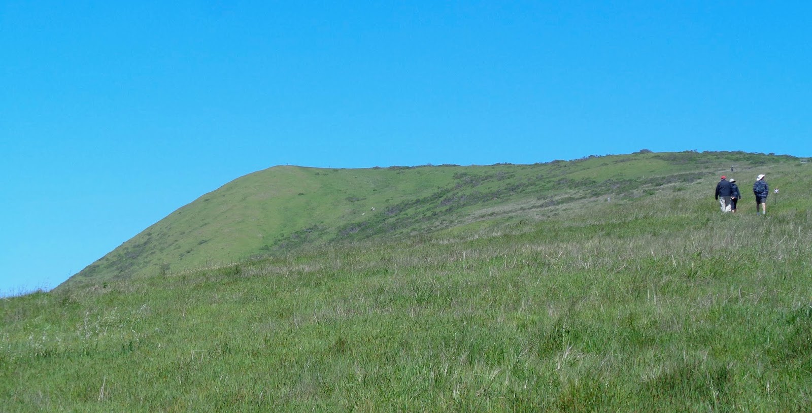
Our road to the valley floor (California’s State Route 41) is a patchwork of lush forest and year upon year of burn scar. Fire fighting in the wilderness of the national park, unlike that of the national forests, is a practice of letting nature take its course.  As we pass from one fire zone to another, we can see the succession of life: sprouting grasses, and brave fledgling sprigs of scrub, oak and pine.  It is the rebirth of the forest as God probably intended and as John Muir probably concurred.

         
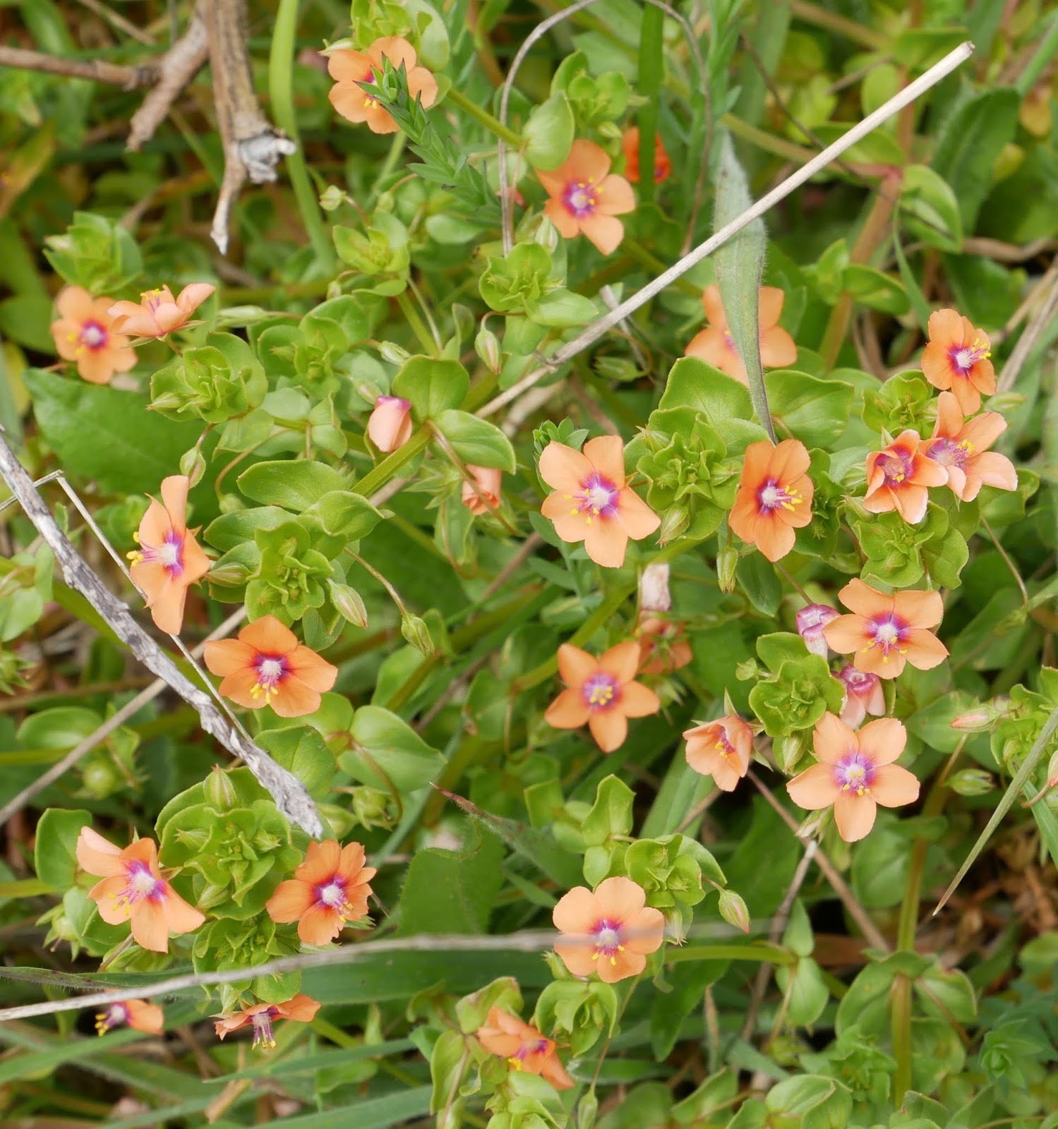
Gazing up from Yosemite Valley, Bridal Veil, Yosemite and so many other many nameless cascades leap over cliffs, their falls looking like silver ribbons on a package that, when opened two or three weeks from now, would yield the priceless gift of a wildflower burst in the valley floor. 


At the foot of one tumbling rill, mist dampens my cap and clothes and offers the mid-day sun a palate with which rainbows are painted against a deep azure canvas.

The day would be spent chasing those rainbows and vistas, peering up at the cliffs and down through the crystalline waters of the Merced.

        
To Muir’s pleasure – or perhaps his chagrin – the paths are now paved and choked, in places, with visitors.  


Visitors from around the world whose voices and dialects provide another tapestry for me to consider: a reminder that our National Parks, starting with Yosemite, may well represent America’s best idea.


o0o

More photos


Muir’s musing.


Morning view from Hwy 41’s Tunnel View.


Unnamed and temporary.


Valley floor awaits spring.


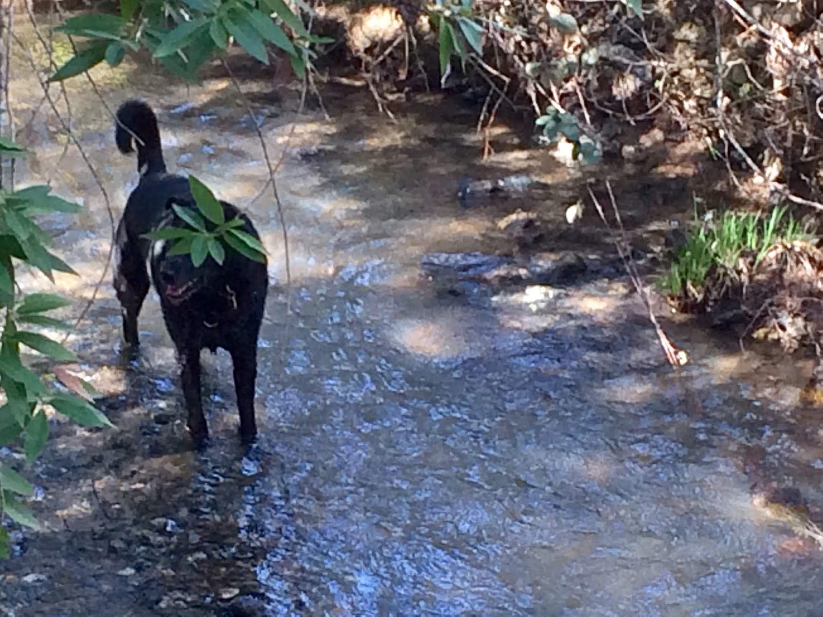
Tenaya Creek crossing.


David Brower’s admonition.


Winter returns.


Our trip to Yosemite was awe-inspiring and too brief.  But evident, after a rather rugged winter and visits to both Yosemite and the Carrizo Plain, is that our National Park system is woefully underfunded.  Signage is down.  Roads and pathways deteriorating.  Meadow restoration, in some places, on hold.  Clean-up after neglectful visits has gone from daunting to undoable.

In a nation that can afford massive budgetary increases to an unaudited military and huge tax decreases to the uber-wealthiest among us, support for our National Parks must not be an afterthought.  These palaces of history, science and beauty must not become available only to the well-to-do. 

Somewhere in our nation is a young John Muir.  He (or she) - no matter the socio-economic caste - must not be denied the opportunity to experience and be inspired as Muir was.  Our parks must be affordable and available to all or they can no longer be referred to as "America's best idea."

© 2019 
Church of the Open Road Press