Day 2 of the Volcanic Legacy Tour
of California and Oregon
The goal would be to arrive in Camp
Sherman, OR early enough in the afternoon to prepare a meal for a riding buddy
who’d be joining me from the north.
The map said I’d be in for about 280 miles.

Conflicting with that dinner bell time schedule was Crater
Lake. I did not want to repeat the
mistake of yesterday, flying past something good to see and regretting it
tomorrow.
Departing Mount Shasta City early, a
glance over my shoulder, some twenty miles north on US 97, bore a classic view
of the Queen.

Apparently, I wasn’t the first traveler to be struck by her
beauty.

Racing north, I passed the marker for the Butte Valley
airstrip located between McDoel and Dorris. I noted the vintage beacon tower, still operational with the
power shed and fuel supply tank visible.

I wondered if the unit might be situated atop one of those
airmail directional arrows like those found along the old route of the Central
Pacific in Utah and Nevada. The
airfield is adjacent to an early route of the Southern Pacific, so it stands to
reason. Lesson not yet learned,
I’m still kicking myself for not hiking the two hundred yards to the facility
to find out.
North of Klamath Falls, Oregon Route
140 circles to the west side of Klamath Lake. Toward the lake’s western-most point, a secondary road heads
north and east to Fort Klamath, a historic place name I’d like to visit. I divert, hoping for pavement.

And glorious pavement it was, skirting the lake and slicing
through yellow pine forests until it angles east through luscious
pastureland. A road sign on OR 62
points me toward Crater Lake and I pass through Fort Klamath with nary a blink.
I like roads that reach skyward,
dancing along ridgelines high enough to where you could reach up and scratch
God’s belly. In the Sierra or the
Rockies that feeling envelopes at about 11,000 feet. In the Cascades it can happen about a mile lower.

Traveling OR 62 the view unfolds to the south. Klamath Lake, now miles away, rests at
my feet, although the haze from some California wild fires tries to steal the
view.
A few miles on, cresting a gritty ridge of ash and pumice,
down onto the forested side, the lake appears.

I pull in at a wide spot. Three quarters of the way across a cinder cone has developed
inside the water-filled crater of the ancient volcano.

Two minutes further, a viewpoint affords a view of “the
Phantom Ship.” The rock is
surrounded by glass smooth reflection of the lake’s rim.

A fellow with a real camera is sighting up to take his best
shot – or a hundred of ‘em. I
click and go.
In my previous visits to Crater Lake, the East Rim Drive was
always closed either due to heavy snow or rockslides. I guess one upside of climate change is open roads due to no
heavy snow.
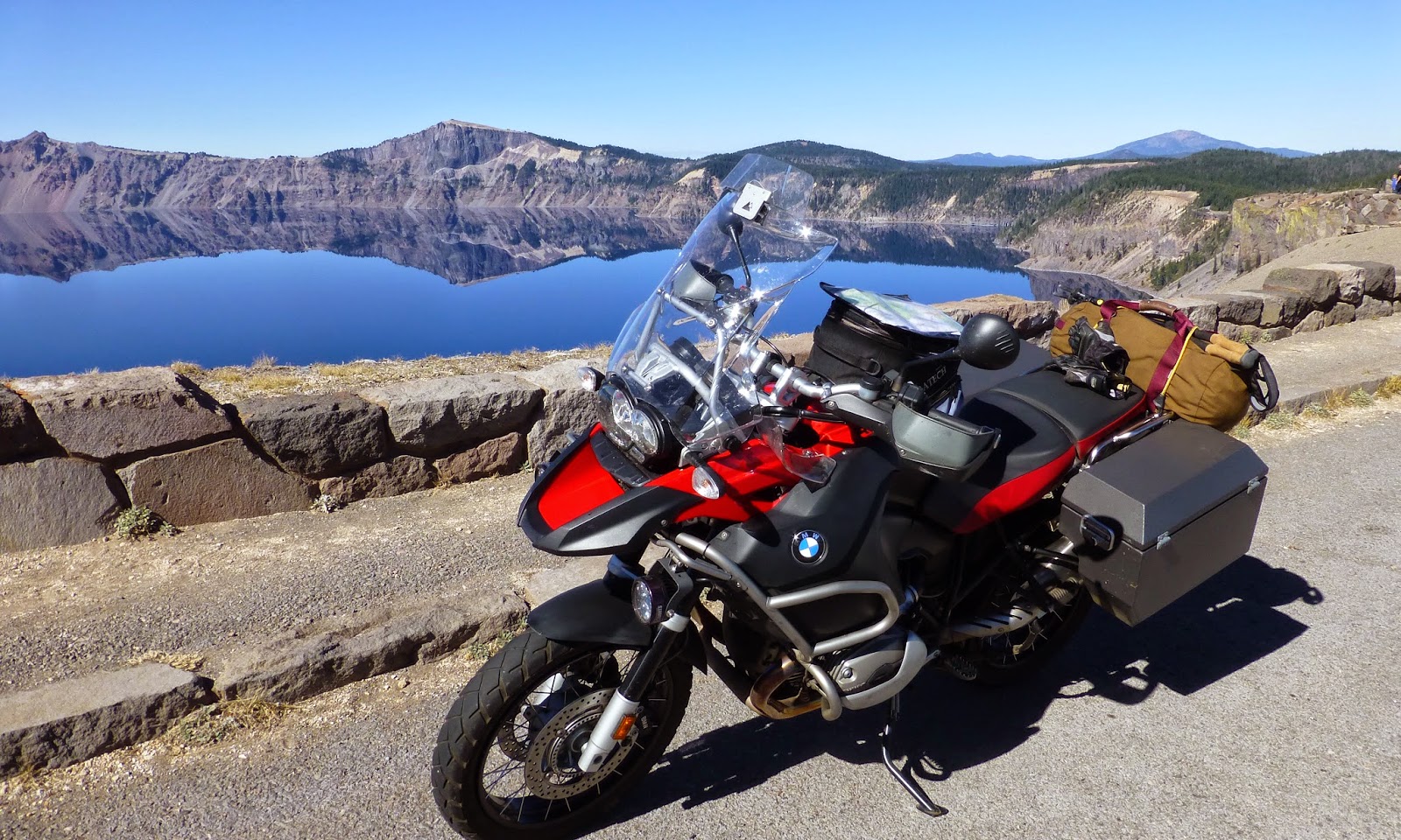
Each turn of the route offers another reflection.

I stop for an additional portrait of the motorcycle as if
anything about the bike might have changed in the six minutes since the last
picture of the thing.
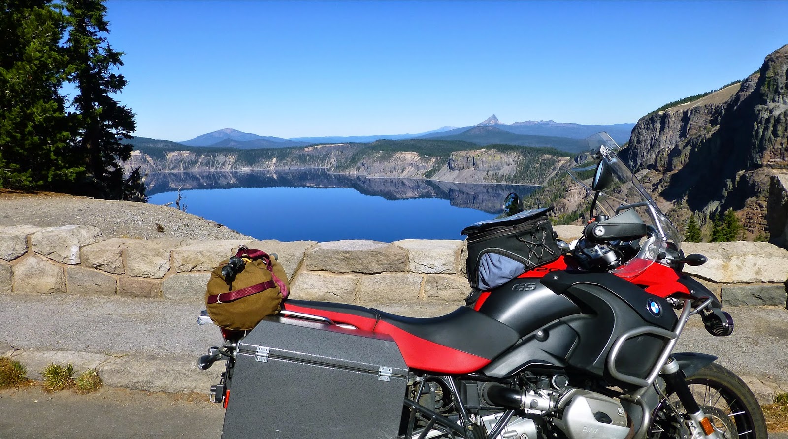
And then another.

After a nine-hour day of riding and
dismounting, the little cabin/trailer we’d secured on the banks of the Metolius
River certainly proved inviting. My
three-hour detour around Crater Lake did not make dinner any later than it was
going to be anyway. Perhaps I did learn the lesson this day.
© 2014
Church of the Open Road Press
No comments:
Post a Comment