Tuesday, October 22, 2019

YUKI TERRITORY

…exploring a road not-yet-taken…

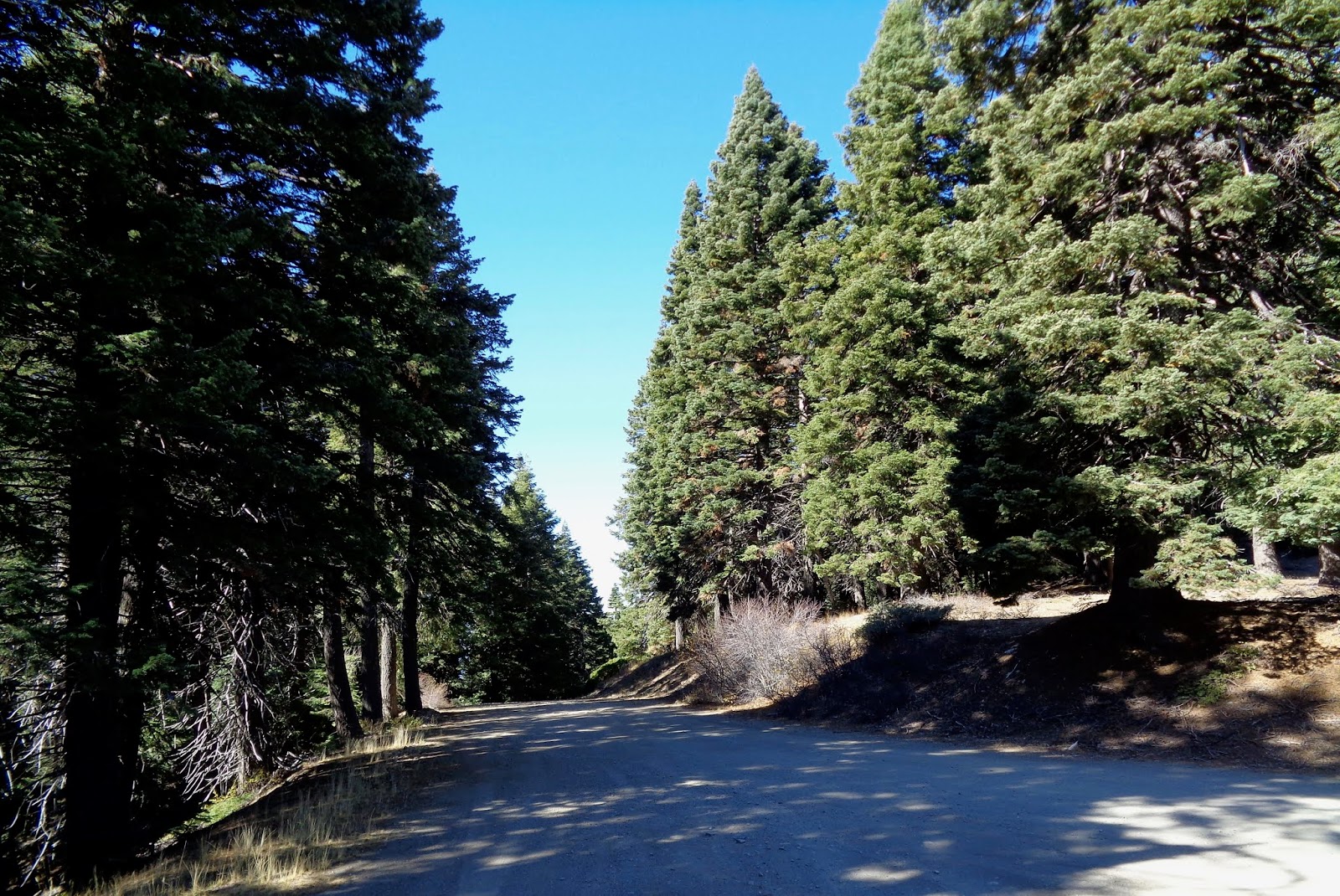
A blue sky domed the late October day and exploration of a road not-yet-taken called.  Plus, the Subaru was still relatively clean from having been to the car wash three weeks ago: and that simply wasn’t right.  The road in question – one I’d examined on multiple maps – would take me through the heart of Yuki Territory.


When communities of people lived naturally, their universe was, in general, centered on a water course and bounded by the hills and mountains drained by that stream.  Trade, if it occurred, happened because folks crossed the ridge or paddled a distance down river.  Sometimes that resulted in conflict; sometimes simply trade.

I’d first read about the Yuki in a couple of books that exposed the genocide of northern California Native Americans who’d been forced-marched to the Round Valley Reservation near now-a-day’s Covelo.  Geographically, among the closet groups herded to that spot were the Yuki whose ancestral territory centered on a length of the Eel River.  Before European incursion, I read, game was plentiful enough, bulbs and berries and acorns abundant and salmon teemed in the river.  Seemed Eden-esque to me.  I’ve never been sure whether the narrative about Native Americans living in harmony with nature was more truth or myth, but I figured a visit to this remote area of California’s Coast Range might help sway me one way or the other.


I picked up Mendocino Forest Road M1 at Lake Pillsbury.  Unpaved, M1 – also called 1N02 – runs the entire north-south length of the Mendocino National Forest. 


(Fun Fact: No paved road crosses the Mendocino National Forest either north south or east west.  Plan on visiting on your dual-sport or in your 4-by.)

At Cabbage Patch, about four miles northeast of the lake, M1 breaks to the north with signage indicating this is the route to Hull Mountain; but also indicating that Eel River Station is reached by not making this choice.  My Forest Service map says otherwise.


The climb to Hull Mountain is steep and not well graded.  I worry that the Subaru, trusty though it is, with its lower profile “touring tires” on fancy wheels, might be a bit too delicate for this purpose.  I grind over ruts and rocky bumps thankful that I’d left the big Yamaha at home.

A view to the south unfolds in the mirror, but I wait until I reach the spur to Hull Mountain to stop.  A short hike up the service road leads me to a derelict set of stairs…


…the remains of the old fire lookout…


…and a remarkable view of Lake Pillsbury with a sliver of Clear Lake in the distance.


200 yards up the road comes the first marker for the Yuki Wilderness, a roadless area that stretches west from M1 into the depths of the Eel River Valley.  


Glancing back toward Hull Mountain – elevation 6800+, I note that the frost has already tinged the leaves of the deciduous scrub in the area. 


In the view northward, the hills look almost afire…


…perhaps not a good metaphor as just up the road remnants of something not-so-long-ago stand waiting to fall as their anchoring roots rot below the surface.


The scene prompts me to rethink that question of living in harmony with nature.  If a huge fire roared through a couple of centuries back, what could the native Yuki done about it?  On the other hand, given that they didn’t thwart the small lightning caused blazes of eons ago, the forests likely never grew so thick and tall that a big conflagration had the fuel to blow up into a fire storm.  Perhaps our native cousins lived in harmony because there was no other choice.


While the road from Pillsbury to Hull Mountain is primitive, beyond that promontory, it is graded and even engineered with drainage culverts.  Ruts are gone. No bedrock protrudes and I wish I’d been riding the big Yamaha.


I stop for a view to the west where the hills gently slip to the river.  The grasses seem to invite deer and other grazers and I believe the Yuki’s piece of Eden was something worth preserving.  Thus, the Wilderness designation.


Continuing north, I climb through the yellow pine belt and come across the newly established Berryessa – Snow Mountain National Monument.  


The fir and pine sough in the soft breeze offering a sound reminiscent of the old sheep camp, a few miles from here, where family would spend early summer holidays back in the 1960s – across Mendocino Pass from Yuki Territory.

But white folks grazed something here.  


The steel gates are modern, but the tell-tale remnants of nearby timbers rotting into dust suggest cattle had been run up this way since the days of George E White, the would-be baron who orchestrated the demise of the Round Valley Reservation back in the 1860s and 70s.

Breaking out of the forest, M1 gently descends the west-facing shoulder of Etsel Ridge.  Round Valley and Covelo are nestled at the bottom.  I imagine that the distant valley is where the Yuki may have taken shelter – along with deer, bear and the occasional puma concolor – when the snow flew in the high country.


Over the course of the next six or eight miles I wind around the end of the ridge and down through mixed oaks, finally following a creek that will empty into the Eel River at Eel River Station.  I pause for a shot of the one-lane bridge; one I’d walked across a few years back and wondered where the road I’d just traveled came from.


Now I knew.  Yuki Territory.

© 2019
Church of  the Open Road Press

Friday, October 11, 2019

1986 BMW R80RT – for sale

The BMW R80RT is the first iteration of the company’s venerated RT line-up.  At the time of this model’s original manufacture, it was among the only motorcycles that came with factory-installed wind protection.  Recall that before this, Craig Vetter and others made bank providing fairings for all manner of BMW and Honda 750-fours.  This RT is a direct descendant of the company’s slash-5 and slash-7 machines, noted for their engine durability and overall rider comfort.  The wind protection simply sweetened the pot.

This thirty-three-year-old motorcycle has just over 32,000 miles on the clock.  Upon my inheritance of the machine, took it to the Zen House** in Point Arena where renown owner/mechanic Dave Harris replaced all seals, installed a new clutch (because he was in there, so why not?), synced the carbs, refreshed the rear tire, corrected a faring strut and gave the machine a good and thorough once over.  (A receipt is available.)  Upon my picking it up, Dave said, “It’s ready to be ridden around the world.” 

My first experience on this model happened in 1984 when Ozzie, owner of Chico’s BMW shop, loaned me his while my R65 was in for service.  I’d wanted one ever since.  Last year, when my brother became incapacitated due to an industrial accident, I purchased it from him.  Although the thing runs like it just came off the factory floor, I have found that I enjoy riding my Yamaha Super Tenere more, thus, the Beemer has been collecting dust since Dave Harris serviced it.  It’s a shame.

Some notes:
·      The battery dates back to August 15, 2018 and needs an occasional boost due to lack of use.
·      The both tires are tubeless, but the front tire requires a tube because of a leak that is so slight neither Mr. Harris nor I could find its origin.
·      A good length of fuel line is included as the ones on the machine may be due for replacement; as are some float bowl gaskets.
·      Factory panniers (molded plastic saddle bags) come with it.

Having invested over $4000.00 in its purchase and mechanical restoration I would like to get three grand out of it – however, what I’d really like to see is it back on the road with the right owner.

If you know of someone who may be interested, please pass this information along to him or her.

Terms of any sale: cash or cashier’s check.

Test rides will be offered only to licensed motorcycle operators old enough to appreciate the beauty and simplicity of a motorcycle such as this.

Contact:  Dave Delgardo – dave@churchoftheopenroad.com*

Final notes:  This machine is the subject of an upcoming article in Rider magazine describing my first ride after picking it up in Point Arena.  Look for that issue in the next couple of months.

*The Church of the Open Road is a blog dedicated to motorcycling through Northern California and the West.  Check it out at www.churchoftheopenroad.com.

** Info on "Zen House" in Point Arena, California: www.thezenhouse.net


Sunday, October 6, 2019

BACKDOOR TO THE REDWOODS

…another lesser-traveled route…

The songs of US 101 south of Eureka include the wailing tires of log trucks, loaded with redwood, heading north to mills and lumber trucks, packed with finished product, heading south.  The raw material is of much smaller diameter than forty or fifty years ago and the milled lumber seems not nearly as red.  Still, a bit of me feels good that the industry has somewhat of a pulse while a too-small sliver of the old growth is preserved.  I guess there’s something a little reassuring in the whining of the wheels of the big rigs running either direction.

Speaking of old-growth: there’s a grove of that old-growth I want to visit, one I haven’t ventured through in a long time.


After a night at the Historic Eureka Inn, I detour off the main highway into Victorian Ferndale in search of a cinnamon roll and a cup of coffee.  Main Street is nearly vacant early this Saturday and I window shop down one side – intrigued by a wrought iron metals studio – cross and wander back the other way.  


The occasional automobile parked at the curb and the lack of cobblestone streeting is all that reminds me I’ve not somehow slipped back in time to 1890.  At the end of the street, a sign points to Mattole Road, a route I’d once traveled with my dad in a ’71 Volkswagen.  The thirty-plus miles looping over golden foothills and out to the coast and back will be a pleasant little adventure.

And, according to my map, I can enter that redwood grove through the back door.


Mattole Road is an historic route that winds around and over Wildcat ridge and through a couple of stream courses.  It is one of those roads that occasionally sees maintenance whether that maintenance manifests itself as 110 yards of new pavement or mile upon mile of broken surface dotted with pothole patches.  Then there are those stretches of no pavement at all where I’m glad Enrico, the Yamaha’s suspension can absorb the washboard.  Having dumped a similar-sized BMW under similar conditions and owing to the fact that nobody knows I’ve added this detour to my itinerary, I pussy-foot my way across.

Payoff is one of those wonderful moments when after cresting a ridge, the Pacific can be seen lapping the sand and rocks of a distant beach.


Corkscrewing this way and that, I pass through Capetown, California – population not many – and pause for a snapshot of an old schoolhouse: one that reminds me that people once did and still do live out this way.


Up and over a rise and down to the ocean, Mattole Road parallels a roiling and turbid Pacific.  Strong and relentless onshore winds buffet the big Yamaha just as it did my li’l VW nearly fifty years ago.  I stop for a picture down the coast and wonder if those winds ever shut themselves off.


The rugged beach along this five-mile stretch of ocean’s edge is littered with drifted logs and lumber, but surprisingly little litter.  I suppose the remote nature of this rocky shore limit family picnics and the incessant breeze limits getting a hook in the water.  As the road curls east and back toward the hills, I stop for a view I might not see for another fifty years.  The sea stack in the distance shows how far I’ve come.


Twenty minutes further on, I wheel through Petrolia. A couple of miles from this place, or so says the plaque, oil was discovered for the first time in California.  A company dubbing itself “Union” extracted the goo, loaded it onto schooners and shipped it to a San Francisco that would later thrive, in part, because of this source of energy.

A mile further, a directional arrow points toward the Point Gorda lighthouse.  Always ready to bag another lighthouse or fire lookout or vista point, I head west.  Perhaps I’ll catch a glimpse of Cape Mendocino, the lower 48’s furthest point west.  The inviting road slips through some golden-leaved black oaks but quickly turns from pavement to gravel.  I tiptoe across a dry ford.  Yards from the ocean, the route splits with the left fork climbing a steep, pebbly stretch up to where, I suppose, the Point Gorda lighthouse is perched.  Weighing discretion and valor and the mass of Enrico, the Yamaha, I decide that since I’m off-itinerary I’d better not make this climb.


Back on Mattole Road, I rumble over the busted tarmac to the top of the western-most ridge of the Coast Range, through  Honeydew – gateway to the Kings Range National Conservation Area – into and out of countless creeks and draws. Rounding a bend, I find I’ve entered the Humboldt Redwoods State Park through that back door.  

Redwoods don’t grow right at the coastline, in general.  Something about the wind or the moisture or the saline air keeps the tiny seeds from germinating and becoming the tallest living things on earth.  But inland a bit, where the climate just so, clusters of these giants form what might best be described as cathedrals.  Sunlight filters in as if through green stained glass.  The floor is carpeted with reddish-brown needles.  A ribbon of pavement is swept clean by passing traffic looking much like the aisle that separates pews for parishioners.

I pull to the side.  After an arduous two hours finding this back door, I dismount, doff my helmet and wade though sword ferns in search of an ancient windfall where I will sit.  

There’s a kind of music here.  The songs of the redwood grove are different from the whine or the wail of the forest being freighted away on the back of a Peterbilt or a KW.  I sit and absorb the cool air and the muted mid-day light.  At first, I hear nothing.  Then come the whispers: nothing really discernable like the chorus of a sacred hymn, but something that will follow me all the rest of the way home.

I’m in no hurry to leave.

© 2019
Church of the Open Road Press

Monday, September 30, 2019

CALIFORNIA’S SALMON RIVER BY-WAY

… by not taking a favorite route, 
I discover a new favorite route…

There are many, many ways to cross from California’s I-5 corridor to the coastal US 101 corridor.  Each is engaging.  Each is repeatable.  Each can become a favorite ride.  State Route 96 from Yreka to Willow Creek can be traveled over and over because it is one of those  favorite rides.

This day – exploring with a riding buddy – I chose an alternative…


After heading south out of Yreka through Fort Jones and Etna on State Route 3, also a favorite route, we head west at Callahan.  Cecilville Road begins as a luscious ribbon of nice pavement, glorious curves and second-gear switchbacks as it winds to a Pacific Crest Trail trailhead at Carter Meadows Summit.  


The view back toward Scott Valley is spectacular and the rugged ridgelines recall alps somewhere in Europe.


An easy descent drops us from alpine forests into mixed deciduous pine and oak along the south fork of the Salmon River.  

Thirty miles and more than an hour on, we arrive in Cecilville…


… where the gas is self-serve…


… and so are the groceries.

Note the box for 'honor system' purchases at the bottom of the chill box which is located just outside the locked front door of the store.

Don’t leave your child unattended!

Also just outside that front door.

Disk golf is available, but we didn’t pack a frisbee.


The stretch between Cecilville and Forks of Salmon gets little use, I suspect as for the entire nineteen miles, we encountered no vehicles.  Which was a good thing.  Even on a motorcycle, passing an on-coming anything would be harrowing.  

The road narrows to perhaps three paces wide except where the gnawing south fork – maybe 300 feet below – has undercut the canyon wall and collapsed a few yards of blacktop.  There, it’s narrower.


Then there’s the rock fall littering what’s left of the pavement.  The drive becomes a delicate, slow dance.  Getting pitched from the saddle after hitting a chunk of schist or quartzite would prove calamitous and, as Butch told Sundance, “The fall’ll kill ya!” 


Forks of Salmon is an even smaller berg with a post office, a campground and, to my view, no mercantile of any kind.  


Horses might be seen loitering in the street – though none this day…


… and near that campground, preserved is evidence of the area’s gold mining past.


Forks is where the two branches of the Salmon meet.  


The main intersection offers a chance for one to follow the north fork of the Salmon east back through Sawyers Bar toward Etna.  


I’ve heard the road is a good one, but it will have to wait as we hold reservations at the historic Eureka Inn out on the coast.  Bucket list it.

West of Forks, the stream carries twice the volume, the canyon is broader, but deeper and the remaining route out to CA 96 is less daunting.  


Latter-day prospectors dredge for gold, fisher people fish and I’m sure the huntin’ is good in season.  I am reminded of this as I round a bend to be stared down by a four-point buck standing in what turned out to be his roadway.


I like remote areas and the roads that carry me there.  I like the echoes of history and admire the rugged people who live in and care for the environs – be they the native Americans of yesteryear or ranchers or miners happy to live off the grid keeping a pocketful of quarters handy in case they need to use the phone.


My imagination wanders and fantasies about the romance of the past abound.  And I think I’ve discovered a new favorite ride.

© 2019
Church of the Open Road Press

Friday, August 16, 2019

DESTINATION: BUCKS LAKE

…a glorious childhood haunt…

I wasn’t expected to show up.  Barbara was the last of the three great moms who cared for a bevy of neighborhood youngsters – myself included – in 1960s Chico.  The memorial gathering for her was to be held some four and a half hours away from Cloverdale.  But it was a summer weekend; Enrico, the Yamaha was due for a road trip; and the canyons and ridges, rocky outcrops and pristine lakes of Plumas County are to travel what whipped cream and a cherry is to a sundae. 

California’s highway 70 traces the rugged Feather River Canyon between Oroville and Quincy.  Pioneered by James Beckworth in the mid-1800s, it is the lowest of the Sierran crossings, though the last to see a railroad.  The highway and the old Western Pacific swap sides of the canyon as both routes pass small hydro facilities, historic whistle-stops and bergs all under gleaming granite cliffs and cool pine forests.


Bucks Lake, itself, is a high-country reservoir dotted with forest service cabins – a little known playground for residents of the northern Sacramento Valley and beyond.  


Kayaks and canoes co-exist with jet skis and fisher-boats while bald eagles and osprey circle above and black bear roam in the woods.  

The road I remember as graded dirt is now long-ago paved. Camping and day-use spots are abundant. The dam I once crossed on foot is now gated off.  I park nearby and walk back to the cabin I’d last visited decades ago.

Barbara, the neighborhood mom, had battled dementia for quite some time, but family made efforts to see that she would spend weekends at “the lake” almost until the end.  It was her happiest place.  

Looking out a picture window, I recalled splashing on the beach, the smell of Sea-n-Ski, sandwiches wrapped in wax paper washed down with Cragmont sodas, and my failure to master the sport of water skiing.  Barbara was laughing and splashing and skiing right along with all the kids.  Happiest place, indeed.


My return home would be a different route.  East of Quincy, a the LaPorte Road winds from Route 70, crossing a diminished Middle Fork of the Feather then climbs Buzzard Roost and Gibsonville Ridges, past the alpine head waters of the South Fork. Each turn offers another breathtaking view.  

August-spring wildflowers carpet the high, cool meadows and it feels as if I am riding through the ground floor of heaven.  

Further west, the LaPorte Road routes past historic mining and lumbering villages – some little more than place names.  Sixty miles on, I am driving through the dry, 95-degree grazing land of the Yuba foothills outside of Marysville, wishing I were back at Bucks Lake reveling in the cool breeze rising off the water.

The day before, when I had entered the cabin, I worried that I wouldn’t be able to identify the neighbor-kid-now-cabin-owner I hadn’t seen in perhaps forty years.  He stood and called me by name.  “Greg,” I said, a bit breathless from climbing the granite stairs to the house, “this still is among the most beautiful places in the world.”  Greg took my shoulders, turned me around to look out that picture window with the stunning view of water and forestlands crowned with fair-weather clouds.  Then he pointed to the hand painted sign above.  It read: “Welcome to the most beautiful place in all the world.” 

© 2019
Church of the Open Road Press