Friday, July 29, 2011

GREAT POTTY STOPS OF THE OPEN ROAD III – UTICA PARK, ANGEL’S CAMP, CA

“Mark Twain wrote here.”

WHETHER WE TRAVEL ALONE or with children – especially with children – finding a pleasant place to ‘hit the head’ can be a challenge. The best pauses to refresh must be conveniently located, easily accessed, clean – flush toilets preferred – and well-maintained, and provide the bonus of something else to do once the deed is done.

It is best if there isn’t a candy counter, a soda cooler or a t-shirt rack on the premises as their absence prevents those can I have? arguments that so spoil a good road trip. It’s nice if there is something to do, something to watch or something to learn so that we can stay out of the car or out of the saddle for a few minutes longer. This cuts fatigue once on the road and leads to safer driving.


WHY THE MARK TWAIN QUOTE? Back east, that statement would read: “George Washington slept here.” Out west, particularly in California and Nevada, Sam Clemens did more than his share of newspaper reporting. This fact is lost upon those whose interactions with his work never travel further west than the Mississippi. His “Celebrated Jumping Frog of Calaveras County” (published November 18, 1865) was set only a couple of miles south of this point.

A statue of Mark Twain greets us as we enter Utica Park in Angels Camp, California in search of another great potty stop. Angels Camp is located on State Route 49 about a half hour north of Sonora and about a half hour south of Jackson – both places where you may have overloaded on coffee or, perhaps, indulged in a Big Gulp.

The park is on the west side of the road. Access from the north is via a narrow one-lane street just north of the old Frontier Auto Supply – a larger white stucco building. The turn is easy to miss. From the south, after passing through historic Main Street, hang a left on Bush and you’ll find it.

Click to access text.
Stainless steel facilities are housed in a clean cinderblock building. Maintenance is regular and thorough. Outside, a granite marker tells the history of the Utica Mine. It is a brief and very informative read.

Not far away, a large jungle gym invites activity for the youngsters.  A stroll across the manicured lawn brings one to the shade of a huge Sequoia under which one might wish to cap nat. Picnickers are afforded a large covered area with tables and charcoal grills.

For those of us with more time, forty minutes will allow enough to walk both sides of the picturesque Main Street. If someone has to have a snack, this’d be the arena. If you don’t want to fight the battle, stick with the cool jungle gym back at the park.

The upside of making a purchase in town is that a fraction of the commerce will likely go to support such small-town features as city parks – especially important in this era of declining support for public good.

Rider buddy Jeff's 2001 MG Jackal with 104k on it.  Wow!

UPON LEAVING “ANGELS,” be ready to delight in historic footnotes and great vistas. Take your time. North on 49 takes you to the northern mines; south toward Yosemite. East on State Route 4 presents a rugged and challenging crossing of the Sierra, west through the foothills to the valley. You cannot take a wrong turn from this spot.

© 2011
Church of the Open Road Press

Monday, July 25, 2011

MY NEW (MAKE THAT “CURRENT”) FAVORITE RIDE

CALIFORNIA STATE ROUTE 3

LIVING IN NORTHERN CALIFORNIA and riding a motorcycle must go hand-in-throttle. Proof that God rides is found in roads like Highway 70 (portions recently repaved!) through the Feather River Canyon, Highway 49 from Mariposa, through the gold country, crossing the Sierra at Yuba Pass, Highway 36 out to the coast from Red Bluff, and Skaggs Springs / Stewarts Point back in. The list is as long as the number of paved miles - longer if one considers the magical nature of graded forest service routes throughout the Sierra and Coast Ranges.

Finding a previously unridden route becomes more difficult with age – make that “experience.”

California 3 courses through the Siskiyous and Trinities between Montague – east of I-5 – and Peanut north of 36. This road has rested on my short list for far too long. So, in returning from the Northeastern loop across the Modoc Plateau, it was fitting that the tour would include “3.”


THE JAUNT FROM MONTAGUE to Yreka is a nicely paved five-mile stretch that proved to be a blessing after the 120-mile dirt and gravel run across the Modoc Plateau. Yreka, the county seat of Siskiyou County and in the running for capital city of the State of Jefferson, has long been a crossroad in far northern California. The I-5 corridor runs through town thanks to the late Congressman Harold T “Bizz” Johnson. A less formidable route for the Interstate would have been east through the Shasta Valley, but Bizz was a native of Yreka.

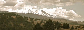
After a night’s rest, the cool of the morning causes the moisture and the aromas to settle. Driving west toward Fort Jones, Etna and Callahan, one can easily become intoxicated by the pine scent at the summits, the jasmine blossoming in towns and the pasturelands in between. The road traces Moffitt Creek to where it joins the Scott River in Etna, all ‘neath the shadows of the Marble Mountains.

Beyond Callahan, the highway twists up and over Scott Mountain Summit. I find myself shifting between third and second gears as the GS rumbles to the top of the pass. The Pacific Crest Trail crosses here and I pause. The Old Timer (the author’s dad) had hiked the Marble Mountains from this trailhead decades ago. I add this to my short list.

Heading south, the road makes a quick descent with luscious curves that demand a conservative right hand. Thirty-miles-per-hour presses the issue on the tall BMW and for a moment I question why thirty is exhilarating on highway 3 but exasperating on I-80 between Roseville and Sacramento.

Another tight corkscrew sneaks up on me, snapping me back to reality. They’ve done a good job engineering the pavement here with good surface quality, good banking and lots of erosion controls. The culverts are so huge that one could camp inside were it not for the late, late spring run-off.

Too quickly, the route has cleared the pass and made its way down the other side. Trinity Lake awaits, brimming from the fullness of the wet winter. There is no telltale bathtub ring is evident to suggest that the lake’s waters are sequestered by an earth-fill dam some ten miles or more further on.

“3” joins 299 at Weaverville and splits off after crossing the Trinity River at Douglas City. The last leg carries me through the cattle and hay country of Hayfork, then down through Peanut.  I was going to stop there for a Coke, but somehow missed the town, truly one of those "don't blink" kinda places.  The glorious Route 3 hooks up with route 36 five miles further on. Right would have taken me to Fortuna and the Humboldt Coast. Left finds me 90 minutes out of Red Bluff and a steamy Sacramento Valley.


"Old Fort Jones" (c) Cal State Military Museum
HEADING DOWN THE VALLEY, I ponder the tiny bergs that dotted my three day tour – Beldon, Canyon Dam, Westwood, Adin, Cedarville, Tule Lake, Macdoul, Montague, Fort Jones, Etna, Douglas City, and bunch of others – knowing why they exist, but wondering how they exist. I resolve that I am glad that they exist along with all of the territory in between.

© 2011
Church of the Open Road Press

Sunday, July 24, 2011

CAPTAIN JACK, GENERAL CANBY - AND THE CONCLUSION OF THE MODOC WAR


THE FAR NORTH OF CALIFORNIA, out east of the Cascades, is a far different place than around these parts. Up in the country of the Modoc, there’s little rain and real cold winters. The soil is thin and barren – just broken down lava rock aged to grit and pebbles by centuries of ice and wind. The ground isn’t much good for growing, and if it were, the growing season is so short that about the time a good seed sprouts, its green shoot just wilts and freezes off.

This was the land of the Modoc Indians and the land of Captain Jack.

BECAUSE OF THEIR SUPERIOR TOOLS and weapons – because of their technology – the white man easily took the whole of North America from the Indians who had lived on the land for countless thousands of years. These white men came from Europe. First there was Columbus, down toward Florida and in the islands of the Caribbean. Then came the folks from England, to Plymouth Rock over in Massachusetts Colony. Then just about everybody: folks seeking freedom from their King; folks seeking riches that they’d heard about; folks looking for a new start; and folks simply running away.

They loaded up on ships, crossed the Atlantic, and plopped themselves down just about anywhere they pleased. And over the course of only a couple of hundred years, the white man infested the whole of the new continent.  Sometimes these newcomers traded for the land they took from the Indians. Beads. Trinkets. Shiny stuff that captivated the native population but stuff that was of no value. Sometimes the newcomers simply set down a tilt up tent, then built a house out of sod or logs. Then defended it. Sometimes, the newcomers wandered through, harvested the deer, the elk and the buffalo and then wandered off.

All too often, however, the coming of the white man lead to conflicts and the conflicts lead to the Indians losing not only their sacred lands, but their lives as well.  Thus, our history is full of bloody Indian wars: the Little Big Horn, Bitter Creek, Wounded Knee; and in California, a massacre at Kingsley Cove on Mill Creek and, up in that forbidding, dry, cold north plateau country, the Modoc War.


CAPTAIN JACK was a Modoc Indian. As a child he learned the ways of his people by listening to the stories of his grandfather by the glow of a fire whose light was never to die. He learned to hunt using tools made of flint and obsidian and deer gut and willow. He learned to snare fish using tools of similar construction and practicing timing and thrust and patience. He also learned the ways of the creatures of the Modoc Plateau, the earth, his home; and in so doing he learned of himself and his place in the world.

As he became older, gold was discovered in the mountains. And with this discovery came a new and strange people with pale skin. People who made strange camps and built solid villages wherever they pleased. People who used wood and wire to cordon off vast sections of range land. People who built towns and cities.

Captain Jack, or Kientepoos, as he was known by his brethren, was attracted to the strange sights and sounds of the white people. He, along with other Modocs and Klamaths and Pitts, moved to towns like Yreka and began to find work in the white man’s mines and stores. The Indians soon began to desire the white man’s clothes, the white man’s food – and his liquor.

As the frontier settlements became more and more civilized, white men began bringing women to town. These new white folks – the women – had heard false tales of the godless and drunken ways of the Indians and came to town terrified of these people they didn’t understand. To the settlers, the women, however, meant comfort and civilization. While an Indian, well, meant nothing. So the councils of the white men decided the women should stay and the Indians should go. And they drove the Modocs off.

But not back to their homelands. No, the white men had a better idea. They sent the Modocs to a reservation in southern Oregon. And since any Indian was just an Indian, the Modocs were placed on a reservation already occupied by the Modocs’ ancestral rivals for land and food: the Klamaths.

Bickering between the two groups started almost immediately. Many of Kientepoos’ people felt unwelcome and unhappy on the reservation. So, in spite of the white man’s demands that they stay there – and threats to kill if they didn’t – Captain Jack led a few of his people back to the homeland of the ancients along the shore of Tule Lake in Northern California. There, the ground would be hard. The winter’s cold. But the heart could rest. For this was home.


BUT TO THE MODOCS' SURPRISE, their homeland was now occupied by many families of white farmers. Farmers trying to scratch out a living in an inhospitable place. But scratching none-the-less. And the farmers felt that the Indians posed a threat to the safety of the white families and demanded that the authorities return the Indians to the reservation. The U.S. Cavalry rolled to the scene. And the little band of Modocs retreated to a geologic formation now known as Captain Jack’s stronghold.

The Stronghold is a fantastic area of tubes that were formed by bubbles of gas that coursed through molten lava thousands upon thousands of years ago forming miles of underground tunnels. When the lava cooled, it hardened and became brittle. When small amounts of rainwater settled into cracks and froze, the powerful yet minute expansion of the water into ice broke the thin tops of these tunnels and they collapsed. What remained was long, aboveground ditches stretching for miles across a treeless landscape.

Once inside these topless tubes, a man could travel for great distances without being seen from the outside. A warrior could fire a carbine rifle at approaching soldiers who could find no cover. In various places, where the lava tops were thicker and the freeze-thaw weathering did not cause collapse, were natural, volcanic caves that provided shelter for sleeping and cooking and protection of women and children.

For nearly a year, a handful of Modocs held off hundreds of cavalrymen. Hidden Indian riflemen picked off many patrolling soldiers. But few of the Modoc warriors were lost.


SEEING THAT THE INDIANS could hold out indefinitely, the Army, under the leadership of General E R S Canby, set out to cut off the Indians from their food and water by throwing up a ring around the Stronghold. Within days, the Indians were forced to make other plans. Captain Jack was wise enough to see that the cause was lost and tried to convince his people to surrender. But the others hurled insults back at him, called him spineless like a snake and even called him a woman. They suggested that, in order to prove his manhood and re-establish his leadership, he should kill the white chief.

So, taking the white flag of truce, Captain Jack set forth to surrender to the cavalry.

Once inside the Peace Tent at the table of council, the Indian pulled a revolver and shot General Canby dead. In the confusion that followed, Captain Jack fled back to the Stronghold.

But the dye was cast. The cavalry tightened its grip on the Indians in the lava beds. Soon, again starving, the Modocs straggled out of the barren rocks and returned to the Klamath Reservation.


ALL EXCEPT KIENTEPOOS. Captain Jack. He was arrested by the cavalry and, for his crime, taken to Fort Bidwell where he was hung by the neck until he was dead.

And with him, the glow of a grandfather’s long-ago campfire flickered and also died.

####

SELECTED BIBLIOGRAPHY:
Riddle, Jeff C., The Indian History of the Modoc War; Urion Press, Eugene Oregon, 1974. As a young boy and member of the small band of Modocs, Jeff Riddle witnessed U.S. General Canby being shot by the angered Modoc chief.

Thompson, Edwin N., Modoc War: Its Military History and Topography; Argus Books, Sacramento, 1971. Edwin Thompson is purported to be a nephew or, perhaps, grandson of one of the soldiers who was engaged in the campaign against the Modocs.

© 1985  revision © 2008
Church of the Open Road Press

Friday, July 22, 2011

CROSSING THE MODOC PLATEAU


 ...on the Old Applegate Trail.


IN THE UNIVERSE OF LONELY PLACES, if limited to the planet earth and further refined to the continent of North America, one might be surprised that in our most populous state there are reaches that are pretty much unpopulated. On my ever expanding and contracting “To Do” list was a crossing of the Modoc Plateau in northeastern California.

Please click on any picture to enlarge...


Folks, indeed, had passed this way before. Excerpts from their journals might give a lesser rider pause. Or a rider with any sense. But not me.


DAVIS CREEK is a one-time berg situated on US 395 where the Applegate Trail begins to circle beneath Goose Lake. A worn stretch of pavement heads westward, becoming gravel as it turns north and slips along the lake’s west shore.

...especially this one!
On the AAA map I placed atop my tank bag, I had assiduously marked the intersections that would be critical to this journey.

The left turn away from Goose Lake led me to a nicely cindered road that coursed under lodgepole pines. The forest floor had been groomed to guard against a lightning strike rocketing down one of these slender miracles, igniting the underbrush, creating inferno-levels of heat and flame, and then leaping to become a devastating crown fire. Made for a pleasant morning.

Eventually, the forestland gives way to scrubbier vegetation as the ground is more dominated by the basaltic floes that typify the Modoc Plateau. Cattle guards at intervals along the route indicate that people do something in these sections.

The map indicated there’d be at least one stream crossing, and I’d hoped for a bridge, however, a well-engineered slab proved to be more than adequate for crossing Boles Creek.

Pausing on that Boles Creek ford for a snapshot, a view of the lava and resultant plant life becomes clear. Not much succession has taken place since that steaming mudflow of a million or so years back: only stands of grasses in small pockets and the occasional and hearty juniper standing against the bitter winters and the broiling summers. I get why this place is so lonely.

Further on – and unsigned when traveling from east to west – one passes into the Clear Lake Wildlife Preserve. I drove for what seemed like miles before I realized that the rise in the land to my right was actually a dike built, perhaps, to stabilize the waters in a very shallow “Clear Lake.” This Clear Lake is not to be confused with the Clear Lake in Lake County – which is California’s largest natural body of water. The flat terrain and the lack of bait shops and worn-out resorts should be a clue.


TULE LAKE, CALIFORNIA is a place where one of my high school buddies was reared. On my short list was to see what the excitement was all about. Didn’t find any – but in the town’s defense, it was a weekday.


Tule Lake was also site to a World War II Japanese Relocation Center. Tours are ranger led on Fridays and Saturdays. It was Wednesday. Addition to the short list.

Availing myself of paved roads I took state route 161 across the north edge of the state. Captain Jack and the Modocs lived up this way and, after themselves being relocated to the Klamath Reservation in Southern Oregon, they broke out and held up in what is now the Lava Beds National Monument. The small band held off a large contingent of US Cavalry for weeks, ending only when, at the table of peace, Captain Jack, pulled a revolver from his waistband and shot dead the commanding officer, General Canby.


FOLLOWING US 97 SOUTH from Dorris, I branched off below Macdoel, knowing it was only 25 miles to Montague, and five more to Yreka where I would spend the night.

Nobody indicated that the roads would be far less than clearly marked. At one junction, I counter-intuitively took the road less frequented, checked the map, doubled back and ended up taking it anyway. The Forest Service up that way doesn’t necessarily mark every spur’s intersection with a road number. I found that if I assumed the unlabeled route meant it was the one I wanted to be on – and I frequently referenced both the AAA map and the DeLorme’s California Atlas and Gazetteer – I might make it to my destination.

Still, a threatening sky prompted a churning in my gut that matched the occasional churning of my rear wheel.

It wasn’t until I found myself crossing the headwaters of the Little Shasta River that my need for Maalox subsided. Something in the immediate environment actually matched something on my map.

Emerging from the little canyon formed by the Little Shasta, I was greeted by a view that made the few miles of uncertainty worth the angst.


AFTER OVER 100 MILES of dirt road on a 240-mile day, I arrived in Yreka in time for a nap followed by dinner (with a nice Chianti) at an Italian eatery.

© 2011
Church of the Open Road Press

Wednesday, July 20, 2011

MY KINGDOM FOR A CINNAMON ROLL IV

ETNA, CA – STATE ROUTE 3

I DIDN’T TAKE A PICTURE because it would have just been weird. I had succumbed to a single item listed near the bottom of the menu at the ranch-style restaurant just outside Etna, California: Hot home made cinnamon roll - $3.50.


ETNA, CALIFORNIA is one of those Rod Serling types of places where, if you stop, you find yourself in a town frozen in decades-back time. At 8:15 on this morning, a man walked his saddled horse down the right-hand side of Main Street. He tipped his ball cap as I passed. There was a lot with “barn find” automobiles, the likes of which might be advertised on E-bay. Except that these cars appeared to have run recently. The 50s era Nash was not choked with weeds. The ‘55 Ford likewise. A five-window Chevy truck – green – sat ready for whatever the day might require. There’s a Sears and Roebuck catalog store on one corner and a trim Methodist Church on another. I’m sure if I’d cut the engine, I would have heard Opie whistling on his way to the fishing hole.

Etna, it seemed to me, is a little chunk of yesterday nestled among cattle ranches and hay acreage at the base of the Marble Mountains in far northwestern California.


“SO. HOW ARE THE CINNAMON ROLLS?” I asked the my-age waitress working the counter where I sat.

“I never ate one,” she replied. Her voice sounded experienced, like she’d attempted too many high notes in her time. Or maybe she was a smoker. “But folks seem to like ‘em.”

The confection came out of a freezer that was pressed against the wall behind the counter. I thought about changing my order, but the woman was quick to strip away the plastic wrap and pop it into a waiting microwave. I slugged down the better part of my first cup of Farmer Brothers as the oven slowly worked its magic. On cue, the woman removed the pastry, backside toward me, and doctored it with something. Turning my way she half slid, half placed the small plate in front of me. She did not say “Enjoy.” Or Bon Apetite.

In front of me lay a mountain. Not as high as one of the peaks of the Marbles that looked down on this berg, but a mountain nonetheless. One not quite able to fit on its dish. One dripping with icing that flowed like summer snowmelt onto the Formica counter. A fork wrapped in a paper napkin slid my way and clanked against the plate.


“BREAKFAST” proved to be cinnamony, with a golden, crusty exterior and a bit more than sweet enough. It would last longer than the amount of time required to thoroughly read the local newspaper out of Yreka. The yeasty quality to the bread offered a nice tang to the palate. Its tenure in the microwave warmed the thing without rendering it rubbery. I liked it. A lot.

The woman returned to refill my coffee for about the third time. By then, I’d slid the remains of the roll away from me. “One more bite,” I told her, “and it’d have killed me.”

“Yeah, well, you’da died happy,” she said. “That’s all you can ask for.”

I nodded.

Then she added: “That’s why I smoke.”


RIDING DOWN HIGHWAY 3, I thought for too many moments about the difference between lung cancer/emphysema and effects of simply over eating on rare occasion. Her comment had taken just a little bit of the sweet out of the sweet roll, making me wish I’d opted for the egg-white vegetable omelet with a side of sourdough. No butter, thank you.

I’d tipped handsomely when I left, but after fifteen miles or so, I knew I’d need to keep searching for the perfect cinnamon roll. One that didn’t come with a death wish.

© 2011
Church of the Open Road Press

Tuesday, July 19, 2011

UNCLE PETE’S TRAIL - FANDANGO PASS ROAD

HISTORIC PATHS crisscross the west. The same can be said of historic lives. Confluence of these paths and lives can be found in the charted but rarely visited reaches of northeastern California.

On a trip to Oregon three years back, I stumbled into the Surprise Valley and spent the night at a $48 a night hotel in Cedarville. Doffing luggage from the tourer, I used the available daylight and drove north to check out Fort Bidwell. This was the place I knew Captain Jack had been executed in payment for his hand in the death of General Canby at the conclusion of the Modoc War.

Halfway between Cedarville and Fort Bidwell, Fandango Pass Road heads westward over the mountains. If ever I get a motorcycle more capable of handling gravel roads, I said to myself, Fandango Pass will be on my short list of to-dos.

Today, I would check that one off the list.


RISING EARLY IN ALTURAS, I assumed my usual practice of riding for a distance before stopping for breakfast. State Route 299 heads east, gently gaining elevation before cresting the Warner Mountains at Cedar Pass. Early morning mists cling to the higher reaches and the smell of the late night-early morning rain sweetens the air. Delightful smooth pavement sweeps through turns that descend past clusters of aspen and pine.


In forty minutes, I’ve achieved Cedarville, a town where former Sacramento resident Jamie Day reports: “strangers wave to you and say hello.” [Northern California Traveler, July 2011] This proved to be true as two gents; stopping for breakfast exited their well-worn pickups, inquired about my GSA and where I was going, and offered the latest report on road conditions up that way.


FANDANGO PASS ROAD is nicely graded and maintained. A push button adjustment dampers the shocks on the BMW to better handle the occasionally washboarded surface. The ascent is so smooth and captivating that I neglect to stop for pictures of the broadening panorama as frequently as I should.

The map lists the lakes in Surprise Valley as dry playas, but after this unusually damp-late season, both Upper and Middle Alkali Lakes shimmer in the mid-morning sun.


PETER LASSEN was a Danish emigrant who landed in Boston for a while but, like many of his day, moved west with fortune. His name is affixed to mountains, creeks, high schools, counties and national forest lands. He rubbed elbows with Spanish governors, US military leaders and California politicians. At one point, he settled at the confluence of Deer Creek and the Sacramento River, establishing a settlement he called “Benton City.” To populate the locale, “Uncle Pete” charted the Lassen Cut-off, a route that split from the Applegate spur of the old Oregon Trail and brought settlers to the northern Sacramento Valley. I knew the near-Chico portion of this route as Dad and I explored the Ishi Wilderness and Bruff’s Camp many times in the 60s.

The Fandango Pass portion was the eastern end of this cut-off, named, some say, because men, in crossing this pass late one season found themselves having to dance a fandango at night in order to warm bodies against the freezing October nights. It makes a nice story. Approaching the summit, that morning mist becomes a little more threatening. At the top I survey the rugged terrain and think about those old boys dancing around the fire to keep warm.


THE ROUTE PAST THE SUMMIT is a gradual descent over nicely groomed cinders. Approaching Goose Lake, where the Lassen Cut-off markedly departs from the Applegate Trail, a well-worn hay barn tells me that rugged folks still populate these reaches – and somehow make a living off the land.

Riding a bike, exposed to the elements and free of radio yammer, one is easily transported back in time. The imagination may turn the motorcycle into a mule or an ox and the route may turn from something graded to something needing to be picked through with a long knife and very careful steps. I can’t help but marvel at those who had the will and tenacity to do this.

Looking back at the Warners this morning, I note the threatening clouds and realize I was only moments ahead of getting drenched under a cloudburst. I wonder if I would have bitched about the conditions or danced a Fandango.


NOTES:

In all of our conflict with Native Americans, only one U S Cavalry general was killed in action. His name was not George Armstrong Custer. You can look it up.


The story of Peter Lassen's death is also quite interesting and still shrouded in darkness.  Yo!  NBC folks:  His story is great fodder for one of those "Unsolved Mysteries" episodes.

REFERENCES:

A detailed account of Peter Lassen’s life, exploits and ultimate death may be found on-line at The Nevada Observer. Lassen’s contemporaries read like a who’s who of pre-and post- gold rush luminaries including Fremont, Sutter, and Bidwell. How their paths intertwine is nicely recounted here through the use of both primary and secondary sources:

http://www.nevadaobserver.com/Reading%20Room%20Documents/life_and_death_of_peter_lassen.htm

The Northern California Traveler is published 10 times per year. Mainly a vehicle to promote real estate sales in northeastern California, editor Dennis Smith ensures that the content matches the good nature and good will of the people and the ruggedness of the area. Plus, the real estate listed is an enchanting look back to when we worked on, recreated on – and maybe appreciated a bit more – the land. www.northerncaltraveler.com

© 2011
Church of the Open Road Press

Friday, July 15, 2011

DAY 16 – A VISIT TO THE REST HOME

Last of a random series of recollections about a recent trip to New York City, Boston, MA and the wilds of the Maine’s “Down East” coast.


“ONE OL’ GAL who sits at my table seems kinda glum. Never smiles.” Mom was preparing me for lunch at the independent living home. She’d moved in – joined the community – only two weeks prior. “It’s all about attitude, I try to tell her.”

“What’s her name?” I ask.

“You know? I don’t remember. Her last name is the same as a small town back in Texas.”

I’d missed the big move. It seems the east coast holiday celebrating our 25th had been on the books for, well, 25 years. Mom’s transition came with significantly shorter notice.


“SO WHAT PLAYS did you see?” The glum woman seemed not at all glum. She became quite animated when I told her we’d seen two shows on Broadway. “And what theaters?” There was a bit of electricity in her blue eyes.

I recalled that “Phantom of the Opera” played at the Majestic, but I drew a blank on where we saw “Catch Me If You Can,” as well as who played what roll.

Mom’s tablemate continued to press. “Didn’t Norbert Butz get the Tony last week?”

“Why, yes.” [Best actor: musical for his role in “Catch Me…”]

“And Tom Wopat. He’s in that one. He used to be on TV.”


I NEVER ANTICIPATED actually seeing a Broadway show on Broadway. Raised on Rogers and Hammerstein and Lerner and Lowe – as opposed to the evils of the Beatles, the Stones or any of a number of other British invaders. I could sing along with, play the tuba part for, and direct most of the songs from most of the musicals of the 50s and 60s. Mom was so proud. And she was assured that I would never experiment with sex or drugs because there would be no rock and roll.

In high school, I hung with the members of the concert band. Some of the guys went on to teach music. Some to perform. The rest of us just went on.

Once I tried out for the lead in the Music Man, but I experienced trouble getting my chops around the syncopation in Professor Hill’s soliloquy about the pool table.  End of career.


AS THE CONVERSATION continued, Mrs. X shared of her love of Broadway. She’d made many trips back. She knew the Majestic and suggested that wasn’t “Catch Me” playing at the Neil Simon? It was. She’d been to the Neil Simon before the name had changed. And the Majestic. And several others.

“You know what?” she said, fixing her blue eyes on mine. “My son opened in ‘A Chorus Line’ back in 1975.”

“Really?”

More electricity.


ROCKY CRAWFORD sat a row or two behind me in 9th grade English and played clarinet in the band. After graduation, he more or less left town; dropped out of sight. Someone said he’d moved south and picked up a gig dancing on the old Carol Burnett Show. None of us quite believed this, although I do remember watching the Tom Hansen Dancers and thinking I might have recognized Rocky.

Using the magic of the Internet I looked up my old classmate. It turns out I had seen him on TV. And from the small screen he went on to Broadway. Not much else was listed in his bio. Again, he dropped out of sight.


AFTER LUNCH, mom had shared the directory of residents with me. I looked for a last name that was the same as a small town in Texas. I’ll need to ask Mrs. Crawford [the small town in Texas and surname have been changed for this piece] how my high school classmate is doing next time I stop in for lunch.

On second thought, maybe not. The delight in her eyes tells me Rocky is doing just fine.


o0o


AT THE LAST MINUTE, we picked up tickets to see the Pops at Symphony Hall in Boston. The program included tributes to Richard Rogers and George Gershwin. From our seats in the first balcony, I recalled the late Arthur Fielder’s aplomb as he conducted this orchestra. Keith Lockhart brings a different, lyric style, but the results are perfection. 101 musicians performing as one. Perfection.

An old gentleman and an old lady crept down the balcony steps just prior to curtain. She had to use the back of each end seat to steady herself as she moved. At intermission, the old gentleman took her hand. Laboriously they climbed the steps. They reentered at the end of intermission in much the same manner as before, with her using each seat back to stabilize her cautious steps.

At the end of the concert, after the orchestra romped through their signature encore – Stars and Stripes Forever (this has to be the group Souza had in mind when he wrote the piece) – the audience buzzed as it cleared. The old man had made it up the small number of steps and had disappeared, but the woman struggled. I stepped forward and offered my hand, which she took.

She looked up at me. “Wasn’t that just wonderful?” She squeezed my hand. “You know, we’ve known Keith since he was a small boy growing up next to us in Poughkeepsie thirty-eight years ago.”

I smiled and shook my head. “No, I didn’t know that.”

She squeezed my hand again and walked with me to the top of the stair. It felt like a second encore, just for me.

© 2011
Church of the Open Road Press
Thursday, July 14, 2011

DAY 12 (B) – A VISIT TO THE QUILT STORE

Yet still more of what has become a random series of recollections about a recent trip to New York City, Boston, MA and the wilds of the Maine’s “Down East” coast.

HER SALT AND PEPPER HAIR was actually salt and cayenne. My curious affinity for those – like me – with red hair prompted me to steal a second glance. The soft flannel shirt – casually draped over her shoulder – looked as if it might have been sourced just down the road in Freeport at L. L. Bean a decade or so ago. The blue jeans, likewise.

Tending this quilt store, the woman looked quite at home. Her knowledge of fabrics and patterns seemed innate. It was matched by an encyclopedic awareness of the burial ground down the block, the current – as well as all previous – disposition of the oldest building in town and (thankfully) the location of the area’s best cinnamon roll. I liked that she knew the area’s history, which, if we forget, we’re doomed to repeat. I thought, however, that the history of this area didn’t seem all that bad. You know: repeatable.


THE BEST ASPECTS of travel are the people you meet and the stories they tell about the places they live.

“A good quilt store isn’t recession proof,” she said, “but with the right fabric – you know, colors, patterns, choices – it will survive.” She fingered pulled a bolt from its moorings and directed my wife to something complementary. Then she added: “I just moved to this location because I needed more space.”

I looked at the calendar on my watch. 2011. The recession isn’t over yet, is it?

Not a retired teacher or office worker or store clerk, the proprietress had always wanted to own a quilt store. “It’s the warmth, I think.” I noted how her green eyes complemented that salt and cayenne hair. I think she caught me doing so but she went on to ask more about the specific project.


FEELING A BIT OF THAT WARMTH myself at this juncture, I walked the block or so to the town’s burial yard, noting how the grave stones in this section of Maine were a mere 30 years older than the oldest of the gold country in my native state of California – and a hundred and fifty years more recent than the oldest in Boston, only 120 miles south. It got me thinking about the big picture and history’s odd cavalcade.

I was pleased to return to see my wife had selected some fat quarters and a pattern or two for purchase. Not that I was surprised.


NOTES:

The quilts illustrated here are those of my wife with the exception of the appliquéd example. It was handed through her family having been discovered in the attic of an indeterminate ancestor. It is presumed that this hand-stitched quilt was fabricated sometime in the 1930s. Currently, it hangs in our front room.


© 2011
Church of the Open Road Press.